(UPDATED at 3:15 p.m. EDT, April 27, 2016)
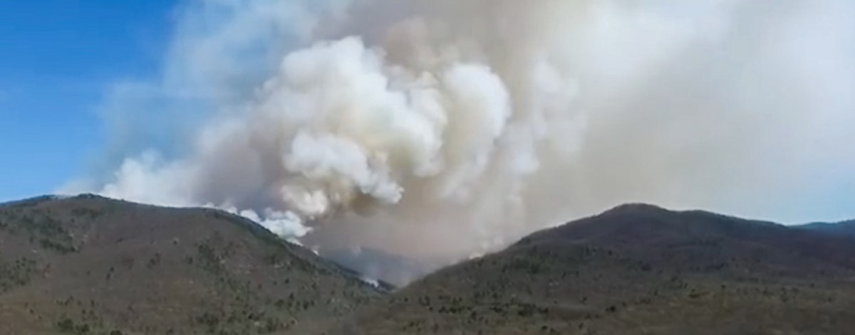
The Rocky Mtn Fire in Shenandoah National Park was recently mapped at 10,326 acres, covering about half of the “Maximum Management Area” established by the Incident Management Team and the Park.
There was rain on the fire Tuesday and more is expected off and on for the next seven days. Considering the forecast and ongoing spring green-up, incident meteorologist Phil Manuel stated that for this area, “Fire weather season is done”.
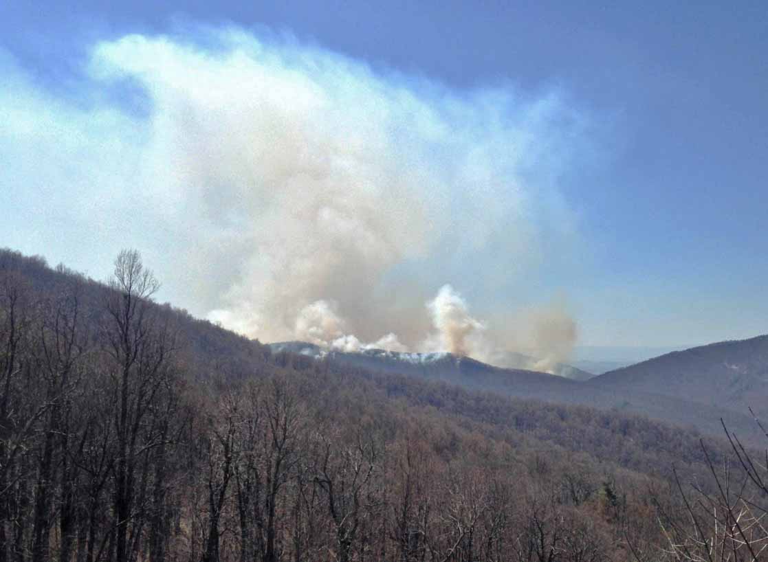
Shenandoah National Park Fire, seen from near Port Republic VA on Sunday. @WHSVaubs @ShenandoahNPS pic.twitter.com/eAycqUJztw
— Art Reid (@Art_Reid) April 27, 2016
****
(UPDATED at 8:55 a.m. EDT, April 22, 2016)

In the video below, Superintendent Jim Northup describes the 20,000-acre Maximum Management Area within which Shenandoah National Park hopes to contain the Rocky Mtn Fire.
****
(UPDATED at 10:35 p.m. EDT, April 21, 2016)

There is news related to the disappearance of 31-year-old Nicole Mittendorff, the missing firefighter from Fairfax, Virginia whose car was found in Shenandoah National Park. She was first reported missing Friday of last week when she did not show up at the fire station for her shift. At approximately 2:00 p.m. today a ground team of National Park Service and Virginia State Police personnel discovered a body in a remote location more than a mile from the Whiteoak Canyon parking area and about 330 yards from the trail in treacherous rocky terrain. National Park Service and Virginia State Police are currently still processing the scene. The search has been suspended. WTOP reports that the Virginia State Police and the family believe the remains are those of Ms. Mittendorff.
The car and the remains were about 22 miles from the Rocky Mount Fire. There has been no report so far that this incident is related to the wildfire.
As of Thursday afternoon, the fire has burned 7,935 acres.
On Wednesday fire crews improved containment lines by burning out vegetation between the fire and eight miles of containment lines along the northern & northwestern perimeter of the fire. Additional fire line preparation was successfully completed along the Skyline Parkway. Work continues on several dozer lines along the western side of the fire to tie together existing terrain features.
With the changing and variable winds Wednesday fire crews picked up multiple spot fires, catching and containing all of them. These included: on the south eastern side, a spot fire north of the Patterson Ridge Trail west of the Plainfield hut, one small one on the northwest corner of the fire and 6 small spot fires near the One Mile Trail Run.
After it’s been burning for five days, the Incident Management Team put out word today that the name is now “Rocky Mtn Fire 2016”.
****
(UPDATED at 1:40 p.m. EDT, April 20, 2016)

The Rocky Mount Fire in Shenandoah National Park has expanded to 5,600 acres, according to the Type 1 incident management team that assumed command of the fire Wednesday morning. The fire is burning in mountain laurel, pine, and oak forests with heavy leaf litter.
On Tuesday afternoon the fire burned across Skyline Drive blackening 80 to 100 acres on the east side of the highway near mile marker 76. Today crews are actively suppressing that portion of the fire, assisted by two water dropping helicopters.
Firefighters conducted a burnout operation near the Beldor Hollow Community to help contain the fire to that area. Crews expect the fire will hold at Beldor Hollow Road.
The fire progressed south near Brown Mountain Trail on Tuesday and was active overnight near Two Mile Run Lane. The Virginia Department of Forestry crews monitored the area overnight. Fire crews are providing structure protection near the Two Mile Run and Lam Hollow communities.
Firefighting resources assigned, available, or en route include two air tankers, four helicopters, six engines, for a total of 248 personnel.
****
(UPDATED at 12:18 p.m. EDT April 19, 2016)
The Rocky Mount Fire in Shenandoah National Park in Virginia continued to spread Monday and Monday night. An unofficial estimate of the size after a helicopter flyover by the Virginia State Police was 3,000 acres. The Incident Management Team will use their own resources later today to map the fire. Monday evening the official estimate was 2,094 acres. The fire is still west of Skyline Drive, which is closed near the fire.
Park spokesperson Lisa Wilkolak said firefighters are employing “aggressive holding” tactics to keep the fire within their designated maximum management area (MMA) but they are not planning to fully suppress the blaze. The MMA is approximately 20,000 acres, or 31 square miles.
The Shenandoah is burning 🙁 #wildfire #shenandoahvalley pic.twitter.com/BQpSoZ7UWJ
— Erin (@bishella) April 20, 2016
The warm and dry weather is helping the fire to move more quickly through the forest than it would in more average conditions. Again Monday night the relative humidity recovery was poor, only going up to 32 percent. The forecast for Tuesday predicts 78 degrees, 20 percent relative humidity, northwest winds of 13 gusting to 21, partly cloudy skies, and a Haines Index maxed out at 6. Wednesday’s weather is expected to be a little more favorable for firefighters.

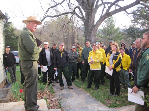
Ms. Wilkolak said there are seven Type 1 Hotshot crews either en route or on scene. The Type 1 Incident Management Team has arrived and will assume command Wednesday. By the end of the day they expect approximately 200 personnel to be assigned.
****
(UPDATED at 10:38 p.m. EDT, April 18, 2016)
The Rocky Mount Fire in Shenandoah National Park in Virginia quadrupled in size over the last 24 hours. Late on Sunday the Park announced it had burned 500 acres. Monday morning that assessment was updated, saying another 200 acres had burned overnight. By 10:10 p.m. EDT today it had grown to approximately 2,094 acres.
The weather that we wrote about earlier today is no doubt the catalyst for this increase. The relative humidity was even lower than the forecast, bottoming out at 13 percent, very low for anywhere — extremely low for the eastern United States. The Energy Release Component is between the 90th and 99th percent of its historic value, indicating very dry vegetation, or fuel. The Haines Index was maxed out indicating a high potential for wildfire growth. And, the humidity recovery Sunday night was poor, only going up to 37 percent. The area was hotter and drier than anytime within the last two weeks.
These are very difficult conditions for firefighters to deal with, but especially when the Park’s strategy is to allow the fire to burn as long as it remains within the 20,000-acre “maximum management area” as described on the fire’s Inciweb page. Usually under conditions like this firefighters prefer an aggressive “full suppression” strategy.
****
(Originally published at 12:16 p.m. EDT, April 18, 2016)
The Rocky Mount Fire in Shenandoah National Park has required the closure of 14 miles of Skyline Drive, the very popular 109-mile long scenic road that runs the entire length of the park.
Since the fire was reported on Saturday in the northern Virginia park it has burned approximately 700 acres according to an update Monday morning from the incident management team.
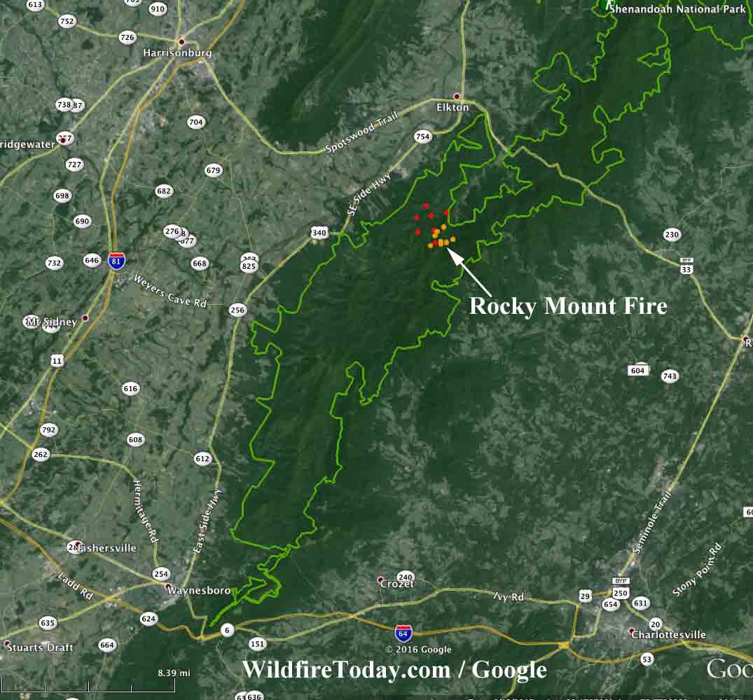
On Sunday the park produced a map of the fire. Scroll down to see another map we made that shows where the fire is located in relation to nearby cities.
The fire is not being fully suppressed. It is in what the Park calls their Fire Ecology Zone “where fire is allowed to occur to achieve natural resource benefits commensurate with the park’s responsibility to protect life and property” according to the Park. Firefighters will take suppression action as necessary in order to keep the fire within the defined 20,000-acre “maximum management area”.
In a statement, park superintendent Jim Northup said, “We are carefully monitoring and actively managing this fire to make sure it is meeting our resource objectives, and will stay in the park. We will reevaluate our strategy and tactics every day and make adjustments as needed. I have great confidence in our fire professionals and appreciate all the assistance we are receiving in managing this fire”.
The weather on Monday could be a problem for firefighters. The forecast for the fire area predicts 78 degrees, a 7-9 mph wind out of the northwest, and a minimum humidity of 19 percent. It will be the warmest day in the last two weeks and the second lowest humidity. The Haines Index will be six, the highest level, indicating a high potential for wildfire growth. The fire is near the border between two Energy Release Component areas that are between the 90th and 99th percentiles of their historical value. As live fuels (vegetation) cure and dead fuels dry, the ERC values get higher, thus providing a good reflection of drought conditions.
The near-real-time weather conditions can be monitored at the Sawmill Ridge automatic weather station 15 miles southwest of the fire. At 12:13 p.m. EDT time it recorded 80 degrees, 19 percent humidity, a six mph wind out of the north gusting to 11 mph, and a 10-hour time lag fuel moisture of 3 (which is very low).
Smoke from the fire will likely blow southeast toward Charlottesville on Monday and Tuesday.
On Sunday a Type 3 Incident Management Team was assigned to the fire but now Dueitt’s Type 1 Team, a larger organization, has been mobilized.

At least three Type 1 Hotshot crews are either on scene or en route — Augusta (from Virginia), and from New Mexico, Silver City and Smokey Bear. Two large air tankers are positioned in Tennessee 420 miles from the fire, a BAe-146 and a P2V.


I find it very coincidental that a firefighter goes missing, obviously unhappy and a massive fire starts!
Disgruntled? Who knows…
Just very odd to me.
Where is the Fire in relation to Nicole Mittendorff car being found? She was a missing FIREFIGHTER…..
A human caused (likely) fire for resource benefit?