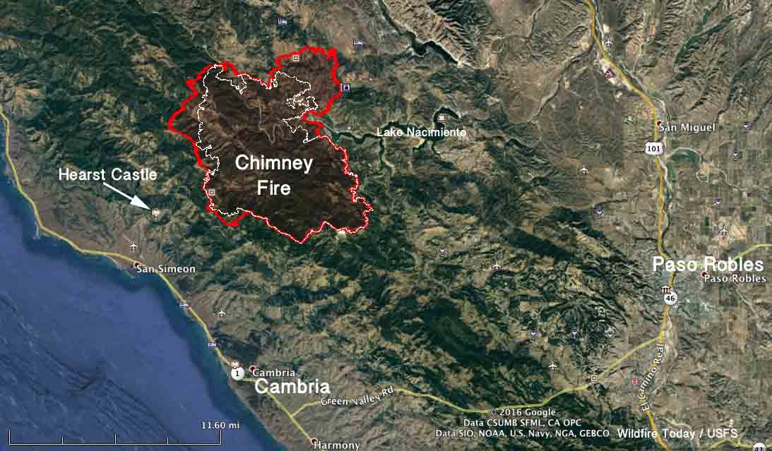
Over the last two days the Chimney Fire north of Cambria near the central California coast has grown by over 10,000 acres, and has now blackened a total of 40,800 acres. Most of that expansion has been on the north side where it has moved another mile and a half into Monterey County. Late Tuesday evening and into the night it was also very active on the southwest side spreading about a mile to the southwest. It is now 2.7 miles from the Hearst Castle. Some of the additional acres on the west side are a result of firing operations by firefighters.
CAL FIRE has updated the information about the impact the fire has had on structures, reporting that 45 residences and 20 other structures have been destroyed, while 7 have been damaged.
On Tuesday the fire behavior was described as extreme after the inversion broke as usual at about 2 p.m. Firefighters have taken advantage of favorable weather conditions at night to conduct firing operations to secure firelines. One of their priorities is burning out an area on the west side that would protect the Hearst Castle.
Evacuation orders are still in place for some areas in San Luis Obispo and Monterey Counties.
(Our previous article about the Chimney Fire.)
