(UPDATED at 11:25 a.m. PDT September 29, 2016)

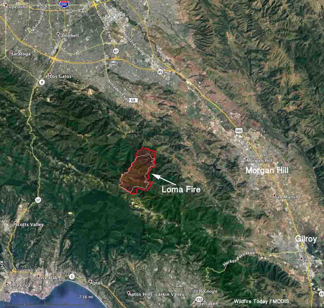
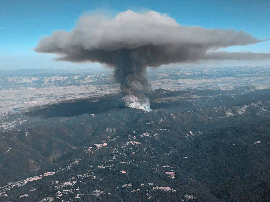
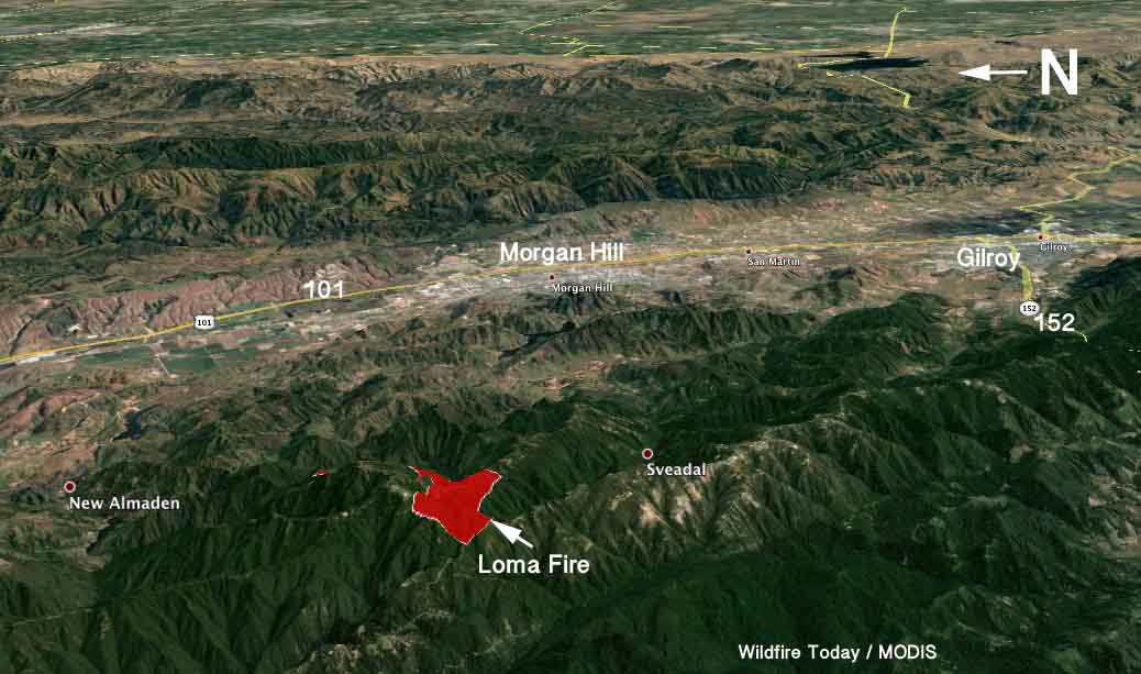
The Loma Fire south of the Silicon Valley in northern California continued to spread to the east Thursday and Thursday night, growing more than 1,000 acres to a total of approximately 4,200 acres.
****
(UPDATED at 8:12 a.m. PDT September 28, 2016)
The video below of the Loma Fire was broadcast live by UPS driver Carlos Daniel Canche on the afternoon of September 26 apparently soon after it started near Loma Chiquita Road in the Santa Cruz Mountains south of San Jose, California. There is discussion in the video’s comments about the popping noises heard in the video. According to Matt Streck with CAL FIRE, the Loma Fire began as a structure fire, so the popping could be ammunition going off as the structure burns. Other items at structure fires also make popping noises, like aerosol cans, tires, and small propane tanks without relief valves. Trees do not explode in fires.
The Loma Fire has burned about 3,100 acres as of 10 p.m. Tuesday, an increase of about 2,000 acres over the previous 24 hours. In addition to the house at which the fire originated, six outbuildings have been destroyed.
Mandatory evacuations are still in place for some areas in the Santa Cruz Mountains. The fire is burning in the Mt. Loma Prieta, Mt. Chual and Uvas Creek drainages.

The fire is being fought by 1,092 personnel, 102 engines, 39 hand crews, 23 helicopters 19 dozers, and 16 water tenders.
So hard to watch: right now, fire lines are so close to this home, you can see firefighters on the ground, horses roaming #LomaFire #abc7now pic.twitter.com/rty9wviUzu
— Natasha Zouves ABC7 (@NatashaABC7) September 27, 2016
#LomaFire firefighters having their morning briefing now. Will let you know latest containment number @kron4news pic.twitter.com/noR8lhkHgv
— Will Tran (@KRON4WTran) September 28, 2016
****
(Originally published at 11:13 a.m. MDT September 27, 2016)

The Loma Fire has burned one structure and is threatening 300 others in the Santa Cruz Mountains 7 miles south of the greater metropolitan area of San Jose, Campbell, Cupertino, and Los Gatos in northern California. Mandatory evacuations are in place for the Loma Prieta ridgeline area.

There has not been extreme wind on the fire since it started at 3 p.m. on September 26. Instead, it is being driven by steep slopes and very dry vegetation.


#LomaFire Forces Santa Cruz Evacuations https://t.co/2MzQmJ62RY @CAL_FIRE #wildfire pic.twitter.com/c1blRCJvxc
— ENS Resources (@ENSResources) September 27, 2016
Loma Prieta fire form Santa Cruz pic.twitter.com/bfW9VV4F3T
— Bill Martin (@BillMartinKTVU) September 27, 2016

As a child, I lived in a little cabin, with family, on Loma Prieta Avenue, at Summit Road. It’s the little house on the very corner, left hand side. This was about 1950/51. There’s some sort of large, metal telephone box out front. My grandfather came up from Los Angeles to see us and stayed at Hotel Lyndon. I certainly wish the best for citizens of my former community.