(UPDATED at 1:51 p.m. MDT October 18, 2016)

Rain in the late afternoon and early evening on Monday helped firefighters working on the Cottonwood Fire 12 miles east of Wall, South Dakota.
Crews were able to assess damaged and destroyed structures inside the perimeter of the fire and it was determined that no primary residences were destroyed. An exact number of cabins, outbuildings and other structures that burned will be determined on Tuesday.
This satellite image of our fire is courtesy of @NWSRapidCity. #CottonwoodFire pic.twitter.com/eNYyj5r3ac
— RC/PC Co. IMT3 (@PennCoIMT3) October 18, 2016
The incident management team anticipates 100 percent containment by the end of the operational period today at 6:00 pm MDT.
Incident Commander Brian Daunt addresses day shift at briefing Monday morning. The night shift had a busy night. Expecting more of the same today. pic.twitter.com/D3d4G4AYoD
— RC/PC Co. IMT3 (@PennCoIMT3) October 18, 2016
****
(UPDATED at 6 p.m. MDT October 17, 2016)
The incident management team on the Cottonwood Fire 12 miles southeast of Wall, South Dakota at 4 p.m. today estimated that about 31,000 acres have burned, with the benefit of better mapping and the ability to evaluate the fire perimeter in the daylight. The team still intends to map the perimeter with a GPS receiver to finalize the data.
At about 6:10 p.m. MDT on Monday it was raining on at least part of the fire.
In addition to the 137 head of cattle that have been reported killed, structures were destroyed but the number of them has not been released.
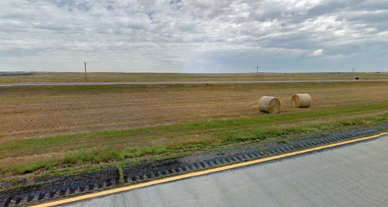
There are no road closures in effect at this time and Interstate 90 currently has no restrictions in the fire area. Smoke should no longer pose a risk to motorists. The fire area will be clearly visible to travelers on I-90.
There are currently nearly 100 personnel working on the fire. At its peak, close to 300 firefighters were fighting the fire.
****
(UPDATED at 9:20 p.m. MDT October 16, 2016)
The name of the fire that started about 12 miles southeast of Wall, South Dakota has been changed from “131” to “Cottonwood”.
The fire is currently being managed by the Pennington County Type 3 Incident Management Team (PCIMT3) and is under Unified Command with representatives of Buffalo Gap National Grassland, Wall Fire Department, Jackson County, and Pennington County.
At 6 p.m. the incident management team estimated the fire had burned between 5,000 and 6,000 acres of private and federal land based on information from personnel in an aircraft. More accurate size information is expected on Monday and may result in a change, they said.

Fire authorities reported that structures have burned, but did not provide any details on the number or if they were residences or other buildings.
All roads in the fire area were open at 8:30 p.m. on Sunday.
****
(UPDATED at 5:56 p.m. MDT October 16, 2016)
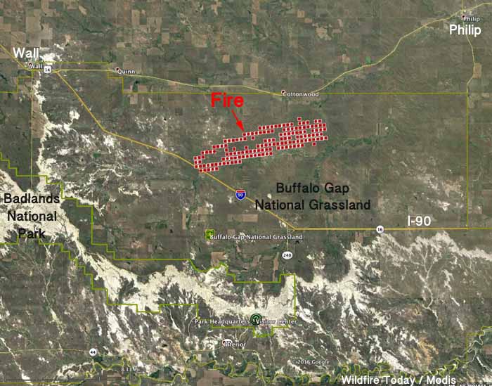
About an hour after the fire named “131” (later changed to “Cottonwood Fire”) was reported at 1 p.m. to the Great Plains Interagency Dispatch Center on Sunday, a heat-sensing satellite passed 438 miles overhead at 2:04 p.m. and recorded heat signatures indicating that it had burned approximately 8,000 acres. That, of course, is a very rough estimate based on the data from the satellite — the fire could be smaller, or larger.
The fire, which appears to be nine miles long, was about 12 miles southeast of Wall, South Dakota, and mostly north of Interstate 90 at 2:04 p.m.

It has been easily detected by weather radar:
#Breaking: Wall fire seen on radar along with an approaching cold front which will shift winds as crews battle fire #KOTAWeather #KOTANews pic.twitter.com/il5X7KrUf4
— David Stradling (@DavidSWX) October 16, 2016
Since 1 p.m. today the weather station 10 miles west of the fire at Pinnacles in Badlands National Park has been recording 14 to 24 mph winds from the southwest shifting to come out of the northwest with gusts above 36 mph. The wind direction change could be a result of the cold front that is passing through. The temperature has been around 80 with a relative humidity between 19 and 26 percent. The area is under a Red Flag Warning issued by the National Weather Service.
As of 5 p.m. the South Dakota Department of Transportation reported that Interstate 90, previously closed between Wall and Kadoka due to the fire, had opened, but they urged motorists to find alternate routes since emergency responders were working in the area.

Fire near Wall, SD, being picked up on radar. Cold front moving in from NW will shift winds in next half-hour #sdwx #firewx pic.twitter.com/Dh025kTXSq
— NWS Rapid City (@NWSRapidCity) October 16, 2016
