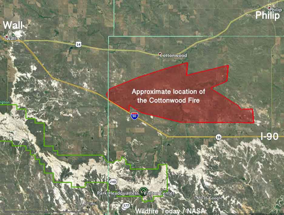
Above: Final official map of the Cottonwood Fire, produced by the Incident Management Team.
The Cottonwood Fire that started 12 miles east of Wall, South Dakota has been contained. After GPS mapping the 16-mile long fire the incident management team determined it had burned 41,360 acres. Jim Strain, the South Dakota Chief Fire Management Officer, said most of those acres were burned during the first eight hours. And according to Darren Clabo, the South Dakota State Fire Meteorologist, it is the fifth largest on record in the state.
Tuesday night the local Type 3 Incident Management Team was released and turned the fire over to the Wall, Interior, Philip, and Kadoka Fire Departments, the Jackson County Sheriff’s Office, and Buffalo Gap National Grassland.
Livestock losses reported to the Jackson County Sheriff’s Office stand at 137 as no additional losses were reported to the team.

Mr. Clabo sent the tweet below when the estimated size of the fire was 31,000 acres.
The three largest western SD wildfires to date in 2016. #sdwx #sdfire pic.twitter.com/9ISiZfpfiZ
— Darren Clabo (@SDFireWeather) October 18, 2016
Mr. Clablo also looked at the data recorded at the weather station in Badlands National Park south of Wall.
Yes it was hot, dry, and windy during #CottonwoodFire but precip stats and wind shift(s) better frame the larger issues. #sdfire #sdwx pic.twitter.com/DDQi2MQjKB
— Darren Clabo (@SDFireWeather) October 19, 2016


Good report. There will be bad ash storms the next time a big front comes through. A northwest wind will affect I-90.