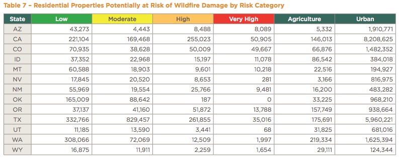
Above: Residences in 13 western states with a high or very high wildfire risk. CoreLogic.
CoreLogic has put together a report that looks at the residential properties in 13 western states that are potentially exposed to wildfire risk. It is an evaluation of the total number of properties at various risk levels, along with the estimated costs of reconstruction of single-family residences.


I would be interested in why the CoreLogic map on page 10 of the report does not show the risk reduction that should be evident in the areas burned by the Buffalo Creek, Hayman, High Meadow, and Lower North Fork fires? Lots of acreage with no trees … just shrubs, grass and few aspens starting back up.