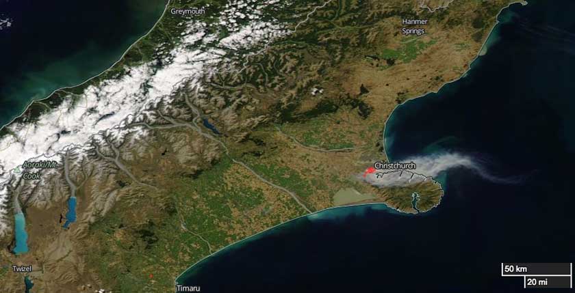
Above: @Howesaman took this photo as she flew in to Christchurch from Wellington.
(UPDATED at 9:05 a.m. MST February 16, 2017)
The wildfire at Christchurch, New Zealand was slowed by light rain Thursday night and more precipitation is in the forecast for Friday.
Officials are reporting that 11 Christchurch homes and two outbuildings have been destroyed by the fire and 2,075 ha (5,127 acres) have burned.
Two fires burned together to become the large fire that spread to the suburbs of Christchurch. One was started by an electrical problem and the other originated at a car park. Officials are not speculating as to whether the causes are suspicious.
Approximately 400 homes have been evacuated affecting about 1,000 residents.
****
A large wildfire is burning in the suburbs of Christchurch, New Zealand in the Port Hills area. As of Wednesday morning U.S. time it had blackened 4,571 acres (1,850 Ha), destroyed an uncertain number of homes, and required the evacuation of approximately 1,000 residents.
On February 14 a helicopter pilot, David Steven Askin, was killed while working on the fire.
Below is an excerpt from an article at nzherald.co.nz:
Christchurch mayor Lianne Dalziel has told Newstalk ZB’s Mike Hosking that she was “very worried” for Christchurch.
“We’ve been going through what’s happened overnight, obviously there’s been more evacuations so we’re looking at 450 properties approximately that have been officially evacuated, with police doorknocking and the army in support as well, so it is very serious.”
She said people have been reporting seeing the fire very close to their properties near Port Hills.
“It looks as if up to seven properties have been affected by the fire, it’s difficult to say until light arrives to get a full handle on how many properties that have been destroyed.”
Dalziel said the blaze was a “difficult fire”.
“We had two seperate fires, one that started in the Selwyn district, managed as a significant rural fire, then fire erupted on the city side, ultimately the worst fears were realised and the two fires came together yesterday.
“It is close to areas of population.”

The weather forecast for Christchurch on Thursday (Wednesday U.S. time) predicts cooler temperatures in the high 60s F, relative humidity in the high 40s, and winds out of the east-northeast at 3 to 6 mph in the morning increasing to 16 mph in the afternoon.
In 2011 an earthquake centered 6 miles southeast of Christchurch caused widespread damage in the city and killed 185 people.
Christchurch fire coverage https://t.co/DmZq79UTaU pic.twitter.com/3MgDxFCa8y
— Lynn Prentice (@lprent) February 15, 2017


Updates on the fires in NZ (Christchurch – South Island and Hawkes Bay – North Island) can be found here – http://www.stuff.co.nz/national/89455976/live-homes-evacuated-as-christchurch-port-hills-fire-rage-out-of-control
http://www.radionz.co.nz/news/national/324398/houses-destroyed-as-large-fires-blaze-across-hawke's-bay