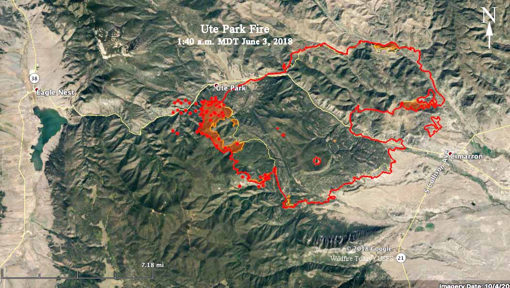
Above: 3-D map of the Ute Park Fire, looking west. The red line on the map shows the perimeter at 10:30 p.m. June 2, 2018.
Increased fire activity near the community of Ute Park prompted the Colfax Emergency Manager and Colfax Sheriff’s Office to issue a mandatory evacuation for the community Saturday afternoon. Winds from the southeast caused the fire to grow to the northwest south of the town. Overnight it kept spreading to the west and a satellite overflight at 1:40 a.m. detected heat on the north side of Highway 64 west of the community. Firefighters are conducting point protection around structures and planned a burnout operation Saturday night to help protect the community which is now encircled by a dozer line.
Saturday’s burning operations to help protect the Cimarron area were successful on the fire’s eastern and southern flanks.
The fire has burned 31,910 acres in northeast New Mexico between Eagles Nest and Cimarron 26 air miles northeast of Taos.


