(Originally published at 9:12 a.m. MDT August 22, 2018)
When I saw the prediction from the Missoula National Weather Service office above, it got me thinking about how this cooler, possibly wetter weather is going to affect the dozens of large wildfires currently burning in the northwest United States. Two of the fires we have written about over the last couple of days, Watson Creek in Oregon and Howe Ridge in Montana, recently had small amounts of precipitation, certainly not enough to put them out, but it will absolutely slow their spread for a day or two.
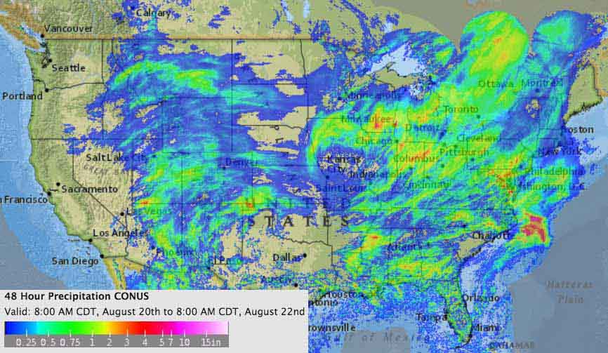
No doubt other fires were also were affected, as you can see in the map below showing precipitation over the last 48 hours. But it looks like Washington, western Oregon, and most of northern California remained dry.

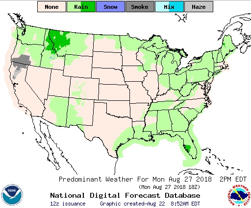
More rain is expected in the Northern Rockies into next week. Below is the forecast for precipitation on Monday afternoon, August 27. The “haze” shown in California and Oregon is presumably smoke from the Mendocino Complex of Fires.

Next are the predictions for precipitation and temperature August 27 through 31.


Below are the outlooks for September, showing a return to warm and dry conditions in the Northern Rockies.


What a dramatic year we have had so far with wild fires! Thank you, Bill, for all the information provided by you. I am so ready for the Fall.