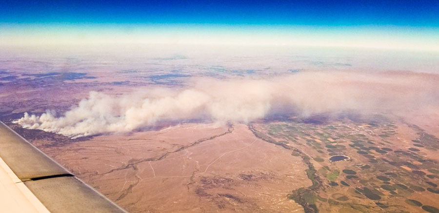
The 24,105-acre Britania Mountain Fire 8 miles west of Wheatland, Wyoming was active Wednesday, influenced by 8 to 15 mph winds out of the west gusting up to 25 mph in the afternoon. The temperature reached 87 degrees at a weather station in Wheatland with 11 percent relative humidity, conditions that kept the fire spreading on the south side and causing a two-mile run to the east between Palmer Canyon and Marble Roads.
(To see all of the articles on Wildfire Today about the Britania Mountain Fire, including the most recent, click HERE.)
The maps produced by the incident management team show the fire up against the north side of Palmer Canyon Road. This could be in part due to firefighters igniting along the road to remove the fuel between the road and the main fire, hoping to stop the fire in that area.
During a satellite overflight at 2:34 a.m. MDT Friday the only large heat sources detected from 200 miles up were on the south side, primarily north of Palmer Canyon Road west of the Albany/Platte County line.
The map below shows previous fires in orange. The fires to the north were the Arapaho and Cow Camp Fires of 2012, while the one to the south was the 2002 Reese Fire. These blazes, especially the ones six years ago, could slow the spread of the Britania Mountain Fire if it reaches those areas — or at least there would be less resistance to control.

Very little official information has been released about the fire since it started on August 26, but a Type 2 Incident Management Team assumed command Friday morning so that could change. Already we have seen a plethora of new maps.
All of Wyoming except for the northwest portion is under a Red Flag Warning again Thursday. The forecast for the fire area calls for 90 degrees, 11 percent relative humidity, and 8-13 mph winds out of the west and southwest gusting up to 18 mph. Conditions should moderate somewhat on Friday.
The predicted weather will keep cities to the east under a possible threat of dense smoke. Areas in Wyoming that could be affected, depending on the exact wind direction, include Wheatland, Guernsey, and Torrington. Cities in Nebraska that could experience smoke are Mitchell, Scottsbluff, Chadron, and Alliance.

South Metro’s Firefighters assigned to the #BritaniaMountainFire worked the fire line from 7 p.m. until midnight Wednesday. The fire has grown to over 20,000 acres and crews are faced with another Red Flag Warning today. pic.twitter.com/AQnuL7QYMq
— South Metro Fire Rescue (@SouthMetroPIO) August 30, 2018

“… Woe, woe, woe to the inhabiters of the earth … “
Interesting way that they have designated the Divisions. Usually it’s A-B-C -etc and Z-Y-X-etc.
God bless the firefighter who are fighting this fire. My heart goes out to everyone affected.