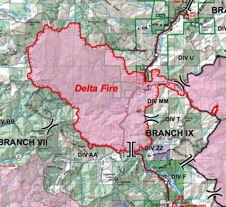
Fire officials said Friday morning that the Delta Fire 24 miles north of Redding, California has grown to 24,558 acres, an increase of more than 2,000 acres since Thursday.
While the fire is steadily growing, it is moving at a much slower rate than it did the day it started, Wednesday, when it burned over 15,000 acres in the first nine hours.
(To see the all of the articles on Wildfire Today about the Delta Fire including the most recent, click here: https://wildfiretoday.com/tag/delta-fire/)
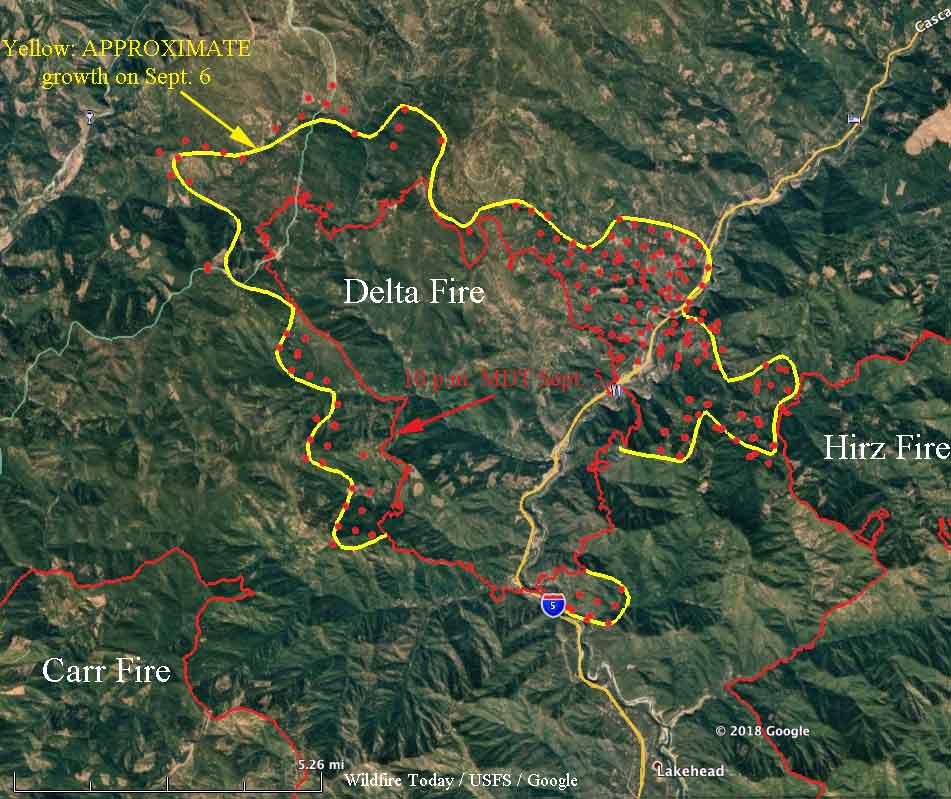
On Thursday firefighters were working on a firing operation on the east side of the fire that would tie it in with the 46,000-acre Hirz Fire, checking the spread on the east side of Interstate 5 and keep it from moving farther north in that area. At 2:24 a.m Friday a satellite detected a lot of heat in that area, so it is uncertain if they were successful.
The map above was released by the incident management team Friday morning; the date and time of the data used to map the perimeter is unknown. The satellite passing 200 miles above the fire at 2:24 a.m Friday detected heat one or two miles farther north along both sides of Interstate 5, which is still closed, reaching almost as far north as the off ramp at Fisher (see the map below).

There was no overnight mapping by a fixed wing aircraft Thursday night. One of the two U.S. Forest Service infrared scanning planes was down with mechanical difficulties, which could be the reason for the “unable to fill”. It was smoky over the fire during the night but that usually does not prevent imaging the fire, unlike clouds which prevent the infrared light from reaching the sensor on the aircraft. The ability to “see” through smoke is one of the primary attributes of infrared sensing technology. However an intense convection column containing smoke, ash, and burning embers can be confused with heat on the ground.
During the large vegetation fires in southern California in 2003 some of the convection columns were so powerful that the windshields on six air tankers were cracked by chunks of debris that were being hurled into the air (page D-6 in 2003 California Governor’s Blue Ribbon Report; huge 20 Mb file). One pilot saw a four by eight sheet of plywood sail past at 1,500 feet.

yep.
(That was supposed to be in reply to John Moore, not jackson8888.)
The rate of spread you people are talking about is phenomenal. Is this the new fire conditions or new norms our firefighters must learn to deal with ?
I wonder what the record is for most-acres shortest-time fires in northern California. How would one measure that anyhow? Shortest time from zero to 10K acres? 20K? Number of acres per hour over the last 10 years? Seems that the Delta Fire has got to be a contender …
The heat to the west of Fisher could very well be burn-out operations in conjunction with the dozer line, couldn’t they?