(UPDATED at 7:03 p.m. PST November 8, 2018)
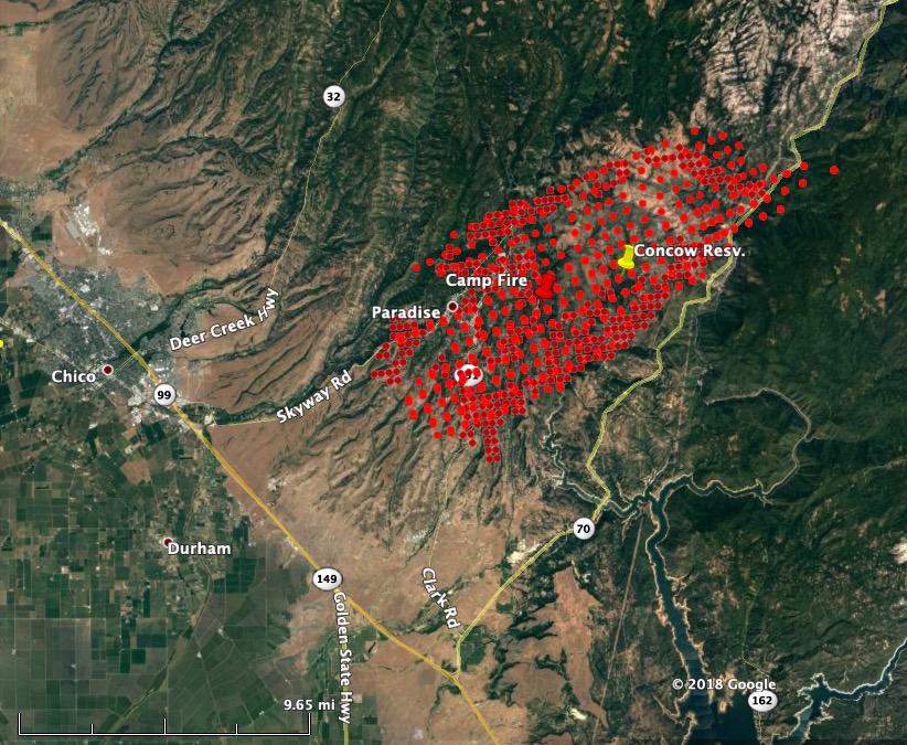
From an article in the Chico ER, updated at 6:36 p.m. Thursday:
Cal Fire-Butte County Chief Darren Read said in the afternoon that hundreds of structures in Paradise have burned, perhaps as many as 1,000. Butte County Sheriff Kory Honea said there are reports of multiple fatalities, and authorities are trying to verify how many.
The Sheriff’s Department estimates that 50,000 people have evacuated.
(To see all articles about the Camp Fire on Wildfire Today, including the most recent, click here.)
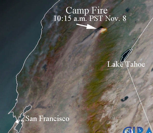
At 3:15 Thursday CAL FIRE estimated that the fire had burned 18,000 acres. Our very, very rough approximation of the size that is indicated by the heat detection in the map above from 1:30 p.m. puts it at around 28,000 acres. Those heat detections can sometimes be inflated when a very intensely burning fire carries a high concentration of burning embers into the smoke column downwind of the fire.
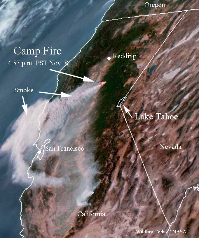
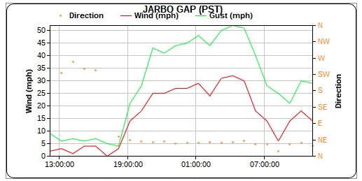
On Thursday afternoon the wind was out of the northeast at 17 mph gusting to 30, with 11 percent relative humidity. Friday night the wind should be similar, northeast at 16 gusting to 34, with 23 percent RH. The weather on Friday should be much more in favor of the firefighters — 68 degrees, RH 13 percent, and much lighter northeast winds at about 8 mph, decreasing to 2 mph by sunset.
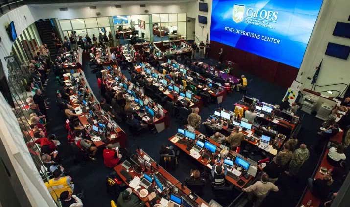
The state of California has activated their State Operations Center.
A very eye-opening interview with a Paradise evacuee who describes the scene of the #CampFire @ActionNewsNow pic.twitter.com/E4ncB41srZ
— Laura Eng (@LauraEngNews) November 8, 2018
(UPDATED at 1:50 p.m. November 8, 2018)

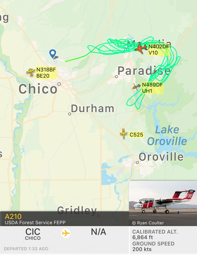
Air Attack has requested seven air tankers for the Camp Fire: four S-2s, two large, and one very large air tanker (DC-10). Apparently the wind speeds have decreased, making it possible to use the fixed wing air tankers.
At 12:13 p.m. a weather station southeast of Paradise recorded sustained winds at 13 mph with gusts up to 33 mph with a relative humidity of 13 percent.
At 1:13 p.m. Friday KRCR published a video interview with “John”, a CAL FIRE PIO, who said the estimated size of the Camp Fire was 17,000 acres. Our very, very rough approximation of the size that is indicated by the heat detection in the map above puts it at around 25,000 acres. Those heat detections can sometimes be inflated when a very intensely burning fire carries a high concentration of burning embers into the smoke column downwind of the fire.
(UPDATED at 12:14 p.m., November 8, 2018)
The winds have been too strong on the Camp Fire at Paradise, California for air tankers and water-dropping helicopters to assist firefighters on the ground. The wind speed increased dramatically at about sunset on Wednesday with gusts out of the northeast up to 50 mph. The wind has slowed on Thursday with sustained speeds at 6 to 18 mph and gusts at 22 to 30 mph.
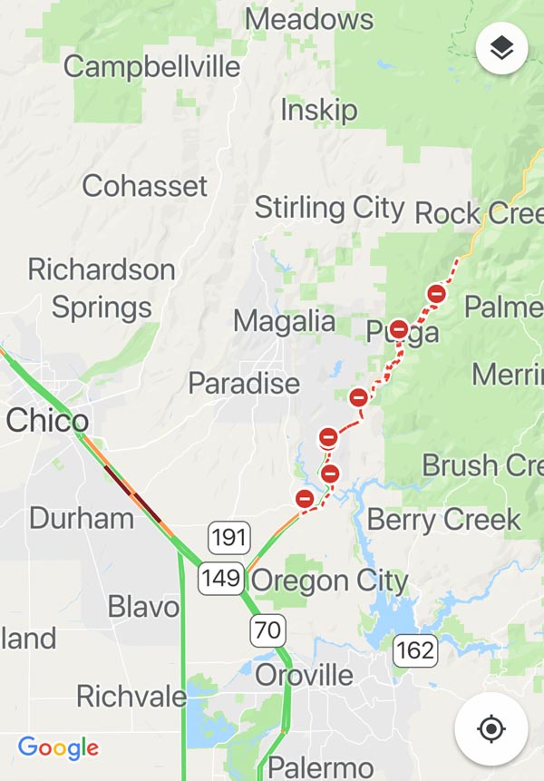
There was a report that the fire had spotted or spread across Paradise in at least one location, at Honey Run Road west of Skyway in Paradise. At noon Thursday it had also reached the intersection of Wagstaff Road and Skyway Road in Paradise, where some evacuees had abandoned their vehicles in the gridlocked traffic and were on foot trying to escape the area.
Unfortunately one of them reported that the maneuver activated the airbag on the fire truck and disabled it, further blocking the road.
The priority at 12:10 p.m. was life safety, rather than protecting structures. Hundreds of evacuees are stranded in their vehicles or are on foot as the fire burns nearby.
#CampFire this is on pentz rd in Paradise. Pray for people to get out safe.??? pic.twitter.com/Qe7MwHiH8e
— Jeff Curtis (@splinkjc) November 8, 2018
Multiple helicopters, including CHP and PG&E, are managing to fly through the strong winds to rescue civilians who are unable to evacuate due to being trapped by the fire or stranded by gridlocked traffic.
(UPDATED at 10:27 a.m. PDT November 8, 2018)
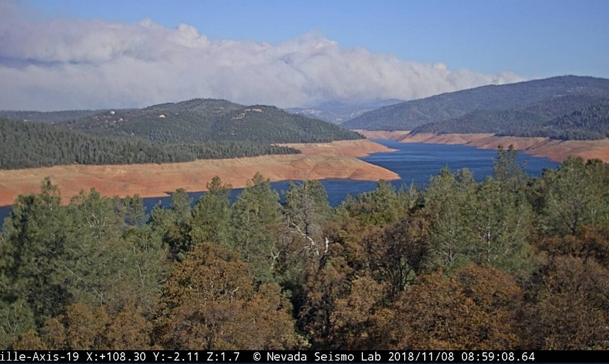
A fire that started Thursday morning is causing evacuations in Northern California. Named the “Camp Fire”, it is spreading rapidly pushed by strong northeast winds.
A hand crew responding to the fire reported at about 9 a.m. that they were entrapped along with about a dozen civilians and were taking refuge in a safety zone.
People fleeing the area are flooding the roads with traffic, causing grid lock in some areas. Some are abandoning their vehicles and attempting to escape on foot. Law enforcement officers and firefighters are transporting injured civilians. Structures are burning on Pentz Road in Paradise and other locations. The town of Paradise is being evacuated.
The Feather River Hospital is being evacuated by firefighters, Life Flight, and Search and Rescue personnel.
Air Attack estimated at about 9:40 a.m. that the fire had burned approximately 6,000 acres. The incident commander has requested 45 strike teams of engines (5 engines per strike team) and many strike teams of dozers and hand crews.

In 1988 I lost my house in the ’49er fire. It was on the first day. During that day, Cal Fire had no idea where the fire was. Then two days later, like the Camp Fire, they grounded all planes because it was too smokey. That was over 30 years ago.
I escaped the Lobo Fire in 2017. Which was the same night as the fire in Santa Rosa. So I asked Cal Fire why they did not fight these fires with more aircraft in a long letter. They called me and their answer was shocking. Basically the true answer is they only own 22 1952 vintage 1200 gallon per plane aircraft, that are flown by non Cal Fire pilots. They would prefer to pay their union workers who fight the fire on the ground than pay for aircraft. Their story about not being able to fly on November 8, 2018 is basically a lie. Their 22 planes maybe could not fly. But other planes that they do not own, but can call up, could have flown and even stopped the Camp Fire BEFORE it reached Paradise.
Don’t let Cal Fire try to pass all of the blame onto PG&E. I also heard that on the morning of Nov.8 sensors detected the fire, but their alarms were turned off because of false alarms. If they were turned on, there would have been early remote warning of the fire. Whose fault is this?
We are all with you and reiterate our feelings of greater compassion and solidarity.
Paradise is a marvelous little town, one could not ask for better. Such a terrible loss
When can residents return to see the damage and go through what’s left?
My prayers to all with worry and loss. This fire was predicted for many years and everyone turned a blind eye. Overstocked forests need thinned, brush and logging slash need treated to reduce fire danger, community fuel breaks need installed, vegetation near homes and roads needs reduced and vegetation removal clearances around homes and communities needs strictly enforced to protect our property and loved ones. Catastrophic fuel loading exists all around the state. Let’s wake up and be proactive.
Anyone know if steiffer road in Magalia is Ok?? My aunt’s husband is missing and was last seen on that road . His name is Elmer ” Suni ” Hopper.
🙁
Can you tell me why they call it the WOOLSEY FIRES??
ALSO I HAVE FAMILY IN PARADISE..HOW DO WE KNOW ABOUT IF THEIR HOME SURVIVED THE FIRE?
Who calls it “Woolsey fires”?
The fire is still actively spreading through communities. Right now firefighters are concentrating on saving lives. It will probably be days before it is even possible to survey the multiple areas for structures destroyed.
There is a Woolsey Fire in Southern California.
We have a new article about the Camp Fire, updated at 7:45 a.m. Friday Nov. 9.
Wow, it’s already crossed Highway 99 ?
Will this be yet another California electrical utility-caused fire? The fire’s reported origin is underneath major power lines.
No, the cause was from a campfire that was started in an unsafe area by out of towners who don’t know fire safety and it got out of hand and started this fire, hence the name “Camp Fire”.
Wrong.
It started near Camp Creek Road, hence the name.
Sorry, it is called “Camp Fire” because it started near Camp Creek Road, near Hwy 70. There is no word exactly on how it started yet…
The 747 was dropping on the Camp Fire east of Chico, CA. One of the DC-10s has been working this fire, the Woolsey Fire. But much of the time the wind was too strong to use fixed wing air tankers.
I just got off the hill. Its a real mess up there. My heart goes out to all involved. We all lost something today.
I have friends and family near the Safeway store any news of that area would be great. Prayers to all the rest of you that family and friends get out safe.
So sorry, hearing the Safeway is gone.
I’m so sorry for all of you effected in any way. I’m down here in Chico crying and wishing I could do something more to help. I’m not religious, but I will pray for you in my own way. Please try to stay strong. Love to all my neighbors. <3
This is one site where they are updating information: https://www.facebook.com/buttecountywildfires/
This is another Facebook page you can go to for some update: https://www.facebook.com/ButteCountyWildfireIncidents/
Evacuations, you can check on twitter with @ButteSheriff
There are Facebook group pages you can go to also. Just put Butte County into your search engine and check them out. CalFire has a page but they don’t update it as quickly. 9-1-1 is overloaded and I believe they have a 2-1-1 # you can call.
Thank you this is helpful information
My parents live on Maple Leaf, off of Clark. they had to abandon there 10 horses. Any news of that area?
Bille road updates? My home..
Calls from Clark and Skyway road a couple hours ago… traffic crawling. Fire on both sides of the roads. Fire definately moving faster than traffic.
Please, any updates on the trapped crew and civilians? I believe a friend is among them.
We just went thru this a short time ago, I hope they knock it down fast.
Jesse Adams
My mom is stuck in the traffic trying to escape – she said there are cars burning a ways ahead of where she’s at…
My sister, bf and animals are trying to escape. WHAT IS THE LATEST ON THE RIDGE ROAD OUT
My family lives in Paradise and are evacuating. All I know is they are driving down the ridge trying to escape.
Any and all information you can provide asap would be appreciated please.