(UPDATED at 3:54 p.m. PDT June 9, 2019)
At 3:50 p.m. PDT Air Attack estimated that the Sand Fire had burned approximately 2,220 acres. He said the spread had been stopped except for an area encompassing 500 acres. Some of the smaller air tankers, the S-2s, were released so they could be ready for initial attack on new fires, and a few of the larger ones are being told after dropping retardant to return to their reload base to “load and hold”.
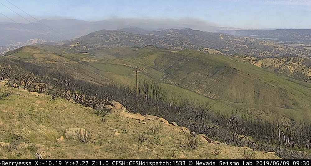
The Lake Berryessa camera that had been pointed at the fire for the previous 24 hours and captured the photos below, apparently got bored with the decreased activity on the Sand Fire. When we checked at 4 p.m. it was pointed in a different direction where no smoke or fire was visible. Back to its regular job of detecting new fires, apparently.
(Originally published at 12:15 p.m. PDT June 9, 2019)
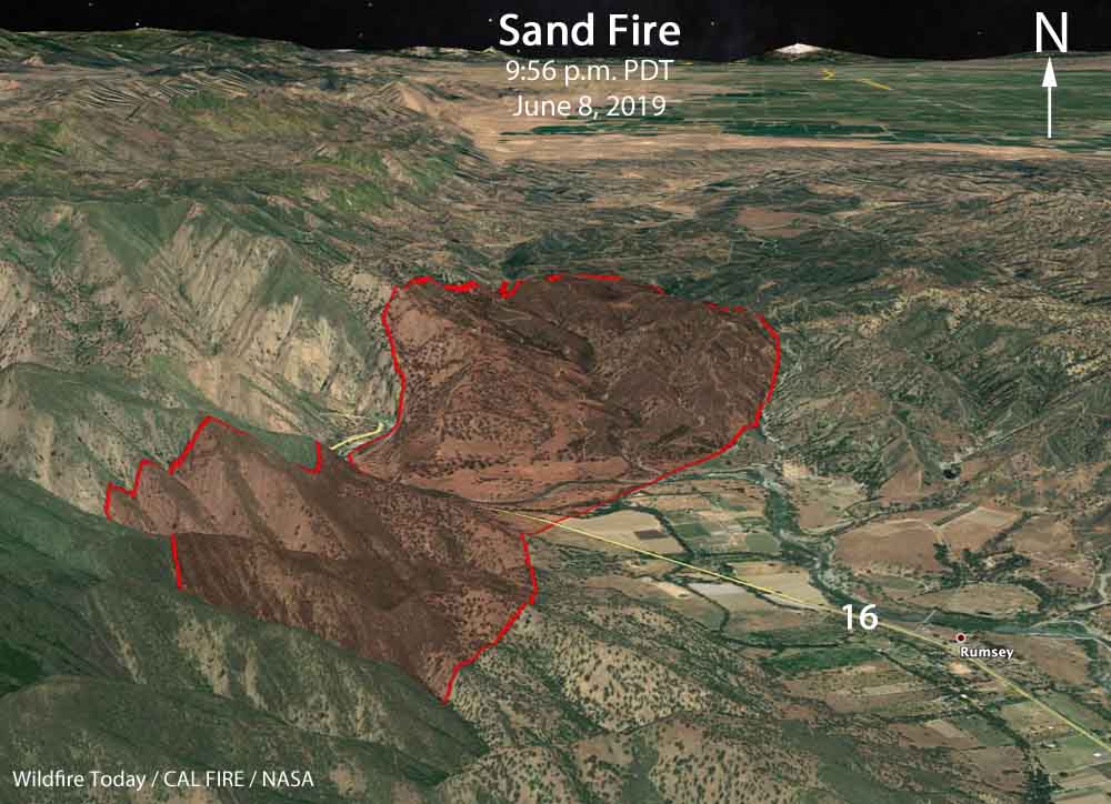
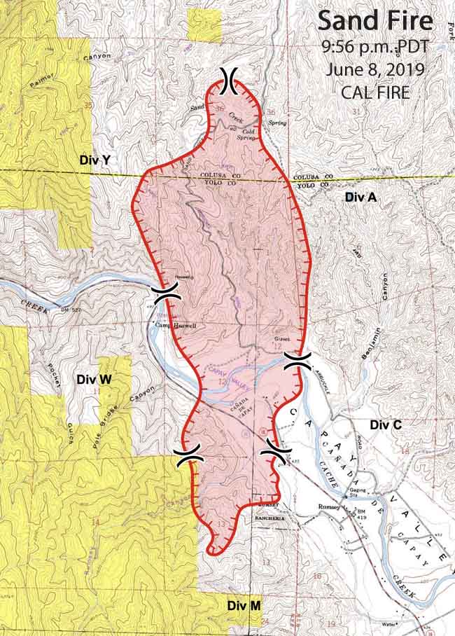
The Sand Fire reported at 2:50 p.m. on June 8 had burned approximately 1,800 acres as of Sunday morning. It started near the Colusa/Yolo county line and spread southwest along both sides of County Road 41 (Sand Creek Road) crossing Highway 16 northwest of Rumsey.
Most of the fire is in Yolo County 13 miles west of Interstate 5 and 19 miles east of the town of Clearlake. It is 4 miles east of Lake County, which has seen numerous very large wildfires over the last several years.
Evacuations have been ordered for all residents on County Road 41. The evacuation Center is the Esparto Boy Scout Cabin at 16980 Yolo Avenue. (evacuation map)
At about 9 a.m. Sunday Air Attack began requesting air support and by 9:54 a.m. bumped the order up to a total of three large air tankers and two S-2 fixed wing air tankers. However, the availability of all of those aircraft proved to be challenging. At least three Type 1 helicopters are also being used on the fire.
The photos below were taken Saturday afternoon and Sunday morning.


Why does it take so long to provide air support to stop these fires from spreading? This fire was reported at 3PM on Saturday and air support was not started till 9AM Sunday?
Air tankers and helicopters were working the fire Saturday also.
Mrs. Penrod, after 31 years in firefighting, I believe I can safely tell you that if firefighters aren’t able to provide adequate efforts, it is because of influences entirely beyond their control. Wildfire is their enemy, and firefighters are driven to stop it, while protecting lives and property is utmost.
Yolo county.
Thanks for the timely details, Bill. Shared with California Tracker Facebook.