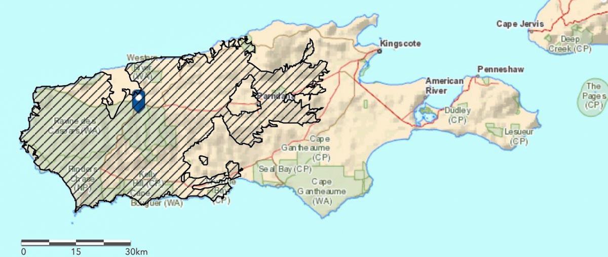
The Ravine Fire that has been working its way across Kangaroo Island off the coast of South Australia has burned almost half of the area of the island, over 210,000 hectares (519,000 acres) or 48 percent. (See map of the fire above)
Below is an excerpt from a January 10 article at 9News:
Properties have been lost, firefighters injured and more land blackened after a night of horrific conditions across the Kangaroo Island bushfires, but the emergency has eased. Assessments are underway, but some homes are believed lost at Vivonne Bay while the town of Parndana was spared for a second time, despite fire bearing down on it from several directions. Both towns had been evacuated amid emergency warnings and the escalating danger.
Two Country Fire Service trucks were involved in burn-overs and two more CFS personnel were injured, taking the total hurt on Kangaroo Island to 22.
With rain falling across the fire ground on Friday, the warning levels for all fires were reduced first to a watch and act and then to a simple bushfire advice.
CFS chief officer Mark Jones said Thursday night was an “incredibly difficult” period for all 280 firefighters on the island.
“Winds were not consistent, they were blustery and came from many different directions,” he said.
The fire danger will increase on Monday as the forecast of Kingscote calls for winds out of the south at 8 to 16 mph. Those northerly winds will grow to 14 to 20 mph Tuesday through Thursday with very little chance of rain.
Much of the eastern third of the island consists of pastures or agriculture land without as many forested areas as found on the west end where Flinders Chase National Park is located. Most of the park has burned along with many structures in and near the park.
Two men were killed on January 4, Dick Lang and his son Clayton.
The State Government on Sunday reported that more than 32,000 livestock animals, mostly sheep, perished in the blazes as well as 830 hives and 115 nucleus hives.
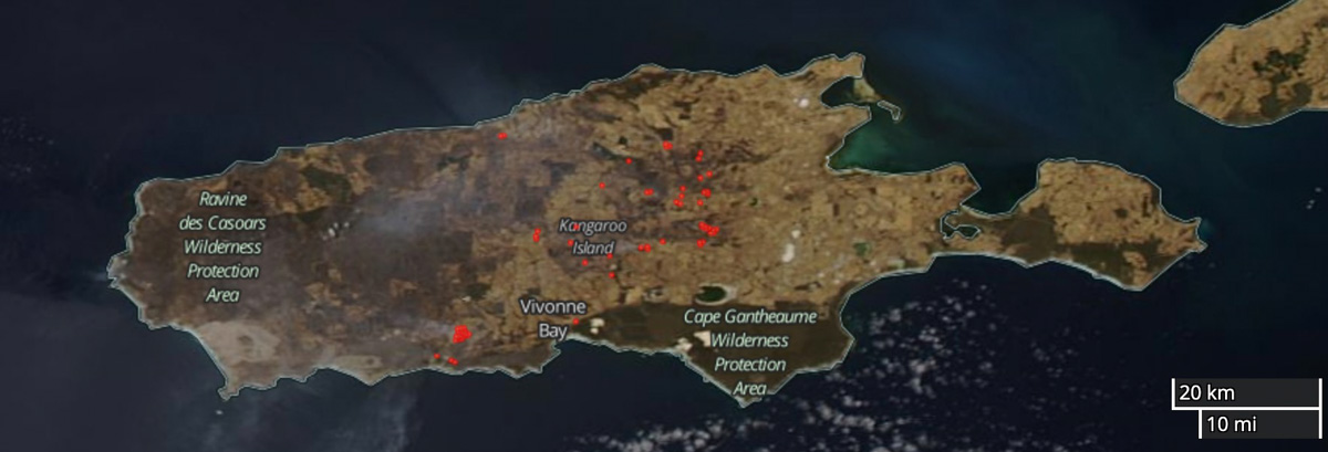
The satellite photos below illustrate the eastward growth of the fire on Kangaroo Island over a five-day period.


My heart aches for all the people impacted by these horrific wildfires; I pray and hope ALL of Australia rebounds from this and emerges even better and stronger. God Bless, y’all! ??
If there is a silver lining, its that the fires are burning the least inhabited part of the island.
I really feel for the innocent and helpless wild animals. Hope and pray that fires will end soon.