(UPDATED at 4:11 p.m. EDT April 11, 2020)
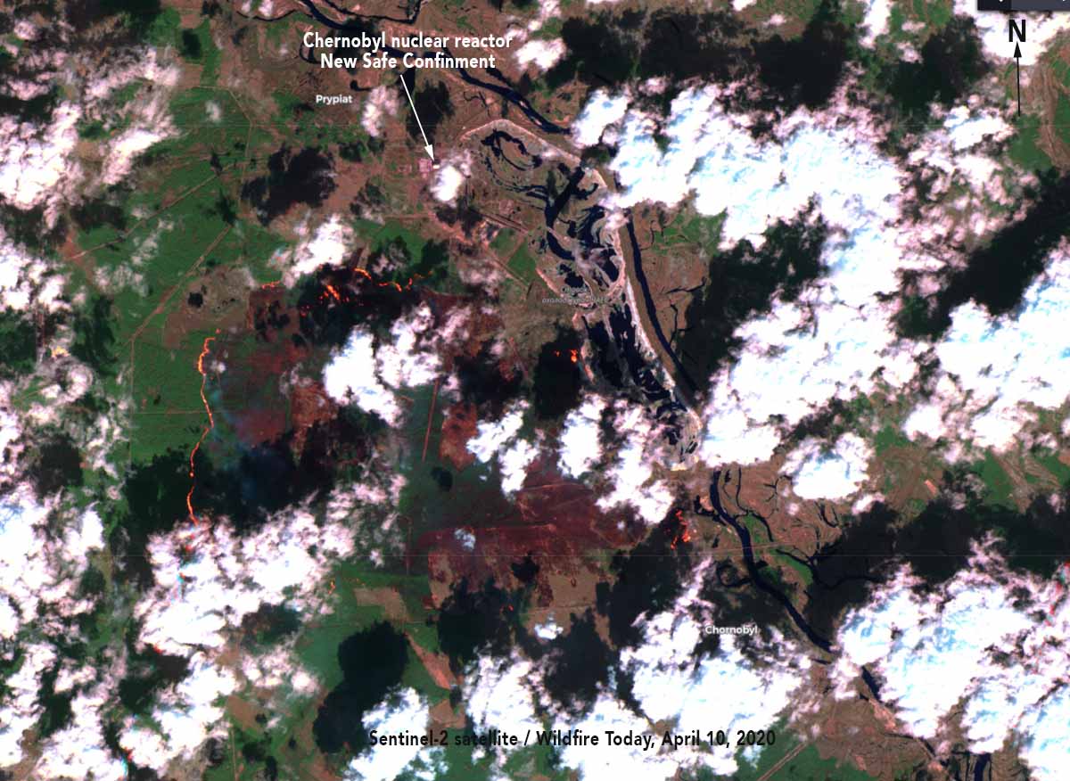
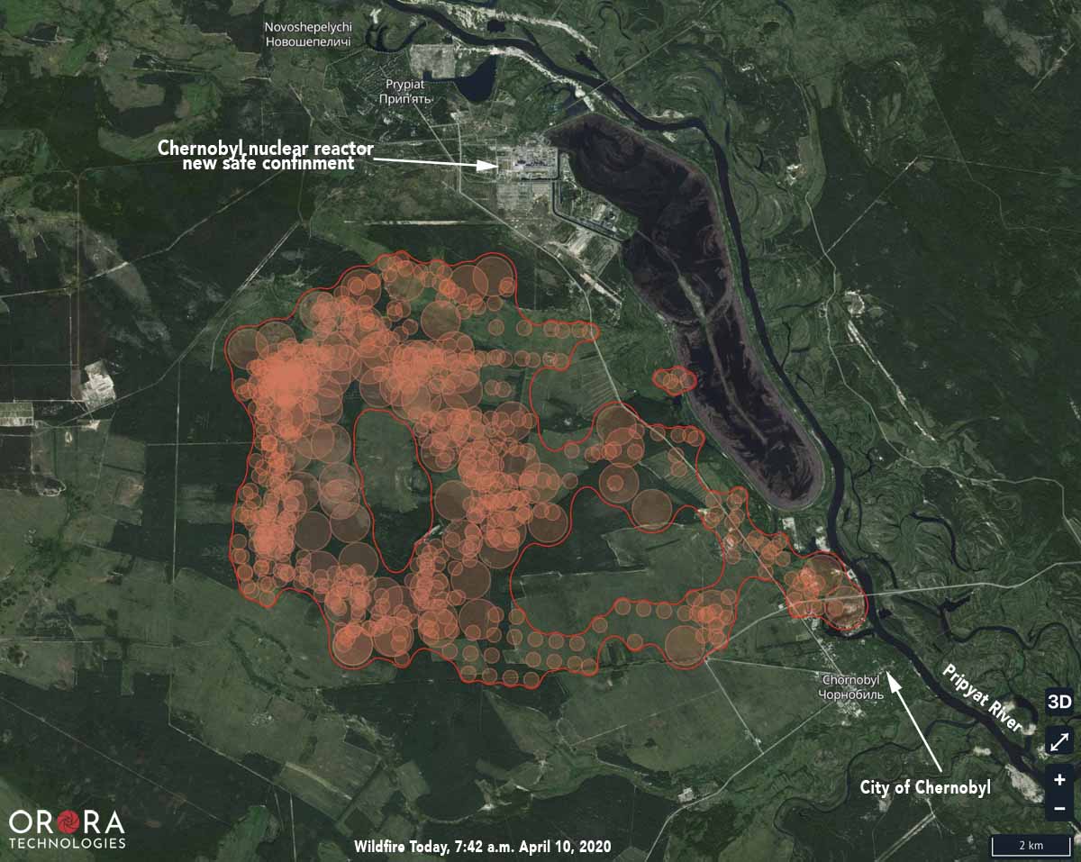
The Sentinel-2 satellite photo above was taken April 10, showing the wildfire approximately 3 kilometers south of the New Safe Containment structure that covers the remains of the Chernobyl nuclear reactor that exploded in 1986 at Pripyat. The area in the photo is similar to that shown in the map below which includes heat detected by a satellite.
(Originally published at 10:59 p.m. EDT April 10, 2020)

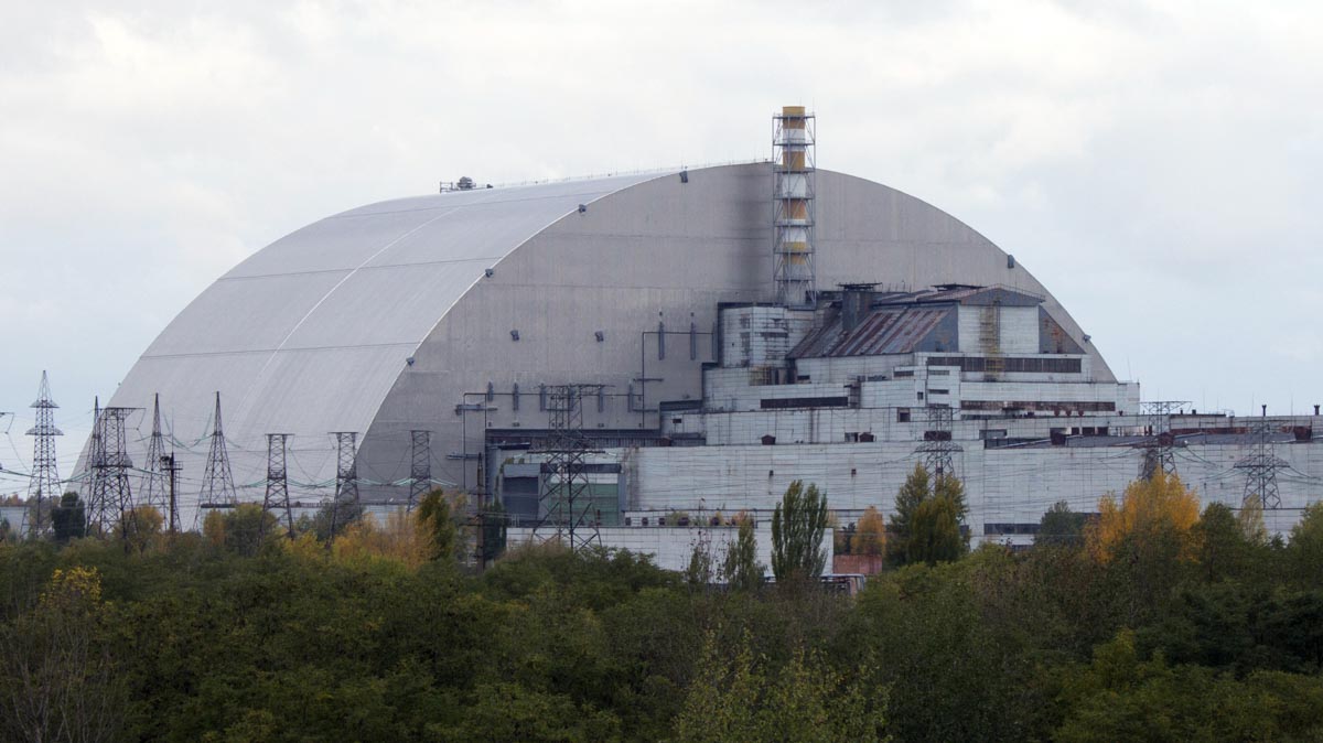
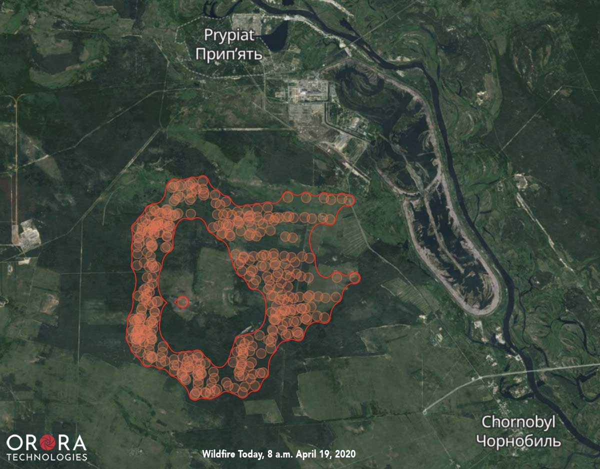
A wildfire that started April 4 in Ukraine has spread rapidly in the last two days to come within approximately 3 kilometers of the New Safe Containment structure that covers the remains of the Chernobyl nuclear reactor that exploded in 1986 at Pripyat.
Satellites detected heat from the fire at 7:42 a.m. EDT April 4 showing the fire extending to the Pripyat River just north of the abandoned city of Chernobyl.
Our very unofficial estimates based on the satellite data put the size at about 7,000 hectares (17,300 acres) as of Friday morning. The fire has been spreading east and southeast.
In recent days elevated radiation levels have been detected near wildfires burning in the exclusion zone around the Chernobyl nuclear power plant. People are not allowed to live within 19 miles of the closed facility, however about 200 people have remained in the area despite orders to leave.


Thank you for this informative article.