September 9, 2020 | 4:20 p.m. PDT

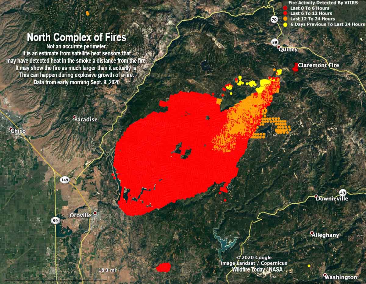
One of the fires on the North Complex of fires east of Chico, California apparently grew by about 100,000 acres Tuesday. Operations Section Chief Jake Cagle said Wednesday morning that 45 mph winds pushed the Claremont/Bear Fire to the southwest for miles until it reached Lake Oroville east of the city by the same name. But it didn’t stop there. According to the map produced by the incident management team it worked its way around the south side of the lake and may have even spotted across the lake.
With the extremely rapid growth, firefighters were unable to have the luxury of containing the fire’s edge, their time had to be spent on the urgent matters of firefighter and public safety, notifying citizens of mandatory evacuations, and protecting structures.
Evacuation information can be found at the Plumas National Forest’s Facebook page. A virtual community meeting will be available there at 6 p.m. PDT today (Wednesday).
The exact location of the fire’s edge was not certain at mid-day Wednesday because an aircraft scheduled to map the fire Tuesday night became unavailable due to a maintenance issue. Without the more accurate mapping system, the incident management team used heat-sensing data collected by satellites to evaluate the size, which is far less reliable. Mr. Cagle estimated Wednesday morning that the fire at that time was about 45 miles long and 30 miles wide.
The incident management team believes the North Complex of fires has burned approximately 254,000 acres, an increase of about 104,000 acres over the figure released earlier in the day.
The North Complex is comprised of multiple fires, most of which were suppressed, but remaining were the Bear and Claremont blazes. The map below shows where they were on August 20 before they burned together. The team fighting the fire now is referring to it as Bear Fire, or the North Complex.

The map below is not an accurate perimeter. It is an estimate from satellite heat sensors that may have detected heat in the smoke a distance from the fire, in addition to the fire itself. It may show the fire as being much larger than it actually is. This can happen during explosive growth of a fire that is burning very intensely and putting up a very large column of smoke containing a great deal of ash and debris.

