November 18, 2020 | 3:28 p.m. PT
We have found better satellite data for the location of the Mountain View Fire at Walker California, which confirms that as of 8:35 p.m. PT November 17 it had spread from Highway 395 northwest across the state line into Nevada.

At 3:10 p.m. PT Wednesday the weather conditions at Walker were 42 degrees, 80 percent relative humidity, with wind out of the southeast at 2 mph — conditions not conducive to rapid spread of a vegetation fire.
November 18, 2020 | 12:39 p.m. PST

A number of wildfires broke out in Northeastern California and Western Nevada Tuesday as a cold front raced through the area.
Low humidity and very strong winds gusting at 40 to 60 mph caused the fires to spread rapidly to the northeast or east.
We will update this article as more information becomes available.
Pinehaven Fire
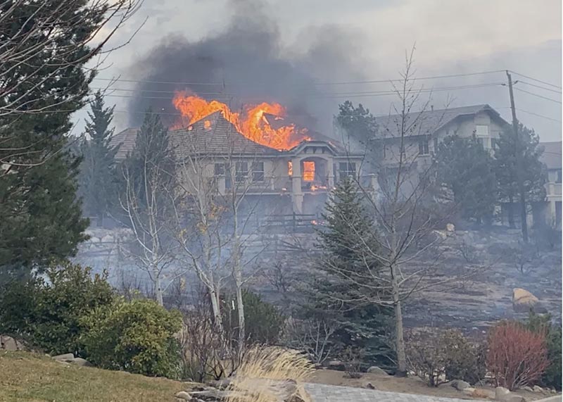
The Pinehaven Fire on the southwest side of Reno, Nevada started at 1 p.m. Tuesday southwest of McCarran Blvd. in the Caughlin Ranch area and crossed the road spreading to Cashill and Skyline Boulevards. It was pushed until 3 p.m. by 20 to 35 mph winds gusting at 40 to 60 mph from the west-southwest while the relative humidity was in the 20s.
Over a tenth of an inch of precipitation was recorded at weather stations Tuesday afternoon.
The fire destroyed five homes and damaged 15 others before the spread was stopped at 7 p.m. Tuesday. The entire area affected was about 1,200 acres but the fire spotted, leaving some areas unburned.

Laura 2 Fire
While the Pinehaven Fire was burning into Reno, the Laura 2 Fire started in the community of Doyle, California 38 air miles to the northwest near U.S. 395. In an update at about 11 a.m. Wednesday the Bureau of Land Management said it had burned 2,000 acres in Lassen County. Rain has slowed the spread. Officials estimate 20 structures have burned.
Mountain View Fire

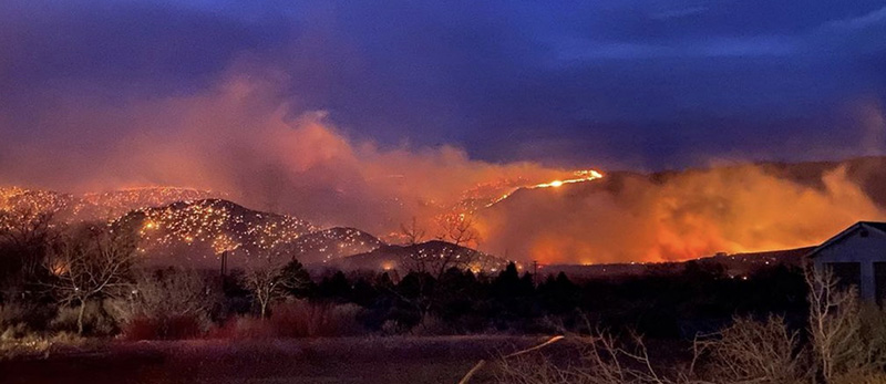
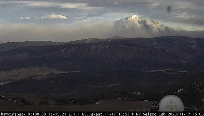
The Mountain View Fire near Walker, California has burned 20,879 acres and resulted in one fatality, according to the Mono County Sheriff’s Office and the BLM. It started in the vicinity of Walker and was pushed by winds out of the west-southwest at 30 to 50 mph gusting at 60 to 78.
There are reports that dozens of structures burned.
The fire has spread into Douglas County, Nevada near the Lyon County line. On the map below, it is not certain that the red dots in Nevada are part of the Mountain View Fire. If it is, clouds may have blocked the view from the satellite between the two areas where heat is shown. Or, between satellite overflights light vegetation burned and cooled, leaving not enough heat to be detected. Precipitation that began at 1 a.m. Wednesday slowed the spread.


Gulch Fire
The Plumas National Forest announced that the Gulch Fire burned about 150 acres near Vinton, California before it was contained at 5:30 p.m. Tuesday.

As a past BLM BC covering Reno to Walker, and a past resident of Walker, its tragic to see the destruction caused by this fire and the loss of life, homes and property to the people that live there. Not unusual to see winds like this ahead of a strong cold front along the Sierra Front. Walker, Coleville and Topaz have had more then their share of tragic fires over the years. Condolences to all the families in the Antelope Valley.
Is it known how they started Bill?
Exactly what I was wondering. Lightning or Human caused or the “Broken Power Line” version of Human Caused ?
It seems so odd when fires “just spring up” at a time when the winds hit.