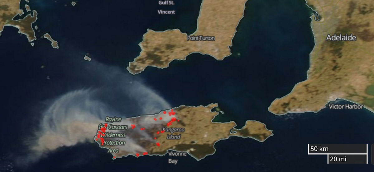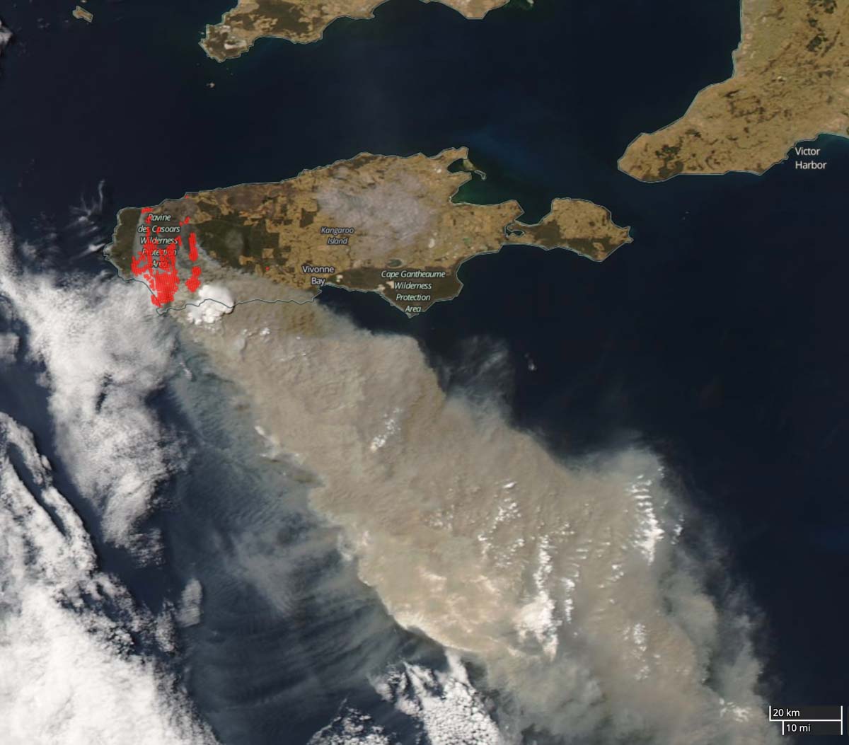
A report on the 210,000-hectare bushfire that burned almost half of Kangaroo Island southwest of Adelaide, Australia found that there was a shortage of resources, a lack of strategic planning, and cases of not following, or actively working against, the chain of command. The fire killed two people and nearly 60,000 livestock, and destroyed 87 homes.
The 2019-2020 bushfire season in Australia was one for the history books. The 10 million hectares (24.7 million acres) blackened were more than the area burned in the Black Saturday 2009 and Ash Wednesday 1983 bushfires combined.
One of the largest was the Ravine Fire that spread east across the 88-mile long Kangaroo Island off the coast of South Australia, burning 48 percent of the island, more than half a million acres.
The South Australian Country Fire Service (SACFS) commissioned a private company, C3 Resilience, to conduct an independent review of the Ravine Fire to “assist with ongoing operational improvement.” The resulting 95-page report states that it is based on 6,359 observations, 522 surveys, and 63 individual and group sessions.
The SACFS said upon releasing the report, “The men and women of the CFS acted in the best interest of the community despite extremely limited resources and facing circumstances which had never previously been anticipated. Many of these men and women did so at their own risk to their welfare and safety. The report notes many positives and clearly defines the need for better resourcing for the CFS.”
Some excerpts from the document:
- Due to the operational load within the organization, the process of only sending endorsed IMTs [Incident Management Teams] ceased, replaced with an ad-hoc manner of the selection of staff for IMTs including field command positions. This lack of competence resulted in communication deficiencies between the ground, lack of integration of local knowledge. The breakdown at times with communications across the IMT in the planning and operations cells, for example, on the Ravine fire provided a basis for the failure of operational planning occurring at critical times.
- The design of doctrine, combined with a lack of capability and competency programs for regional staff along with fatigue led to the RCC [Regional Command Center] being overwhelmed. This led to a lack of strategic resource planning, including using what capability existed within their own region to support operations on KI [Kangaroo Island].
- Much of the good work completed was discounted by a culture of some not following, or actively working against, the chain of command. Secondly, there was a lack of accountability by some crews for the mopping up and blacking out procedures led to further fire spread. The lack of technology gave the IMT little intelligence picture to work to in collecting the achievement of tactics where successful, and detecting issues of lack of accountability where they occurred.
- The SACFS [South Australian Country Fire Service] has a lessons management system, however it failed implementation for the KI fires, as the lessons have not translated into planning across coordinated fire fighting agencies.
- The fires on KI needed every capability they could get. The insertion of the ADF [Australian Defense Force] was a welcome one, however the tasking process took some time to adjust to and work through. The integration of the forestry industry was mixed between fully integrated and not at all.
- There is significant opportunity to achieve good community outcomes by further integrating FFUs [Farm Firefighting Units] into operations of fires across KI. By all parties agreeing on a coordination model, and common standards of PPE [personal protective equipment], safety standards and how to communicate, it will only increase positive outcomes for the community.
- Aviation responded well to support ground crew efforts. The establishment of a TRZ [Temporary Response Zone] could have assisted with a more rapid deployment to the Ravine Complex. An even closer relationship between IMT and aviation specialists will increase the outcome for fires on KI to integrate air and ground tactics.

Heartbreaking images of Kangaroo Island, before fire and after fire. ? pic.twitter.com/Oq6XtfRzh9
— JIW∆ (@MustaqimJiwa) January 8, 2020

We are planning on taking a camper van to KI from 23-31 may 2022.We are nature/wildlife lovers and love bushwalking.
Can you indicate if the bushfire damage has revegetated fully by then?
Thank you Allan and Angela Manton
A couple links to some videos for this fire to help put in to context the condition on the ground for tht fire. Note langauge warning.
Escaping fire storm on Kangaroo Island. Farm fire units. Not the rate of spread.
https://www.youtube.com/watch?v=fQAHupUy9w8
This is a video of us on a mobile Cfs truck driving out of Flinders Chase during a second burn over within several minutes.
https://www.youtube.com/watch?v=Fa6o77ltr5U