2:56 p.m. PDT July 3, 2021
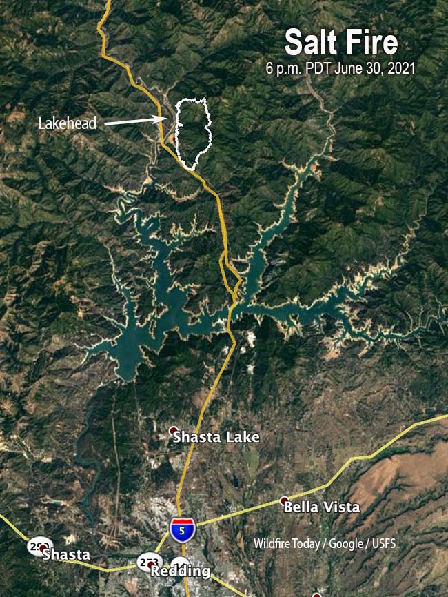
The Incident Management Team for the Salt Fire 19 miles north of Redding California announced Saturday they estimate that 27 residences and 14 outbuildings have been destroyed in the fire.
Evacuation orders and warnings are still in effect. For the latest information on evacuation orders and warnings, visit https://211norcal.org/saltfire
The fire has moved into Campbell Creek and toward the Crane Mountain area.
9:49 a.m. PDT July 3, 2021

The Salt Fire 19 miles north of Redding, California added another 2,424 acres on Friday by spreading about a mile to the north and moving about 1/10 of a mile in some locations on the east side. The fire has now burned 7,467 acres.
From the Incident Management Team Saturday morning:
Evacuation orders and warnings remain in place for communities near the fire. Crews will work today to prioritize structure protection on the fire, including north and west of Gilman Road, and around Salt Creek. Other priorities include protecting private timber lands within the fire area, and maintaining the Interstate 5 corridor.

Updated 3:15 p.m. July 2, 2021

The inversion that trapped smoke overnight on the Salt Fire north of Redding, California has at least partially broken at mid-afternoon on Friday, improving visibility and allowing more active fire behavior — as you can see in the photo below. Overnight the relative humidity rose to 60 percent but sank to 16 percent by 1:19 p.m. Friday with winds out of the southeast at 6 mph with gusts to 15.
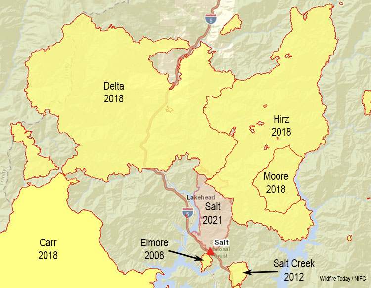
The above map is rather striking, showing other fires that have occurred nearby in the last 13 years. The year 2018 was extremely busy for firefighters in Northern California. In order for the Salt Fire to spread much to the north it would have to burn through three year old vegetation, where it would be relatively easy to suppress, if it burns in those areas at all. To the southeast, however, on a four mile path to an arm of Shasta Lake, there is no recorded occurrence of fire between the 2012 Salt Creek Fire and the 2018 Hirz Fire.

Updated 7:44 a.m. PDT July 2, 2021

The Salt Fire 19 miles north of Redding, California was active Thursday afternoon putting up a large plume of smoke. By 5 p.m. it had spread two miles to the north and about a half mile east during the previous 23 hours. During a 5 p.m. mapping flight Thursday the main fire had not crossed Interstate 5 or the Sacramento arm of Shasta Lake. At that time it had burned 5,043 acres. A satellite overflight at 3:24 a.m. Friday indicated that it had continued to spread during the night to the north for an additional half mile.
An AlertWildfire camera west of the fire showed nothing but smoke at 7:24 a.m. Friday, indicating there was an inversion, similar to the conditions Thursday morning. Later, as the atmosphere and the fire heat up, it will likely break up like it did Thursday, leading to better visibility and possibly another smoke plume.
While the Type 1 Incident Management Team is transitioning to assume command of the fire, not much information is available. This is typical — an existing team does not want to step on the toes of the new group, and the incoming team is still getting their feet on the ground. Team transitions can also lead to problems in managing the fire out in the field, but good teams are aware, and take steps to minimize any issues that could compromise the safety of the firefighters.
PHOTOS: #SaltFire destroys homes in Gregory Creek area south of #Lakehead
https://t.co/tIItic2wR6 via @BreakingNews_RS— Michael Barthel (@RealMiBaWi) July 2, 2021
Updated at 5:12 p.m. PDT July 1, 2021

The Incident Management Team announced at 3:30 p.m Thursday that the Salt Fire 19 miles north of Redding, California had grown during the day to approximately 4,500 acres. As the temperature increased and the relative humidity went down, the fire activity picked up.
The firefighters plan to keep the fire east of Interstate 5 and the Sacramento arm of Shasta Lake.

The status of Interstate 5 is variable depending on fire conditions. For a while overnight all lanes, north- and southbound, were closed. Thursday afternoon lane closures were in place but traffic was getting through. Check with Caltrans for current conditions.
For the most recent evacuation information, see the Shasta County Sheriff’s Office Twitter feed.

Updated at 1:00 p.m. PDT July 1, 2021

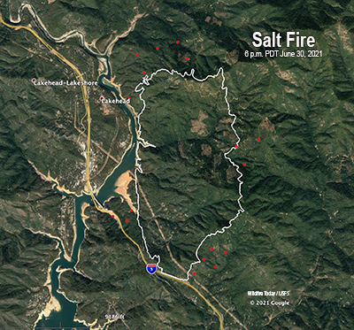
The Salt Fire 19 miles north of Redding, California spread rapidly after it was reported at 2 p.m. on Wednesday, June 30. It is burning just east of Interstate 5 and the upper reaches of Shasta Lake near Lakehead, spreading north towards Sacramento Peak. Rapid to extreme growth occurred on the fire Wednesday due to terrain, weather, and dry fuels.
Spot fires ignited on the west side of Interstate 5 but firefighters were able to suppress them before they grew large. The Shasta-Trinity National Forest is the lead agency handling the fire with the California Department of Forestry and Fire Protection assisting.
The Salt Fire was mapped at 2,800 acres Wednesday evening. It has been designated as a Type 1 incident — the highest level of complexity — and a Type 1 Incident Management Team has been ordered. California Team 2, with Incident Commander Mike Minton, is expected to inbrief Thursday afternoon.
At least 500 residences will be threatened within the next 72 hours. The Shasta County Sheriff’s was expected to assess Thursday morning how many structures have been destroyed.
The fire is very near Shasta Lake, but firefighters had to request water tenders because the lake is so low that there are few places from which to draft water to refill fire engines.
Caltrans reported at 8:20 a.m. Thursday that northbound I-5 was closed approximately 10 miles north of Redding, at Fawndale. Southbound I-5 has reopened. This is a dynamic situation and changes have occurred. Check with Caltrans for the current conditions.
Evacuation warnings and orders are in effect. For the most recent evacuation information, see the Shasta County Sheriff’s Office Twitter feed.


My husband is from Redding. We were heartbroken to see the devistation. The men from Calfire have done a great job fighting this beast. Prayers to all
Looks like it may bump into footprint of Hirz Fire?