
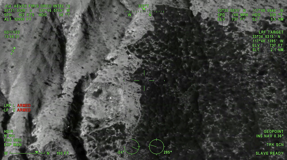
The Emerald Fire near Laguna Beach, California was mapped by the Fire Integrated Real-Time Intelligence System (FIRIS) aircraft. The video below was recorded at 1:45 p.m. February 11, day two of the fire. The image switches back and forth from thermal infrared to regular video, with heat showing up as bright white. This data can help firefighters know where to concentrate their containment and mop up efforts.
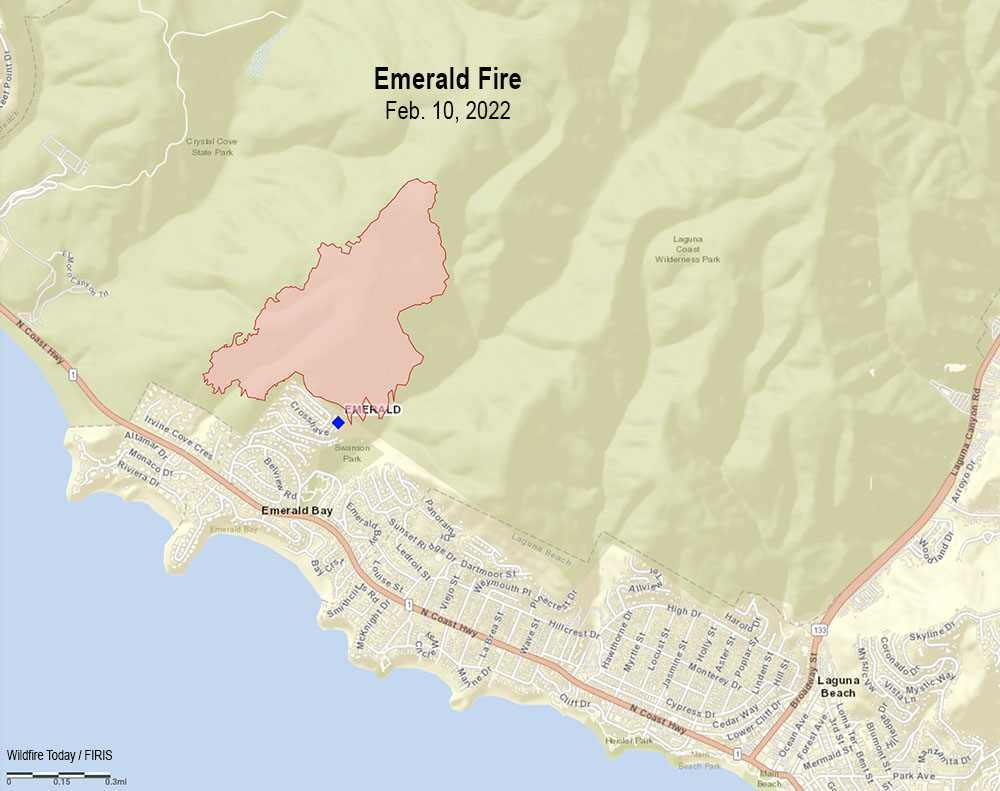
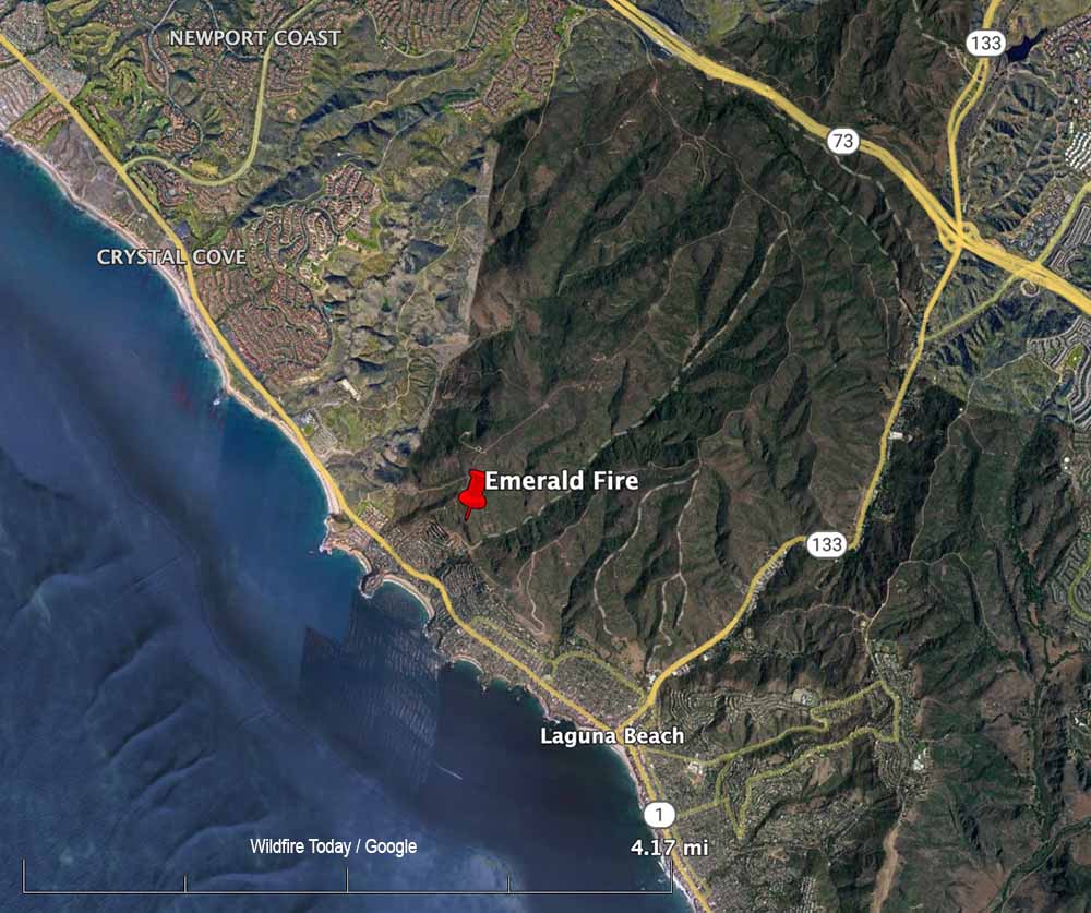
After the fire was reported Feb. 10, 2022 at about 4 a.m. in the Laguna Coast Wilderness Area, strong winds pushed the blaze near homes in the Emerald Bay area of the coastal city. It ultimately burned 154 acres, coming very close to homes, as you can see in the video.
In the aircraft were Peter Cain (Pilot), Matt Hedman of AEVEX on the controller, and Air Tactical Group Supervisor Steve Price providing narration.

What a waste of flight time and money. Used to walk around those fires routinely and check for heat. It’s called mop-up and patrol.