Updated at 10:20 a.m. MDT April 16, 2022

The perimeter of the McBride Fire at Ruidoso, New Mexico did not change in any significant way Friday, even as a few pockets of vegetation in the interior burned, putting up occasional bursts of smoke. Firefighters have been mopping up to further secure the fire’s edge. Dozers and ground crews are working on the north side in the rugged, tough country in the Eagle Creek area. On the east edge where the fire is burning in old fire scars, crews are scouting for potential control lines, such as old two track roads.
Some evacuations have been lifted, but others remain in place. The list, updated once or twice a day, is posted online.
The Incident Status Summary filed Friday evening shows resources working on the fire include 5 hand crews, 23 fire engines, and 3 helicopters. In a Saturday morning briefing the Information Officer said a total of 299 personnel were assigned. The number of homes destroyed remains at 207.
Updated 8:28 a.m. MDT April 15, 2022

The McBride Fire at Ruidoso, New Mexico grew by about 300 acres Thursday and was mapped that night at 6,162 acres. The changes in the perimeter, some of which could be attributed to more accurate mapping or tactical burning operations, were on the southeast side north of the intersection of Gavilan Canyon Road and US 70 and on the northeast side near Eagle Creek Canyon Road.
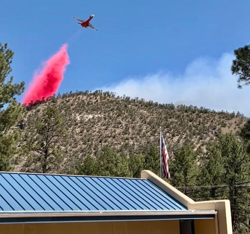
Again on Thursday, more moderate winds allowed helicopters to assist firefighters on the ground by dropping water. Crews worked on constructing or securing fire lines on the east and south sides. On the northeast side dozers worked with firefighters to construct fire line. Crews put out any remaining hotspots on the southwest side, focusing on the areas where structures were damaged or destroyed.
Resources assigned to the McBride Fire Thursday evening according to the National Situation Report and the Incident Status Summary report, included 1 hand crew and 15 fire engines, for a total of 138 personnel. The report showed no helicopters even though Incident Commander Dave Bales said in a Thursday afternoon briefing that helicopters had been dropping water.
The Nogal Canyon Fire which is being suppressed by the same Incident Management Team is burning on the Lincoln National Forest 12 miles northwest of Ruidoso, southwest of Nogal. Thursday afternoon officials said it had burned 394 acres, an increase of 49 acres in 24 hours. About 65 personnel are assigned that blaze.
Updated 9:45 a.m. MDT April 14, 2022

The McBride Fire at Ruidoso, New Mexico spread further to the northeast Wednesday, burning an additional 300 acres on the north side of Eagle Creek Canyon Road.
Thursday morning fire officials said the 5,736-acre fire has destroyed 207 homes. That number does not include outbuildings. Tuesday night, just hours after the fire started, officials said structures were lost in the areas of McBride, Gavilan Canyon, Fawn Ridge, Homestead Acres, and Lower Eagle Creek.
An elderly couple was found deceased at a home on Gavilan Canyon Road in Ruidoso on Tuesday. Law enforcement personnel found the couple after a report from a family member that they were unaccounted for.
To see all articles on Wildfire Today about the McBride Fire, including the most recent, click HERE.

Wednesday night the incident management team said evacuations affecting approximately 4,500 people were in effect for the following areas:
- Moon Mountain Area: High Loop, Lupin, Starlight
- Gavilan Canyon: From Highway 70 to Lower Eagle Creek
- East of Hull: McBride, Snowcap, Timberline, Fawn Ridge
- Homestead Acres/Lower Eagle Creek
- Rancho Ruidoso Valley Estates, Deer Valley, Deer Park, and Alto east of Flute Player
Another fire that started Tuesday, the Nogal Canyon Fire, is burning on the Lincoln National Forest 12 miles northwest of Ruidoso, southwest of Nogal. Thursday morning officials said it had burned 345 acres and destroyed 6 homes.
A Type 1 Incident Management Team, Southwest Team 2 led by Dave Bales, assumed command of the McBride and Nogal Canyon Fires at 6 a.m. Thursday. Mr. Dales said Thursday morning there are 250 people on the McBride Fire, and more have been ordered. He said the strategy is full suppression.
The McBride Fire is just outside a Red Flag Warning area on Thursday. The forecast predicts 16 to 21 mph winds out of the southwest with 6 percent relative humidity. On Friday the winds will be from the west-southwest at 22 mph with gusts to 31 mph, again with 6 percent humidity.

The decreasing wind speed Wednesday and Thursday is permitting helicopters and air tankers to assist firefighters. The fixed wing aircraft have been reloading with retardant at Alamogordo and Roswell.
The fire has spread into the footprints of two previous fires, the 2000 Cree Fire and the 2011 White Fire.

The power company is working to restore electrical service to the remaining 5,000 customers near Ruidoso. Most of the damage to the system was caused by the extreme winds gusting over 70 mph.

Incredible on the ground footage from the #McBrideFire from @gabe_krqe — you can see how close the fire came to Ruidoso Middle. https://t.co/mjsDLSokDc pic.twitter.com/0g3ew2y3Kv
— andra litton (@tornandra) April 14, 2022

Couple of impressive photos here:
https://www.elpasotimes.com/story/news/2022/04/14/mcbride-fire-continues-ruidoso-new-mexico-two-deaths-reported/7318025001/
Was this a control burn? because now you have a major big problem people lives and homes lost. Someone might be putting on a zebra suit, but wait it was the FS ?
Cause is under investigation as of 4/14/2022, 11:07:48 AM.
https://inciweb.nwcg.gov/incident/8061/
I understood the McBride fire was started when gusting winds knocked out power lines.
It’s not hard to find the info that this fire started in NM State Forestry’s response area, ie private lands. So no, definitely not started by the Forest Service.
McBride fire was not a controlled burn. Cause is under investigation.