
Updated at 1:57 p.m. PDT May 12, 2022
At briefing Thursday morning at 8:30 fire officials said one firefighter working on the Coastal Fire in Orange County, California was injured and transported to a hospital. The evacuation orders are still in place, affecting about 900 homes. The Orange County Sheriff’s office has current information about evacuations.
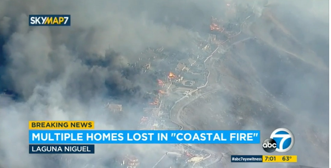
The estimate of homes destroyed is still at least 20, said Orange County Fire Authority Chief Brian Fennessy. The fire has burned 199 acres.
10 News reported that Southern California Edison sent a letter to the Public Utilities Commission regarding “circuit activity occurring close in time to the reported time” of the fire, according to the company’s spokesperson David Song.
“We submitted an initial Electric Safety Incident Report to the California Public Utilities Commission,” Mr. Song said. “SCE is required to submit an ESIR to the CPUC on certain types of incidents. … Our information reflects circuit activity occurring close in time to the reported time of the fire. …The submission of this report to the CPUC is intended to put them on notice of an incident so that it can conduct its own investigation.”
Updated at 4:50 a.m. PDT May 12, 2022
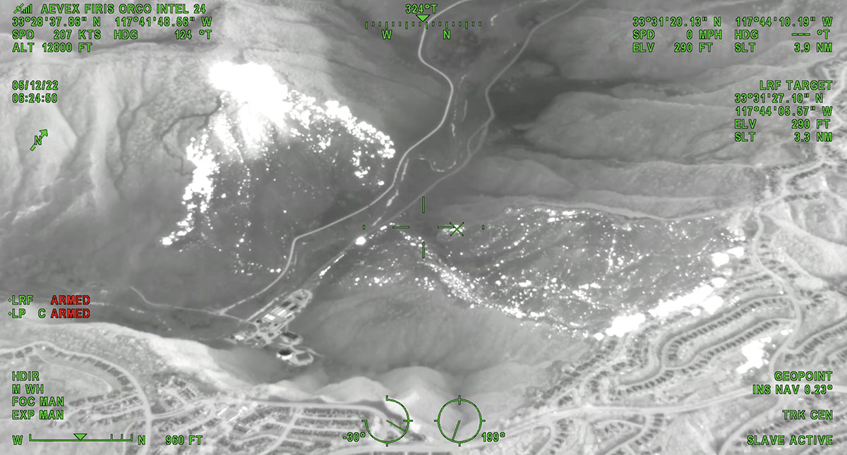
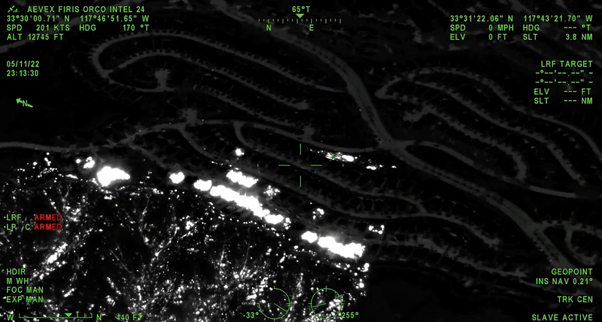
Below is a thermal image of the Coastal Fire at 11:13 p.m. May 11. The white areas represent heat.
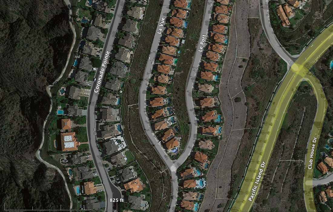
OCFA’s FIRIS Intel 24 on the Costal Incident. Second video of the incident showing the impacted structures along Aliso canyon trail and Coronado point road with the spot fires on top by the club house. Fire is holding at 195 acres. pic.twitter.com/NBMPorYRgD
— FIRIS (@FIRIS) May 12, 2022
8:15 p.m. PDT, May 11, 2022
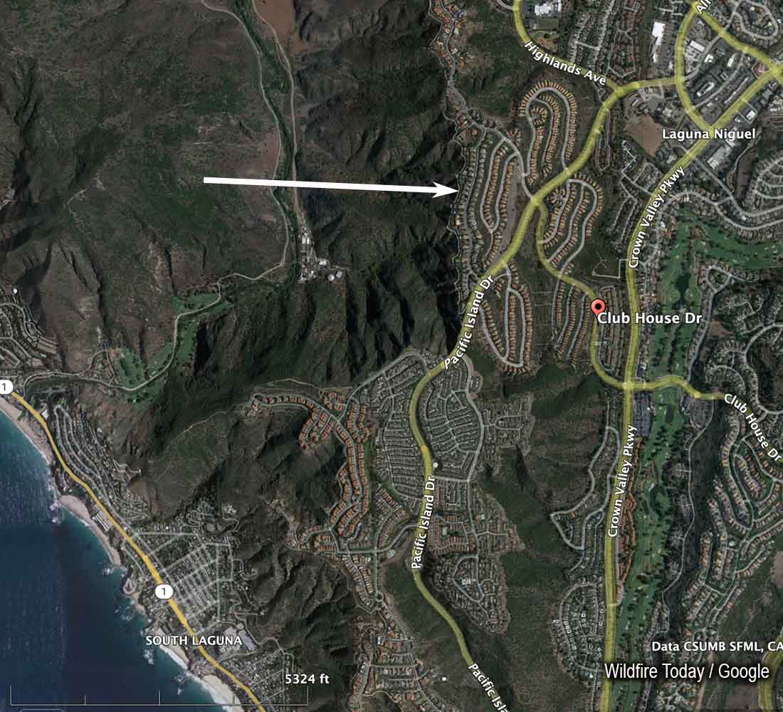
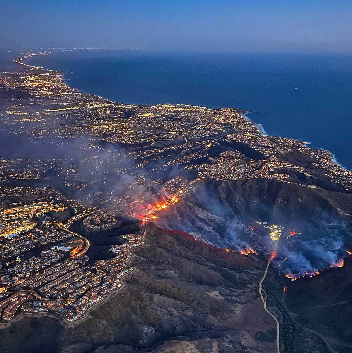
A brush fire in the Laguna Niguel community of Orange County in Southern California spread into homes Wednesday. It was named “Coastal Fire.”
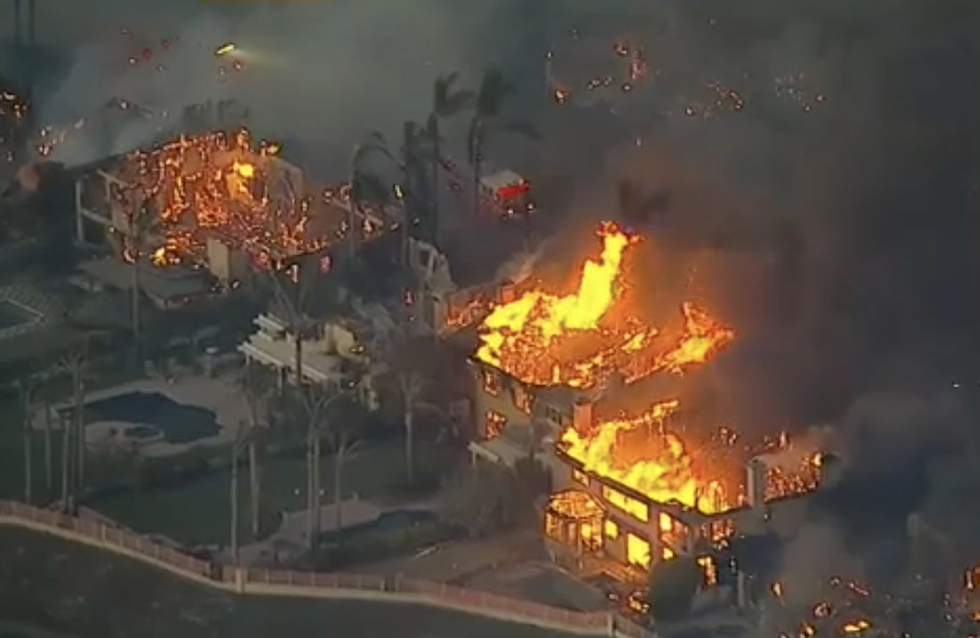
Brian Fennessy, Chief of the Orange County Fire Authority, said at 7:54 p.m. that the fire had burned about 200 acres and he was aware of approximately 20 homes that were destroyed or damaged. The Chief said some of the homes appeared to have been ignited not by direct flame impingement, but from the ember shower, possibly passing through unscreened attic vents.
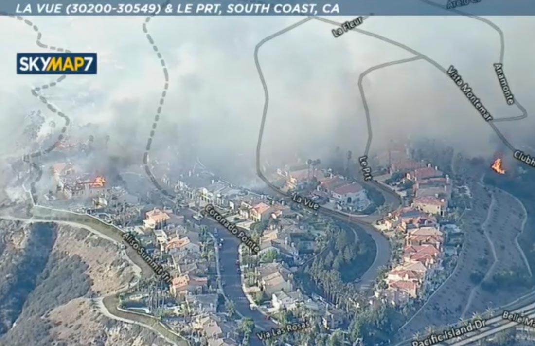
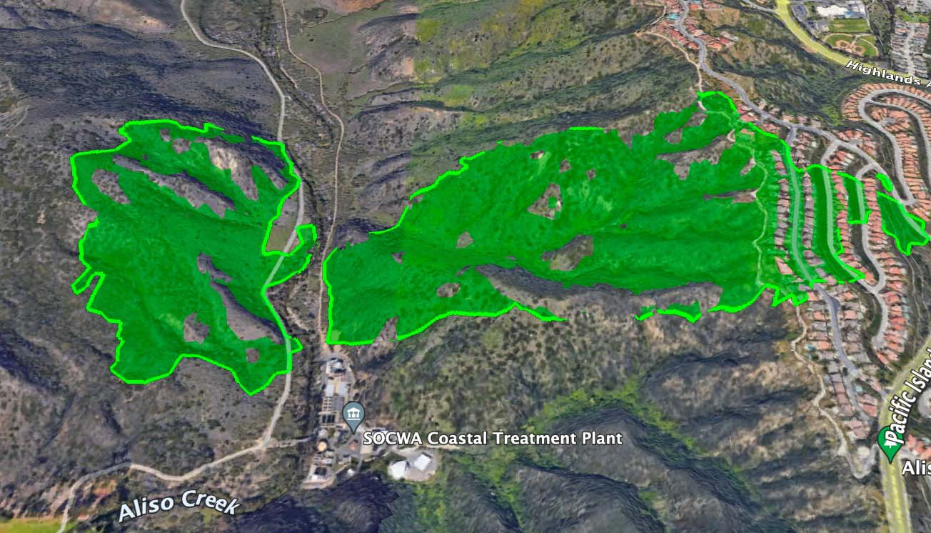
The fire started at about 2:45 p.m. Wednesday approximately a mile east of the coast, west of Aliso Creek, and was pushed by a moderately strong wind out of the west. It burned downhill to the creek, crossed it near a water treatment plant and ran uphill another half mile to rows of large, densely packed homes. By 6:20 p.m. the fire had crossed Pacific Island Drive near Clubhouse Drive.
There was a firebreak below the first structures that were in the path of the fire. It appeared to have prevented flames from the burning brush from directly impacting the homes, but the ember shower and then house to house spread did much of the damage in the community. As homes burned, radiant heat may have ignited the nearby neighboring structures. More embers were generated as each house went up in flames.
When the forward spread through the brush slowed after many drops of retardant and water by air tankers and helicopters, firefighters concentrated on preventing house to house spread. Live television coverage showed a firefighter applying water on a totally involved home, in order to protect the exposure — to cool it enough that the home next door did not burn.
Yesterday on Wildfire Today we posted an article titled, “In a wildfire burning embers transported downwind are what cause most structures to burn.”
Chief Fennessy said the wind was not unusual, but the vegetation, the fuel, is very dry. “This has become the norm,” he said. “Expect more of this.”
The cause is under investigation.
Thanks and a tip of the hat go out to Jeff.

What ever happened to the O.C.F.A. Quick Reaction Force? It’s only May!
A lot of fire people apparently haven’t either, but it is so good to hear that many are catching on to the effects of embers and how they “behave.”
Speaking of the Laguna Niguel mansions, has anyone noticed or studied the possibility of embers getting under the tile roofs? I have seen some news footage that looked suspicious, but have no direct evidence, just informed conjecture . . .
I was the subcontracting consultant that restored the coastal soil and vegetation to a roof in Laguna Beach that they now call the “iconic (fake) rock house” just north of Aliso Creek https://www.google.com/maps/@33.5110802,-117.752556,3a,75y,259.11h,94.86t/data=!3m7!1e1!3m5!1seRV8_eCxd-mhupfm0jeKiQ!2e0!5s20180101T000000!7i16384!8i8192 about 40 years ago (about a mile WSW of the present fire.)
Looks like Jack Cohen from the Missoula Fire Lab is proven right once again. Will folks ever learn?