
9 a.m. PDT June 26, 2022
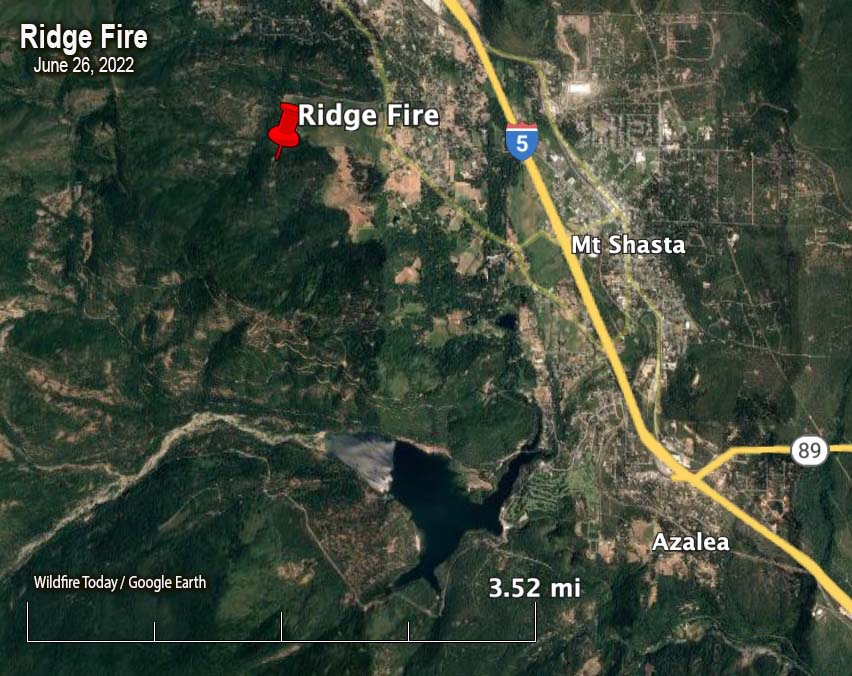
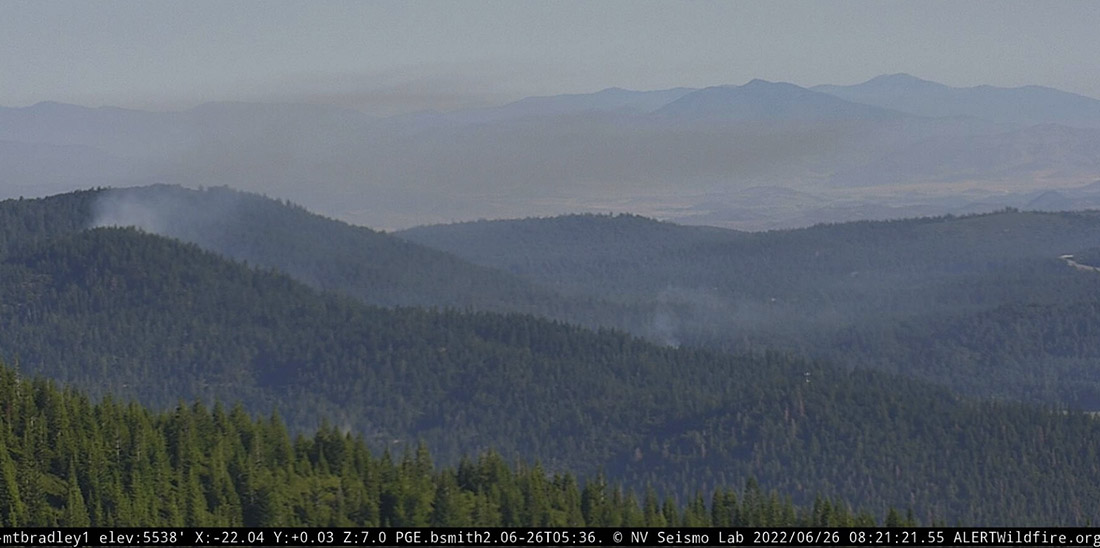
At about 9 p.m. Saturday firefighters responded to the Ridge Fire two miles northwest of the city of Mt. Shasta, west of Interstate 5 in Northern California. Infrared cameras showed multiple heat sources. It is not known if there was more than one ignition or if spot fires occurred from a single fire. The size estimate from CAL FIRE is 10 acres.
It is in an area with difficult access, on private land about a quarter mile outside the Shasta-Trinity National Forest.
#RidgeFire (W/O #MtShastaCity, Siskiyou Co) – There are now at least 3 visible spot fires on the cameras & they all appear to be east or N/E of the original fire. pic.twitter.com/H79NeTMEAZ
— CA Fire Scanner (@CAFireScanner) June 26, 2022
The weather after sunset at the Mt. Shasta weather station two miles away in the community, recorded 2 mph winds out of the southeast switching to the northeast after 9 p.m. The relative humidity in the town, which may not be representative of conditions near the fire on ridge, increased overnight from 10 to 63 percent.
The forecast for Sunday at the fire area calls for 93 degrees, 12-15 percent relative humidity, and 2 to 6 mph winds out of the southeast becoming south in the afternoon.

At least they put it out not like last year at Shasta. Thx
Why do they have to attack it? Can’t they just talk to it? Work things out?
What is the fuel loading in the area where the 3 spot fires started ?
It looks like it’s just North of the burn scar from the Carr Fire, the fire that burned from Redding to Lake Shasta in July-August 2018.
That area is fairly thick. Generally a lot of heavy brush under a timber over story.
And it’s about 25 air miles north of the Carr fire footprint.
So obviously started. People mad they didn’t get their way in trying to stop the always spectacular and consistently safe Lake Siskiyou July 4th fireworks show.
What’s the status of some of the older fires?