Updated 5:00 p.m. PDT July 13, 2022
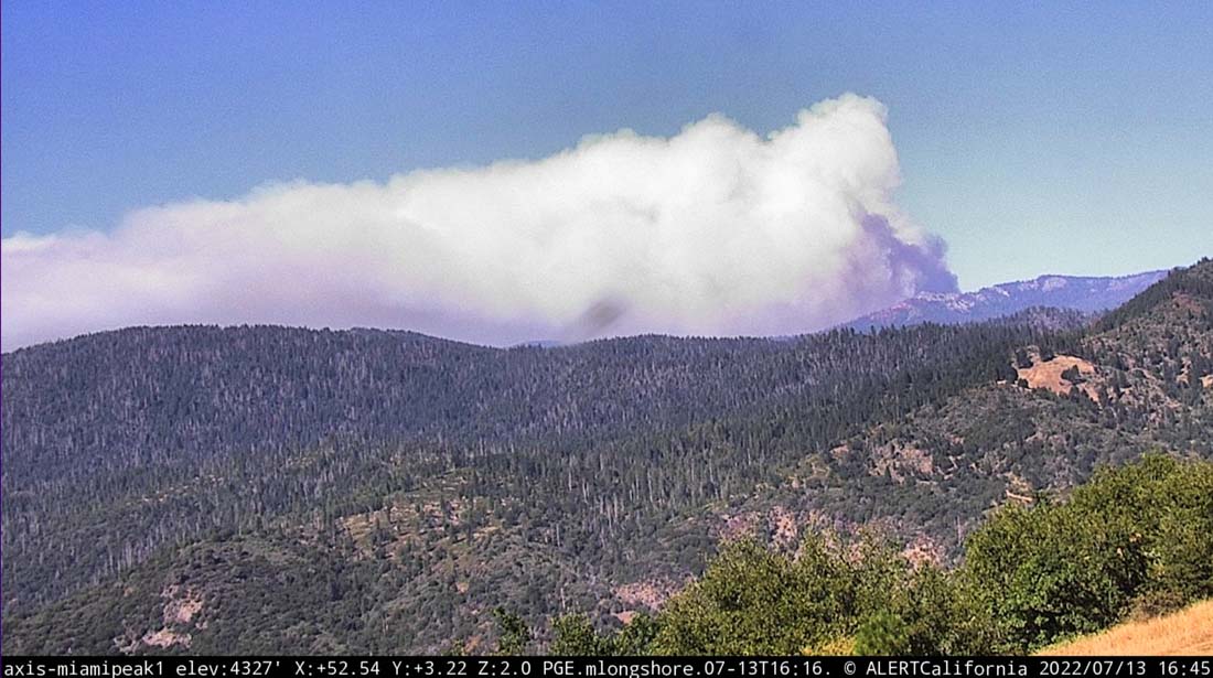
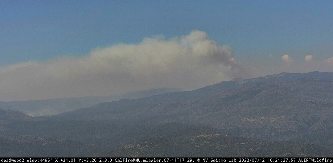
The Washburn fire in Yosemite National Park has kicked up Wednesday afternoon like it has every afternoon since it started July 7.
Helicopters have been assisting ground-based firefighters on the east side of the fire today, but due to spot fires and increased fire activity in the afternoon they called in two large and one very large air tanker to slow the spread.
A community meeting about the fire will be streamed live on Facebook at 7 p.m PDT on July 14.
The FIRIS aircraft shot video of the fire earlier today:
OES Intel 12, July 13th on the #WashburnFire Yosemite National Park. Fire is mapped at 3,949 acres at 11:09 hours. pic.twitter.com/n79QnMzOj7
— FIRIS (@FIRIS) July 13, 2022
Updated 6:04 a.m. PDT July 13, 2022
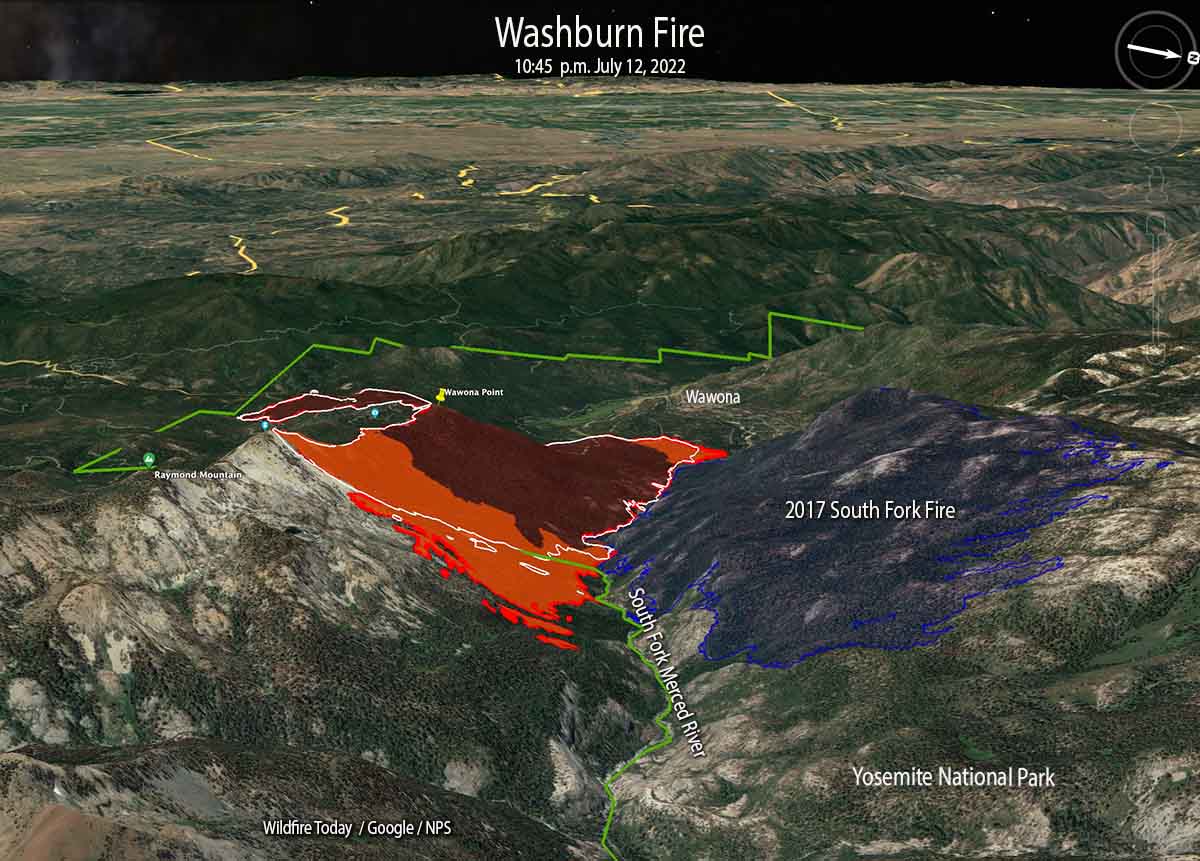
Most of the fire activity on the Washburn Fire over the last 24 hours has been on the east side where it has burned out of Yosemite National Park and into the Sierra National Forest. So far crews have been able to suppress all of the spot fires on the north side that crossed the South Fork of the Merced River and ignited the five-year-old vegetation in the footprint of the 2017 South Fork Fire.
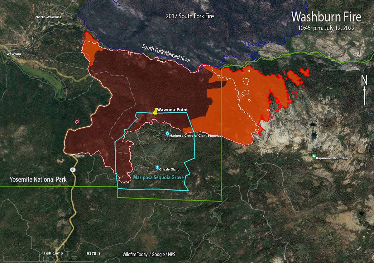
The incident management team is evaluating the feasibility of building a fireline on the east side between Raymond Mountain and the river in order to stop the movement beyond that point.
On a flight at 10:45 p.m. an infrared line-scanning aircraft mapped the fire. An infrared analyst interpreted the data and found that it had burned 3,772 acres.
Below, another aircraft using a different system, FIRIS, reported it was 3,843 acres at 10:06 p.m. July 12. Their infrared video, looking east, is below.
OES Intel 12 on the #WashburnFire Yosemite National Park. Fire is mapped at 3,843 acres at 22:06 hours. pic.twitter.com/zSKsUd6rGD
— FIRIS (@FIRIS) July 13, 2022
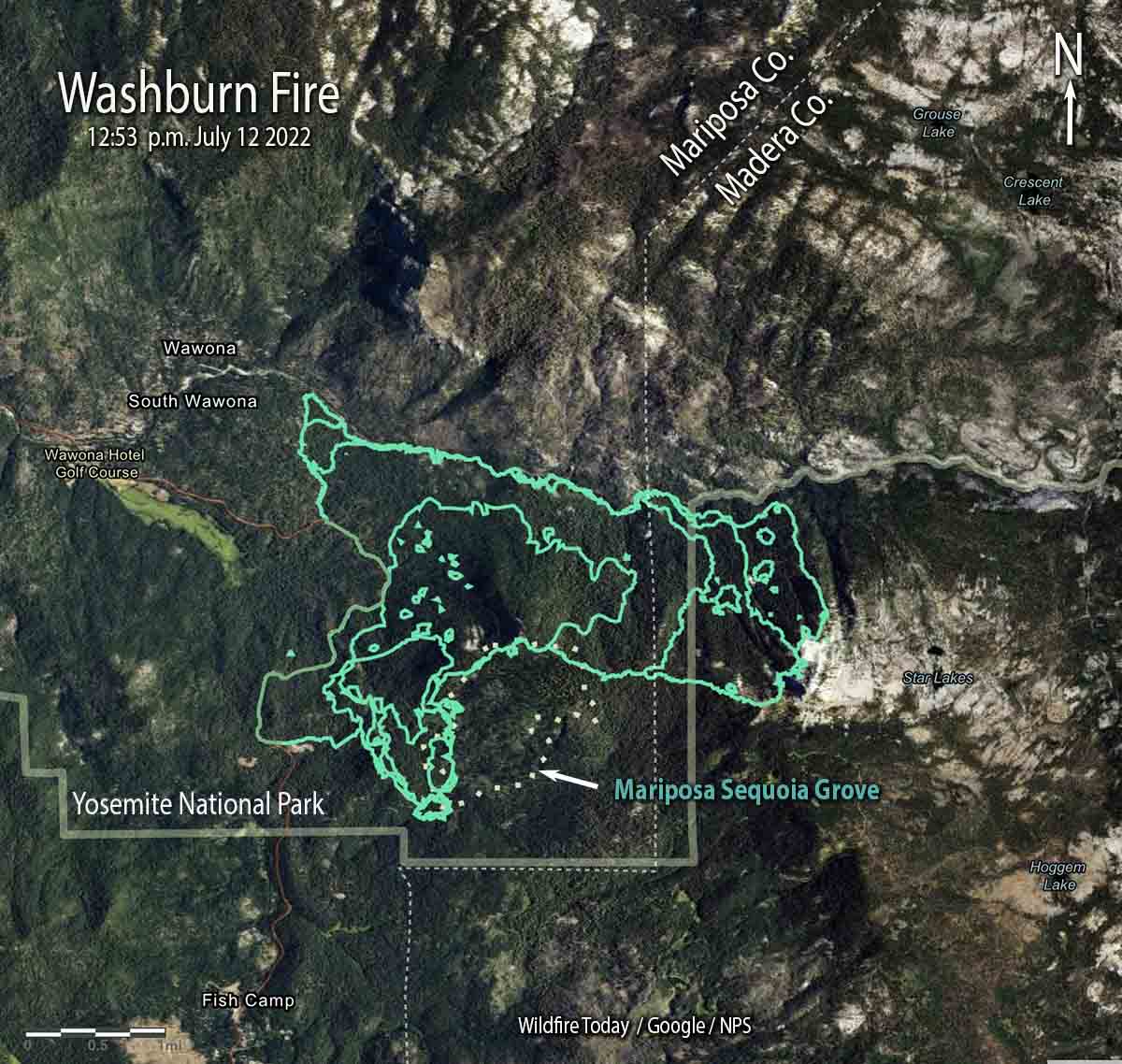
Fire crews are making progress on the Washburn Fire in Yosemite National Park — the south and west sides are starting to look more secure. At 12:53 p.m. Tuesday it was mapped at 3,516 acres.
Approximately 340 acres of the blaze is within the Mariposa grove of giant sequoias, some of which are close to 3,000 years old. The more than 500 mature giant sequoias are adjacent to heavy fuels and have so far avoided serious damage from the fire, the National Park Service reported Tuesday.
On Monday, firefighters suppressed about 15 spot fires on the west side of the fire that were across Highway 41. They now have a fire line around the Wawona community and have structure defense equipment in place.
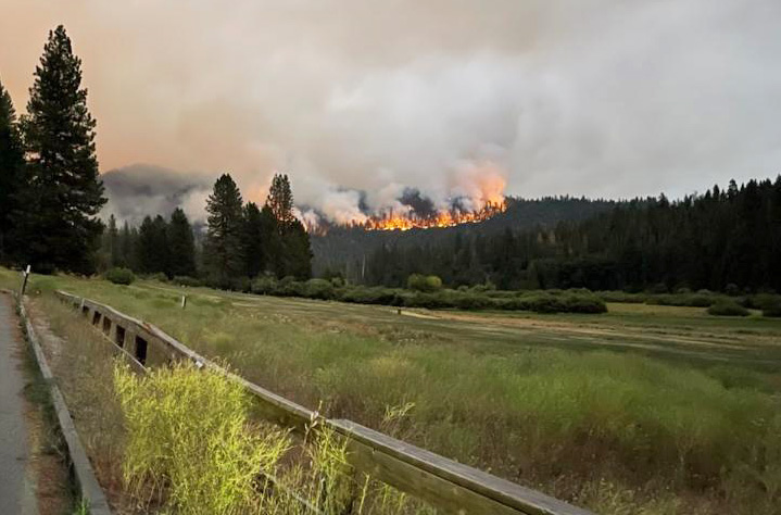
On the northeast side the line is complete from the highway down to the South Fork of the Merced River and around the community. On the north side the fire has reached the river in most places and crews are putting out spot fires as they occur across the river in the fire scar from the 2017 South Fork Fire.
The east side continues to spread. Firefighters assisted by air tankers have constructed fire line along the ridge east of Wawona Point and so far that is holding. About a mile to the east hotshot crews are evaluating the feasibility of building a fireline between Raymond Mountain and the river in order to arrest the movement beyond that point.
Yosemite Superintendent Cicely Muldoon said the fire was caused by humans.
“As you all know there was no lightning on that day so it is a human start,” Muldoon said Monday night. “It’s under investigation. That’s all I can say about that right now. We’re looking at that really hard.”
The weather for this week will continue to be warm and dry due to a strengthening high pressure system. Winds should remain light to moderate and mostly terrain driven. Temperatures will reach the low-90s and relative humidity will be in the 20-30 percent range.

“Recreational” campfires should be banned in California, and anywhere that serious drought conditions persist. There is no good reason to continue allowing people to “recreate” with fire! So many people are clueless how to burn a fire safely, and often abandon fires that are not fully out, even if “unintentionally.”
A campground, or dispersed camping in or near a national park can have hundreds of “recreational” fires burning throughout the summer vacation season (which also coincides with “fire season”). This is not sensible. Of course such a ban wouldn’t stop illegally-started fires.
I’d like to see a study of how many wildfires are started annually by “recreational” campfires. Could be a good case for the ban.
We travel in an RV full-time and use your website, as well as Inciweb and Calfire, to stay informed and avoid wildfires and “red flag” areas along our routes. Five years on the road, and we have never lit a campfire. Not once! We prefer the fresh forest air over smoke. If only we could convince our neighbors.
Thanks for your reporting.