
Updated 7:19 a.m. PDT August 7, 2022

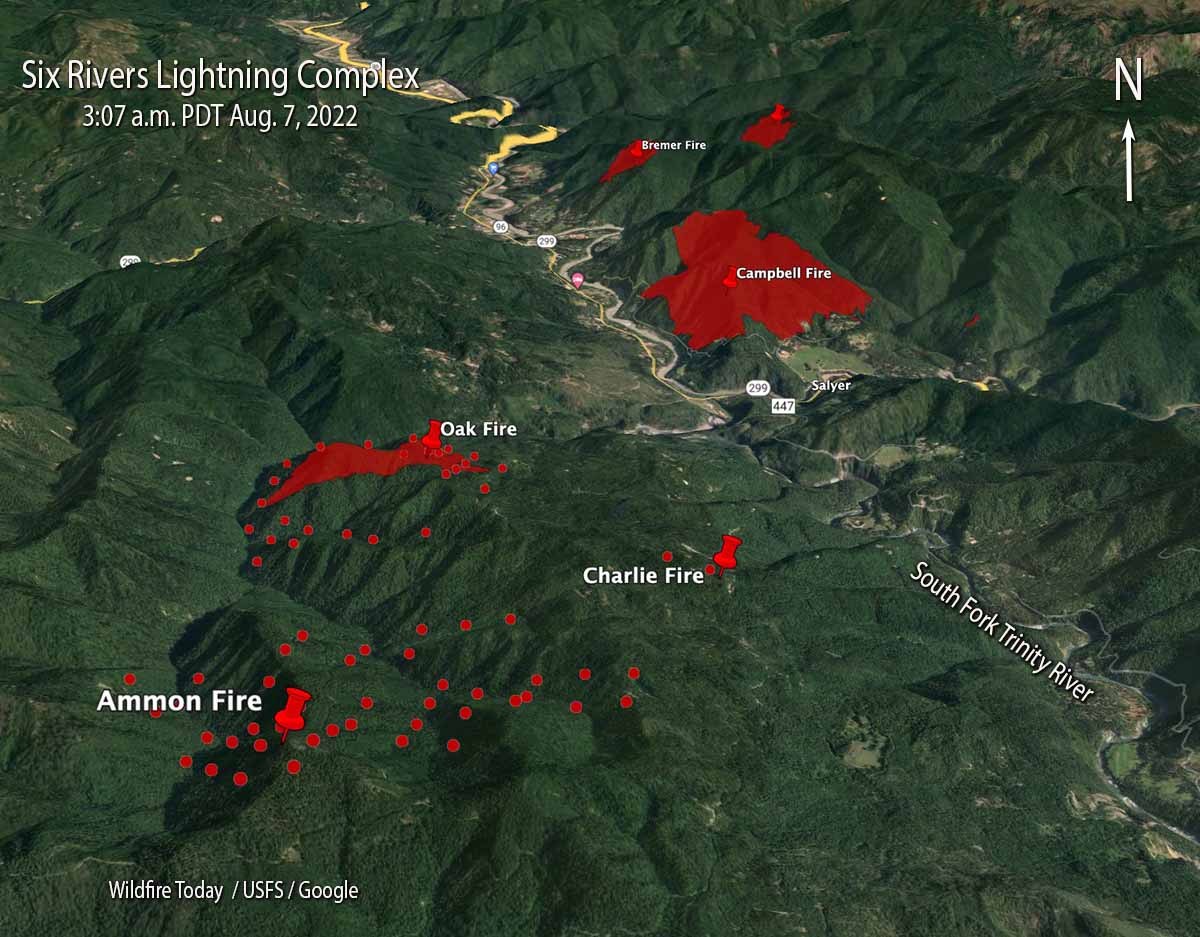
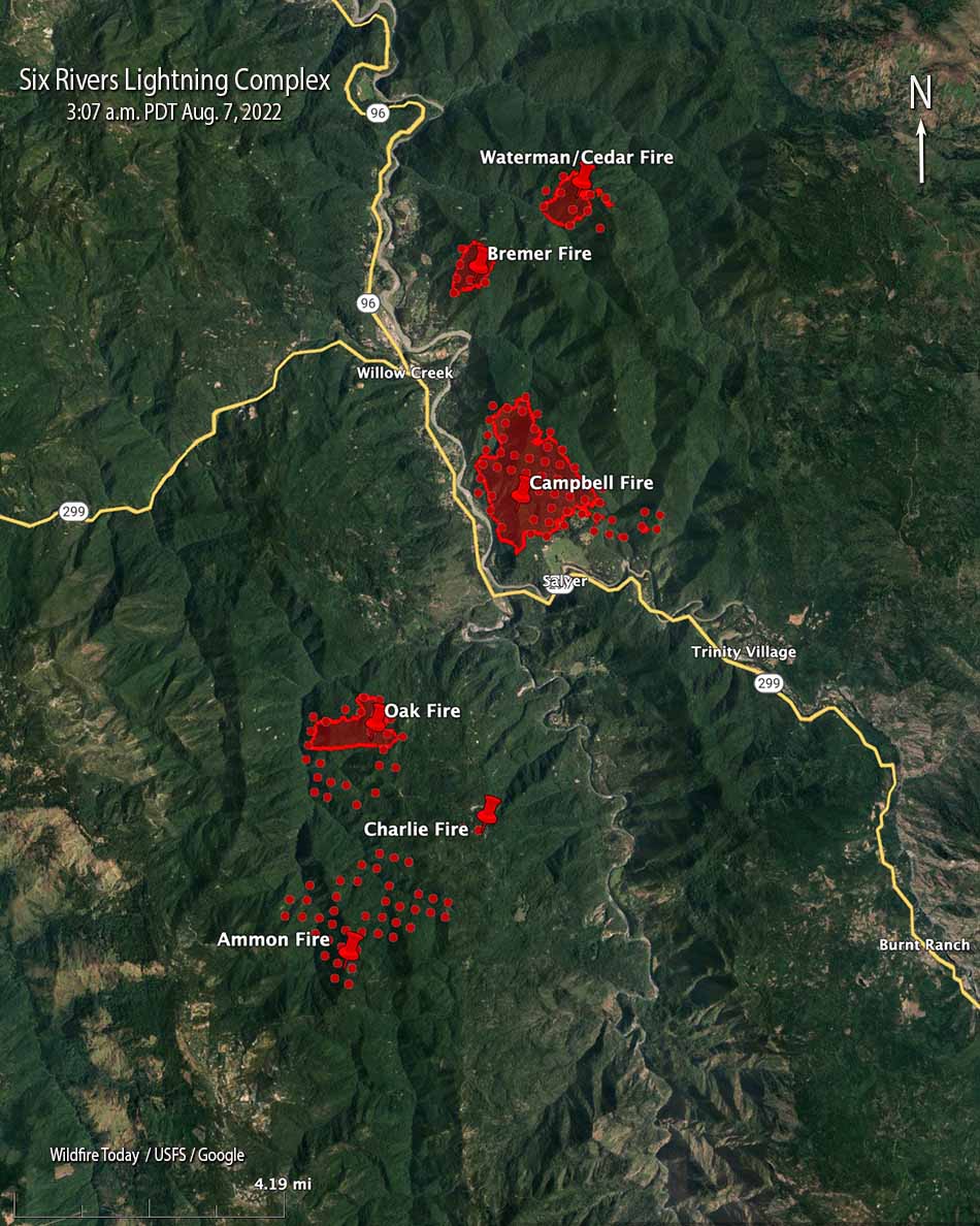
Saturday night at 8:32 a fixed wing aircraft mapped four of the eight fires on the Six Rivers National Forest that comprise the Six Rivers Lightning Complex of fires. The three closest to Willow Creek and east of Highway 299 at that time were the Bremer (213 acres), Campbell (1,526 acres), and Cedar (250 acres).
As can be expected when a dozen fires all start at about the same time in rugged country, there has been some confusion about the names of the fires. We did the best we could to sort that out, but the names on these maps could be subject to change.
Evacuations are in effect. Evacuation zones can be found at community.zonehaven.com. An evacuation center has been established at Trinity Valley Elementary School, at 730 Highway 96, Willow Creek. For more information and up-to-date evacuation information go to humboldtsheriff.org/emergency, or Humboldt County Office of Emergency Services or Trinity County Office of Emergency Services.
The Type 2 Incident Management Team 11, led by Incident Commander Christopher Fogle, will assume command August 7th at 6:00pm.
Updated at 8:13 p.m. PDT August 6, 2022
Updated at 8:02 p.m. PDT August 6, 2022
The Six Rivers National Forest is calling the fires near Willow Creek, California, the Six Rivers Lightning Complex. They released the following information and map on Saturday.
We cannot stress this enough- This is a VERY ACTIVE INCIDENT and is emerging and changing rapidly. Please don’t take notifications lightly and stay informed.
Evacuations are in effect. More information:
Humboldt County: facebook.com/HumCoOES
Trinity County: facebook.com/TrinityCoOES
- WATERMAN: Approx. 75 acres. Fire is located northeast of Willow Creek on Waterman Ridge Road 7N02 Forest Route 4.
- CEDAR: Approx. 80 acres. Fire is located near Waterman Fire.
- BREMER: 15 acres. Fire is located northeast of Willow Creek on ridgetop above the Bigfoot Subdivision.
- FRIDAY: Fire is located south of Willow Creek ½ mile up Friday Ridge Rd from Hwy 299.
- OAK: 200 acres. Fire is located south of Willow Creek. Near FS Road 5N31 and 6N20.
- CHARLIE: Contained. Located south of Willow Creek near the Oak Fire and along FS Road 6N20.
- CORRAL: Fire is located northeast of Willow Creek on Tish Tang Ridge.
- CAMPBELL: Due to fire activity, the Bravo and Campbell fire have merged and is now being called the Campbell fire. Approx. 150 acres. Located south of Willow Creek on the west side of Campbell Ridge above Campbell Ridge above Campbell Ridge Road.
Twelve fires were discovered on August 5. Firefighters stopped the spread of four of them thanks to aggressive initial attack.
Some of the air tankers working the fire are reloading at the Rohnerville Air Attack Base south of Eureka.

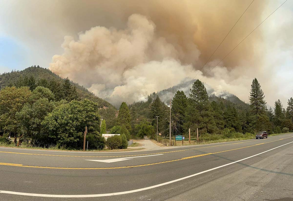
The fire behavior is described as extreme with group torching and running. The Type 2 California Incident Management Team 11 (Fogle) is assigned, tentatively scheduled to in-brief Sunday August 7.
2:18 p.m. PDT August 6, 2022

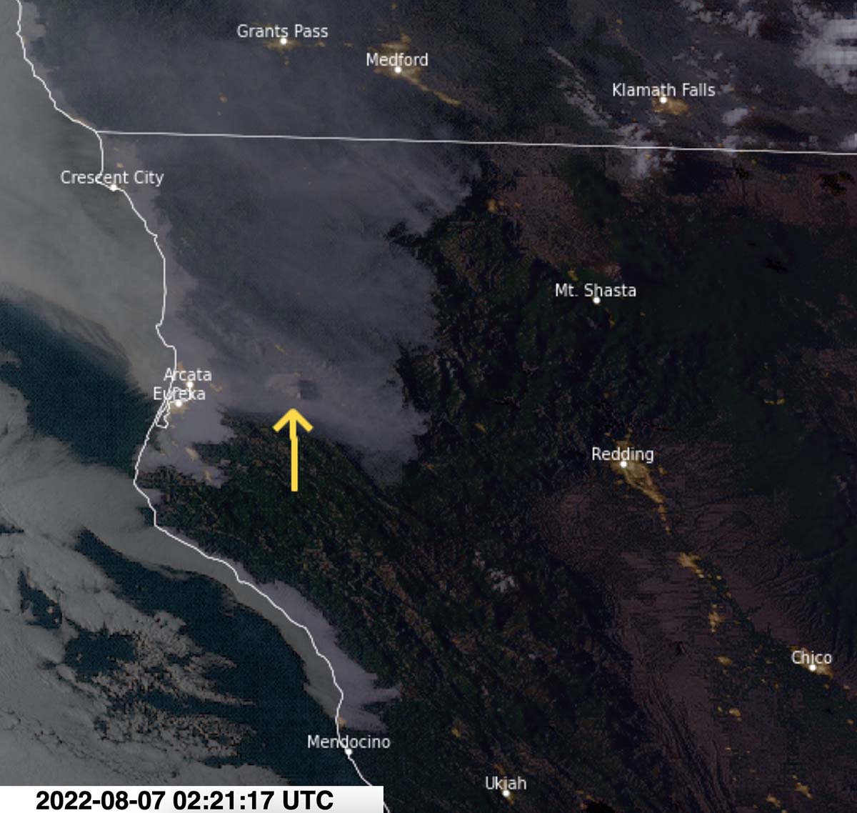
Numerous wildfires have been detected in Northern California near Willow Creek about 28 miles east-northeast of Eureka. Approximately a dozen recently reported fires are within 10 miles of Willow Creek.
This a rapidly evolving situation. While some of the fires are part of what is called the Six Rivers Lightning Complex of fires, it is not clear yet how many are within that complex.
Here is a list of some of the incidents, generally working from south to north:
- Charlie Fire
- Oak Fire, 200 acres
- Bremer Fire, 35 acres
- Surprise Fire
- Frida Fire
- Bravo Fire, 50 acres
- Campbell Fire, 100 acres
- Cedar Fire, 80 acres
- Waterman Fire


I had to use my miraculous prayers to put out the fires today. May every fire needing to be put out be extinguished today.
Sincerly,
Michelle Piatt
Finally we have unquestionable evidence that some Wildfires are NATURAL because there were THUNDER STORMS and FORESTS long before there were humans.
Next your will proclaim that rain comes from the clouds! These relegations you come up with!