Updated 1:05 p.m. PDT Sept. 1, 2022

The Border 32 Fire which is burning in Southern California on both sides of Highway 94 between Barrett Junction and Potrero was mapped at 4,438 acres at 10:51 a.m. by the FIRIS aircraft. That is an increase of about 200 acres over the previous 24 hours.
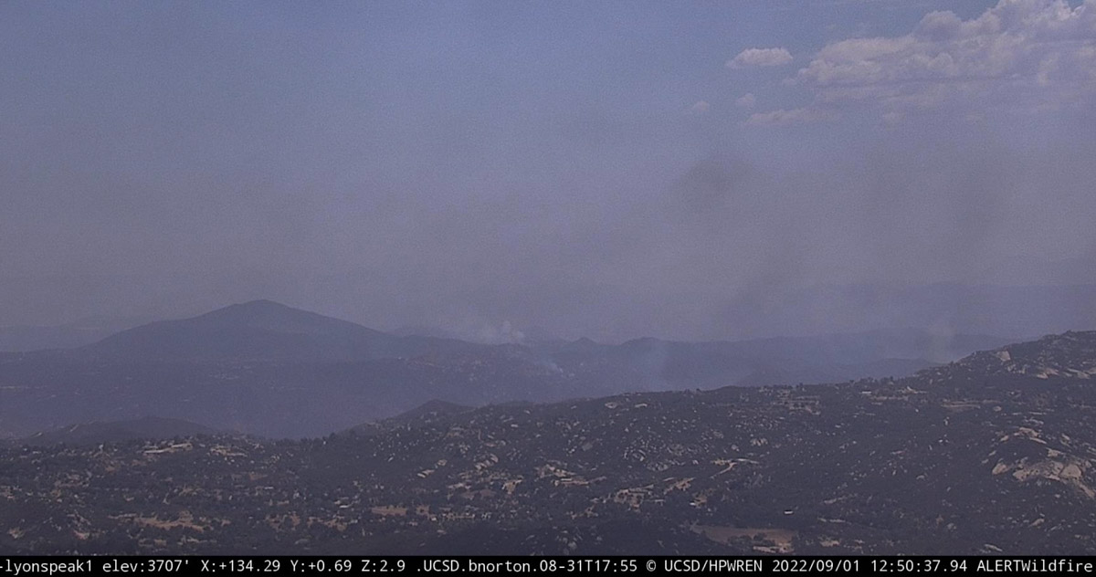
The cameras are showing minimal fire activity, but that could change during the heat of the afternoon.
Updated 6:04 a.m. PDT Sept. 1, 2022

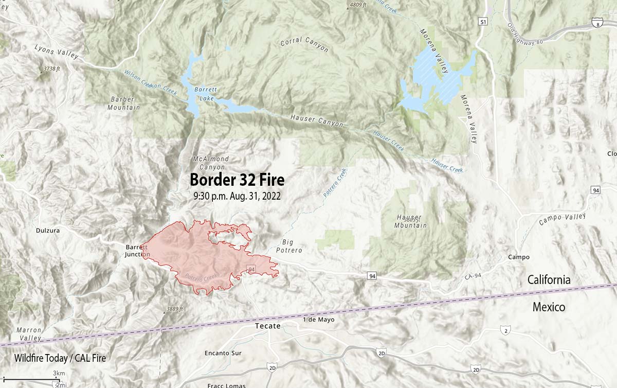
At around sunset on Wednesday the Border 32 Fire spread across Highway 94. When the fire was mapped at about 9:30 p.m. it was on both sides of the highway for a two-mile stretch along the highway just west of Tecate Road. At that time it was very close to Potrero, 1 mile from Tecate, 1 mile from the US/Mexico border, 4 miles west of Canyon City, and 8 miles west of Campo.
At least four structures are reportedly destroyed and more than 400 residences are affected by evacuations.
The 9:30 mapping flight determined it had burned 4,243 acres.

CAL FIRE said at 11 p.m. on Wednesday that the fire continues to threaten Barrett, Potrero, and Tecate.
The Customs and Border Protection said the Tecate border crossing will not open Sept. 1 at the usual time of 6 a.m. but will remain closed. The Otay Mesa crossing is an alternative.
The San Diego County Sheriff’s office has ordered evacuations. They have posted a map showing the areas affected.
After Wednesday night at 9 p.m. the wind speeds decreased from 15-20 to 5 mph, slowing the spread of the fire. The maximum relative humidity overnight was 36 percent. The spot weather forecast for Thursday calls for 107 degrees, 20 percent RH, and south winds up to 8 mph shifting to the west at 12 mph with gusts to around 20 mph in the afternoon.
Updated 5:29 p.m PDT August 31, 2022

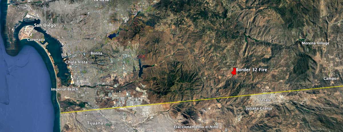
The Border 32 Fire grew rapidly after it was reported southeast of San Diego Wednesday at about 2:30 p.m.
The blaze is about 5 air miles west of Potrero, the same distance northwest of Tecate, and 3 miles north of the US/Mexico border.
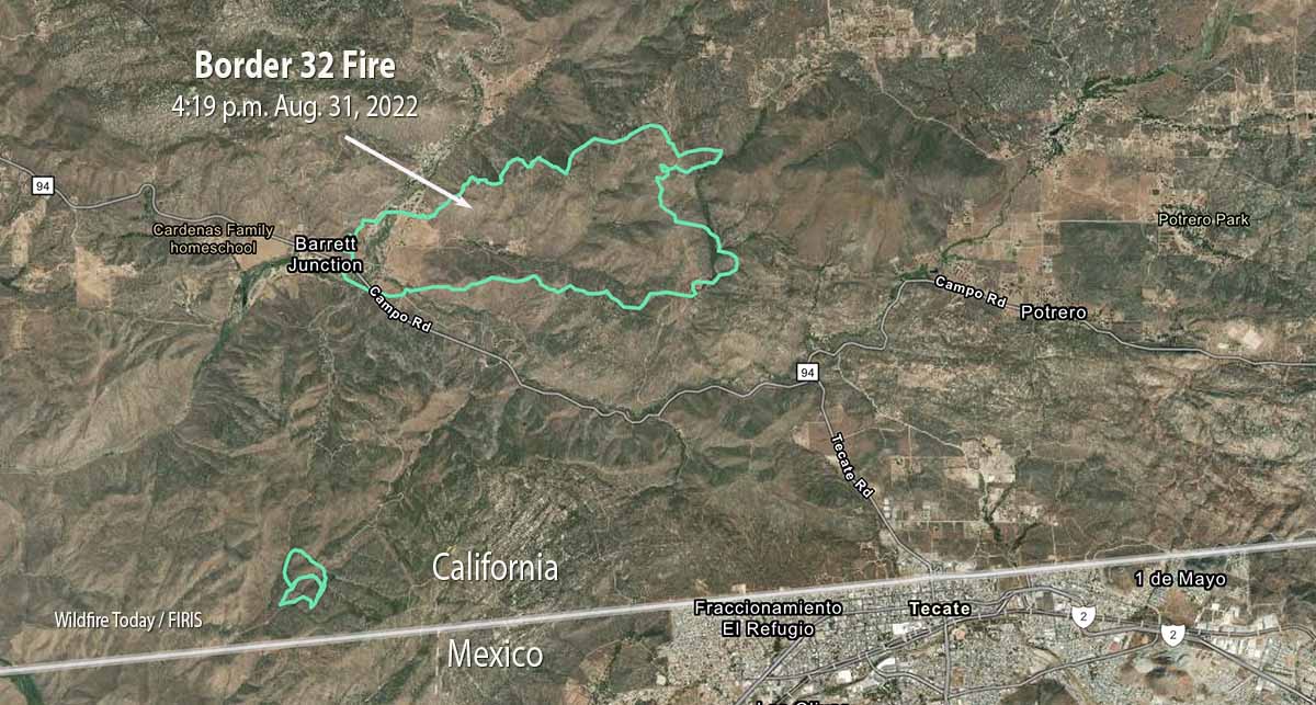
It is spreading quickly primarily to the east and east-northeast in the general direction of Potrero and Potrero Park. All but a relatively small portion of the fire is north of Highway 94. Judging from the map it apparently started east of Barrett Junction, south of the highway and southeast of the junction with Barrett Smith Road.

At 4:34 p.m. the fire had burned an estimated 1,446 acres.
The Incident Commander has requested a very large number of engines, dozers, and air tankers.
Evacuations
The San Diego County Sheriff’s office has ordered evacuations. They have posted a map showing the areas affected.
Weather
The forecast includes a heat warning for the rest of the week all the way through Saturday night, at least. At 4:30 p.m. PDT on Wednesday the nearby Barrett Junction weather station recorded 100 degrees, 20 percent relative humidity, and 18 mph winds gusting out of the south-southwest at 28 mph. For Wednesday evening and night the wind speeds will decrease to 6 mph out of the north-northwest by 9 p.m., with 77 degrees and a maximum humidity of 40 percent. For Thursday firefighters should expect 106 degrees, RH of 22 percent, and 13 mph winds gusting out of the west up to 21 mph.


We will update this article as more information becomes available.

I know we are not out of the woods yet, although I would like to thank the crew from San Miguel FD, Engine 23 for their presence in Coyote Holler on Aug. 31
God bless. Thank you, gentlemen.
Why is it at approximately 2:35 heading east was 1st cal fire commander truck first then hand crew following them type 2 brush truck and last type 2 dozer in route to the fire but only one rotory air craft and no fix wing aircraft and low wind speed (which in this terrain makes best sense to lay two lines of defense from fire burning up a draw and destroying property and homes , just imo ) , I watched everything I owned destroyed including animals because a simple brush got out of control the same as the fire in japatul valley last couple of years ago with a simple tractor caught on fire after being parked and structures and a lot of equipment was destroyed , just saying
Hi Ronnie. I wonder if air tankers out of Ramona were already committed to the Route Fire (I-5/Grapevine area) which started a few hours earlier. LR