
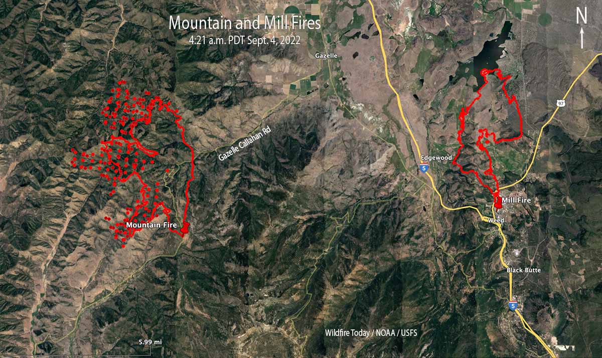
Two wildfires in Northern California, the Mill and Mountain Fires, have burned a total of more than 10,000 acres in and near the town of Weed 56 air miles north of Redding. Both fires are being suppressed by CAL FIRE’s Incident Management Team 5.
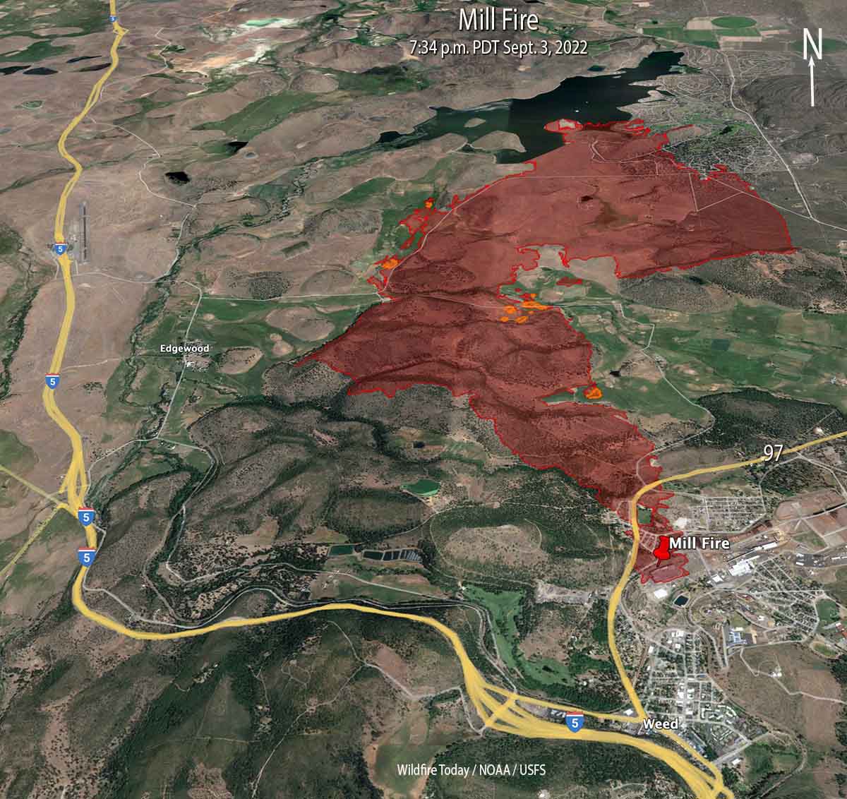
Mill Fire
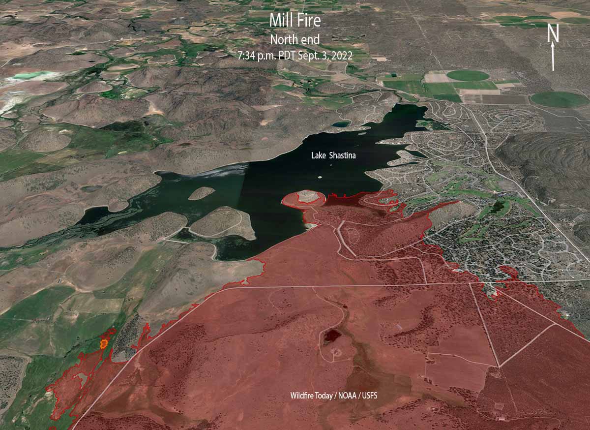
The fire is believed to have started near a lumber mill where it destroyed a commercial building and spread very rapidly through a portion of the town of Weed. It continued for another five miles to the north until it reached Lake Shastina.
Initially working with aerial imagery, officials determined that 132 structures had been affected. Damage assessment teams began ground truthing the information on Sunday. The initial early estimates from the Mayor of Weed and a CAL FIRE Unit Chief were that 100 homes were destroyed.
Evacuation orders and warnings are still in place but officials are repopulating areas where safely possible. A map is at Zonehaven.
Additional growth of the Mill Fire on Saturday was minimal. It was mapped Saturday evening at 4,254 acres.
Mountain Fire
About 12 miles west of Weed the Mountain Fire had burned 6,451 acres when it was mapped Saturday evening, but it continued to spread into the night to the north and west. There have been no reports of destroyed structures and 685 remain threatened. Approximately 332 people have been evacuated.
Evacuations are in effect. A map is at Zonehaven.
The fire is very different from the Mill Fire. There are fewer structures close to where it is presently burning, it is in remote, rugged terrain, and there is little road access. Fire behavior in the last 48 hours has been described as extreme, with hazardous trees, snags, strong gusty winds, and high temperatures. The area ranges from 2,700′ to 6,000′ elevation. On September 2 a Fuels and Fire Behavior advisory was issued for Northern California due to extreme drought, extremely dry fuels, and extended periods of hot weather. It warned that fire behavior would be elevated for the near future.
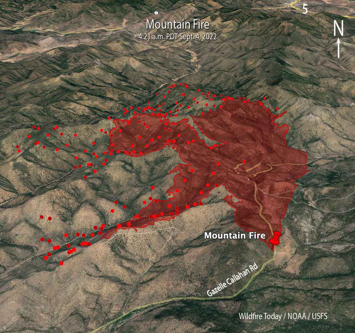
There is no nearby significant recorded history of fire in the National Interagency Fire Center database. However that database is often lacking complete information. The fire has the potential for growth in all directions, including through numerous clear cuts with dry, light to medium flashy fuel.
Threatened communities include Gazelle and Scott Valley.

Bill, the fire stopped in my backyard in the NE corner (little appendix looking slop). The reason it stopped there is a fuel break installed by a landowner on Jackson Ranch Road. And great work by a rapid response set of firefighters (calling out Captian Josh Faulkner of Sugar Pine Camp and his crew).
That fuelbreak reduced the fire intensity so that all we had faced were spots that we could handle and let burn together. Without that fuelbreak we were looking at 30’+ flame lengths and I am confident an additional 10-100 homes at risk.
I managed to reach my house ~10 minutes before the spots started landing, so I was not as well set up as I liked to handle them (I have a small fire pump/tank system setup at the house as a contingency). Josh and his crew, and Engine 2677, arrived at the right moment. They knocked the fire down enough for me to mop up and they took off to address other heads of the fire. Amazing job.