(UPDATED at 12:37 p.m. MDT September 5, 2019)
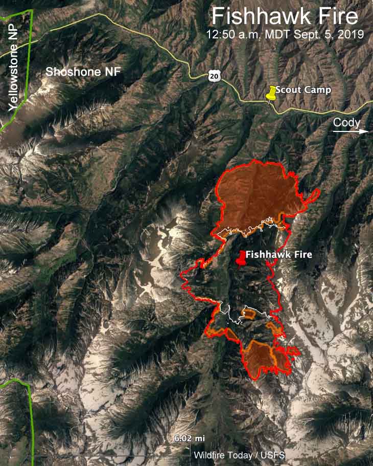
Strong winds gusting up to 33 mph along with low humidities caused the Fishhawk Fire to more than double in size Wednesday to 10,321 acres. It spread two miles to the north and the same distance to the south. The spread to the west and east is slowed by steep ridges going up to 9,000 to 11,000 feet. However the overnight mapping shows the northeast section of the fire crossed the ridge at the 9,800-foot level, establishing fire in the adjacent drainage to the east.
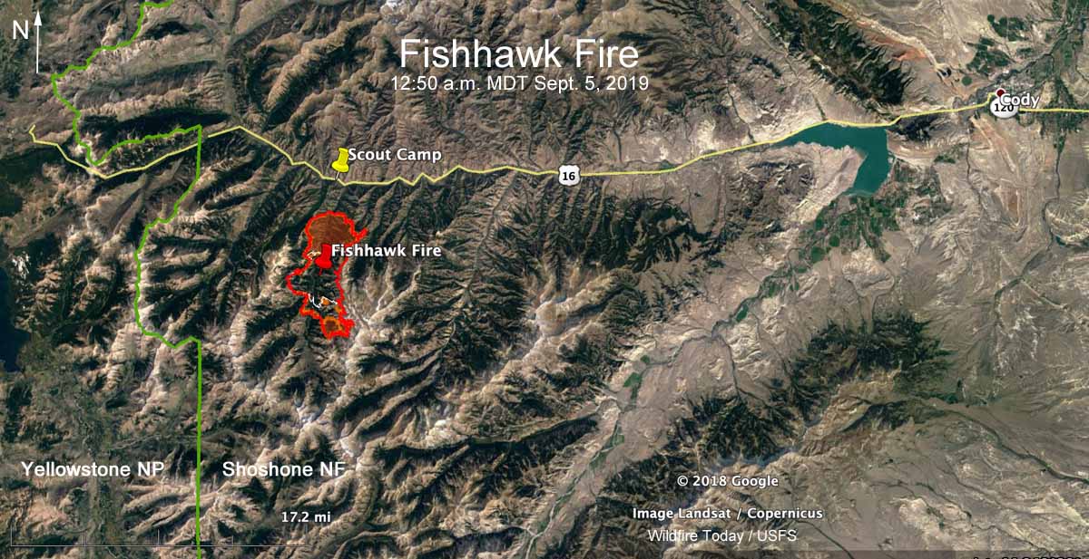
During the 12:50 a.m. MDT mapping flight on Thursday the Fishhawk Fire was 1.5 to 2 miles from Highway 14/16/20 and the Camp Buffalo Bill Scout Camp. It is 38 miles west of Cody, Wyoming and about 6 miles east of the east entrance to Yellowstone National Park. (see the map above)
(To see all articles on Wildfire Today about the Fishhawk Fire, including the most recent, click here.)
Wednesday night the Park County Sheriff’s Office issued a mandatory evacuation notice for the Scout Camp as well as the cabins in the Kitty Creek drainage.
The evacuation notice said, “…the fire has breached a line of protection that indicates a full evacuation is necessary.”

The Rocky Mountain Type 2 Blue Team assumed command of the fire at 6:00 am. Thursday.
The fire is not being fully suppressed, however the Forest Service will attempt to protect structures and private property.
On Thursday structure protection work continued in the North Fork corridor along Highway 14/16/20. Firefighters have been building fireline around structures in Kitty Creek in addition to implementing structure protection around the nearby lodges. Due to rugged terrain and safety concerns, the southern perimeter of the fire will not be staffed by personnel, but will be monitored by air assets, according to the Incident Management Team.
The day after the fire was detected, Mark Giacoletto, the Shoshone National Forest Fire Management Officer said, “Appropriate actions will be taken when it is needed and where it is safe to do so with the highest probability of success. The amount of standing dead timber and the hazardous terrain in the vicinity of the fire makes it unsafe to put firefighters near the current location of the fire.”
While the 2008 Gunbarrel Fire north of Highway 14/16/20 burned at least 67,000 acres, there have been relatively few fires in recorded history south of the highway. Much of the vegetation in the area has not burned in more than 80 years.

I’m a firm believer in aggressive initial attack, but looking at the terrain and fuel type, along with the fire behavior the first few days, I don’t think all the aircraft available would have made a difference here, let alone multiple other resources. It will likely rock out to the South, and hopefully hold on the highway with the forecasted weather and resources available.
Why was the fire not engaged when it was several hundred acres versus now?
Jim, I’m still trying to understand the logic these people are using. Its the same in R-5 the Station fire wiped out half of the LA river drainage. We protected the drainage because the watershed value for the LA river exceeds is worth far-more then standing timber. Homes, ranches and so on. If you remember the Yellowstone fascial several years ago, they did the same thing LET IT BURN. After several of the fires burnt together it endangered the entire park and it was really to late but decided to take action. I come for the old school and still believe you used over welling force and keep them small. You do however provide for safety first.
Weather for the next week looks favorable for moderated fire behavior.
Wow what does this mean they are going to let it burn ? Ask the Yellowstone Park super about the let it burn policy. This new generation will never learn.
Yellowstone, being a National Park and is to be kept natural, does not fight it’s fires. The other fires, outside of Yellowstone are being fought hard and long.
This fire is about 6 miles east of Yellowstone NP, in the Shoshone National Forest.
Yes, and about 30 miles from me in Cody…Yikes… 🙂
That statement would come as a surprise to the staff of Yellowstone, which has suppressed many wildfires over the years. If a lightning fire occurs in a certain location, under appropriate conditions, then it might be allowed to burn within a specific area. Otherwise, like every other wildland fire agency, the fire is suppressed. National park status makes no difference.
Oh, Okay. I was just there 2 days ago and that’s what we were told. I take a second tour Tomorrow, I’ll ask again..thank you for the heads up!
You’re welcome! I’d be interested in knowing who told you that Yellowstone doesn’t fight wildfires. The park would want to do some outreach to clear that up.