Jacob City and Halfway Hill fires burn thousands of acres in Utah

11:04 a.m. MDT July 11, 2022

Halfway Hill Fire 3-D map 10:34 p.m. July 10, 2022
Halfway Hill Fire 3-D map looking south at 10:34 p.m. July 10, 2022.

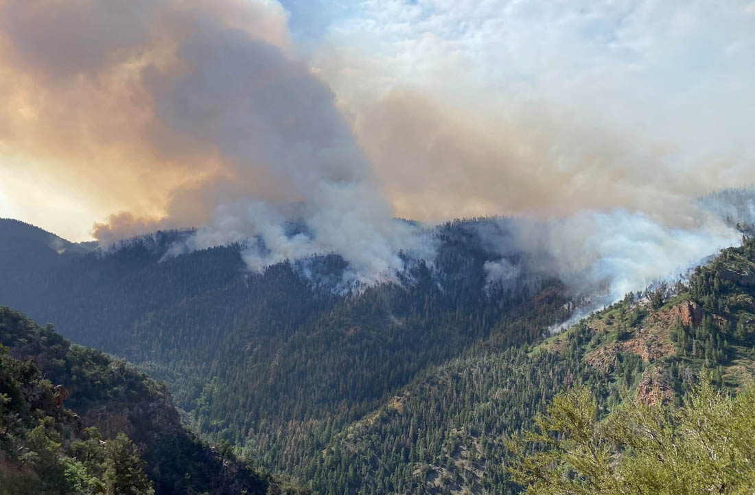
Two wildfires in Utah are burning in steep, rugged terrain.

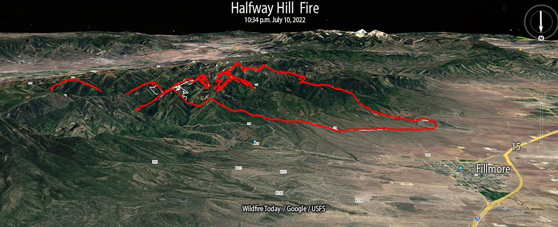
The Halfway Hill Fire is in the Fishlake National Forest two miles southeast of Fillmore east of Interstate 15. The activity on the fire Sunday was more moderate than the previous two days as the wind speeds lessened. It was mapped Sunday night at 10,417 acres. Most of the heat detected by the sensors on the aircraft was on the eastern side.

Halfway Hill Fire, July 10, 2022. Utah Fire Info
Halfway Hill Fire, July 10, 2022. Utah Fire Info.

Residents of the Virginia Hills subdivision are still under an evacuation notice.

Map of the Halfway Hill Fire 10:34 p.m. July 10, 2022
Map of the Halfway Hill Fire. The red line was the perimeter at 10:34 p.m. July 10, 2022. The white line was the perimeter about 24 hours before.

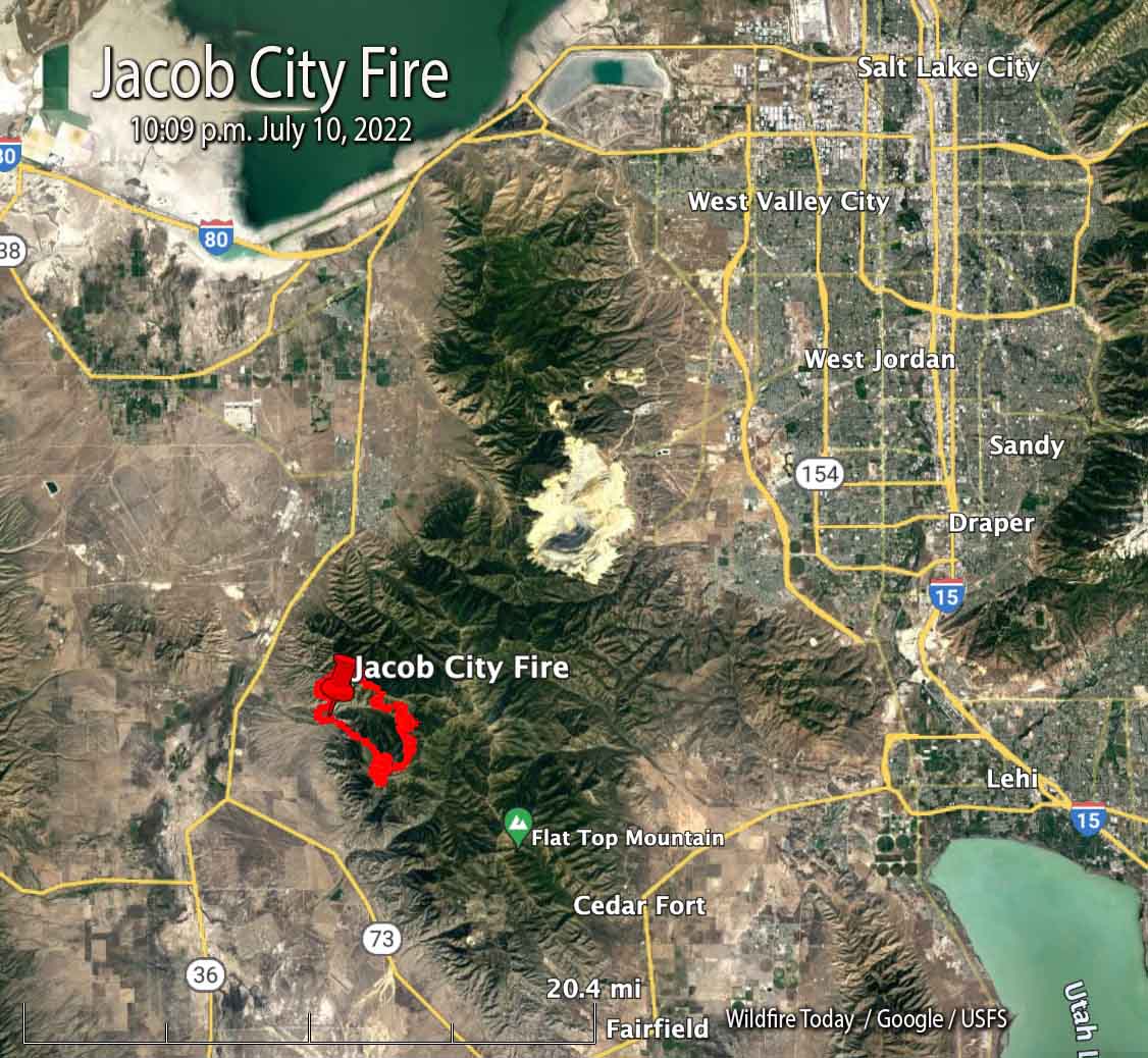
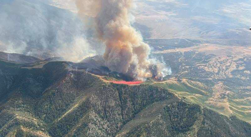
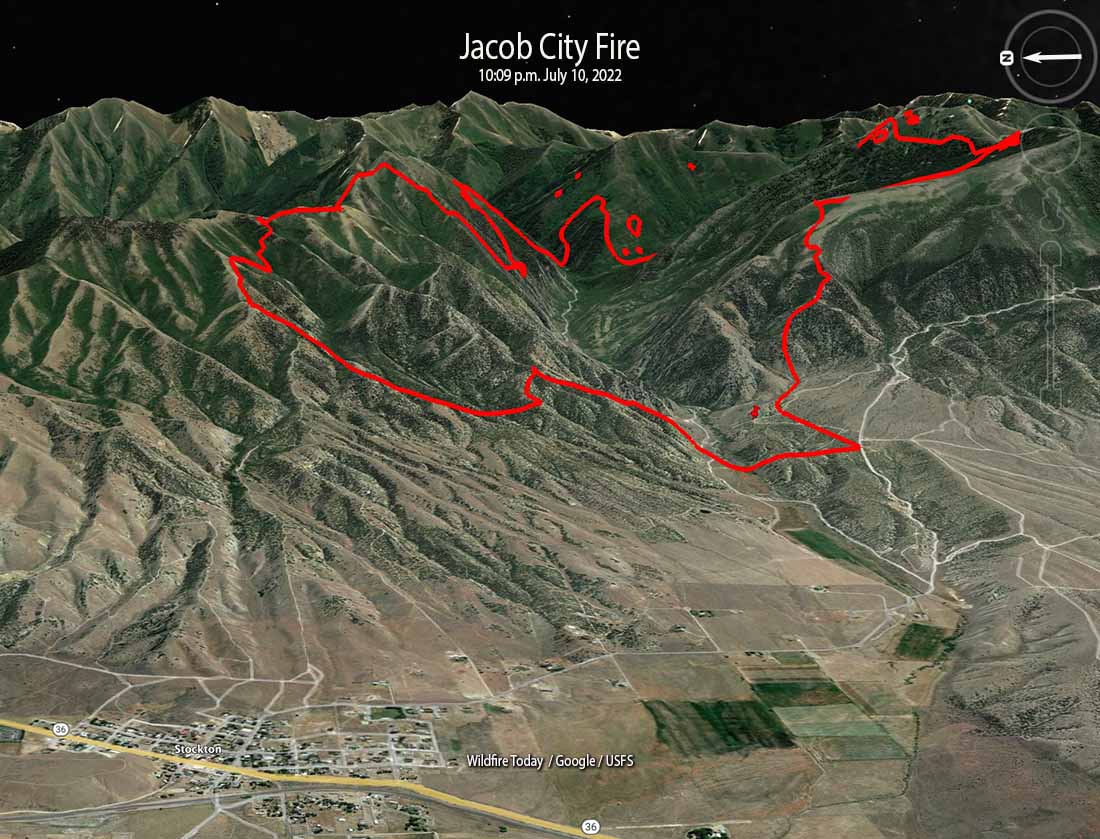
The Jacob City Fire has burned 4,094 acres 2 miles east of Stockton. When it was mapped at 10 p.m. Sunday it was very active on the northwest and southeast sides. As of Sunday evening no communities are imminently threatened, according to Utah Fire Info.

Jacob City Fire map 10:09 p.m. July 10, 2022
Map showing the location of the Jacob City Fire at 10:09 p.m. July 10, 2022.
Jacob City Fire, July 10, 2022
Jacob City Fire, July 10, 2022. Utah Fire Info
Jacob City Fire 3-D map 10:09 p.m. July 10, 2022
Jacob City Fire 3-D map looking east, 10:09 p.m. July 10, 2022

Typos, let us know HERE, and specify which article. Please read the commenting rules before you post a comment.

Author: Bill Gabbert

After working full time in wildland fire for 33 years, he continues to learn, and strives to be a Student of Fire.