Wildfire acres burned to date in United States (outside Alaska) is lower than average

Precipitation, 7 days
Precipitation, during the seven days ending at 11 a.m. MDT August 13, 2022.

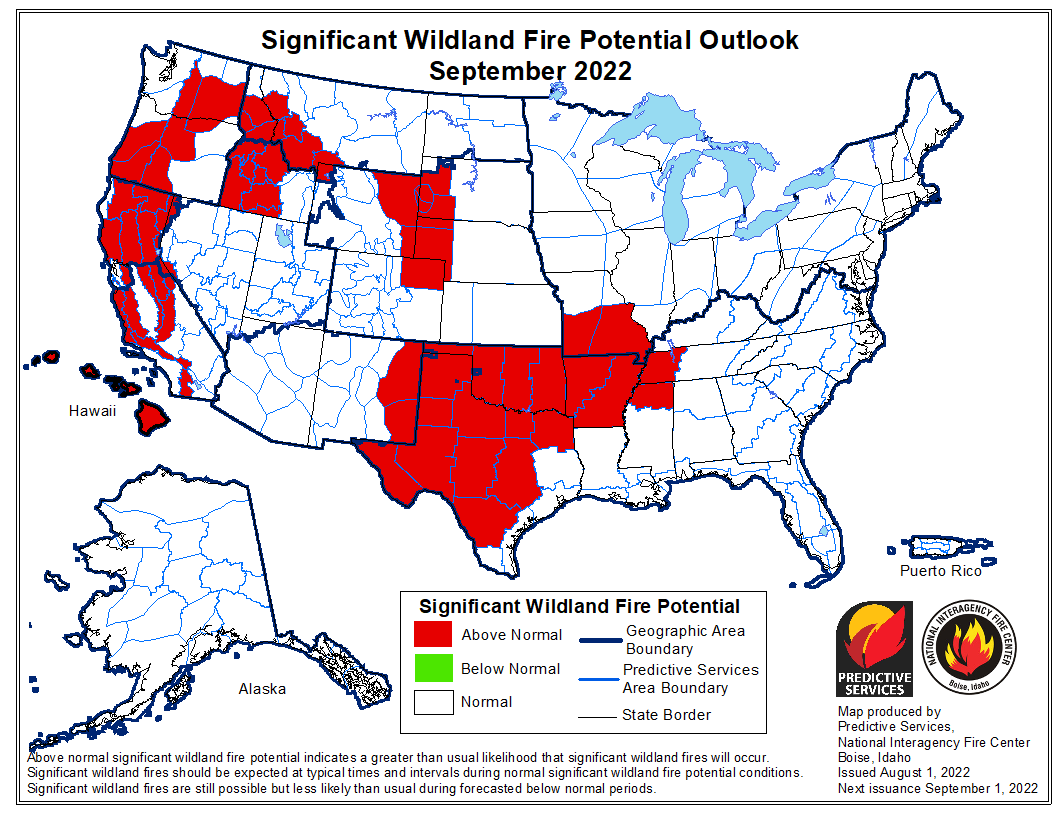
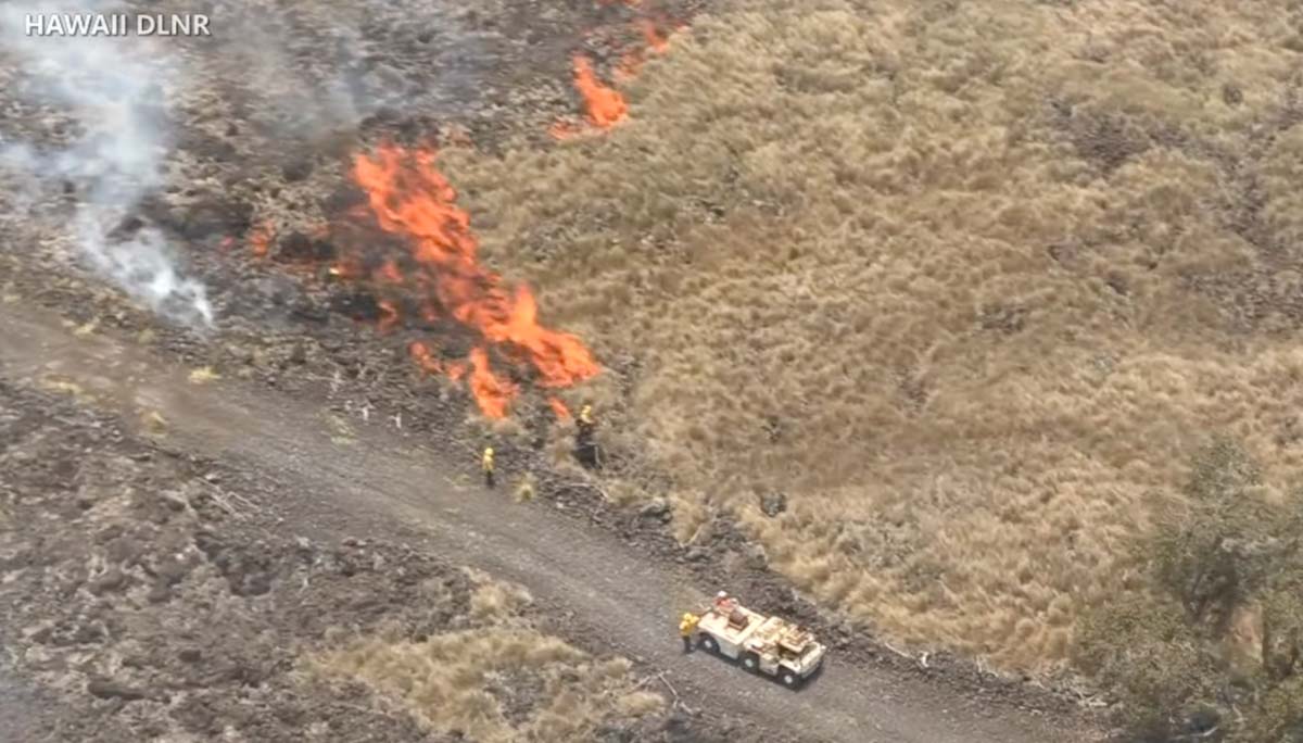
It seemed to me that over the last few weeks the wildfire activity has been slower than typical for this time of the year, so I did a little digging. Using historical data from the National Interagency Fire Center and acres burned to date from the August 13 national Situation Report, it turns out that Alaska has burned nearly three times their 10-year to-date average while the other 49 states combined are running 12 percent below the to-date average.

Over the last 10 years Alaska’s average acres burned in a full year is 1.1 million. This year they are at 3.1 million, more than the other 49 states combined. There has been a major increase in Alaska acres burned after mid-August in only 2 of the last 18 years. And it has been fairly quiet there, fire wise, for the last four weeks.

So far this year, fires in the other 49 states have blackened about 2.8 million acres, 12 percent below the to-date 10-year average of 3.2 million. The 49 states typically burn 6.2 million in a full year, so if this year turns out like the average of the last 10, we’re about half done.

The Situation Report does not break out data for Alaska and the other 49 states, so just looking at their 50-state numbers a person would see that the 5.9 million acres burned to date is 27 percent higher than the average of 4.3 million, when actually the +27 percent figure is very wrong for both Alaska and the lower 49 states.

We usually separate Alaska stats because fires in that huge state are managed far differently from the other 49. Most of them are not fully suppressed since they are less likely to endanger people or private property than in the lower 49 states. The second reason is that the fire occurrence is extremely variable, with the acres burned since 1990 ranging, for example, from 43,965 acres in 1995 to 6,645,978 in 2004. Including the Alaska numbers in the total would skew the data for the other 49 states making it more difficult to spot trends.

Wildland fire potential for September, 2022
Wildland fire potential for September, 2022. NIFC.
Wildland fire potential for August, 2022
Wildland fire potential for August, 2022. NIFC.

Leilani Fire burns more than 20,000 acres in Hawaii

Started in a US Army training area in July

Updated 8:55 a.m. PDT August 13, 2022

More accurate mapping on Friday found that the Leilani Fire on Hawaii’s Big Island was not as large as the earlier 25,000-acre estimate, and had instead burned 16,400 acres as of Friday afternoon. Fire officials said it was about two miles from Highway 190.

From BigIslandNow, August 12 at 3:41 p.m. HST:

“The last two days the fire was mostly burning in invasive fountain grass. It’s the first plant that comes in after fire disturbance,” said Steve Bergfeld, the Hawaii Island Branch Manager for the Hawaii Department of Land and Natural Resources Division of Wildlife, and one of three incident commanders on the fire. “Unfortunately, the fire has moved into some dryland forest which has native ōhiʻa lehua and we are trying to keep flames away from this sensitive area.”

Seven contracted bulldozers left a fire command post this morning, leading the way into the fire area, where the heavy machines continued building wide fire lines. Five helicopters from the U.S. Army’s Pōhakuloa Training Area are conducting aerial water drops. It’s hoped this all-out assault on the Leilani fire will result in firefighters gaining the upper hand in the next few days.

The video below was shot Friday August 12 by the Hawaii Department of Land and Natural Resources (DLNR).

The photos below are still images from DLNR videos.


12:01 p.m. PDT August 12, 2022

Map of the Leilani Fire, morning of Aug. 12, 2022
Map of the Leilani Fire. The red and tan dots represent heat detected by a satellite early in the morning Aug. 12, 2022. The small red perimeter was the extent of the fire on July 22, 2022.

A fire in Hawaii that the Hawaii Department of Land and Natural Resources (DLNR) said has been burning for weeks has suddenly become much more active. The Leilani Fire started in the US Army’s Pohakuloa Training Area on the Big Island and was mapped July 22 at 2,362 acres. Recent strong winds and extremely dry conditions have helped it spring back to life and was reported Thursday evening to be 25,000 acres.

Satellite heat detections early Friday morning appeared to show it has advanced out of the Department of Defense training area and spread northwest onto state land, approaching the Daniel K. Inouye Highway (Highway 200). State officials said it was about a mile south of Hawaii Belt Road (Highway 190).

Leilani Fire big Island Hawaii
Leilani Fire, image from video by Hawaii Department of Land and Natural Resources.

Officials with the DLNR said Thursday it was not threatening any homes but dry fuels and winds gusting up to 30 mph are making it difficult to contain the blaze. It is burning through brush and grass dessicated during the drought.

A spokesperson for the Army told The Associated Press that while there is active military training in the area, the cause of the fire remains under investigation.

Leilani Fire big Island Hawaii
Leilani Fire, image from video by Hawaii Department of Land and Natural Resources.

“There are units up there training, I can’t confirm or deny if live fire was taking place,” said Michael O. Donnelly, chief of external communications for the U.S. Army Garrison Hawaii. “It’s business as usual, but the exact cause we don’t know.”

Leilani Fire big Island Hawaii
Leilani Fire, image from video by Hawaii Department of Land and Natural Resources.

Fire south of Bordeaux in France forces 10,000 to evacuate

Q400 drops retardant on a fire in France
A Q400 drops retardant on a fire in France. Reuters.

The number of acres burned this year in France through mid-August, 148,000, is six times the full-year annual average over the last 15 years. Currently there are eight large fires in the country.

In the southwest, the Gironde region south of Bordeaux has been especially hard hit. One of the fires started a month ago and burned 14,000 acres. It was thought to be controlled, but officials said it either “reignited” on Tuesday or arson may have played a role. Since then it has blackened an additional 18,000 acres, destroyed or damaged 17 homes, and prompted about 10,000 residents to evacuate.

It has forced the closure of the A63 motorway, a major route to Spain between Bordeaux and Bayonne.

The difficulty in suppressing the fires is being attributed to record-breaking drought, strong winds, and high temperatures occasionally hitting 104 Fahrenheit in the southwest.

wildfires in France in the Gironde region map
The red areas represent heat detected at wildfires in France in the Gironde region south of Bordeaux during the 31-day period ending August 12, 2022. FIRMS.

International assistance is coming in the form of 65 firefighters from Germany, others from Romania, Austria, and Poland, and water scooping air tankers from Greece and Sweden.

firefighters Romania are assisting France
Dozens of firefighters from Romania are assisting France

France has a fleet of nine S-2 air tankers and has purchased six Q400 MR air tankers, with at least four having been delivered.

There is also large fire in the mountainous Serra de Estrela park in central Portugal, where 24,000 acres have burned. It is being fought by about 1,500 firefighters.

map Fires Portugal Serra Da Estrela Natural Park
The red areas represent heat detected by satellites in Portugal’s Serra de Estrela Natural Park during the 7-day period ending August 12, 2022.

Report: US Forest Service is sometimes overstating fuel management accomplishments

Forest thinning in the Umpqua National Forest
Forest thinning project in the Umpqua National Forest. Credit, Oregon State University.

NBC News conducted an investigation into some of the claims and statistics about vegetation management projects that are designed to improve forest health and/or and reduce the threat of wildfires. The emphasis of the very lengthy article about their findings was not so much to question the need or effectiveness of the hazardous fuel reduction projects, but to examine their claims of accomplishments, which are sometimes misleading.

Many fuel management projects on National Forests include multiple treatments of a single area. There can be some combination of thinning, pruning, piling, chipping, or prescribed burning, all considered independently and occurring at different times. In an extreme scenario, if the project was 100 acres and five different treatments occurred, each might be reported as accomplishing 100 acres of fuel treatment. They then tell Congress they treated 500 acres.

The NBC article gave an actual example of a project on the San Bernardino National Forest in Southern California near Big Bear Lake. The 173-acre project had multiple treatments. From the article:

They first [step] appeared in 2016, when the Forest Service assigned workers to cut trees to reduce the area’s density. The agency came back two years later, pruning the remaining trees and piling the cut wood across the full 173 acres, then chipping 52 acres of it. A few months later, workers burned 18 acres of the piles.

The pruning, piling, chipping and burning were entered as separate items in the database and the agency reported them as 416 acres of treated land in its 2019 fiscal year totals to Congress. In summer 2021, it burned the remaining 155 acres of piles, reporting them in that year’s totals.

The Forest Service’s efforts ultimately reduced fire risk on 173 acres of land, but they were reported to Congress as 744 acres over four fiscal years.

“These acres are reported six times because we must request funding to accomplish the full suite of activities on the same 173 acres,” said [Wade] Muehlhof, the service’s spokesperson. “Each of these activities needs to be planned and budgeted for annually.”

The Forest Service tells Congress that it reduces wildfire risk on more than 2.5 million acres of its land every year. But this process of recounting the same acres any time more than one type of work is completed means that far less land is protected from damaging fire than is being reported.

NBC estimates that nationwide the FS has overstated accomplishments by 2.5 million acres, or 17 percent. In California the numbers are higher, 27 percent in the past five years, and by roughly 35 percent in the places near the most people, the state’s wildland urban interface areas.

The NBC article was written by Adiel Kaplan, with assistance from Monica Hersher and Joe Murphy.

Ranger Jake describes the damage in Yellowstone National Park caused by the June 13 flooding

June 13, 2022 flood in Yellowstone National Park
June 13, 2022 flood in Yellowstone National Park. YNP image.

Yellowstone National Park released a video yesterday describing the massive damage to the park’s infrastructure that occurred June 13 when unseasonably warm weather, melting snow, and very heavy rain produced widespread flooding across the north end of the park. Yellowstone Digital Communications Specialist, Jake Frank, gives his first-hand account of the 500-year flood event.

These photos are still images from the video below.

June 13, 2022 flood in Yellowstone National Park
June 13, 2022 flood in Yellowstone National Park. YNP image.
June 13, 2022 flood in Yellowstone National Park
June 13, 2022 flood in Yellowstone National Park. YNP image.
June 13, 2022 flood in Yellowstone National Park
June 13, 2022 flood in Yellowstone National Park. YNP image.

More information is at www.nps.gov/yell

Impressive fire whirl on the Sam Fire in LA County

Fire whirl on the Sam Fire in LA County, Aug. 10, 2022
Fire whirl on the Sam Fire in LA County, Aug. 10, 2022. KTLA-2

On Wednesday afternoon the Sam Fire burned nearly 150 acres of grass and brush in northwestern Los Angeles County. No structures were damaged and there were no reports of injuries.

The KTLA Channel 5 helicopter captured some interesting video of an impressive fire whirl. It’s hard to appreciate it from seeing still photos since it did not appear to be very tall like many large fire whirls, but the indrafts it created are fascinating. At the end of the video below, an Air-Crane helicopter dropped water that at least for a while took most of the energy out of it.

Fire whirl on the Sam Fire in LA County, Aug. 10, 2022
Helicopter drops water on a fire whirl on the Sam Fire in LA County, Aug. 10, 2022. KTLA

Maybe a helicopter pilot can tell us how ballsy it was, or was not, to fly close enough to drop water on the fire whirl.

Fire whirls, much like dust devils, are not uncommon on a fire when the atmosphere is unstable, and are much smaller than fire tornados. In 1978 a researcher for the National Weather Service in Missoula, David W. Goens, established parameters for the two.

He said the average size of a fire whirl is usually 33 to 100 feet, with rotational velocities of 22 to 67 MPH.

But a fire tornado dominates the large scale fire dynamics. They lead to extreme hazard and control problems. In size, they average 100 to 1,000 feet in diameter and have rotational velocities up to 90 MPH.


Thanks and a tip of the hat go out to Pat.