A heavy aerial and ground attack by firefighters kept homes safe on the north side of Whitefish Lake over the weekend. Fire managers with the Montana Department of Natural Resources and Conservation said the human-caused fire was ignited by equipment operating in a dry hayfield; the fire burned onto forested areas of the Stillwater State Forest.
The North Lake Fire burned only about 5 acres, but spot fires quickly spread to a 17-acre perimeter. The fire was 80 percent contained by Monday and crews were still mopping up. The fire was first reported by the Warner Peak Lookout, according to the Western News out of Libby, Montana.
Aerial support was dispatched Saturday afternoon and included Type 1, 2 and 3 helicopters. Five engines, two watertenders, a hotshot crew and another crew assisted. Homes and other structures were within the vicinity, but no evacuations were necessary. Flathead County requested assistance from the Red Cross to open a shelter at Canvas Church in Kalispell.
Montana Public Radio reported that another relatively small fire late Sunday took off from the outskirts of Lolo. Firefighters kept the wind-driven fire, burning through dry grass and brush, to about 20 acres — but it destroyed a mobile home and damaged a second one. According to the Missoula Rural Fire District, the fire also destroyed four shops and garages and another 12 outbuildings; it also totaled or damaged about a dozen vehicles. The fire is under investigation.

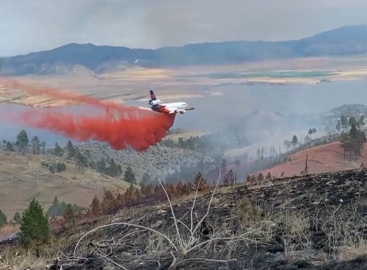
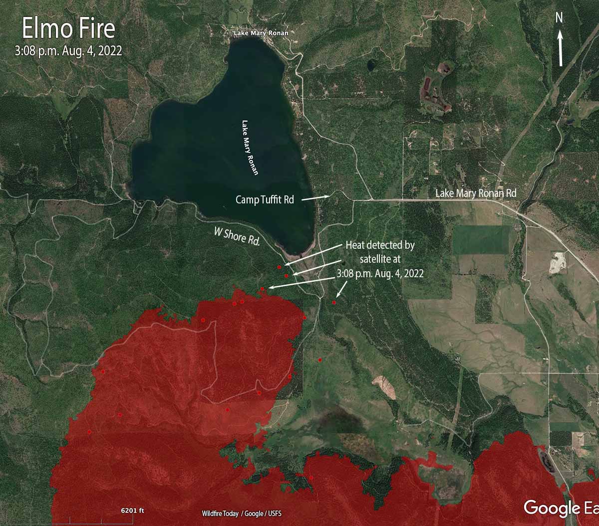
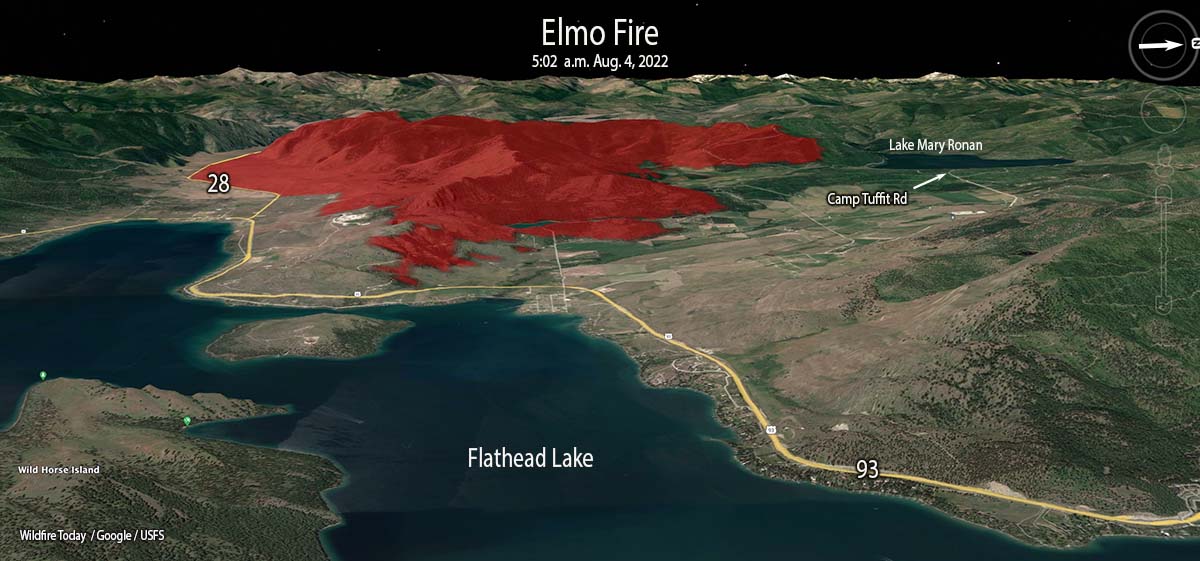
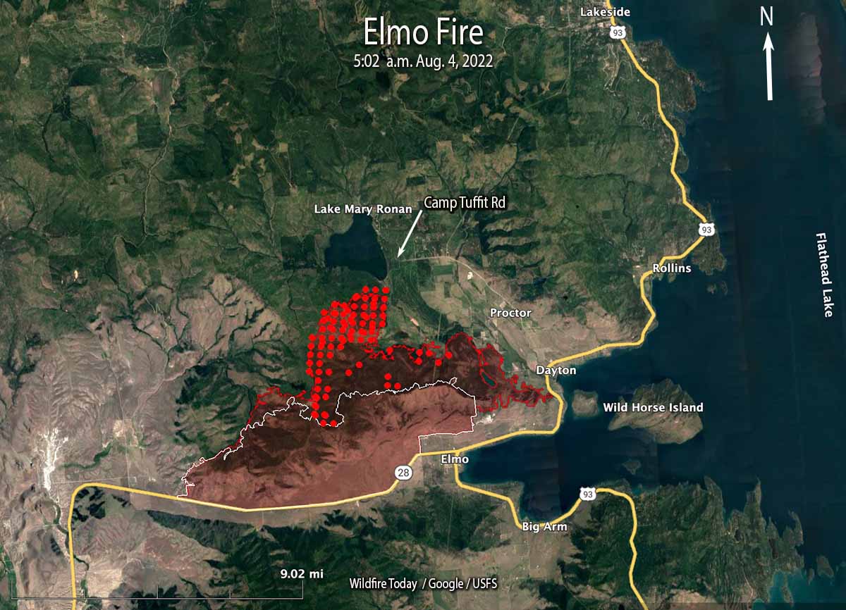
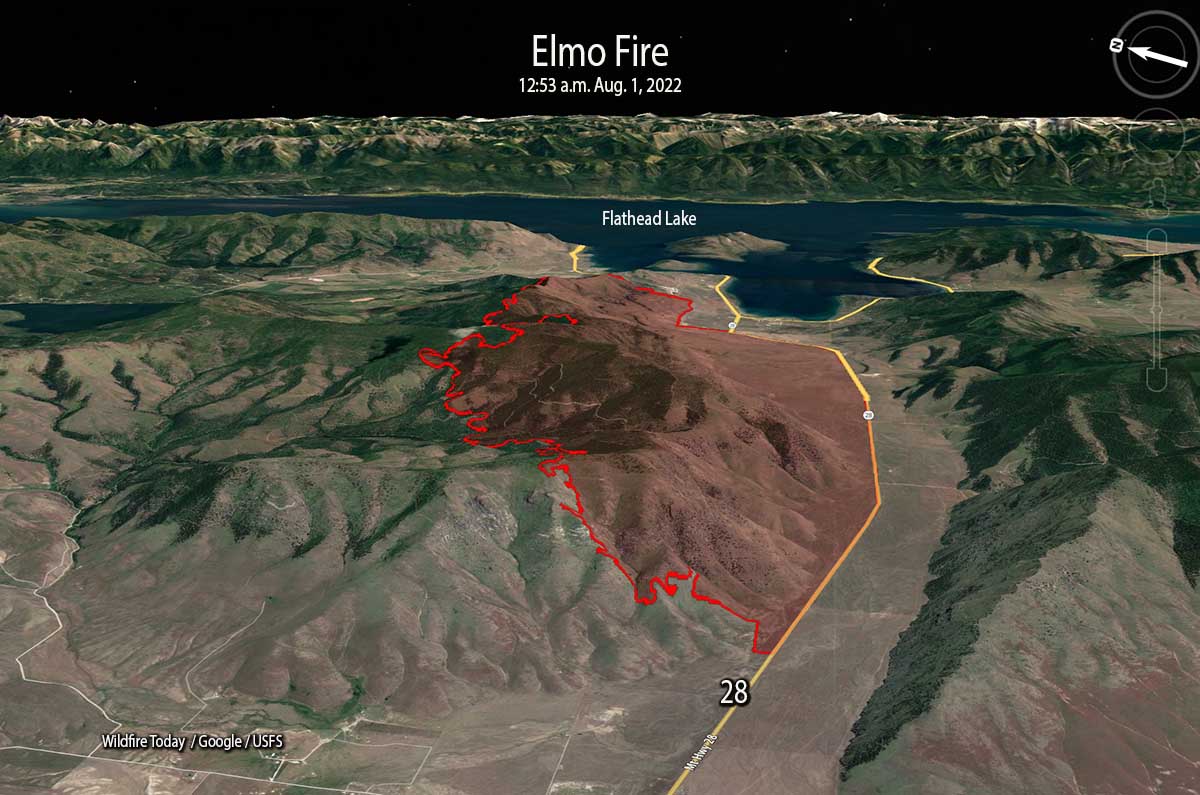
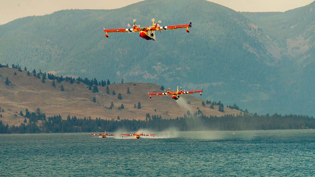
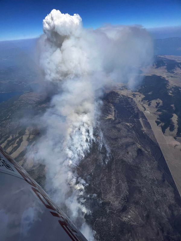
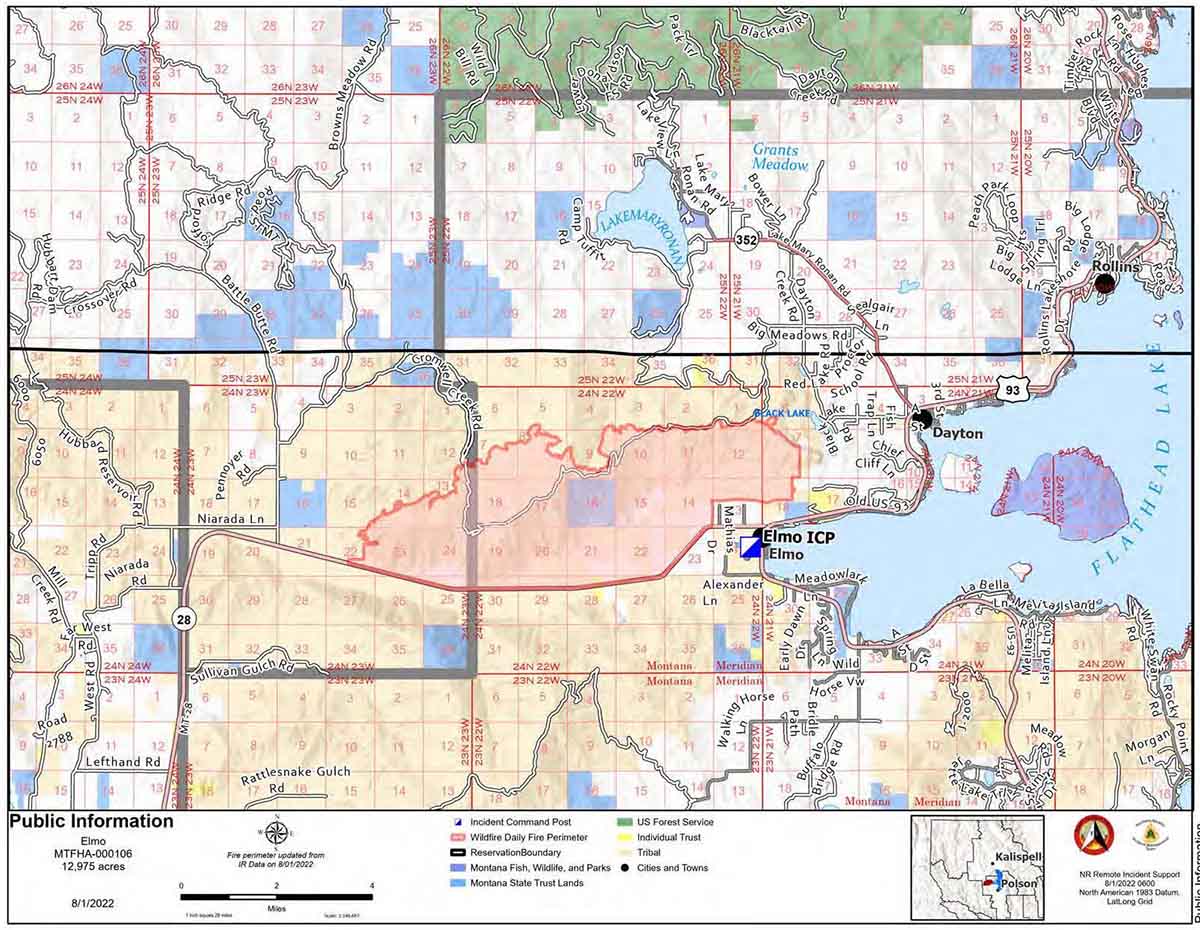
Numerous fires burned actively across northwest Montana and at least three new fires took off in the Mission Valley Sunday after a dry lightning storm. The Niarada Fire west of Elmo was at 1,000 acres Monday morning, and Confederated Salish and Kootenai Tribes (CSKT) fire managers said Hwy 28 was closed Sunday after the fire jumped the highway; it was estimated at 200 acres by Sunday evening, about 11 miles west of Elmo, and 18 smokejumpers were working the fire. Four SEATs, a helicopter, and other resources also responded.
The Middle Ridge Fire southwest of Sloan’s Bridge, at 500 acres, was burning in grass and timber. North of Dixon, the Communication Butte Fire was estimated at 255 acres, with 20 firefighters assigned. CSKT fire managers said no structures were threatened by any of the fires.
Numerous other small fires cropped up Sunday in Lake and Flathead counties.
The Woodward Point and Porcupine Creek fires were detected in the Mission Mountains on the east side of Flathead Lake; along Hungry Horse Reservoir, the Ridge Fire had burned about 5 acres and the Emery Fire was less than an acre. Other smaller fires were reported farther down the reservoir.
The Kah Mountain Fire in the Swan Mountains was at 15 acres.

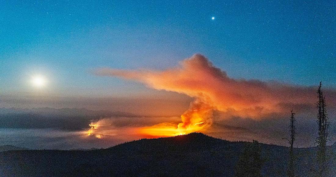
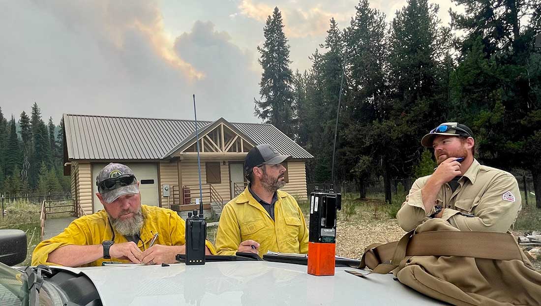
The Colt Fire, northwest of Seeley Lake on the Flathead and Lolo National Forests, had grown to nearly 6,200 acres Monday. It is burning in dense timber with heavy dead and down fuels, about 12 miles northwest of Seeley. Fire behavior has included torching, spotting, and active consumption of heavy fuels. The fire was started by lightning on Monday, July 17, and Montana DNRC and USFS firefighters responded the next day. The fire is burning on the Lolo National Forest but is under Montana DNRC fire protection.

Fire managers expect the fire will increase in size with the forecasted weather conditions. The Colt Fire is a full-suppression fire and crews are creating fuel breaks and containment lines, along with doing structure protection assessments and prep. Air resources will be assigned as needed. Several forest roads and other areas have been closed.
The USDA has designated Flathead and Lincoln counties as primary natural disaster areas, according to a KPAX-TV report, meaning farmers and ranchers can apply for emergency loans. Gov. Greg Gianforte asked Agriculture Secretary Tom Vilsack that 11 counties be designated drought disaster areas. The USDA responded that Flathead and Lincoln counties will be named primary natural disaster areas, so farm operators there can be considered for Farm Service Agency (FSA) emergency loans.