Firefighter injured last month passes away in hospital

Christian Johnson, 55, was severely burned on the Spring Coulee Fire in Washington

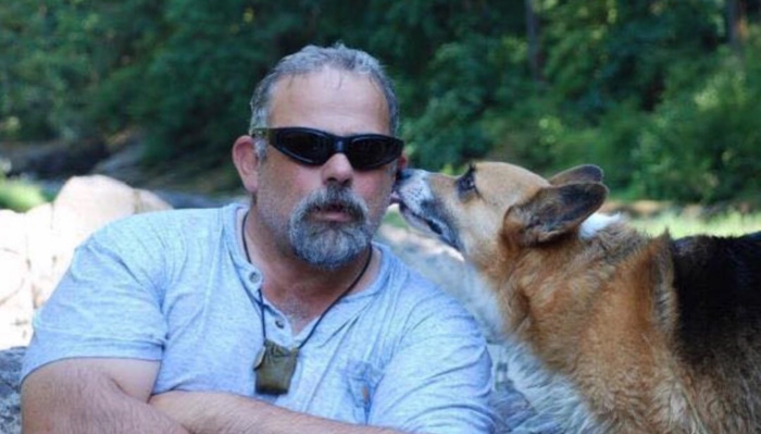
Christian Johnson
Christian Johnson, Assistant Chief of the Okanogan Volunteer Fire Department.

A firefighter who received second and third degree burns over 60 percent of his body September 1, 2019 while battling the Spring Coulee Fire in Okanogan County, Washington passed away yesterday, October 2, 2019. Christian Dean Johnson, 55, of Okanogan was surrounded by his wife Pam, family, and friends at Harborview Medical Center.

From the GoFundMe page that was created September 3:

Christian has served his country as a sergeant in the Us Army, and was deployed with the Washington State National Guard from November 2003-May 2005 in Baghdad. He retired after 22 years of service and has volunteered for the Okanogan Fire Department for 20 years.

Christian is a selfless man, who is always willing to help those in need, and never ask for anything in return. We are now asking for your help to make this long journey a little easier for him and his family. Any amount of donations are greatly appreciated and will go towards helping his wife (Pam Johnson) with travel, housing, food, etc.

Our sincere condolences go out to Mr. Christian’s family and friends. May he rest in peace.

Smoke forecast for October 3, 2019

Smoke from the Decker Fire west of Colorado Springs will affect areas southwest of Denver

Above: Smoke forecast for 8 p.m MDT October 3, 2019, near surface and vertically integrated.

These maps were generated by NOAA at 6 a.m. MDT October 3, predicting the distribution of smoke. The forecast below indicates that near surface smoke from the Decker Fire south of Salida will be affecting the Denver area as well as locations southwest and north of Denver on Thursday.

smoke forecast Colorado Decker Fire
Forecast for smoke created by the Decker Fire that will be near the Earth’s surface in the Colorado area at 8 p.m MDT October 3, 2019.


Satellite photo of smoke from the Decker Fire

The fire has burned over 4,000 acres south of Salida, Colorado

This satellite photo shows smoke from the Decker Fire Wednesday evening as the lights were starting to be turned on in the Denver and Colorado Springs areas.

The fire has burned approximately 4,000 acres.

More information about the Decker Fire.

California passes bills boosting mental health support for firefighters

The legislation addresses peer support and treatment for post-traumatic stress

Legion Lake Fire South Dakota
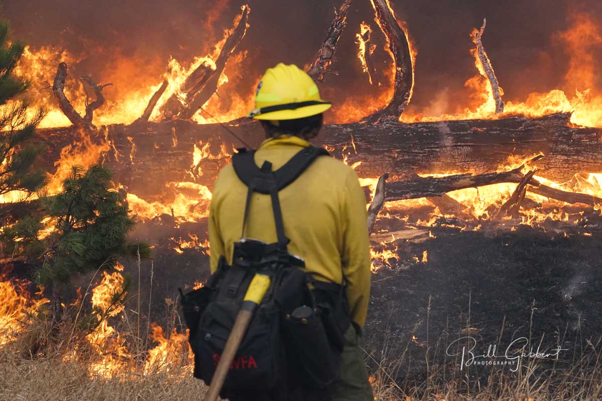
A firefighter at the Legion Lake Fire in Custer State Park, South Dakota, December 13, 2019. Photo by Bill Gabbert.

Yesterday the Governor of California signed into law two pieces of legislation that can improve support for the mental health of firefighters.

The California Firefighter Peer Support and Crisis Referral Services Act authorizes state, local, and regional public fire agencies to establish a Peer Support and Crisis Referral Program to provide an agency-wide network of peer representatives available to aid fellow employees with emotional or professional issues. The bill also provides that emergency services personnel have a right to refuse to disclose, and to prevent another from disclosing, a confidential communication between the emergency service personnel and a peer support team member, crisis hotline staff member, or crisis referral service.

A second bill, SB-542 Workers’ Compensation, classifies post-traumatic stress as an “injury”, like conventional physical injuries. This will allow compensation for hospital stays, surgery, medical treatment, disability indemnity, and death benefits.

The bills do not apply to federal employees, with a few exceptions for some NASA and Department of Defense firefighters in the state.

These bills are a step toward recognizing presumptive diseases or injuries that when suffered by a firefighter are presumed to be an on the job injury, and would be treated as such. Montana, British Columbia, Washington, and other jurisdictions have presumptive disease programs for firefighters. Of course the key is the list of diseases that are covered. Listing one or two would leave out the eight or ten others that can be caused by serving the public as a firefighter.

Evacuations ordered at the Decker Fire south of Salida, Colorado

Winds on Wednesday caused some movement to the east

Above: Morning briefing at the Decker Fire, October 3, 2019. IMT photo.

(UPDATED at 9:01 a.m. MDT October 3, 2019)

Strong winds gusting at over 25 mph out of the west on Wednesday pushed smoke from the Decker Fire to the east toward Colorado Springs. The wind combined with the relative humidity dipping down to the ridiculously low 2 percent at Salida resulted in the northern portion of the fire to spreading to the east. (see map below)

(To see all articles on Wildfire Today about the Decker Fire, including the most recent, click here.)

There was no fixed wing aircraft mapping flight Wednesday night due to mechanical problems with the plane. The map below shows heat detected by a satellite as late as 3:48 a.m. Thursday, but that data from hundreds of miles overhead is not as accurate as an aircraft 5,000 to 10,000 feet above the ground. So consider the dots that represent heat to be approximate locations. With that in mind, the fire may or may not have approached or crossed the boundary of the Rio Grande National Forest, the green line.

map Decker Fire
The dots represent heat on the Decker Fire detected by a satellite. The most recent heat detected (red dots) was at 3:48 a.m October 3, 2019.. The red line was the perimeter at 1:27 a.m. MDT Oct. 2, 2019.
Satellite photo smoke Decker Fire
Satellite photo of smoke from the Decker Fire just south of Salida, Colorado.
smoke Decker Fire
On Wednesday October 2 wind pushed smoke from the Decker Fire to the east. IMT photo.

The Rocky Mountain Type 1 Incident Management Team assumed command of the fire at 7 am. Thursday.

Resources assigned to the fire Wednesday evening included 8 hand crews, 10 engines, and 5 helicopters for a total of 259 personnel. Approximately $1.9 million has been spent on managing this less-than-full-suppression fire to date.

We will update this post as more information becomes available.


(UPDATED at 3:50 p.m. MDT October 2, 2019)

map decker fire colorado
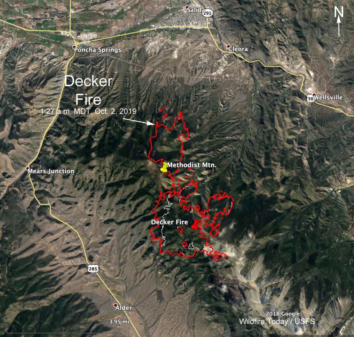
Map showing the perimeter of the Decker Fire 3 miles south of Salida, Colorado at 1:27 a.m. MDT Oct. 2, 2019.  The white line was the perimeter about 24 hours before.

Continue reading “Evacuations ordered at the Decker Fire south of Salida, Colorado”

Decker Fire activity increases south of Salida, Colorado

Due to crowning, extreme fire behavior, and rapid growth a Type 1 Team has been ordered

map 3-d decker fire colorado
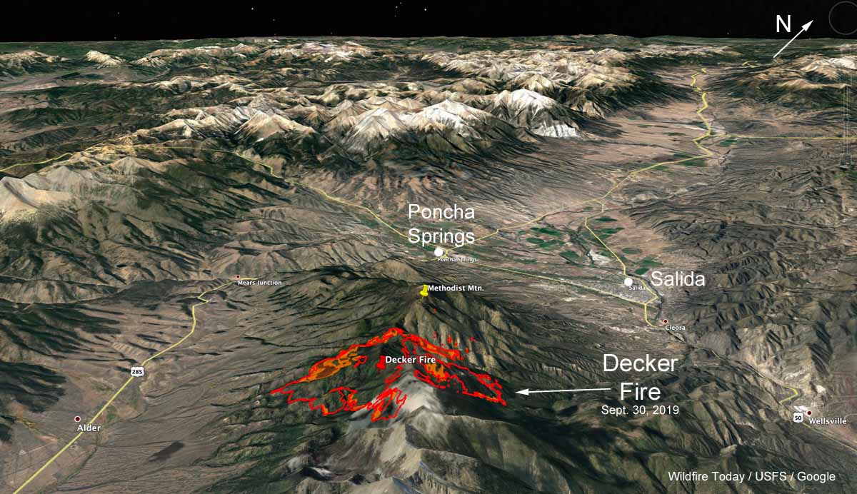
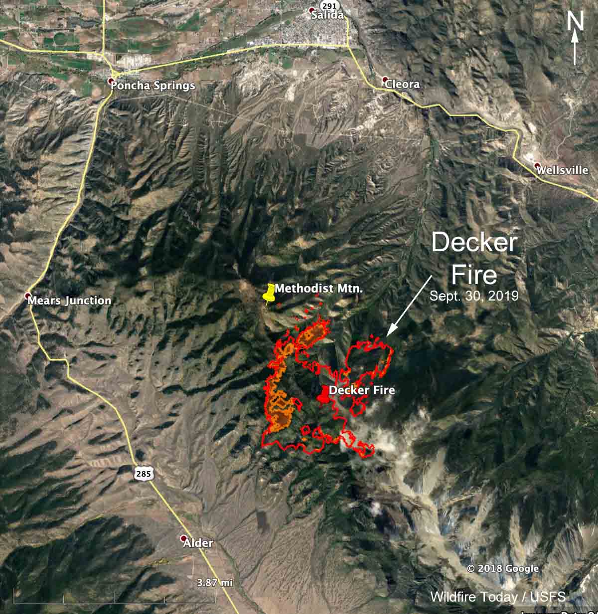
3-D map showing the perimeter of the Decker Fire 5 miles south of Salida, Colorado Monday evening, Sept. 30, 2019. Looking toward the northwest. Click to enlarge.

(Originally published at 6:38 p.m. MDT October 1, 2019)

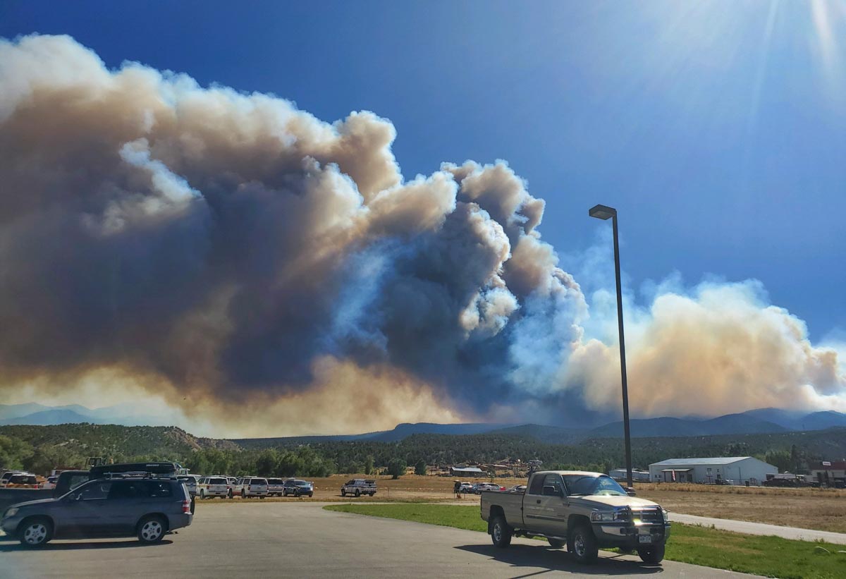
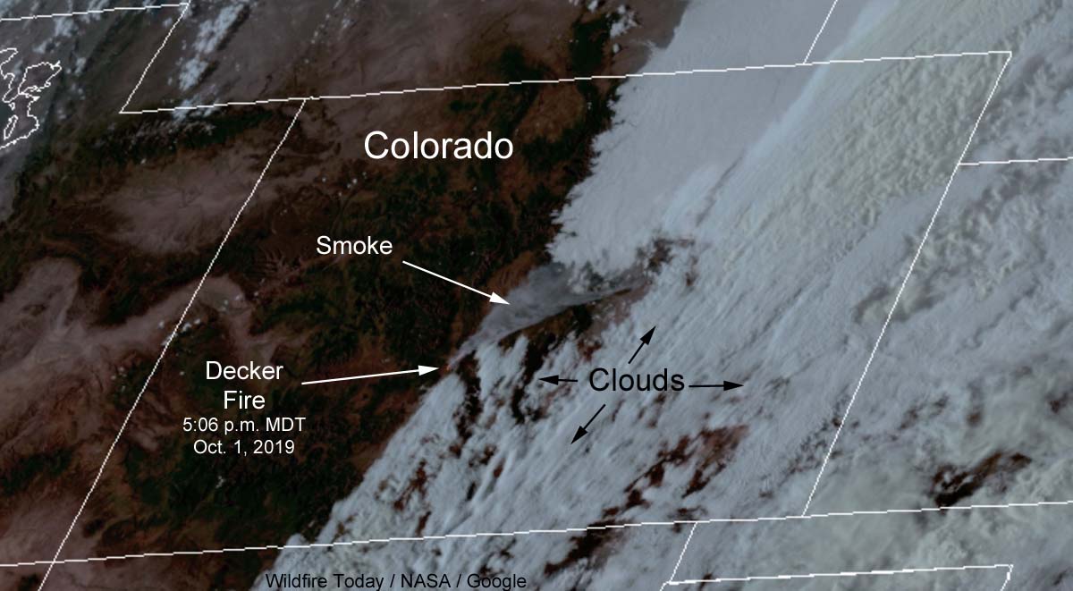
Firefighters have been herding around the Decker Fire that has been burning since September 8 five miles south of Salida, Colorado. (see map) But 16 percent relative humidity and strong winds gusting out of the south at over 40 mph Tuesday afternoon caused the fire to spread toward the north and northeast. Late Tuesday afternoon a very large plume of smoke could be seen by a satellite moving northeast in the general direction of Denver 95 miles to the northeast.

(To see all articles on Wildfire Today about the Decker Fire, including the most recent, click here.)

satellite photo smoke decker fire colorado
Satellite photo showing smoke from the Decker Fire at 5:05 p.m. MDT Oct. 1, 2019.

In response to the extreme fire behavior and crown fires seen on Tuesday, a Type 1 Incident Management Team, the Rocky Mountain Team, has been ordered is scheduled to in-brief at 6 p.m. on Wednesday.

A mapping flight Monday night determined that the fire had burned 2,206 acres. At that time most of the fire activity was on the north and northwest sides. Spot fires have occurred east of Methodist Mountain, with one just a quarter mile away from the communications towers on the peak.

Tuesday night the temperature at the elevation of the fire, about 10,000 feet, will drop to 37 degrees but the humidity will remain fairly low for nighttime at that elevation, around 38 percent. The southwest wind at 17 to 23 mph will continue pushing the fire to the northeast. On Wednesday forecasters expect 49 degrees, 11 percent RH, and winds out of the west at 22 gusting to 33 — conditions that could be conducive to additional fire growth.

map decker fire colorado
Map showing the perimeter of the Decker Fire 5 miles south of Salida, Colorado Monday evening, Sept. 30, 2019.