Spread of the Taboose Fire slows, but strong winds predicted

Forecasters expect 30 to 40 mph winds on Wednesday and Thursday, changing directions about every 12 hours

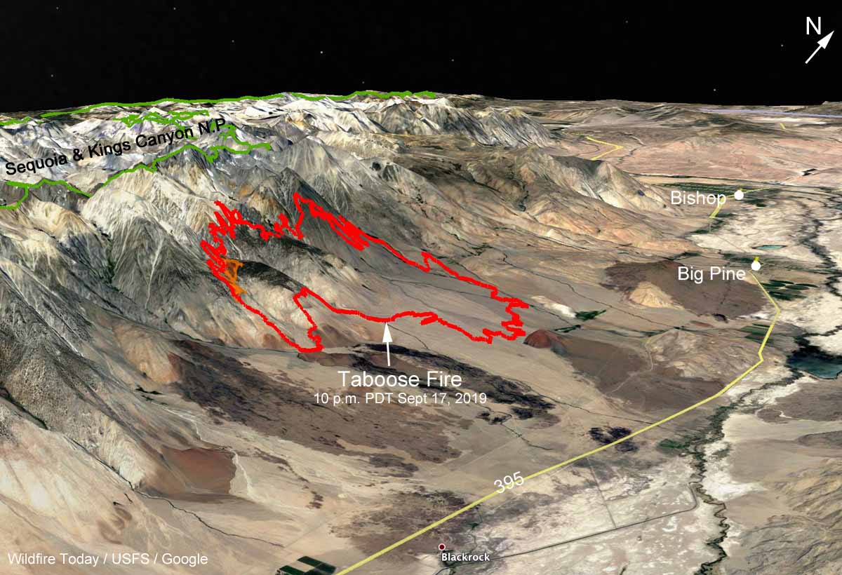
3-D map Taboose Fire
3-D map of the Taboose Fire mapped at 10 p.m. PDT September 17, 2019. Looking northwest. Click to enlarge.

(9:16 a.m. PDT Sept. 18, 2019)

After burning 10,187 acres since it started September 4, the growth of the Taboose Fire on the east slope of the Sierras slowed Tuesday. A mapping flight found that the fire added another 174 acres primarily on the south side along Taboose Creek. Firefighters took advantage of lower winds Tuesday and continued to work on fire suppression and strengthening containment lines with crews on the ground assisted by helicopter water drops.

But 30 to 40 mph winds in the forecast for Wednesday and Thursday of this week could challenge firefighters, particularly on the south side in the Shingle Mill Bench area. The changing wind direction, which will shift about every 12  hours, will present even more headaches, coming from the south Wednesday, from the west Wednesday night, and out of the north Thursday and Thursday night. During this period the relative humidity at the base of the fire will be in the lower teens during the day. The wind event should be over by Friday. The area is under a Red Flag Warning until Thursday evening.
Taboose Fire
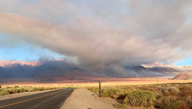
The Taboose Fire on September 8, 2019. InciWeb photo.

Most of the Taboose Fire is in the Inyo National Forest 7 miles south of Big Pine and 20 miles south of Bishop, California (see  map above). It is burning on a steep slope, from 4,700 feet on the east side up to 10,000 feet on the west where it could be running out of fuel. The ridge top at 13,000 feet is also the eastern boundary of the Sequoia and Kings Canyon National Park.

Mt. Whitney, the highest point in the contiguous United States is 27 miles farther south on the ridge at an elevation of 14,505 feet.

Resources assigned to the fire include 12 hand crews, 24 fire engines, and 5 helicopters for a total of 575 personnel.

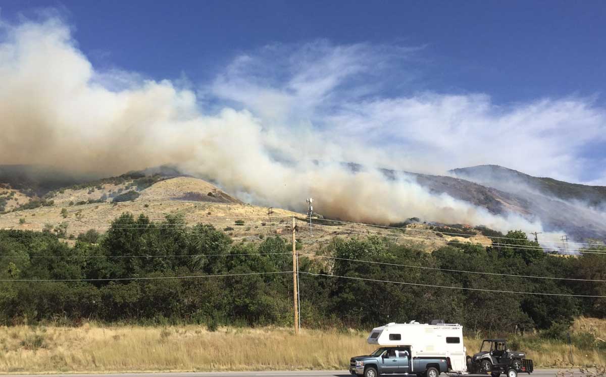
Francis Fire requiring evacuations in Davis County, Utah

The fire is between Salt Lake City and Ogden

Francis Fire Utah

(Updated at 11:16 a.m. MDT Sept. 17, 2019)

At 6:30 p.m. on Monday the size of the Francis Fire between Salt Lake City and Ogden, Utah was estimated at 100 to 200 acres but Tuesday morning fire officials said it spread since then to 550 acres. (Later in the morning that was changed to 365 acres.)

The  weather overnight was conducive to additional fire growth, with the relative humidity remaining in the 20s until it began rising after 2 a.m. eventually topping out at 82 percent at 7 a.m. when 0.03 inches of precipitation was measured at the BEUU1 weather station near Ogden. The overnight wind speed was 3 to 8 mph with gusts up to 20 mph.

In a briefing Tuesday morning fire officials said the cause of the fire was lighting that occurred a week ago.


Below is a video that apparently was shot shortly after the fire began spreading near Main Street and Haight Creek Drive.

It is not common for a lightning strike to ignite light to medium fuels, such as grass or brush as seen in the video above, and for it to smolder unreported for a week near a heavily populated area before growing into a large wildfire. But it is possible that investigators found evidence at the point of origin indicating a lightning strike and lightning occurrence data confirmed a ground strike at that location.

The mandatory evacuations ordered Monday were lifted at 10 p.m. Monday.


(Originally published at 6:47 p.m. MDT September 16, 2019)

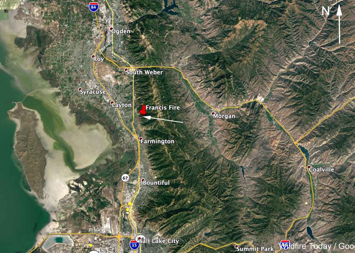
A vegetation fire that was reported around 3 p.m. MDT Monday has spread across a slope above Fruit Heights between Salt Lake City and Ogden, Utah. Structures have been threatened and the Davis County Sheriff’s Office (@DavisCountySO) has ordered evacuations in some areas. (see map below)

At 6:30 p.m. @UtahWildfire, a Twitter account associated with a government agency, reported that the Francis Fire had burned 100 to 200 acres. A strong wind has been pushing it across the slopes and caused spotting in the grass  and oak brush.

In addition to the 17 fire engines working the fire, the aircraft assigned include an MD-87, a BAe-146 (Tanker 168), and four helicopters plus an air attack ship and lead plane. Below we have one video from Twitter of an air tanker drop, and more are on Fire Aviation.


There have been many fires in the greater Salt Lake City area in the last one to two months. They all have a Utah tag on Wildfire Today.

Francis Fire Utah map
Map showing the approximate location of the Francis Fire at 5 p.m. MDT September 16, 2019.

Wildfire smoke to affect Oregon, Idaho, Colorado, and Montana on Sunday

Red Flag Warnings for areas in California, Nevada, Oregon, and Wyoming

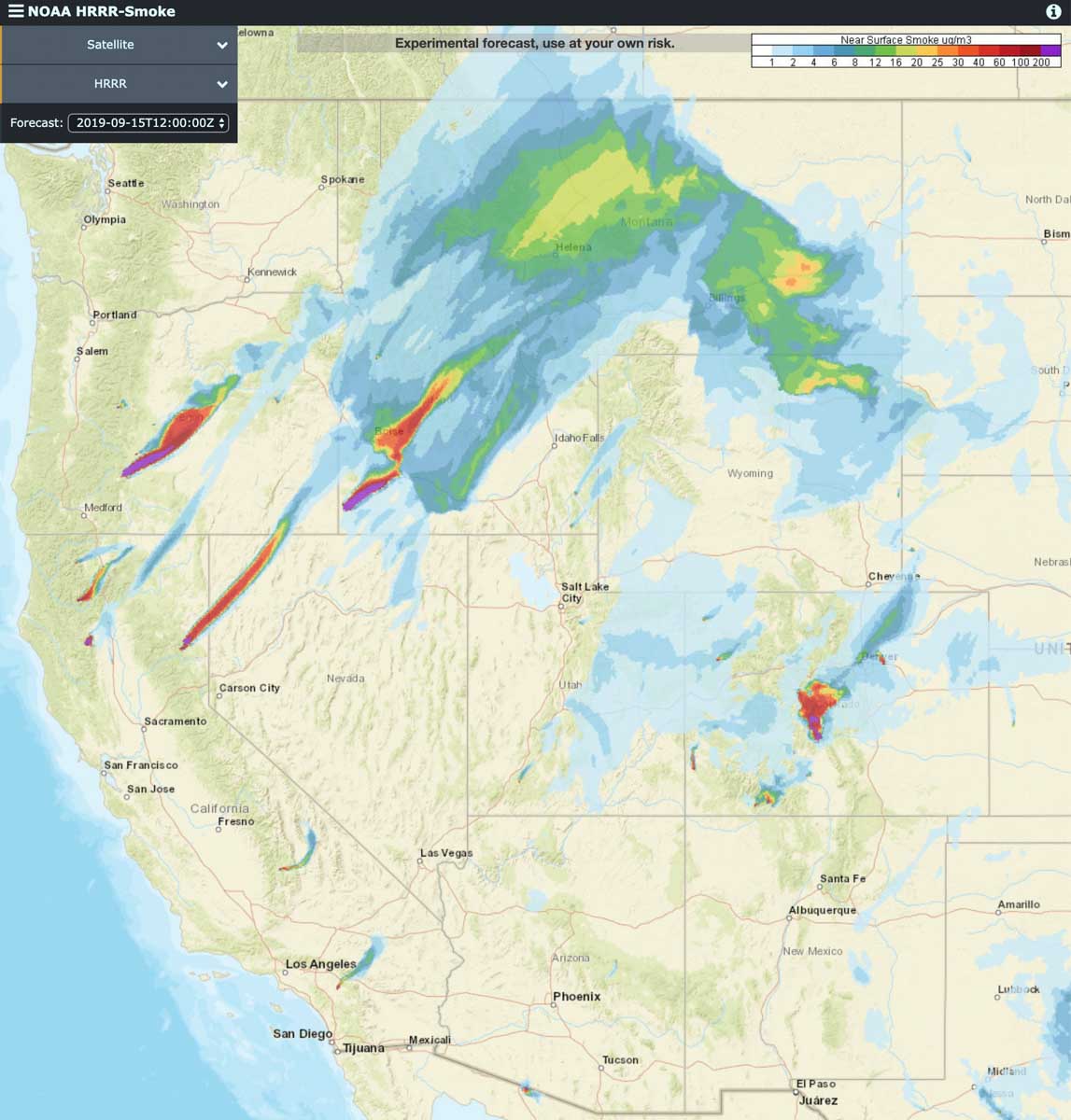
forecast near surface smoke
Forecast for smoke near the Earth’s surface at 6 p.m. MDT September 15, 2019.

Smoke from wildfires are producing smoke that forecasters expect to affect large portions of Idaho, Montana, and Colorado on Sunday. The map above is the forecast for 6 p.m. MDT.

The largest producers of smoke today are:

  • Oregon: the 13,000-acre, largest ever prescribed fire on  the Fremont-Winema National Forest just east of Crater Lake National Park, south of Highway 138 and west of Highway 97.
  • Idaho: a wildfire in state-protected lands in the southwest corner of the state 77 miles southwest of Boise, ID and 32 miles south-southeast of Jordan Valley, OR.
  • California: The 53,148-acre Walker Fire 16 miles south of Susanville, CA.
  • Colorado: Decker Fire, 6 miles south of Salida, CO, a fire 36 miles southwest of Salida, and two fires 20 and 40 miles east of Durango.

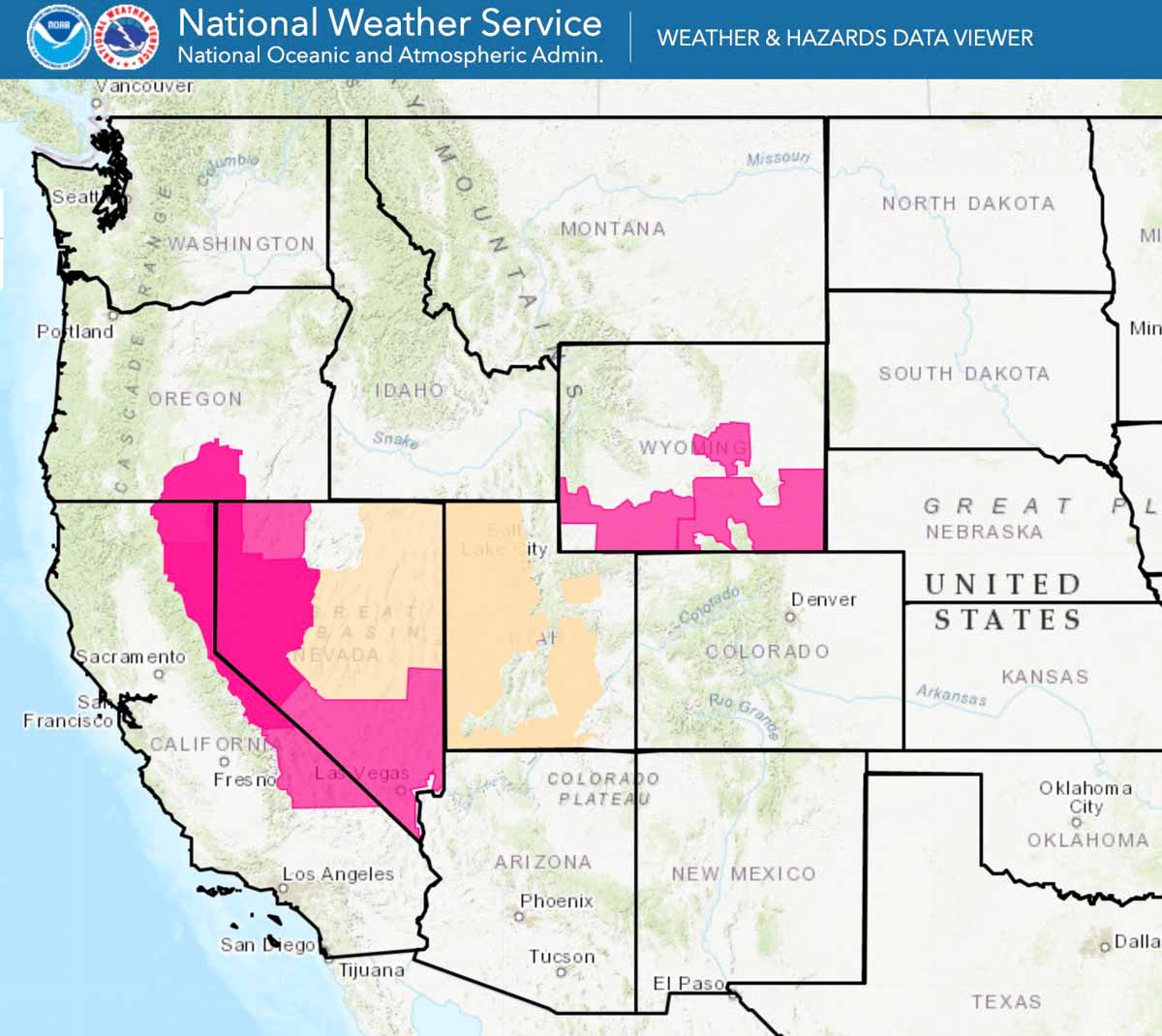
Red Flag Warnings are in effect Sunday for areas of California, Nevada, Oregon, and Wyoming.

Red Flag Warnings
Red Flag Warnings, September 15, 2019.

(Red Flag Warnings can be modified throughout the day as NWS offices around the country update and revise their weather forecasts.)


270 firefighters working out of remote spike camp on the South Fire

(9:26 a.m. PDT September 14, 2019)

South Fire California
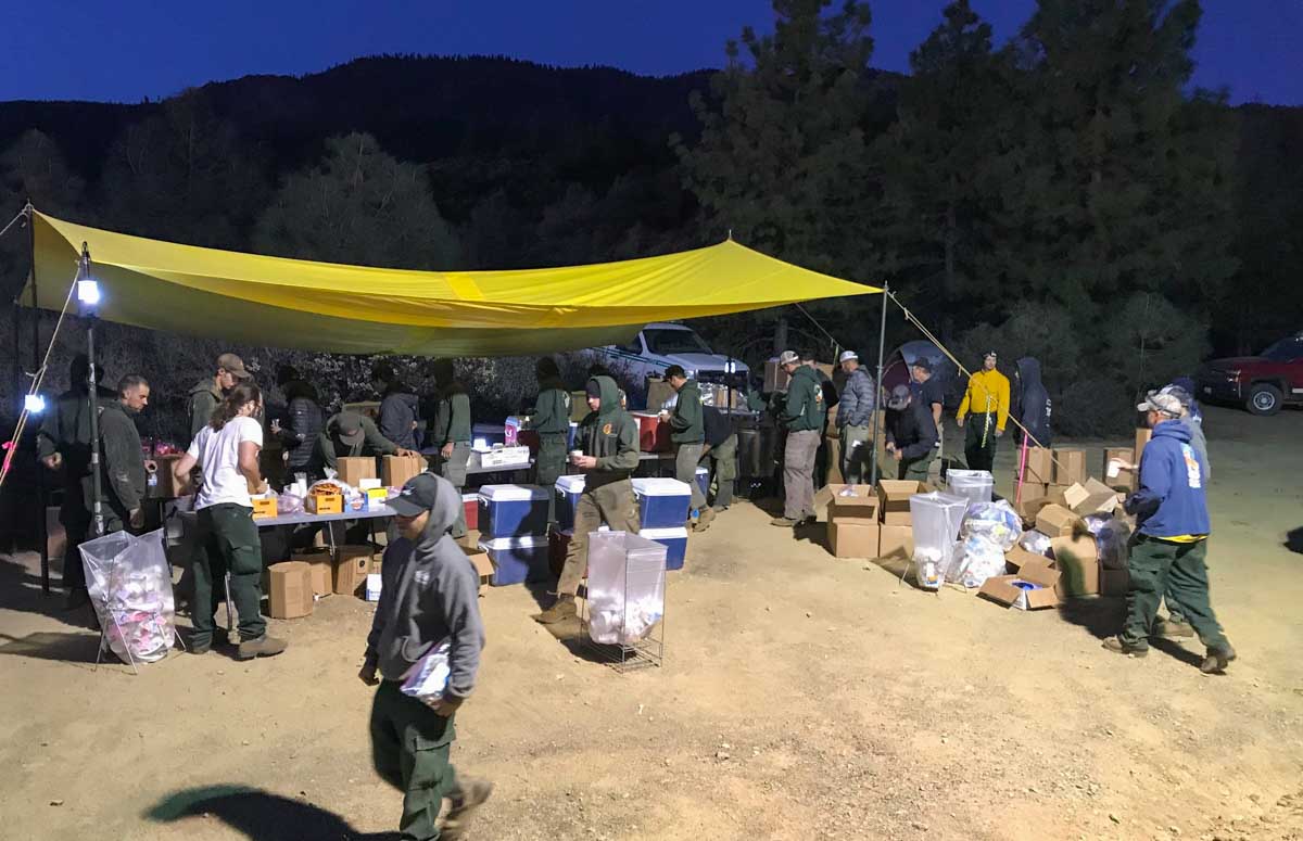
Spike Camp on the South Fire, September 12, 2019. Inciweb.

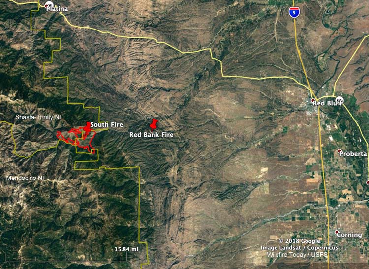
The South Fire has burned 4,094 acres on the Shasta-Trinity National Forest and state protected lands since it started from a lightning strike on September 5, 28 miles west of Red Bluff, California. (see  map below)

It is burning in a very remote area with difficult access. About 270 firefighters are working out of a spike camp on a landing strip north of the fire in order to reduce travel times, but from there they still have an hour drive to get to their work assignments each day.

Below is information from the Incident Management Team on Friday:

“Firing operations on the northwest section of the fire were successful and will continue as weather permits. The fire south of Buck Camp and Hamilton Gultz had moderate fire activity and the southeast portion of the fire continues to hold within the containment lines. Fire in the Yolla-Bolly Wilderness continues to burn in a north / northwest direction towards the Syd Cabin Glade area.

“Firefighters will continue to construct direct fireline, which is the closest proximity to the fire, where they can and use natural barriers. Roads are being cleared of brush for easier access to the fire for the firefighters. Structure protection continues within and around the fire area.

“The main objective is to fully suppress the fire while providing for firefighter and public safety which is the highest priority. Firefighters continue to protect private and Forest Service infrastructure, along with natural and cultural resources, by limiting fire spread south of Cottonwood Creek and north of Nuisance Ridge and Ball Rock Road.”

map South Fire California
Map showing the location of the South Fire at 9:49 p.m. PDT September 13, 2019.
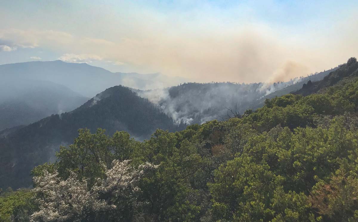
South Fire California
South Fire, September 12, 2019. Inciweb.

NIOSH is studying the health effects of fighting wildfires

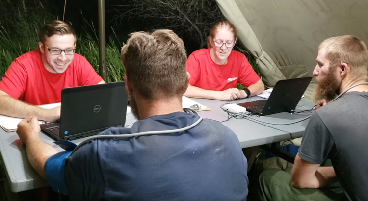
firefighters health study
Screenshot from the firefighters health study video below.

This is the second year of a multi-year study that is following six crews and taking health data from them on fires as well as at the beginning and end of the fire seasons.

The video provides a brief overview of this new approach to examine the potential health effects that wildland firefighters may experience working on wildland fires. This effort is a collaboration between the National Institute for Occupation Safety and Health (NIOSH), the U.S. Forest Service, and the National Park Service. As you will see in the video, a NIOSH team actually goes into the field on a wildfire in Idaho to test members of the Sawtooth Interagency Hotshot Crew on potential impacts to their overall health, including effects to their hearts, lungs, kidneys, and hearing. As results of this effort are made available, the Wildland Fire Lessons Learned Center will share them.

Update on the Fire and Smoke Model Evaluation Experiment

fire Manning Creek burn
Manning Creek burn on June 20, 2019. (Photo by Roger Ottmar)

The Fire and Smoke Model Experiment (FASMEE) is a large, multi-agency effort funded by the Joint Fire Science Program and the U.S. Forest Service to identify and collect critical fuel, fire behavior, and other measurements that will be used to advance scientific understanding as well as operational and research modeling capabilities associated with wildland fire. The goal is to allow managers to increase the use of wildfire and prescribed fire.

On June 20, 2019, FASMEE completed data collection on Manning Creek, the first of two large, operational stand-replacement burns in a dense mixed conifer-aspen forest as part of FASMEE’s Phase 2 Southwest Campaign (Phase 1 was a planning phase and other campaigns are possible). The burn was conducted by the Richfield Ranger District located on the Fishlake National Forest in Utah. Over 40 scientists participated using ground sampling methods, drones carrying state of the art imagery and air quality sampling instrumentation, fire hardened video and still cameras, and LiDAR to collect a suite of data including fuel loading, fuel consumption, fire behavior, plume dynamics, and smoke data. Readers can view video and photographic imagery captured during the Manning Creek fire at https://fasmee.net/study-sites/manning-creek

Richfield Ranger District personnel will conduct a second stand replacement research fire this fall near Annabella Reservoir with over 120 scientists participating. In addition to the suite of instruments and sampling techniques deployed during the first research burn, two fixed wing aircraft including NASA/NOAA’s FIREX-AQ DC8 will be sampling plume smoke and heat release. Additional LiDAR and radar units have been acquired to better identify plume dynamics, with cameras and thermocouples added within the fire perimeter to capture data on soil heating and aspen regeneration.

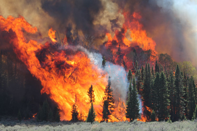
fire Manning Creek burn
Manning Creek burn on June 20, 2019. (Photo by Brett Butler)
drone fire Manning Creek burn
A wildland firefighter flies a drone over the Manning Creek burn on June 20, 2019. (Photo by Adam Watts)