LA Times writes about trauma, low pay, and morale among Forest Service firefighters

Fire crews on the Route Fire entrapped
Fire crews on the Route Fire in Southern California, 4:40 p.m. Sept. 11, 2021, about five minutes before they were nearly entrapped. Photo by one of the firefighters.

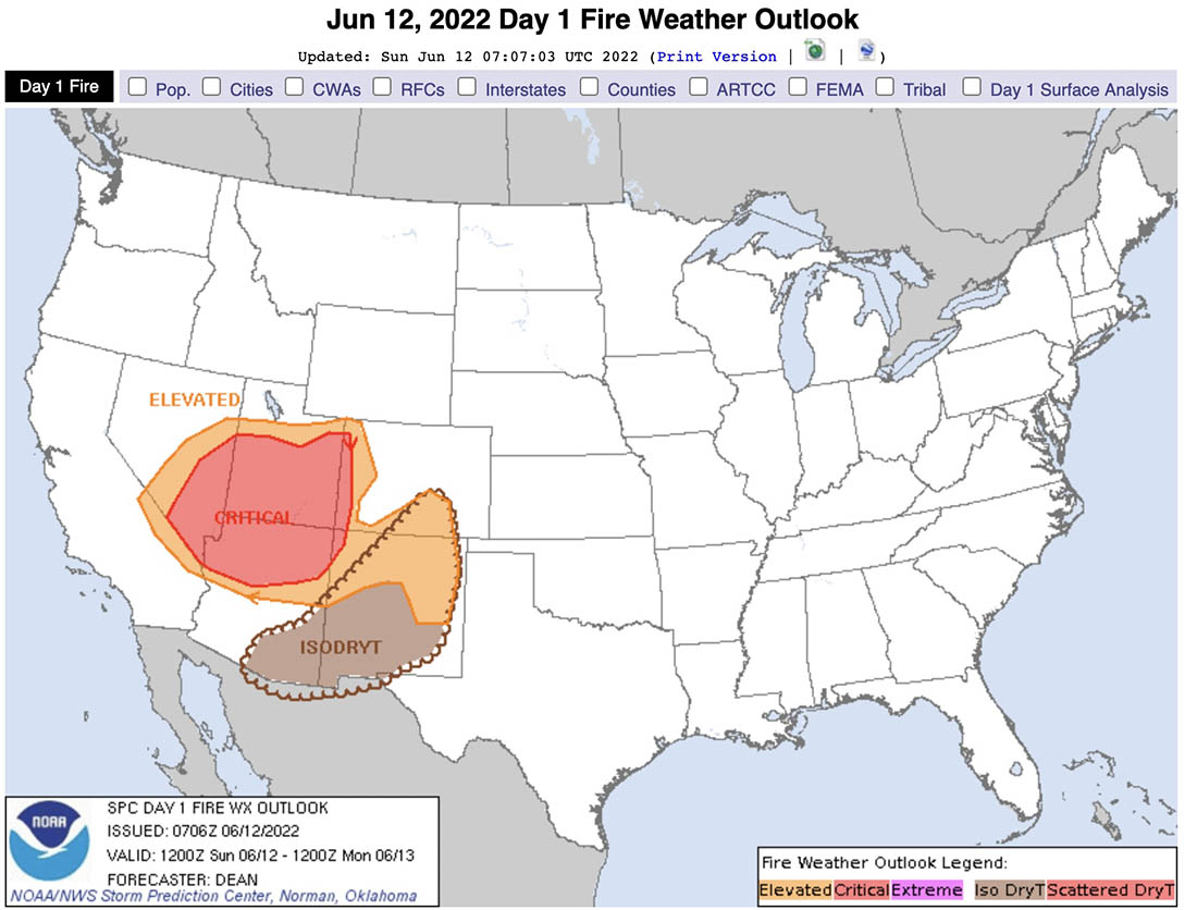
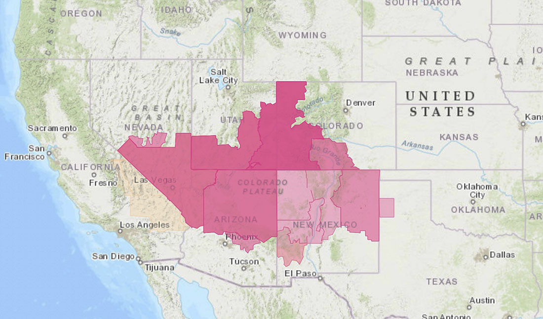
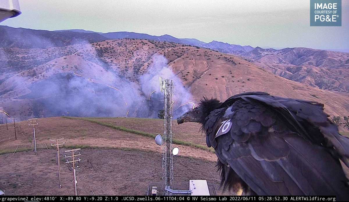
I have never seen anything like this. Over the past few months numerous politicians have been motivated and nationally recognizable media outlets have assigned reporters to dig through the opaque barriers established by the US Forest Service, Bureau of Land Management, and the National Park Service to expose the worsening working conditions of wildland firefighters. Even though Congress passed a law requiring improvements in several areas, the bureaucratic morass of inaction driven by the indecisiveness of leaders has led many of them to abandon all hope, and quit.

Reasons cited by current and former firefighters include very low pay, long hours, too much time away from home, too little time with families, limited opportunities for career growth, costs of housing, inadequate mental health support, and the temporary and sometimes life-altering physical injuries experienced by these tactical athletes. This has led to severe difficulties in hiring and retaining firefighters, resulting a large number of vacant positions at all levels.

One of the latest well-researched pieces about the decline of working conditions for federal firefighters was published today, written by Alex Wigglesworth, a staff writer for the Los Angeles Times. It is titled, “Hellish fires, low pay, trauma: California’s Forest Service firefighters face a morale crisis.”

In addition to documenting and elaborating on the issues above, their research found:

  • “Only 62% of federal firefighter positions [in California] are filled, according to a source within the agency. Before 2020, nearly all firefighter positions across the nation would typically be filled at this time of year.”
  • “Roughly a third of all Forest Service fire engines in California are on five-day staffing, meaning there aren’t enough crew members to operate them seven days a week.”
  • “Another 13% of engines are “down staffed” — essentially parked due to lack of firefighters.”

The reporter mentioned Chris Mariano who was a GS-6 Squad Boss on the Truckee Hotshots in Northern California until April 7, 2022 when he resigned. Wildfire Today published a letter he wrote at the time. He said drafting it was difficult —  the best part of his life was working as a hotshot on the Tahoe National Forest:

“I prospered — I was all in,” he wrote. “I wanted nothing more than to be a hotshot, to be a leader, to care for the land and to be of service. While the sense of purpose and camaraderie remain, I now feel hypocritical to recruit or encourage crew members to work for an agency that is failing to support its fire management programs and thus the public.”

“The agency is failing its firefighters on so many levels. Classification, pay, work life balance, mental health, presumptive disease coverage, and injury/fatality support. There are efforts to correct some of these issues but for many it is too little too late…We are losing people at a terrifying rate at a time when wildfires burn longer, hotter, more frequently, and with devastating severity.”

Rancho Fire destroys structures southwest of Red Bluff, California

10:58 a.m. PDT June 14, 2022

Rancho Fire map, 219 a.m. June 14, 2022
Rancho Fire map, 2:19 a.m. June 14, 2022.

The Rancho Fire in Rancho Tehama in Northern California has destroyed 10 structures and damaged 4 others, the California Department of Forestry and Fire Suppression said Monday night.

It was mapped Monday afternoon at 255 acres with a 17-acre spot fire out ahead. Tuesday morning at 8 a.m. it had grown to about 700 acres, CAL FIRE reported.

Evacuations are in effect and 158 structures are threatened.

Rancho Fire, 8:04 p.m. PDT, June 13, 2022.

The fire is 14 miles southwest of Red Bluff and 14 miles northwest of Corning.

Rancho Fire map, 12:07 a.m.. June 14, 2022

The aerial video below was shot at 6:20 p.m. PDT June 13, 2022. After that, the size more than doubled.

Three fires spreading rapidly northeast of Flagstaff, AZ

Haywire Fire, Pipeline Fire, and Double Fire

Updated at 7:06 a.m. MDT June 14, 2022

map Pipeline & Haywire Fires 930 p.m. MDT June 13, 2022
Map showing the perimeters of the Pipeline & Haywire Fires at 9:30 p.m. MDT June 13, 2022. The red dots represent heat detected by a satellite at 1:41 a.m. MDT June 14, 2022.

A mapping flight at 9:38 MDT Monday night determined that the Pipeline Fire had grown to 20,178 acres and the Haywire Fire was 4,051 acres. Both blazes are within the Coconino National Forest, but at that time the Haywire Fire had reached the boundary and may spread outside the Forest. The Double Fire appears to have merged with the Haywire Fire.

The fires are burning in timber and grass. Some of the areas near the Sunset Crater Volcano National Monument have volcanic soils with little vegetation between patches of shrubs, grass, and trees. The elevation ranges from 6,000 to 10,000 feet, with the higher elevations on the west side of the Pipeline fire having a much greater density of timber as evidenced by the photo below and the extreme fire behavior Monday when flames at least 400 feet high were seen in videos.

Pipeline & Haywire Fires June 14, 2022
View from the OLeary camera, north of the National Monument at 8 am. June 14, 2022.

In April of this year the 19,000-acre Tunnel Fire burned across the National Monument. The photo below was taken in 2017.

Sunset Crater Volcano National Monument
Sunset Crater Volcano National Monument, May 20, 2017.

Updated at 11:00 p.m. MDT June 13, 2022

I have seen and been under many smoke columns, but I’ve never seen this on a large fire. Things that come to mind are mountain wave and wind shear. And, GTFO.

Here’s another photo.

Pipeline Fire north of Flagstaff June 13, 2022, by @russdussel

Fire officials said the Pipeline Fire has burned about 6,500 acres.

A man has been arrested Sunday in connection with starting the fire. He told officers he had ignited toilet paper after using it and placed it under a rock Saturday, and that he tried to put out the fire with his sleeping bag. His camp was 80 yards from where the fire started, according to court documents.

This is not the first time a wildfire has been ignited by burning toilet paper. We have eight other articles on Wildfire Today tagged “toilet paper”.

Thanks and a tip of the hat go out to Dick.


Updated at 8:13 p.m. MDT June 13, 2022

Map of the Pipeline & Haywire Fires
Map of the Pipeline & Haywire Fires. Data accessed at 7 p.m. MDT June 13, 2022. The exact time the data was created on June 13 is unknown.

In a briefing Monday evening fire officials said at least one structure has been destroyed in the three fires burning north and northeast of Flagstaff, Arizona. It appears that the Pipeline, Haywire, and Double Fires have or will soon merge with the footprint from the Tunnel Fire that burned about 19,000 acres north of Flagstaff in April of this year.

The blaze was exhibiting extreme fire behavior Monday afternoon.

Coconino County has established a website with maps showing evacuation status.

Satellite photo smoke Pipeline and Haywire Fires
Satellite photo showing smoke from the Pipeline and Haywire Fires at 6:21 p.m. MDT June 13, 2022. The red arrow points to the fires. NOAA.

Monday afternoon the wind near the fire was gusting as high as 49 mph out of the south-southwest while the relative humidity dropped as low as 6 percent. This, and the very dry vegetation, accounts for the extreme fire behavior on Monday.


2:35 p.m. MDT June 13, 2022

map Pipeline Fire, June 13, 2022 Arizona Flagstaff
Map of the Pipeline Fire ane Haywire Fire, June 13, 2022. The Tunnel Fire, the green perimeter, burned in April, 2022. The red dots represent heat detected by a satellite at 2:49 a.m. MDT June 13, 2022.

Three fires in northern Arizona are spreading rapidly in the Coconino National Forest north and northeast of Flagstaff.

The Pipeline Fire six miles north of the city started Sunday morning June 12. On Monday it has been pushed by winds gusting out of the southwest at 25 to 35 mph as the relative humidity dropped to 10 percent in the afternoon. It has reached the Tunnel Fire that blackened about 19,000 acres in April of this year. Judging from the massive smoke column it appears to be burning around it. Fire officials estimate it has blackened approximately 5,000 acres, but that number is changing hourly.

Pipeline Fire, June 13, 2022 Arizona Flagstaff
Pipeline Fire, June 13, 2022, by @RealTaoOfSwan.

Another fire, the Haywire Fire, was was reported Sunday afternoon on the southeast side of the Tunnel Fire perimeter. It is about seven miles northeast of the Pipeline Fire, making it unlikely that it could have begun as a spot fire started by a lofted burning ember. Fire authorities said the probable cause of the 1,600- acre fire is from a lightning strike several days earlier and is expected to merge with the Double Fire.

A third fire was also reported Sunday afternoon about two miles south of the Haywire Fire. The Double Fire has burned about 500 acres according to Forest officials and was likely also caused by lightning.

Continue reading “Three fires spreading rapidly northeast of Flagstaff, AZ”

Sheep Fire prompts evacuations northeast of Wrightwood, California

22 miles northwest of San Bernardino

Sheep Fire map June 12, 2022
Sheep Fire map June 12, 2022.

The Sheep Fire just northeast of Wrightwood, California has prompted evacuations of some areas northwest of the community. The San Bernardino County Sheriff’s Office and NIXLE have the details. An evacuation center is at Serrano High School, 9292 Sheep Creek Road, Phelan, CA 92371.

The fire is burning on both sides of Highway 2 and Sunday evening was spreading toward Desert Front Road. Most of the heat detected by a satellite overnight was on the northwest side of the fire.

Smoke over the Sheep Fire
Smoke over the Sheep Fire at 8:24 a.m. June 13, 2022.

Monday morning the Southern California Geographic Coordination Center said it had been mapped at 939 acres, an increase of 139 acres overnight. It was reported Saturday June 11 at 6:30 p.m.

Sheep Fire, June 12, 2022
Sheep Fire, 1:18 p.m. June 12, 2022.

The incident is being managed by the Angeles National Forest, San Bernardino County Fire, and CAL FIRE in unified command.

Sunday afternoon a cell phone outage was reported in the Wrightwood area, and law enforcement was prepared to go door to door if additional evacuations were required.

California Incident Management Team 14 with Incident Commander Watkins will in-brief Monday at 5 p.m.

Sheep Fire, June 12, 2022
Sheep Fire, June 12, 2022. Photo by Local 935.

Red Flag Warnings in six states Sunday

Possible dry lightning in New Mexico and Arizona

Storm Prediction Center June 12, 2022 forecast lightning thunderstorms
Red flag warnings are in effect Sunday for locations in Nevada, Utah, Colorado, Texas, New Mexico, and Arizona. In New Mexico most of the warnings will last until Monday evening.

The forecast calls for winds gusting at more than 40 mph with single-digit relative humidity.

In addition, the NOAA Storm Prediction Center warns that isolated thunderstorms with little or no rain could occur in portions of New Mexico, Colorado, and Arizona.

Red Flag Warnings June 12, 2022 fire wildfire
Red Flag Warnings June 12, 2022.

Multiple fires near Grapevine north of Los Angeles

Plant Fire
Plant Fire at 4:54 a.m. June 11, 2022.

Friday afternoon and early Saturday morning firefighters responded to multiple fires near Interstate 5 in the Grapevine area north of Los Angeles. The Grape Fire on Friday was mapped at 19 acres, according to @barkflight. Then at about 4 a.m. Saturday firefighters responded to the Plant Fire close to the freeway. @CAFireScanner noted that Engine 345 reported there were three separate fires on the west side of I-5 that would likely burn together, and then merge with the earlier Grape Fire.

Plant Fire
Plant Fire at 5:10 a.m. June 11, 2022.

At 7:33 a.m. PDT the Grapevine 2 AlertWildfire camera showed very little activity on the Plant Fire.

Plant Fire
Plant Fire at 7:33 a.m. PDT June 11, 2022.
Plant Fire map
The red squares represent the APPROXIMATE location of heat detected by a satellite as late as 3:28 a.m. PDT June 11, 2022.

Judging from the video below the fire was very active in the predawn hours.

A photo of a condor was grabbed by the AlertWildfire camera.

Condor #76
Condor #76 observing the Plant Fire
Condor #76 information