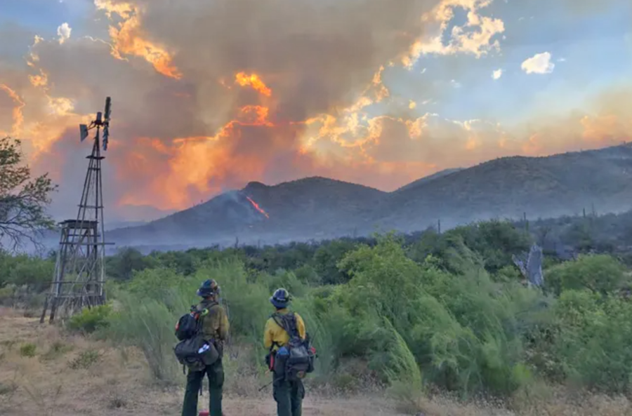
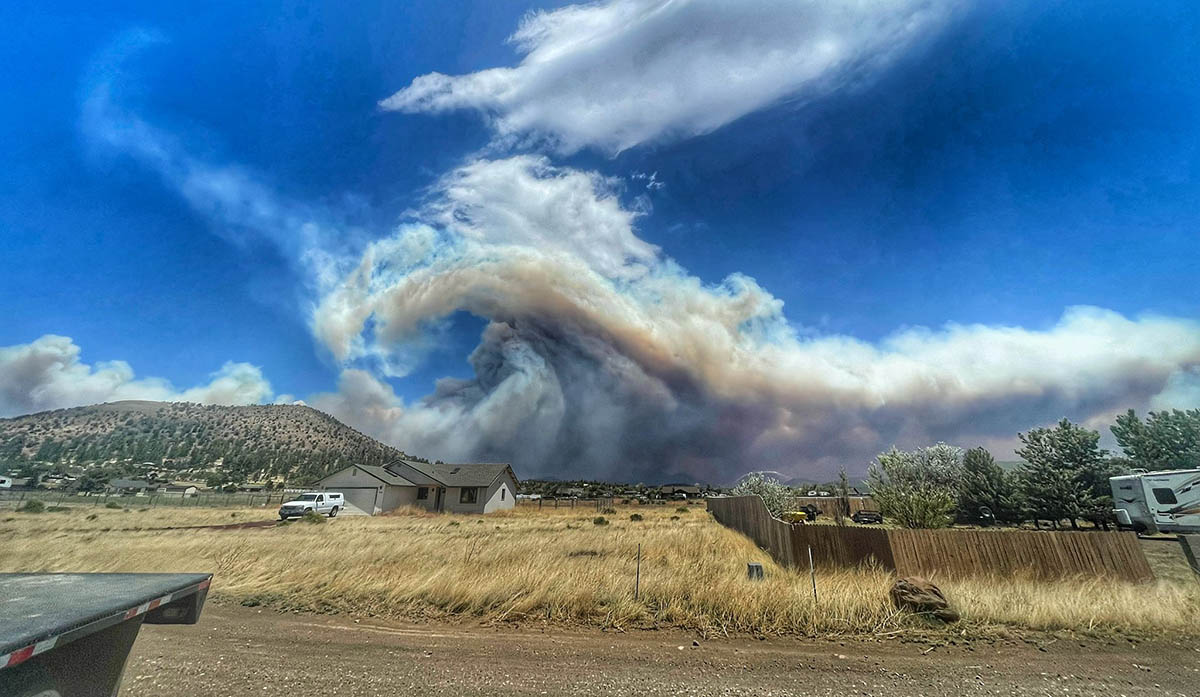
Wildfires in Arizona are burning near the town of Kearny, about 90 miles southeast of Phoenix.
The Romero Fire is estimated at 3,500 acres, spreading west and north through grass and brush. It’s 13 miles southwest of Kearny and 22 miles northwest of Mammoth, according to the Arizona Department of Forestry and Fire Management. There is as of Saturday afternoon zero containment.
Romero Fire, Arizona, east of Casa Grande
azcentral.com reported that another fire, the Circle Fire, has burned about 200 acres at the base of Antelope Peak southeast of Kearny. The fires are just north of the Freeman Fire, which burned 32,568 acres.
The Southwest Coordination Center (SWCC) reports that scattered to numerous wetting thunderstorms are predicted for the Mogollon Rim and parts of eastern Arizona. The region reported 17 new fires on July 19, with 1,517 recorded so far for 192,579 acres thus far in 2024.
A longstanding wildfire safety collaboration between the Tonto National Forest and Arizona’s Gila County officials needs updating. The county began collaborating with the USFS and local fire districts back in 2006 when it installed 14 water tanks, bladders, and storage systems in helicopter-accessible areas on the forest. The intent, according to a recent Gila County Board of Supervisors meeting, was to put fires out as soon as they were detected in the Rim Country area near Payson. The water sites were positioned where helicopter turnaround time would be less than five minutes.
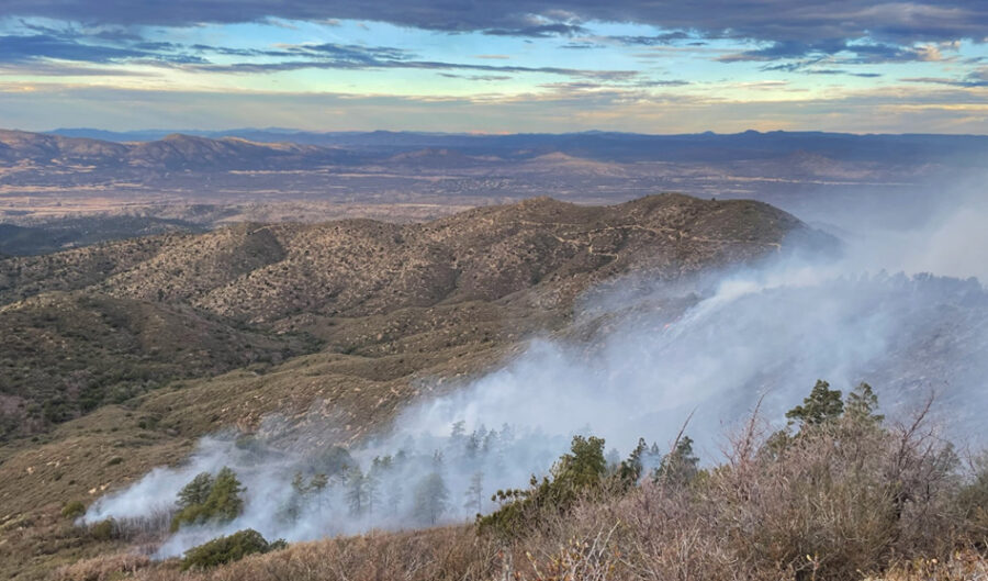
The Woodbury Fire, Superstition Wilderness on the Tonto, photo (c)2019 Daisy Mountain Fire Department
But those water systems are now falling apart. Gila County Emergency Services Coordinator Carl Melford told the Board of Supervisors that the average lifespan of a water bladder is five to seven years, and many of the sites have old bladders with deteriorating water storage tanks.
Melford hopes to use a $609,000 congressionally directed earmark grant through the USFS to fix the deteriorating system. The funds would have to be matched from Gila County for a total of $1.2 million.
“This funding provides the opportunity for the evaluation and purchase of new water tank storage systems to replace the dilapidated tanks and old bladders and to hire a qualified contractor to transport and install 56 tanks of 5000-gallon capacity at the 14 locations,” Melford said in his proposal to the board. “This will increase the capability of fire suppression efforts, which is vital to the protection of Gila County residents’ life and property in areas prone to wildfires.”
“We really don’t say we have a ‘fire season’ because we can have activity throughout the state year-round,” Arizona Department of Forestry and Fire Management spokesperson Tiffany Davila told the Arizona Republic last year. “We can see fire activity increase during the end of April, beginning of May.”
The Tonto National Forest’s most recent wildfire, the Valentine Fire, started on August 16 last year, nearly caused evacuations, and burned nearly 10,000 acres.
Fire crews are fighting the Hackberry Fire, burning seven miles west of Prescott, Arizona since Monday morning, according to the Arizona Emergency Information Network.
The fire had burned 30 acres as of Monday afternoon, Prescott NF firefighters said.
Hackberry Fire 12/18/2023
Updates:
Fire crews report there are no values at risk or threatened.
The cause of the fire is unknown and under investigation.
How many acres has it burned? The Hackberry Fire has burned 30 acres and is zero percent contained. Infrared imaging has not yet been done to get an accurate estimate of acres burned. Recreationists should avoid camping, biking, and hiking near the fires and use caution while driving the roads as firefighters will be traveling to and from the fire.
Are there any evacuations? There are no evacuations yet announced, nor any communities warned to prepare for evacuation.
What roads or highways have been closed? Authorities have not announced any road closures.
Wildfire Go-Kit: Residents in wildfire-prone areas are urged to have an emergency supplies kit to bring with them if they are evacuated from their homes. An emergency supply kit, a “go bag,” should be put together long before a wildfire or other disaster occurs. Make sure to keep it easily accessible so you can take it with you when you have to evacuate.
The National Fire Protection Association (NFPA) recommends that residents store emergency supplies in a plastic tub, small suitcase, trash can, backpack, or other container. Residents should make sure they have the necessities, such as three gallons of water per person and a three-day supply of ready-to-eat food, the NFPA said. A first aid kit, prescription medications, contact lenses, and non-prescription drugs should also be taken into account.
Copies of important family documents, including insurance policies, identification, bank account records, and emergency contact numbers should also be put into a waterproof portable container in your kit.
The NFPA lists other items that would help in a disaster, including:
Sleeping bag or warm blanket for each person
Battery-powered or hand-cranked radio and a NOAA weather radio to receive up-to-date information
Dust mask or cotton T-shirt to filter air
Matches in a waterproof container
Complete change of clothing including long pants, long-sleeve shirts, and sturdy shoes stored in a waterproof container
Firefighters had an 870-acre wildfire burning south of Wickenburg, Arizona about 60 percent contained today; the Cloud Fire near Vulture Mine and Whispering Ranch roads started Thursday, according to the BLM.
State Forestry was responding with aircraft, engines, and hand crews. KJZZ reported that 75 firefighters from the BLM, Wickenburg, and Buckeye Valley were also working the fire.
12NEWS had video. Forestry officials said airtankers slowed the progress of the fire, which was burning in short, dense grass.
The fire started Thursday about 16 miles from Wickenburg.
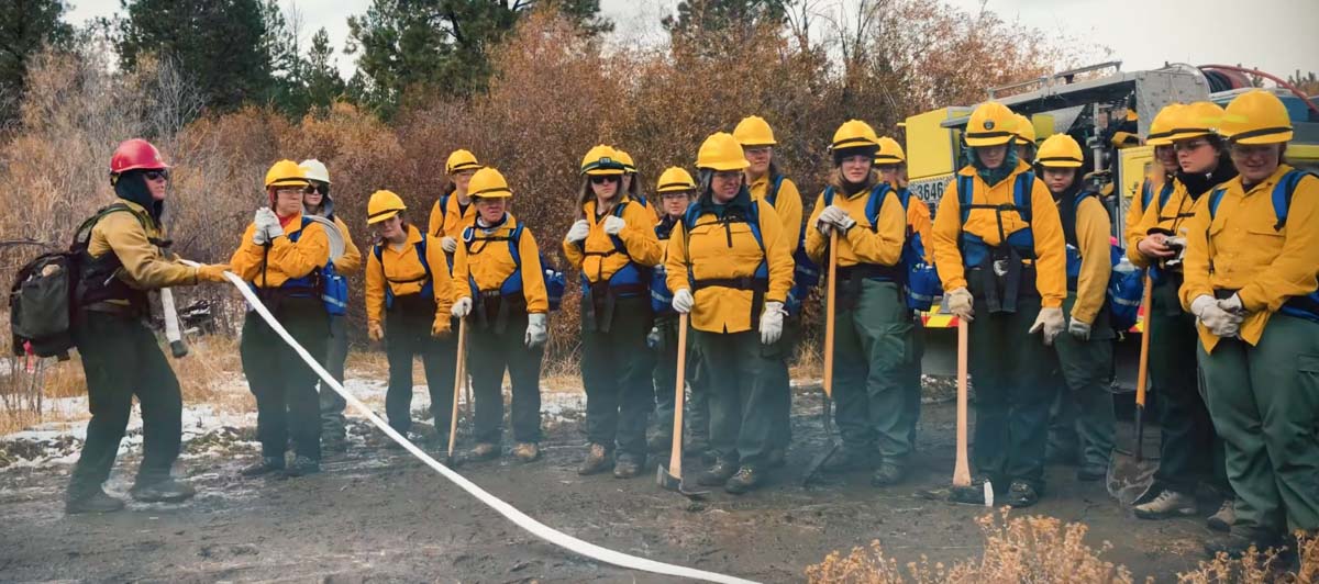
The US Forest Service will be hosting the annual Women in Wildfire Training this fall in Arizona. This is a fast paced, six-day training where women from around the nation have an opportunity to participate in hands-on wildland fire training in a simulated fire assignment. Anyone is welcome to apply, no experience necessary. After the completion of the training, students become certified as FFT2 (Firefighter Type 2) and will be provided with information on how to apply in USAjobs if interested in working on a fire crew.
The camp will be held at the Pinedale Work Center on the Lakeside District of the Apache-Sitgreaves National Forests in Arizona. The dates for the training are Sept 23rd-25th and Sept 30th-Oct 2nd. Participants must attend both timeframes. Time and travel are paid, and equipment is provided. Apply by August 21, 2022.
If you have any questions, contact:
Naomi Corkish (naomi.corkish@usda.gov, 928-333-6247) or
Matt Sigg (matthew.sigg@usda.gov, 316-617-9898).
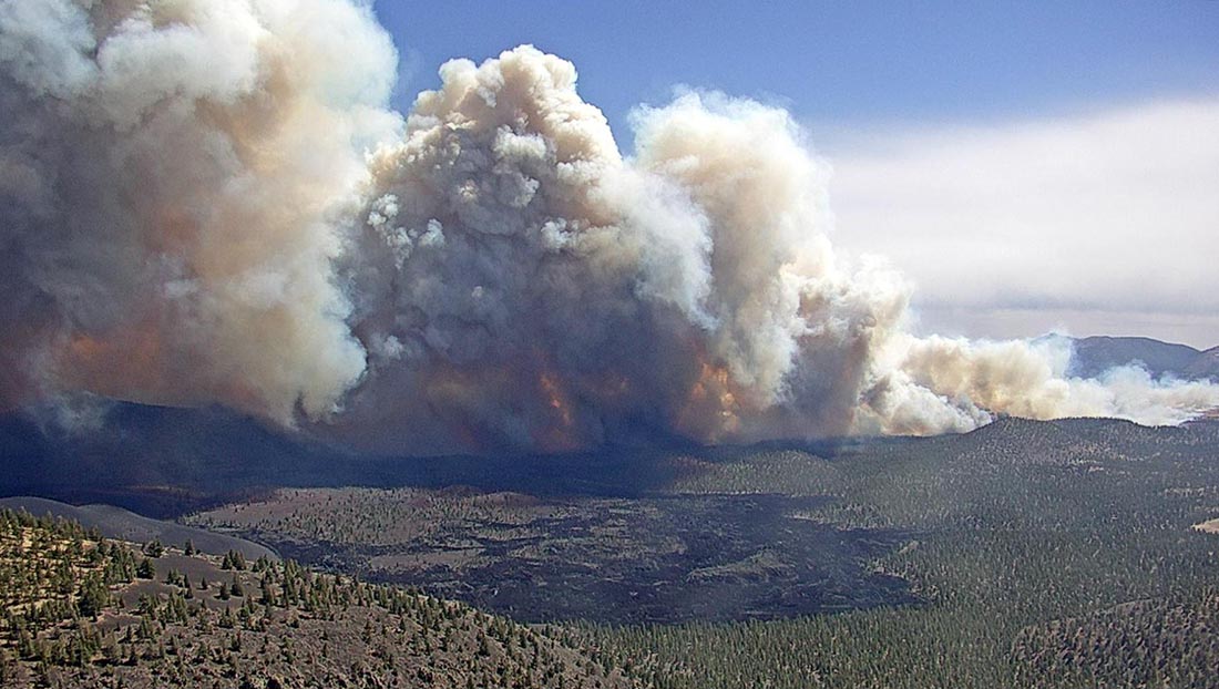
Tunnel Fire north of Flagstaff, AZ, April 19, 2022, as seen from O’Leary Lookout in Northern Arizona. USFS photo.
This article first appeared in the Arizona Daily Sun. It is used here with their permission and the author’s.
Arizona Daily Sun Editor’s note: This is a bit unusual, to run a column on the front page, but I thought Mark’s perspective from his more than two decades working with Hotshots was a valuable read. He wrote this on a personal basis and not on behalf of any fire or forest management organization.
By Mark Adams
This has been a rough year for extreme fires in Flagstaff.
Before most of the U.S. Forest Service seasonal workforce was even finished with their mandatory two weeks of training, the Tunnel Fire started in one of the windiest areas of the San Francisco Peaks, during one of the windiest springs I can remember. In addition to that, it was located in the Schultz burn scar, which, at 12 years old, was primed for a fast-moving and difficult-to-contain fire due to the tall grass and kiln-dried logs that are easily receptive to any hot ember that decides to land on it. The Tunnel is what one seasoned “fire dog” referred to as a career fire — meaning that experiencing a fire like that happens once a career, if at all.
Amazingly, this fire was in mid-April, and sadly, many structures were lost, despite the huge, aggressive firefighting effort. The Tunnel Fire was unprecedented for the amount of damage caused in that short amount of time. In a typical year the Coconino averages around 175 fires, and nearly all of them are caught early and mostly go unnoticed by the average Flagstaffian. This summer we have had around 23 fires already and two of them have become career fires. Both escalated to become the No. 1 priority fires in the nation, the Tunnel and now the Pipeline Fire.
I moved to Flagstaff 28 years ago from the East Coast and like most other Flagstaff transplants, the Peaks drew me here and have been my sacred place. The Peaks are the heart and soul of Flagstaff; some might say they are the heart and soul of the state. When I moved here, I knew nothing about wildfires. The little I did know was from what I saw on the news about the Yellowstone fires of 1988. Like most people, I didn’t understand why fire managers were letting Yellowstone burn and not putting them out; I was mad that all those forests were burning. If the internet had been around, I would have been a loud critic of the Forest Service, just like so many people today commenting in online forums like they are experts in forest and fire management.
Fast forward many years later, after a long career as a Hotshot, I now better understand wildfire and the critical role it plays throughout our Western forests. All of the forests are flammable and will burn, eventually. The work we do and our efforts each year are done in hopes that they burn under our terms.
During my career, my crew and I have been emergency-shifted from one fire to another two times. The first time was on an afternoon in 2010 when I was a Mormon Lake Hotshot and we were on the Tecolote Fire in New Mexico. The radio sounded out from Incident Command: “Get Flagstaff and Mormon Lake hotshots off the mountain and come to ICP and demob immediately, there is a situation on the Peaks in Flagstaff.” In a matter of hours (which is lightning fast in federal government time), we were out of the Santa Fe Wilderness and on the road home to help fight the Schultz Fire. The next day we were briefing with fire managers at the Chevron station on Highway 89. We would be deployed behind the homes of Timberline and tasked with doing whatever we could to protect them.
History repeated itself this week. While on the Cerro Bandera Fire south of Grants, New Mexico, I received a text from Flag Dispatch of a new start. These texts come daily and normally I read them and say to myself, “Oh, they’ll catch that one” — because we do 98% of the time. This time was different. Upon checking the text, I immediately realized this one could be a problem — it’s windy and it’s in a bad spot. After making a few phone calls, once again my crew and I were quickly released and on the way back home to protect the mountain we and so many others love so much. We made it to the fire seven hours after it was first reported, lightning fast considering we started that day in a different time zone.
Pipeline Fire north of Flagstaff June 13, 2022, by @russdussel
Luckily that night we were able to help others piece together a plan and save many homes through quick action and, ironically, having the already burned ground of the Tunnel Fire helping us. Had that fire scar not been there, the Pipeline Fire would have destroyed many more homes than the Tunnel Fire had.
The next few days, grueling work was put in by my crew and many other crews from around the nation. I am forever grateful to the three Hotshot crews from California that were with us on the ridge below Fremont Peak. Ninety people hiked in and out every day, working some tough ground that spanned from 8,500 to 12,000 feet in elevation. The air was thin, the hazards were too numerous to count and if someone got hurt, medical extraction would be challenging. The alternative to this option was not good. Had we not been up to the work, the fire would have continued to the west and with the strong westerly winds gone, it would have torched the entire mountain. All of Flagstaff would have been buried under sandbags for the foreseeable future.
Flagstaff dodged another bullet. We got lucky — lucky the firefighting resources were available, lucky they recognized the situation, lucky we were willing to accept the risk of injury or worse. It’s coming. It’s only a matter of time. All of the Peaks, minus the rocks, are flammable and will burn someday.
End of story.
Recognizing and accepting this will only help to protect our Peaks. I say this because we have altered the natural cycle of fire for far too long. Now we have one of the most sacred places in the Southwest that is primed and more than ready for a catastrophic fire. Our challenge is to ensure that it doesn’t burn all at once and try to stay as close to the natural cycle as possible. And that natural cycle includes stand-replacing fires. We have a long way to go in protecting not only the Peaks but our forests in general, and it is time that we wake up and do what needs to be done. Everyone talks a good game, but we all can do more to ensure that we have healthy ecosystems to live in for generations to come.
There are ways that we, as a community, can limit the catastrophic results of the Big One:
1. Allow for day use only on the Peaks and Dry Lake Hills near Highway 89, 180 and across Forest Road 418.
2. Follow all campfire restrictions.
3. Educate the influx of out-of-towners moving here, often unaware of our wildfire-dependent and prone ecosystem.
4. Do everything in your abilities to prepare your home/property for wildfire. The 10 years you prepare before a fire are far more important than the 10 minutes or even hours before a fire — no matter how many engines, crews, airtankers and helicopters are available.
5. Support and obey any forest closures and don’t whine about it!
6. Get used to smoke! Support aggressive, forward-thinking fire management, including managing fires under the right conditions on the Peaks and across the forest.
7. Reward and support active fire and forest management, including prescribed burning, even if there is an occasional bad outcome (99.8% of all prescribed fires are successful).
8. Question managers that do not take risks, by choosing the safe route — putting all forest fires out small, never managing a fire for resource benefit and not conducting as many prescribed fires as possible. They are just kicking the can down the road.
The Peaks are going to burn again and I would much rather they burn when we say so. Not when a campfire or burning toilet paper decides to get one going in the wrong spot on the wrong day. The choice to manage a fire or light a torch for prescribed fire is not one that we take lightly, the responsibility is huge! Things sometimes go wrong despite the best intentions. But the alternative of doing nothing has only one outcome and it’s not good.
Remember, it’s not if, it’s when.
Mark Adams has been a Hotshot on the Coconino National Forest since 1999, working on all three crews: Blue Ridge, Mormon Lake and Flagstaff Hotshots. He is currently the superintendent of the Flagstaff Hotshots. He wrote this as a concerned resident of the Flagstaff area — not as a representative of the Forest Service or Coconino National Forest.