Wildfires in Israel force tens of thousands to evacuate

Firefighters have been battling a rash of fires since November 21.

Since Monday November 21 many wildfires have broken out in Israel, forcing 60,000 residents to flee from the coastal city of Haifa as the fire spread into the center of the metropolis.

Normally this time of the year the country would be entering their rainy season but the fires are occurring during a two-month drought. The situation has been worsened this week by strong dry winds making the fires more resistant to control.

Gilad Erdan, Israel’s public security minister, told reporters that almost half the fires were the result of arson. The term “pyro-terrorism” has been thrown around loosely in various articles, but that has not been confirmed by an authoritative source.

The fires slowed on Friday enabling some evacuees to return to their homes.

The Israeli newspaper Haaretz reported that the Israeli Air Force is using 10 drones to detect fires and spot suspected arsonists.

The 747 Supertanker has been contracted by the Israeli government and after a 12.5-hour non-stop flight landed in Tel Aviv at about 10:25 a.m. MST on Friday.

Global Supertanker Services sent two complete flight crews with the air tanker, President and CEO Jim Wheeler said. Each crew consists of two pilots and a drop system operator. In addition there were four maintenance and ground personnel, one supervisor, and Bob Soelberg, Program Manager for Global Supertanker, who will liaise with the Israeli government.
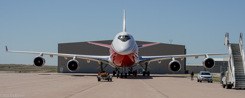
747 Supertanker
The 747 Supertanker at its home base in Colorado Springs, May 4, 2016. Photo by Bill Gabbert.

The 747 can drop retardant, foam, gel, or other fire suppressants.

This is not the first time a Supertanker has mobilized to Israel. In December 2010 the first generation of the aircraft dropped on the Mt. Carmel Fire in which 44 prison guards in a bus were killed after being trapped by the fire. The supertanker was one of 30 firefighting aircraft that were dispatched at that time from countries all over the world, including six Modular Airborne FireFighting System (MAFFS) air tankers from the U.S. military. The assistance from the MAFFS was approved and arranged late in the incident. Some never took off and others were turned around at a refueling stop in the Azores.

Since the deadly Mt. Carmel fire Israel has substantially beefed up their fire aviation resources and now have 14 Single Engine Air Tankers under contract supplied by Elbit Systems and Chim Nir Flight Services. The SEATs have their place in the firefighter’s tool box, but the 747 carries far more than all of their SEATs combined.

In June Israel loaned three of their SEATs to Cyprus to help suppress large fires near Paphos and Evrychou. Now they are on the receiving end as firefighting aircraft are arriving from the U.S., Greece, Cyprus, Croatia, Italy, and Turkey. In addition, Russia sent two water scooping Be-200 air tankers. One can be seen scooping in the video at the top of the page.

In spite of a report in a major east coast newspaper, the U.S. National Interagency Fire Center has not received any orders for firefighting resources. But, according to BLM spokesperson Randall Eardley, there have been some discussions about crew availability. Jessica Gardetto of the BLM said the Pentagon has inquired about the process for sending assistance internationally.

The weather forecast for Tel Aviv calls for warm, dry, and sunny weather through the weekend with 6 to 8 mph winds out of the northeast and relative humidities in the teens. For the 7 days after that the humidity will 33 to 57 percent with stronger winds on Wednesday through Friday.

Firefighters battling two fires in central Virginia

Above: Smoke from the Eades Hollow and Mount Pleasant Fires can be seen in a satellite photo taken Wednesday afternoon, November 23, 2016.

(Originally published at 5:55 p.m. ET November 23, 2016)

Two wildfires in central Virginia were very active on Wednesday, creating smoke that drifted northeast toward Washington, DC.

The Mount Pleasant Fire has burned 4,400 acres since it started November 19 10 miles northwest of Amherst, Virginia on the George Washington and Jefferson National Forests within the Mount Pleasant National Scenic Area. Wednesday morning 122 personnel were assigned, plus engines, dozers, three aircraft, and other resources that are en route. On Tuesday the fire grew by 1,689 acres. A Type 3 Incident Management Team from the Montana Department of Natural Resources has assumed command of the fire.

Mt. Pleasant Fire
Mt. Pleasant Fire. InciWeb photo.

The Eades Hollow Fire 16 miles northeast of Amherst has blackened 922 acres, growing by 422 acres on Tuesday.

Continue reading “Firefighters battling two fires in central Virginia”

Fighting fire on Thanksgiving

Above: A briefing at the Springs Fire, Banks-Garden Valley, Idaho, Boise National Forest, Idaho Dept. of Lands, August, 2012.

Tomorrow, November 24, 2016 is Thanksgiving Day in the United States, a time when most Americans, in addition to having a fine meal and enjoying sports on television, are thankful for their blessings.

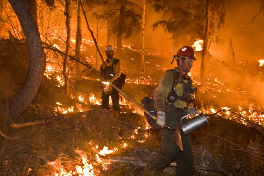
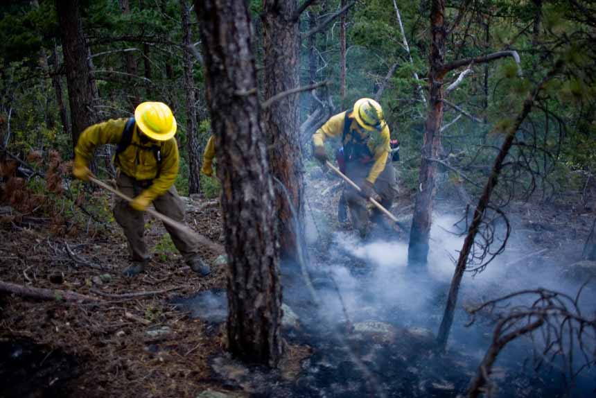
There will be about 4,100 firefighters in the southern states that will not have those pleasures. They will be constructing fireline, burning out, installing fire hose, applying water, driving across the country, attending briefings, providing logistics, dispatching personnel, completing time sheets, and making plans for the next day of putting out the 120,000 acres that are currently burning.

Please keep those men and women in your thoughts on Thursday.

firefighters wildland fire wildfire
Cascade Complex, Idaho, 2007
firefighters wildland fire wildfire
Houses inside of the Fourmile Canyon Fire near Boulder, Colorado in the wildland-urban interface. The 7,000 acre fire claimed nearly 170 houses in the first days of the blaze. Several of the houses that were saved had properly prepared their land for the potential of wildfire, including building with fire resistant materials as well as preparing defensible, fuel-minimized spaces in the areas surrouding the structure.

Continue reading “Fighting fire on Thanksgiving”

Horton Fire causes evacuations southeast of Boone, NC

Above: The Horton Fire, as seen from the entrance to Blue Ridge Mountain Club at 5 p.m.November 22, 2016. Incident Management Team photo.

(UPDATED at 11:20 a.m. ET November 23, 2016)

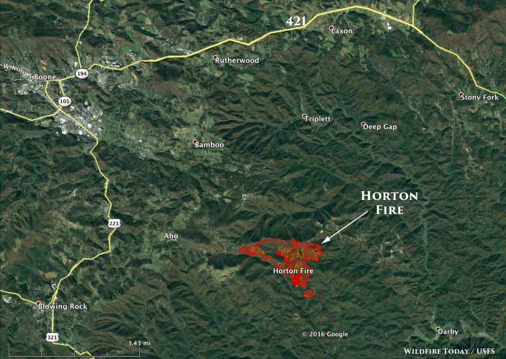
The Horton Fire seven miles southeast of Boone, North Carolina was very active Tuesday night, continuing to spread to the east and southeast. It is burning on all sides of Dugger Mountain northeast of Joe’s Creek and has covered an estimated 761 acres as of Tuesday night.

No homes have been destroyed but 55 remain threatened. Firefighters are burning out fuels around structures in order to protect them.

Mandatory evacuations remain in effect near Watson Drive.

Fire managers expect the fire to grow to 1,500 acres on Wednesday . The weather forecast for the fire area calls for 54 degrees, 6 mph winds out of the south, 30 percent relative humidity, and partly cloudy skies. There is a 35 percent chance of rain Wednesday night, and conditions on Thursday will be more favorable for firefighters with the humidity in the 70s.

map Horton Fire
Map showing the perimeter of the Horton Fire at 11:30 pm ET November 22, 2016.
Horton Fire
Burnout along Sampson Road on the Horton Fire, November 22, 2016. Incident Management Team photo.

****

(Originally published at 6:27 p.m. ET November 22, 2016)

A fire that started Monday evening seven miles southeast of Boone, North Carolina is forcing some residents to evacuate. By Tuesday afternoon, according to the incident management team, the Horton Fire had burned 700 to 800 acres.

The fire is burning in steep, heavily wooded country, and is threatening 55 homes six miles east of Blowing Rock, NC.

The weather in the fire area on Wednesday is predicted to be moderate for fire behavior — partly cloudy with a 5 mph wind out of the south and 53 degrees, but the relative humidity will be fairly low, bottoming out at 31 percent. There is a slight chance of precipitation Wednesday night. The relative humidity will be high on Thursday– 75 percent.

For the latest articles at Wildfire Today about how smoke from the wildfires is affecting various locations in the South, check out the articles tagged “smoke”.

A do it yourself fire whirl

This gentleman created a do it yourself device for making what he calls a fire tornado. Generally in the wildland fire world we reserve that term for very large scale fire whirls that could be hundreds of feet in diameter. Fire whirls are much smaller and not terribly uncommon if the atmosphere is unstable.

What he made is interesting and no doubt fun to look at. But we feel compelled to point out some of the safety hazards if you were considering making something like this. Cutting glass with a 110-volt power tool cooled with a jerry-rigged running water setup is not the smartest thing in the world. Then there’s the liquid fuel burning in a cup.

Hopefully plugging something into a GFCI outlet will save me if something goes wrong.

There must be an easier way to construct a device like this without having to cut glass. I wonder if you could use a glass chimney from a kerosene lantern mounted on a base that has vents allowing the air to enter at an angle so as to encourage the whirling motion?

Thanks and a tip of the hat go out to Dave.

Wildfire smoke decreases in Southeastern U.S. on Sunday, increases on Monday

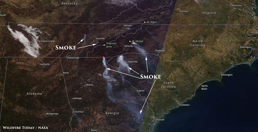
Above: Satellite photo from Sunday afternoon, November 20, showing plumes of smoke.  

The amount of smoke created by wildfires in the southeastern United States decreased on Sunday. In satellite photos from last week smoke could be seen that covered large portions of South Carolina, Georgia, and North Carolina. However as you can see in the photo below, the smoke increased on Monday.

The amount and location of the smoke varies depending on the wind direction and the fire activity. It is difficult to predict more than a day in advance the quantity and location of smoke.

wildfire smoke map
Satellite photo from November 21 showing wildfire smoke. NASA

Below are maps predicting air quality information and the location of smoke for today, November 21.

Continue reading “Wildfire smoke decreases in Southeastern U.S. on Sunday, increases on Monday”