North Carolina Forest Service flying drones to map hotspots

News 13 out of Asheville recently got up close and personal with a piece of firefighting technology when a news crew joined a North Carolina Forest Service drone pilot on a grid mission to map hotspots. Firefighters are tracking daily progress in heat reduction across the 434-acre Poplar Drive Fire. It is now about 45 percent contained.

“We can give the guys in the field a list or a map; we have tablets that we put the dots on and they can walk right to the dot and see it’s a stump hole or something and they can put water on it,” said Matthew Bishop, a drone pilot based out of New Bern. He explained that the drone flies overnight and shoots infrared photos that feed to a computer program that produces location data.

“We used to call it gridding by hand, and you would literally use the back of your hand,” Bishop said. “This makes it a little easier on everybody.”
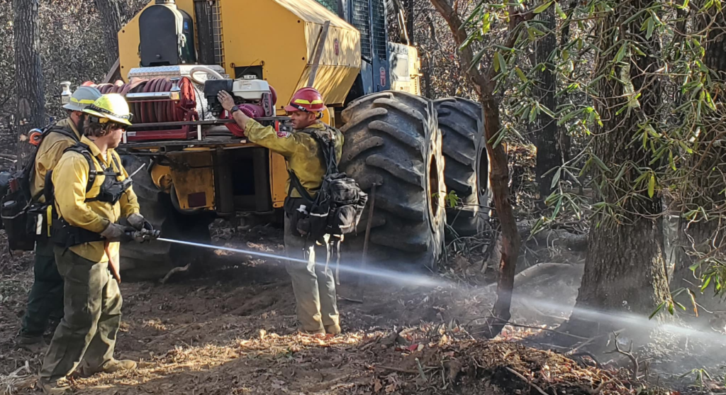
Firefighters drowning hotspots on the fire in North Carolina

The grid mission was mapping the area where Green Mountain Road meets Kyles Creek Road. Bishop said there could be thousands of hotspots the drone sees that may not be visible to firefighters on the ground, but they can check them the next morning. “We all can see smoke with the helicopters or the regular camera,” said Bishop, “but it’s hard detecting the heat without the thermal imagery.”

Drones can fly in most weather and are water-resistant; they’re equipped with a wide-angle camera, a camera with 200x zoom, and a thermal imaging camera, along with a laser rangefinder to pinpoint precise locations.

News 13 also reported that temporary flight restrictions (TFRs) were established over the fire to keep the public from interfering with firefighting operations.

“On this fire, we’ve got one helicopter that’s providing drops,” North Carolina Forest Service Public Information Officer Philip Jackson said. “We have a scout plane looking for hotspots. If there’s other drones in the area, it might make us ground our own pilots for safety concerns.” Persons violating the TFR are subject to hundreds of dollars in fines.

The TFR up to 7,500 feet was established by state forest officials last Wednesday.
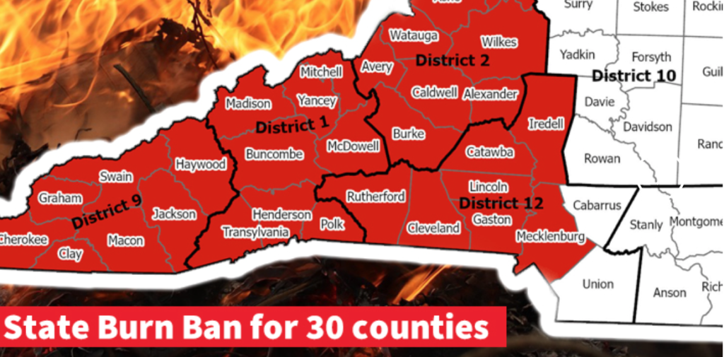
Burn ban in North Carolina

Two state burn bans in 30 western North Carolina counties: Last week, because of increased fire risk, the N.C. Forest Service issued a ban on all open burning and also canceled previous burning permits for many counties until further notice.

A dozer cutting line on the Poplar Drive Fire

“With the long-range forecast and conditions on the ground showing no improvement, expanding the ban on open burning to additional counties is a necessary precaution,” said Agriculture Commissioner Steve Troxler. “We keep a close eye on weather, fire danger, and fuel conditions, especially this time of year. We’re making daily assessments, and the burn ban will be expanded into Piedmont counties and farther east if needed. If you’re in a county that does not fall under the ban, think twice about any outdoor burning until we see significant soaking rain across the state.” He said anyone violating the burn ban faces a $100 fine plus $183 in court costs, and anyone setting a fire may also be liable for the costs of suppressing the fire.

Details on burn bans are online [HERE].

Jackson cautioned against violating the burn ban or the flight restrictions prohibiting flying a drone over or near the Poplar Drive Fire.

“Drones can and have collided with aircrafts before,” Jackson said. “It’s a real safety hazard for the pilots and significantly impedes our ability to do our job.”

Officials declare emergency in North Carolina, big fire in Virginia

Officials have declared a state of emergency in a western North Carolina community where a wildfire has burned hundreds of acres and is threatening dozens of homes. It was estimated at 5 percent containment this afternoon.

According to the North Carolina Forest Service there was  one home damaged and two homes destroyed, along with one outbuilding and one uninhabited cabin; wyff4.com reported that the cause of the Poplar Drive Fire is  under  investigation. There have been no reported injuries.

The 431-acre fire in Henderson County threatens at least 75 other threatened structures; North Carolina Forest Service is focusing on putting in firelines.

CBS-19 out of Charlottesville reported that crews are also  fighting several separate fires in forested areas of Virginia, Tennessee, and Kentucky as wide swaths of those states face moderate to severe drought conditions and warmer-than-normal temperatures.

Several counties in western North Carolina are currently in a severe drought, with wildfire activity increasing in the dry conditions. The North Carolina Forest Service issued a burn ban Sunday for 14 counties in the western part of the state because of hazardous conditions and said the ban  would stay in effect until further notice.

Q code: aim your camera here.Meanwhile, the Virginia Department of Forestry and the National Park Service are managing the 2800-acre Quaker Run Fire under unified command with Madison County Emergency Management. Their goals this afternoon included keeping the fire east of Rapidan Road and prepping both Rapidan Camp and Camp Hoover. Another priority is protecting power poles in the fire area.  Resources include Type 3 and Type 1 helicopters, and listed hazards included rolling rocks and continued falling snags.

Shenandoah National Park fire
Quaker Run Fire 11/06/2023 — NPS map by Justin Shedd

Park officials cautioned that visitors will encounter smoke in some areas; the fire is  burning on private, public, and park land on the eastern boundary near Whiteoak and Old Rag. The Quaker Run Fire includes about 670 acres within the Shenandoah National Park boundary. Updates on the air quality status is available online through the Wildland Fire Air Quality Response Program. Updates are published daily by 8:00 a.m.

The powerline that supplies the Big Meadows area has been de-energized for firefighter safety. Big Meadows Wayside, the visitor center, and the campground are open and using generators. Some visitor amenities may be limited, and Big Meadows Lodge is closed for the season.

Virginia fire
Helicopters offer a good vantage point for monitoring the fire’s progression, especially in steep, mountainous terrain.  Virginia DOF photo

Fire weather forecast: High pressure is overhead but should slide offshore late Monday. Gusty south winds should return as the warm front lifts into the region. Gusts of 20-30 mph are possible at the fire location, and winds will be even higher on the ridges through Tuesday evening. Minimum humidities will remain around 35-40 percent across the Shenandoah Valley, with a predicted 40-45 percent east of the Blue Ridge. By Tuesday, these values are expected to improve as moisture builds back into the region.

Smoke is heaviest in the communities of Syria and Madison, which are closest to the fire, and in the central portion of the Park near Big Meadows, Whiteoak, and Old Rag. Smoke typically settles into low-lying areas in the evening and overnight, remains heavy in those areas in the morning, then lifts out in early afternoon. Smoke at Big Meadows is usually most noticeable in early afternoon as it is lifting or in the evening when smoke begins to settle. Hikers are encouraged to avoid the central part of the park.

 ~ Thanks and a tip of the hardhat to Matt and Cary.

Aircraft busy on North Carolina fire

State and federal crews are battling a wildfire that started on western North Carolina’s Nantahala National Forest — one of four national forests in the state.

North Carolina SEAT
A new Kodiak 100 owned by the State of North Carolina on the Collett Ridge Fire. Ron Stamey photo.

WLOS-TV reported that the Collett Ridge Fire had grown to 52 acres by Wednesday the 25th and was burning toward Junaluska Road. Earlier today it was estimated at 90 acres. Both USFS and North Carolina Forest Service personnel are working on the fire.

“Given the rough and rugged terrain, an airtanker has been ordered to assist the two helicopters and other firefighting resources on scene,” officials said.

Collett Ridge Fire
Lightning started the Collett Ridge Fire on October 23 on the Cheoah-Tusquitee Ranger District of the Nantahala National Forest. USFS photo

The Southern Scoop News reported that the fire was ignited by lightning on the top of Collett Ridge on October 23 and has been backing down the ridge to the north.

David Ilse, Acting District Ranger for the Cheoah-Tusquitee Ranger District, said fire growth today was minimal because of the cloud cover and higher relative humidity over the fire area. “We are using aerial resources and are working to place crews safely on the ground,” he added.

The fire grew on the northwest corner, with backing fire and 6-inch flame lengths. Crews yesterday scouted the terrain and fuels of the Bolden Creek drainage to determine where best to put in a fireline and locations for planned safety zones. A helicopter with a bucket dropped water on hot spots.

Crews were establishing hand line today from Collett Creek Road to Bolden Creek and then from Bolden Branch Road over to Lords Way down to Junaluska Road — incorporating trails, creeks, and the existing road system. Aviation crews were working the fire perimeter throughout the day.

North Carolina Forest Service fire stats
   North Carolina Forest Service fire numbers

Earlier this month, fire officials warned residents about the dry conditions. North Carolina Forest Service District Ranger Brian Rogers said at this time of year, even yard cleanup can be a fire risk.

“If they’re going to be burning leaves or debris, make sure that they have tools on hand,” he said, “water hose, shovels, buckets, something that they can extinguish their fires with and make sure they’re fully out.”

He predicted the fire risk would worsen if rainfall amounts didn’t improve.

“Some of the areas here in western North Carolina are 10 to 25 percent below normal precipitation,” said Rogers.

Yesterday North Carolina Forest Service Ranger Bo Dossett told ABC45 News that conditions are extremely dry and fire-prone. “Sometimes when there are big dead trees on a ridgeline and we get long periods of dry weather like this, those dead trees can become a new source of ignition when we get lightning like we did last week. Stream flows are down, water tables in the forest are lower. It makes fires harder to control,” he said.

North Carolina fire reaches 3500 acres

The Pulp Road Fire in Brunswick County reached 3,500 acres today and was still at zero percent containment. The 15,000-acre preserve where it’s burning crosses Brunswick and Columbus counties and is designated a National Natural Landmark. According to the N.C. Forest Service, the area was cleared of unburned fuels outside the fire perimeter, and crews had mopped up spot fires.

Pulp Road Fire

The N.C. Forest Service — one of several state forestry agencies in the U.S. that are named “Forest Service” — has mobilized its Red Incident Management Team to take over the fire. Resources earlier today included multiple engine and tractor plow strike teams plus aircraft. The PortCityDaily out of Wilmington reported that personnel will staff the fire through the weekend.

The state DEQ raised air pollution alerts to red in Brunswick County and orange in both New Hanover and Pender counties.

According to the Wilmington Star News, the fire initially was lit as a controlled burn in the Green Swamp Game Land and Green Swamp Nature Preserve, but yesterday the fire burned out of control and was classified as a wildfire. It nearly doubled in size since Thursday night. Smoke is thick in some areas and it is affecting visibility; officials have urged drivers to use caution.

State and local officials urged residents with respiratory issues to remain indoors.

Earth Day is a quiet fire day – except for coastal North Carolina

On April 22, 2023, Earth Day 2023,  the largest fire of national note is burning in North Carolina.

For April 21, the most recent update of the national portal for the Geographic Area Coordination Centers – because it’s not quite busy enough for weekend staffing – there are three GACCs at Preparedness Level 2 – Eastern, Southern, and Southwest – while the rest of the country is at PL 1.  And a scan of national-level fire hazards doesn’t show any Red Flag Warnings or Watches for the day.

For the prior week, national initial attack activity in the National Situation Report was considered light at 1,075 fires, with 50 large fires reported and 50 contained. Fire names ranged from a label only an agency can love (AR-BUP-000924 in the Buffalo National River)  to a menagerie of animals – Swine, Third Goat, Antelope Flats, Wolf Creek, Otter Creek, Kingfisher Hollow – to the uniquely local – Natural Bridge (named for the actual Natural Bridge in Kentucky), Muzzle Loader Club (perhaps the local shooting range in Oklahoma?), Jimmys Water Hole in New Jersey and Shinhollow in New York, and Tinaja in southern Arizona (translated from the Spanish as “large earthenware jar”).

The Fire Weather Outlook for Earth Day was minimal except for southwest Arizona. The Day 2 Fire Weather Outlook for today noted that “Elevated conditions are likely near the international border in the Lower Colorado River Basin, as 15 mph sustained southwesterly surface winds overlap with 15 percent humidity for a few hours around afternoon peak heating. Elevated highlights were added since fuels should be marginally receptive to fire spread.” Looking ahead, the only fire hazard of note in the fire weather outlook is for the New Mexico-Texas-Mexico area on Tuesday-Wednesday, April 25-26.

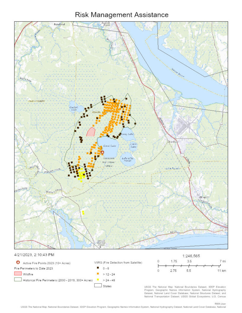
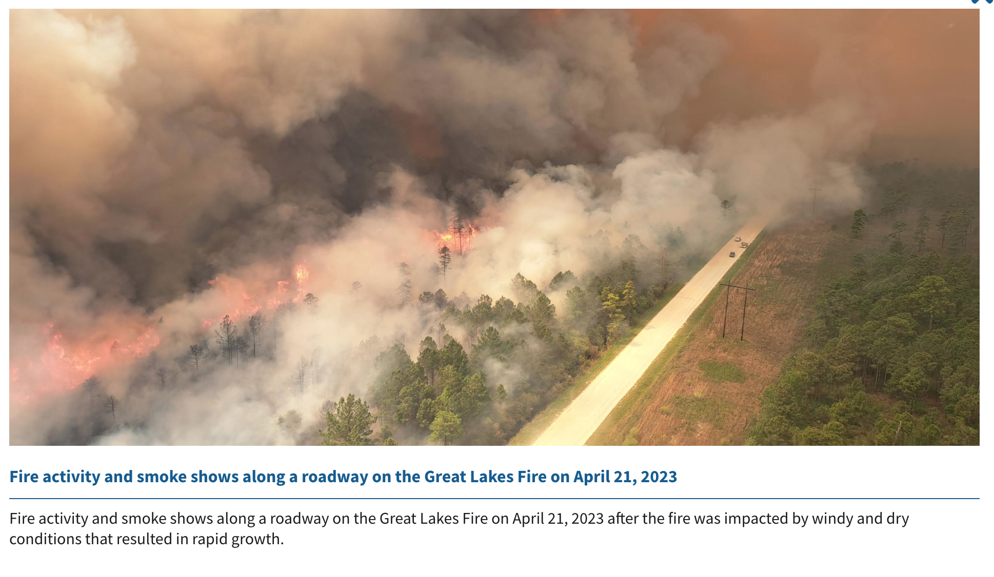
All this being duly noted, one can be certain that residents near the Great Lakes Fire will agree that this fire (also called the Great Lake Fire) likely holds claim to being Earth Day’s fire of note in the U.S. Named for a singular Great Lake, with other lakes around it, in the Croatan National Forest), the fire quadrupled in size in 24 hours, from 7000 to an estimated 30,000+ acres, with a national Southern Area fire management team being assigned.

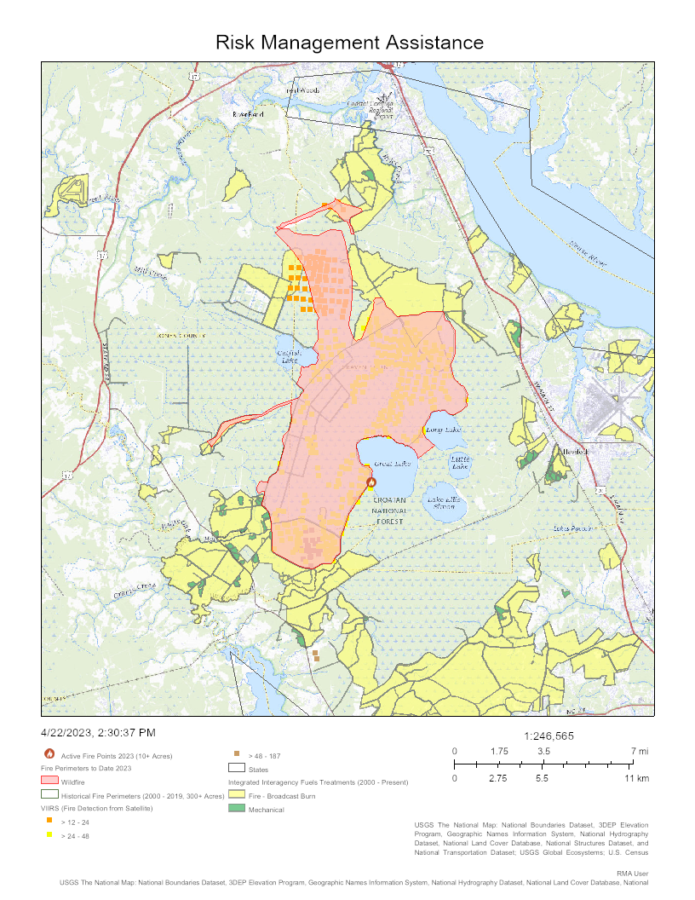
As noted yesterday in our partner site, FireAviation.com, the VIIRS satellite data offered space-based mapping of  yesterday’s growth that was confirmed in the map available today from the Risk Management Assistance Dashboard … compared to yesterday’s rapid spread, the majority of recent heat signatures are to the north, where the fire is burning into and between past fuel treatments. The fire has definitely outgrown the 21,000 acre footprint of 2012’s Dad Fire.

Great Lake Fire Croatan NF NC 2023-04-22

Additional mapping is being shared by Joseph Elfelt …

And current info arrives from a variety of Twitter posts with the handle of #GreatLakeFire (no plural) …

A recent tweet equated the fire’s size to the acreage of DisneyWorld, which, in case you were curious, was forecast to have average crowds for Earth Day according to the Magic Guides Crowd Calendar.

There is no current estimate for how many firefighters are working the Great Lake(s) Fire, though it’s certainly increasing. Yesterday’s census for the Southern Area had some 1200 resources assigned in the overall GACC area.

North Carolina: Great Lakes Fire burning in footprint of 2012 fire

Managing fires is a traditionally on-the-ground profession that adapted quickly to the value of aerial resources. On the Great Lakes Fire in North Carolina, listed at 7000 acres yesterday, a range of sky-based tools help convey the current status, even from a continent away.

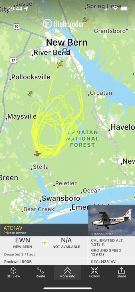
For one, there’s avionics tracking — such as that provided by FlightRadar24. A screen shot just past noon conveys a circle significantly larger than the fire footprint reported the night before.

A screen shot of FlightRadar24, with air traffic above the Great Lake Fire, at 1244 EDT, April 21, 2023.

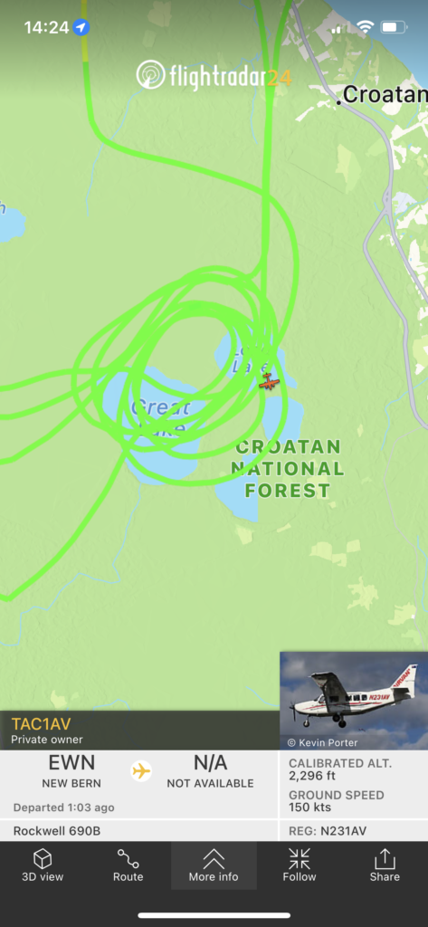
Some seven hours later in the shift, at 1724 EDT, the aerial observation ship is circling tighter and to the north.

A screen shot of FlightRadar24, with air traffic above the Great Lakes Fire, at 1244 EDT, April 21, 2023.

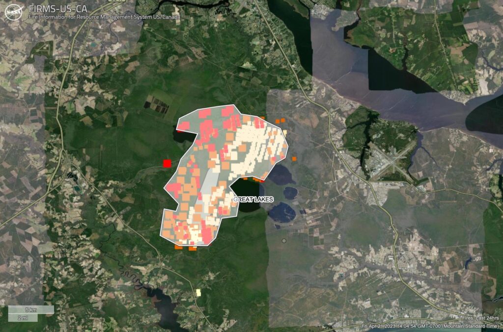
Switching to VIIRS satellites, the heat signature shows growth (and likely burnouts) in the past six hours (the brighter red, with the lighter yellow being 24 hours old). Using the Area tool built into NASA Lance FIRMS site, a rough (and likely large) estimate puts the fire at 30,000 acres.

VIIRS heat detection and estimated perimeter of 30,000 acres (which may be exaggerated by heat from the smoke column).

Switch to the toolset shared via the Risk Management Assistance Dashboard and one can overlay fire histories (the black solid line) … and lo and behold, the current estimated perimeter seems to align with the Dad Fire, a 21,000-acre fire in 2012, as well as prior fuel treatments to the north and south.

One additional tool is the mapping, forecasting, interpretation, and messaging of smoke and its impacts … as shared here via a Twitter post from the N.C. Air Quality Forecast Center.

We echo what the Air Quality center notes in its tweet: this is a developing situation, and the maps shared here are interpretations of what is certainly more challenging, and being more accurately portrayed, on the ground and in the air above the Croatan National Forest.

04/28 UPDATE:  The Great Lakes Fire remains at 32,400 acres with 30 percent containment, according to Inciweb updates. They got a little rain this morning and more is forecast over the weekend. At this morning’s firefighter briefing, meteorologist Scott Kennedy said, “I’m disappointed by the amount of rain over the fire,” referring to last night’s precipitation of approximately ¼ inch of precipitation — or less. We need a lot more rain to saturate the fire that is burning underground.” The fire is suspected to be human-caused and is still under investigation. It’s burning in pocosin swamp and mixed fuels within and around the footprint of the 2012 Dad Fire, which burned roughly 21,331 acres. Previous prescribed burning by the U. S. Forest Service helped slow fire spread this week by reducing the amount of burnable vegetation.

INCIWEB PHOTO, Great Lakes Fire.

Wildfire in eastern North Carolina grows to 5,200 acres

A North Carolina fire has spread across several thousand acres and had reached about 34 percent containment by late Sunday afternoon.

Last Resort Fire photo by North Carolina Forest Service

The News & Observer reported that the Last Resort Fire is burning on both private and federal lands in rural Tyrrell County. After firing operations on Saturday, the fire was estimated at 5,800 acres. That was revised downward  late Sunday.

eastern North Carolina
https://products.climate.ncsu.edu/fwip//?tab=fcst&state=NC&map_bg=ter

The North Carolina Forest Service said the fire’s burning near Columbia, just south of the Albemarle Sound. Joint command has been established with the U.S. Fish and Wildlife Service.

North Carolina fires to date
2023 North Carolina fires to date

Light rain moderated conditions late yesterday, and crews are working on containment lines. Fire managers cautioned that smoke may impair driving conditions in the area; about 75 firefighters from both the state and U.S. Fish and Wildlife were assigned. A Type 3 IMT took over management Sunday.

13NewsNow reported that the fire may cause smoky conditions on the Outer Banks and was producing heavy drifting smoke to the east of the fire.

03/27/ update: People from as far north as Washington D.C. are complaining of smoke smell.

Two wildfires in the Pisgah National Forest in NC burn 80 acres

Map Cals Creek Fire wildfire north carolina
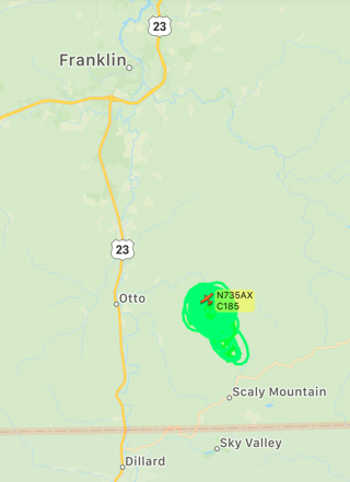
Map showing the flight path of a Cessna 185 operated by the State of North Carolina orbiting the area of the Cals Creek Fire east of Otto, NC.

About 65 firefighters are working to suppress two wildfires in North Carolina that have burned a total of 80 acres.

U.S. Forest Service firefighters are responding to two significant fires, including the Camp Daniel Boone Fire that has burned into the Shining Rock Wilderness on the Pisgah National Forest.

The fire started on private property off Little East Fork Rd. in Haywood County Friday afternoon, April 3 and has spread into the Shining Rock Wilderness Area on the Pisgah Ranger District of Pisgah National Forest. It has burned 50 acres near the Art Loeb Trail west of Deep Gap. Approximately 40 firefighters are responding from the North Carolina Forest Service and U.S. Forest Service. NC Forest Service helicopters and air tankers made multiple water drops yesterday to try to slow the spread. A U.S. Forest Service helicopter is on scene again today. The northern Art Loeb and Little East Fork trailheads are closed due to the fire and hiking to Deep Gap or the peak of Cold Mountain is discouraged.

The Cals Creek Fire is burning east of Highway 23/441 in Macon County near Otto, NC. The 30-acre fire started on private property and is now also burning on U.S. Forest Service land in the Nantahala Ranger District of the Nantahala National Forest. Approximately 25 firefighters from the NC Forest Service and U.S. Forest Service are responding. A NC Forest Service helicopter was used for water drops yesterday.

The causes of both fires are under investigation.

State and Federal firefighters responded to multiple additional wildfire starts across Western NC yesterday. U.S. Forest Service firefighters also responded to a small fire on the Uwharrie National Forest in the NC Piedmont.

Fire danger is expected to remain high through the weekend. The North Carolina Forest Service issued a ban on all open burning for 32 Western North Carolina counties due to hazardous forest fire conditions. The burning ban goes went into effect at 5 p.m. Friday, April 3, 2020, and will remain in effect until further notice.

Recalling Forest Service Chief’s visit to the number one ranked Job Corps Center

In light of the announcement to transfer  the management of  25 Job Corps Civilian Conservation Centers from the U.S. Forest Service to the Department of Labor (DOL) and to permanently close 9 of those 25 centers, it is interesting to look back on a story written and published by the Forest Service nine months ago about then Interim Forest Service Chief Vicki Christiansen’s visit to “the number one Job Corps Center out of 123 nationwide.” She was later confirmed as Chief of the Forest Service.

The text and photos below are from the Forest Service article posted at www.fs.fed.us:


Interim Chief Vicki Christiansen, Schenck Job Corps celebrate number one ranking

Schenck Job Corps Center Chief Christiansen
From left, Forests of North Carolina Forest Supervisor Allen Nicholas, USDA Forest Service Interim Chief Vicki Christiansen, Southern Research Station Director Rob Doudrick, and Southern Region Acting Regional Forester Ken Arney preserve the memory of their visit by posing alongside the Schenck Job Corps sign. USDA Forest Service photo by Marvin Ramsey.

NORTH CAROLINA – “Look for the fire that burns within you and gives you the juice. You are capable of doing anything you put your mind to.” USDA Forest Service Interim Chief Vicki Christiansen offered these words of advice to the students at Schenck Job Corps Civilian Conservation Center, located on the Pisgah National Forest in North Carolina.

Christiansen journeyed to Schenck Job Corps Center on September 26, 2018, to congratulate the students and staff on the center’s remarkable Program Year 2017 performance. The center’s program year ended on June 30, 2018 and resulted in it being ranked as the number one Job Corps Center out of 123 nationwide. Not only did Schenck achieve the number one overall ranking, it also ranked number one in graduate job placement.

Having also been recognized as the number one center in 2014, this is a repeat performance for Schenck within a span of five years. Job Corps Centers are evaluated on weighted measures and performance goals that include credential and high school diploma attainment, job placement and wages.

Along with Schenck, eleven other Forest Service Job Corps Centers–Flatwoods, Trapper Creek, Frenchburg, Blackwell, Centennial, Curlew, Wolf Creek, Weber Basin, Anaconda, Pine Knot and Lyndon B. Johnson–finished in the top 50 of the 123 Job Corps Centers.

“Having the Chief here is really cool,” said Rosalyn Velasquez, a member of Schenck’s Advanced Fire Management Program and its associated Davidson River Initial Attack Crew. The DVR has built a stellar reputation with its 100% graduation rate and consistent graduate job placement into career positions with the Forest Service and other public lands management agencies. The DVR students were impressed that, like them, Christiansen began her career as a wildland firefighter and has now risen to the heights of her current position.

Christiansen was enthusiastic about the value Civilian Conservation Centers bring to the Forest Service. In PY17 alone, Job Corps students contributed 42,912 hours to national forests and grasslands project work. These hours equate to a dollar contribution of $1,059,497. Additionally, Job Corps students have contributed approximately 460,000 hours to wildland fire support and 5,000 hours to hurricane support.

Schenck Job Corps Center Chief Christiansen
Having begun her career as a wildland firefighter and state forester, Forest Service Interim Chief Vicki Christiansen, recalls her classes studying fire behavior with members of the Davidson River Initial Attack Crew. USDA Forest Service photo by Marvin Ramsey.

Christiansen offered wise advice to the students on how to approach a job as they begin their careers. “Good leaders first learned to be good followers,” she stated before sharing this fable. “One day a traveler came upon three bricklayers and inquired what are you doing? The first one replied ‘laying these brick,’ the second one replied ‘working as a member of this team’, while the third replied ‘I’m part of this team that is building this grand cathedral.’” Christiansen ended by saying, “The moral of the fable of ‘The Three Bricklayers’ is that we all have our roles.”

Job Corps Civilian Conservation Centers changes lives one student at a time by equipping them with valuable skills to help them find jobs and support the nation’s economy. Along with supporting the Forest Service national priority of promoting shared stewardship, Civilian Conservation Centers also provide critical support to their local communities and, in PY17, volunteered 60,274 hours to community projects, equating to a dollar contribution of $1,488,156.

Schenck Job Corps Center Chief Christiansen
From left, Davidson River Initial Attack Crew enjoy a picture with Forest Service leaders. Southern Research Station Director Rob Doudrick, Southern Region Acting Regional Forester Ken Arney, USDA Forest Service Interim Chief Vicki Christiansen, Schenck Job Corps Davidson River Initial Attack Crew members David Williams, Joseph Mousseaux, Austin Griffin, Cortney Brown, Christopher Sanchez, Osman Guzman-Reyes, Abdusalam Ibrahim, Joseph Woods, Richard Alidon, Trevon Lindsay, Dylan Hobbs, Lerron Dugars, Trey Brandenburg, Walter Moore, Shavonte Crosby, Taj Pham, Richard Bostic, Rosalyn Velasquez, Patrique Hall, Samuel Leach, Schenck Job Corps Works Program Officer Kenneth Barton, Job Corps National Office Acting Assistant Director Jimmy Copeland, and National Forests of North Carolina Forest Supervisor Allen Nicholas. USDA Forest Service photo by Marvin Ramsey.

North Carolina firefighters suppress fire in deep organic soils

Squires Fire Pender County, North Carolina
A firefighter on the Squires Fire in Pender County, North Carolina. NCFS photo.

From the North Carolina Forest Service:


Mop-up efforts on the Squires Timber Fire in Pender County concluded this week and it’s now in monitor status. NCFS rangers are keeping an eye on this to make sure it stays out. About three acres of the wildfire were in a Carolina bay with heavy organic soils which made for challenging control as the fire burned as much as two feet deep. The 8-acre wildfire began April 29 but flared back up after long, hot, and dry days. The initial cause was an escaped debris burn.

Squires Fire Pender County, North Carolina
A firefighter works on the Squires Fire in Pender County, North Carolina while wearing wildland firefighter personal protective equipment. NCFS photo.
Squires Fire Pender County, North Carolina
A dozer puts in a fireline on the Squires Fire in Pender County, North Carolina. NCFS photo.