Trabuco fire in Orange Co. Calif. stopped at about 20 acres

(UPDATE September 7, 2016: investigators determined that the fire started from sparks created when a golfer’s club struck a rock.)

Firefighters on the ground and in the air stopped a wildfire in Mission Viejo, California Tuesday afternoon after it burned 20 to 25 acres near the Arroyo Trabuco golf course east of Interstate 5 in Orange County.

Aside from the excellent job by the personnel at the scene, we were interested in this fire because of two photos put on Twitter by Maaike aka Shinobi (@ShinobiHaruka) showing before and after, or, during and after. There is a remarkable change in a short amount of time. The photos are used here with her permission. (We enlarged the flying object and pasted it as an inset.)

Trabuco Fire Trabuco Fire

I think the photos were taken not more than two hours apart.

Firefighters beginning to get a handle on the Gap Fire in northern California

Above: The Gap Fire as seen from the Klamath River. Undated photo from InciWeb.

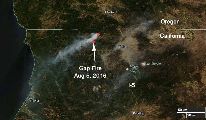
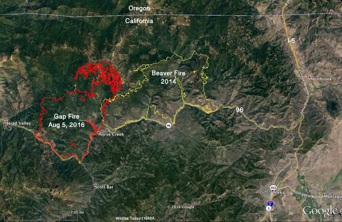
The Gap Fire has been burning in Seiad Valley 20 miles northwest of Yreka, California for 11 days. It grew quickly during that time to now cover almost 28,000 acres, but firefighters are beginning to get a handle on the blaze. That effort is helped by barriers on at least two sides — the Klamath River on the south, and the two-year old scar from the Beaver Fire.

map Gap Fire California
Satellite photo showing smoke from the Gap Fire Sept 5, 2016. NASA image with text by Wildfire Today.

The Gap Fire has burned into the footprint from the Beaver Fire. Burning operations along the river and on the north side are likely to hold those areas. And, the west flank is also looking good.

The photo below was taken August 12, 2014 at the Beaver Fire north of the Klamath River.
Art Prints

Advisory evacuations are in place for some areas along the Klamath River.

On Tuesday firefighters will continue to work on the firing operations on the north and south sides and provide structure protection along the river.

The incident management team reports that two structures were destroyed near Hick’s Gulch on the north side of the Klamath River, but have yet to be assessed on the ground.

map Gap Fire Beaver California
Map of the 2016 Gap Fire at about 11:30 p.m. Sept 5, 2016, and the Beaver Fire of 2014. Click to enlarge.
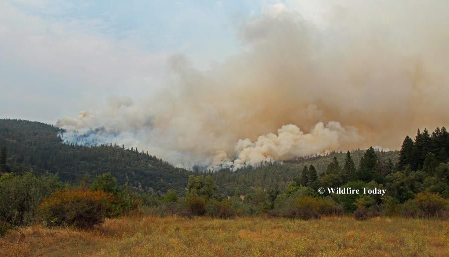
Gap Fire California
Gap Fire as seen from Highway 96 looking toward Hicks Gulch. Photo by Lisa Cox (undated).
Gap Fire California
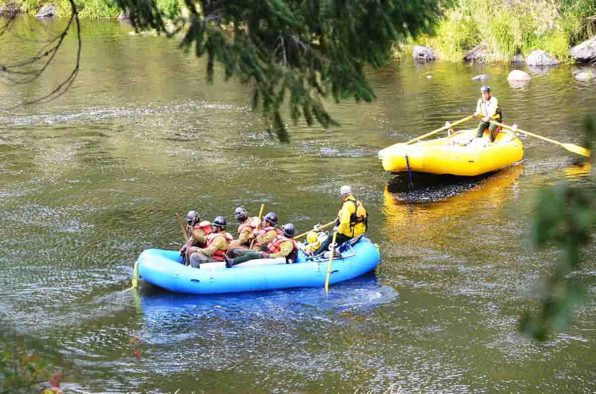
Firefighters on the Gap Fire are taken across the Klamath River by local rafters.
Beaver Fire
This photo was taken near the western edge of the Beaver Fire, August 12, 2014 near the Klamath River. This general area is now the eastern edge of the Gap Fire. Photo by Bill Gabbert.

Yellowstone’s Maple Fire slowed by rain and cool weather

Above: Rainbow over the Maple Fire at 9:50 Monday morning, September 5, 2016, as seen from West Yellowstone, MT. Photo by Ray Mines.

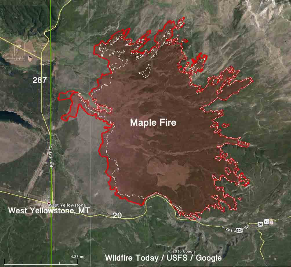
Rain on Sunday and Monday accompanied by cool weather has slowed the spread of the Maple Fire that has come within three miles of West Yellowstone, Montana. Since it started on August 8 it has burned 40,443 acres just north of the west entrance road, Highway 20/191.

The small amount of rain on Sunday was followed by about 0.15″ Monday, as recorded at the weather station east of the fire at Madison Junction.

Ray Mines, who took the photo above from the Incident Command Post at West Yellowstone, said it was 34 degrees Monday morning with a wind chill of 28.

Satellites have not been able to find any large heat sources over the fires in the park for the last couple of days. There are no doubt many small ones that the sensors 200 miles overhead can’t detect. But drier weather later in the week will bring the potential for the fire to become more active.

map Maple fire
The red line was the perimeter of the Maple Fire at 9 p.m. MDT Sept 2, 2016. The white line was the perimeter on August 29.

About 200 lightning strikes occurred in the eastern part of Yellowstone Sunday, resulting in at least two new fire starts. The Petrified Fire was near the Petrified Tree west of Tower Junction in a fire suppression zone. Firefighters extinguished the single-tree fire with the help of helicopter water drops. Firefighters are monitoring the one-tenth acre Jasper Fire east of Tower Junction near Specimen Ridge.

Horse-drawn fire engines

horse pulled fire pumper
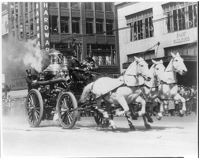
A three-horse team pulls a steam powered pumper to a fire, sometime between 1900 and 1920. Library of Congress.

I doubt if there are many people still alive that remember seeing horses pull a steam-powered pumper to a fire. But for about 50 years, from the 1870’s until around 1920, it was a common occurrence in large cities.

The horses were very well trained. At some stations when the alarm would sound the horses’ stall doors would open and they would walk out and position themselves in the exact spot so the harness could be quickly applied.

Below is an excerpt from Dennis Smith’s History of Firefighting in America:

…The stalls were positioned behind or next to the rigs. In 1871, a quick hitch was developed. Two years later, Charles E. Berry, a Massachusetts firefighter, created a hanging harness with quick-locking hames. His invention was so popular he left the fire department and sold his patented Berry Hames and Collars nationwide.

Not every horse could serve as a fire horse. The animals needed to be strong, swift, agile, obedient and fearless. At the scene, they needed to stand patiently while embers and flames surrounded them. They needed to remain calm while the firefighters fought the blaze. This was the case in all weather conditions and in the midst of a multitude of distractions.

The fire departments carefully selected their horses. Veterinarians for the departments evaluated each animal. Both stallions and mares were eligible to serve.

In Detroit, weight requirements were issued for the animals. Those pulling hose wagons must weigh 1,100 pounds, to haul a steamer 1,400 pounds, and to cart a hook and ladder 1,700 pounds. Stations also tried to create matched teams of two and three horses when possible…

In the video below the animals appear to be very excited as they are being harnessed just before they launch out of the station into a full gallop.

Fire horses became famous and much loved in the cities. In the next video some of the bystanders seem to be as excited as the horses.

Large wildfire burns homes at Javea, Spain

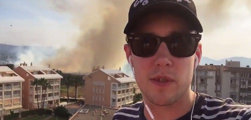
A large wildfire on Spain’s Mediterranean coast has destroyed structures and forced 1,000 residents and holiday makers to evacuate.

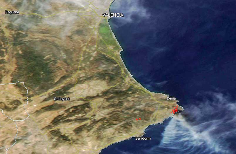
The fire started Sunday in the Javea area, a popular tourist resort at Costa Blanca and was attacked by 300 firefighters and 20 water-dropping aircraft. They had the fire temporarily knocked down, but after sunset when the aircraft were grounded it picked up again. The fire was still active Monday morning.

According to the The Telegraph, the fire was started deliberately in three spots between Javea and Benitachell and has burned approximately 20 homes. The army has been called in to assist firefighters.

map fire Javea Spain
The red dots represent heat detected by a satellite as a wildfire burned near Javea, Spain.
Map Javea fire
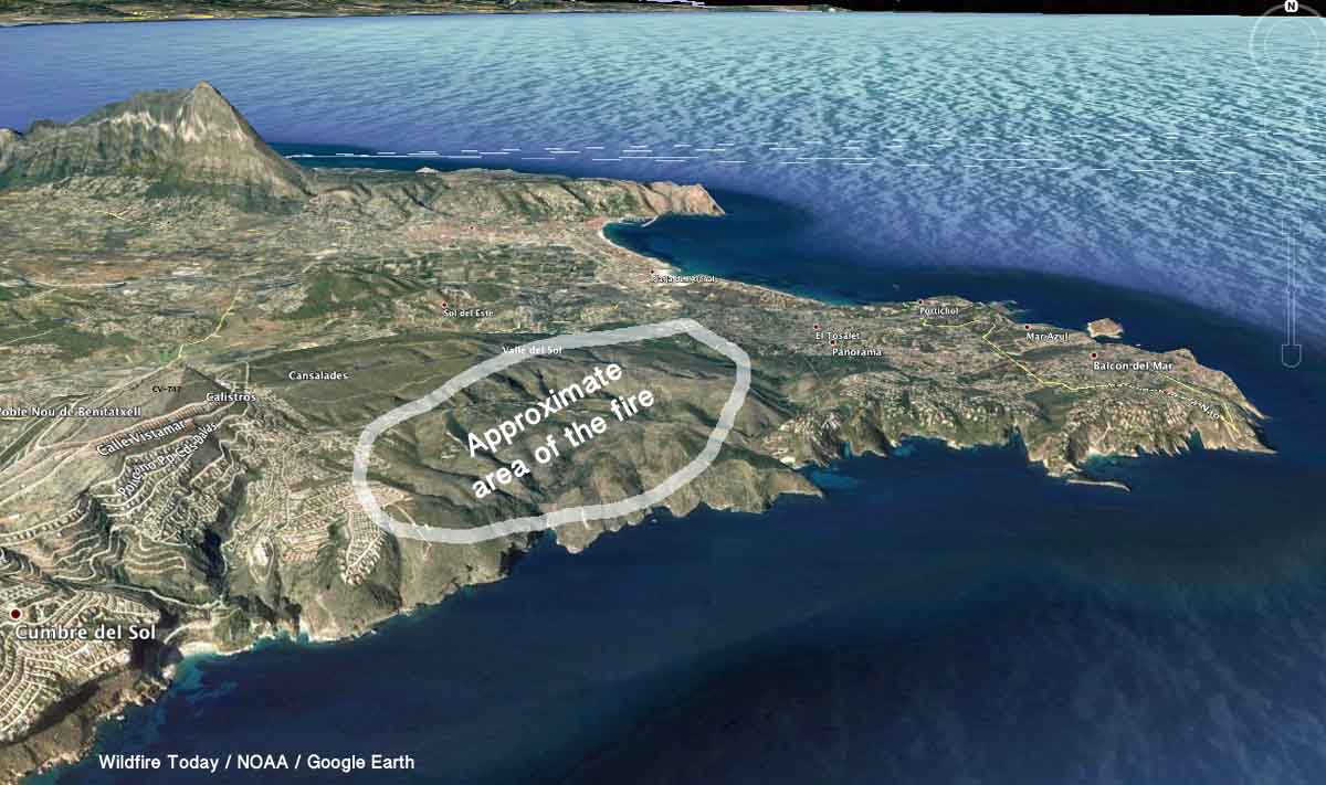
This 3-D Map shows the approximate area where the Javea fire burned September 4 and 5, 2016. This is a very rough estimate, based on the satellite data. Click to enlarge.

The fire started on one of the hottest days of the year when the temperature reached 40ºC (104ºF).

Many people have posted information on Twitter about the fire, including BBC media personality Chris Stark, who sounds like the actor Hugh Grant in a couple of videos he has uploaded about the fire. Apparently he was on holiday in the area. We can’t embed Twitter videos, but you can see them here. For a while he thought that perhaps his apartment and car had burned, but at the last report they were spared.

Chris Stark
Chris Stark. A screenshot from one of his videos posted Monday morning, U.S. time.

The video below is a drive through a residential area in which the fire burned.

West Government Creek Fire west of Vernon, Utah

The Alpine Hotshots posted the above photo September 4, 2016 on Twitter.

And September 3:

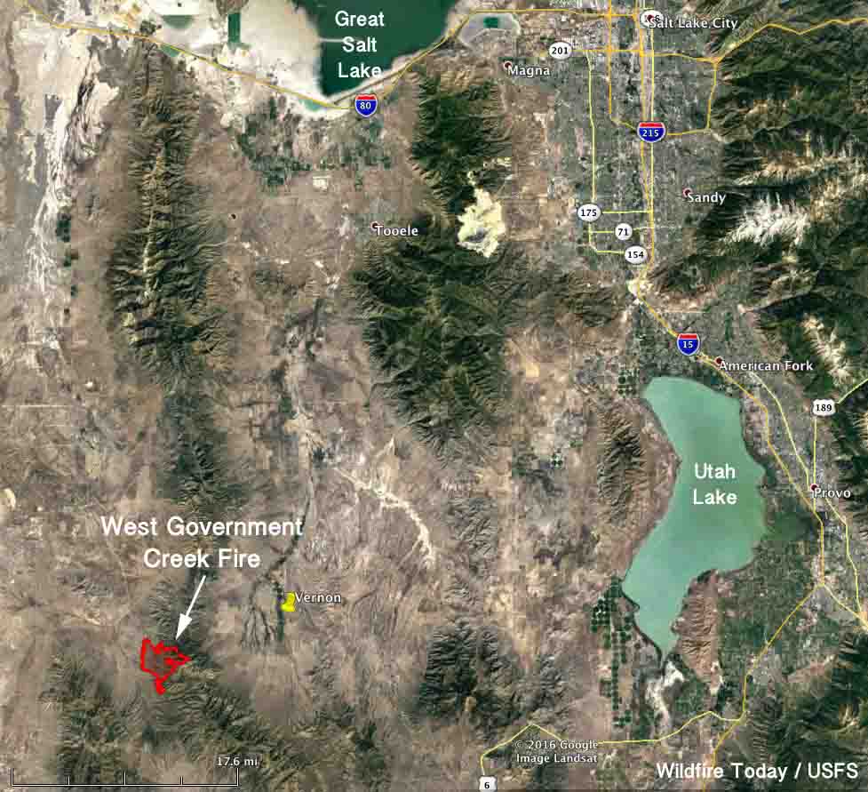
The West Government Creek Fire has burned 4,006 acres 7 miles west of Vernon, Utah and 50 miles west of Provo. It started from lightning on September 2 and is burning in grass, sagebrush and Juniper. The management objective is full suppression. The fire is in the Wasatch National Forest except for the northwest section.

West Government Creek Fire
West Government Creek Fire. InciWeb.
map West Government Creek Fire
Map showing the location of the West Government Creek Fire in Utah, Sept 4, 2016. Click to enlarge.