Smoke from California’s Mosquito Fire expected to move into Nevada, Oregon, and Idaho

smoke forecast fire wildfire
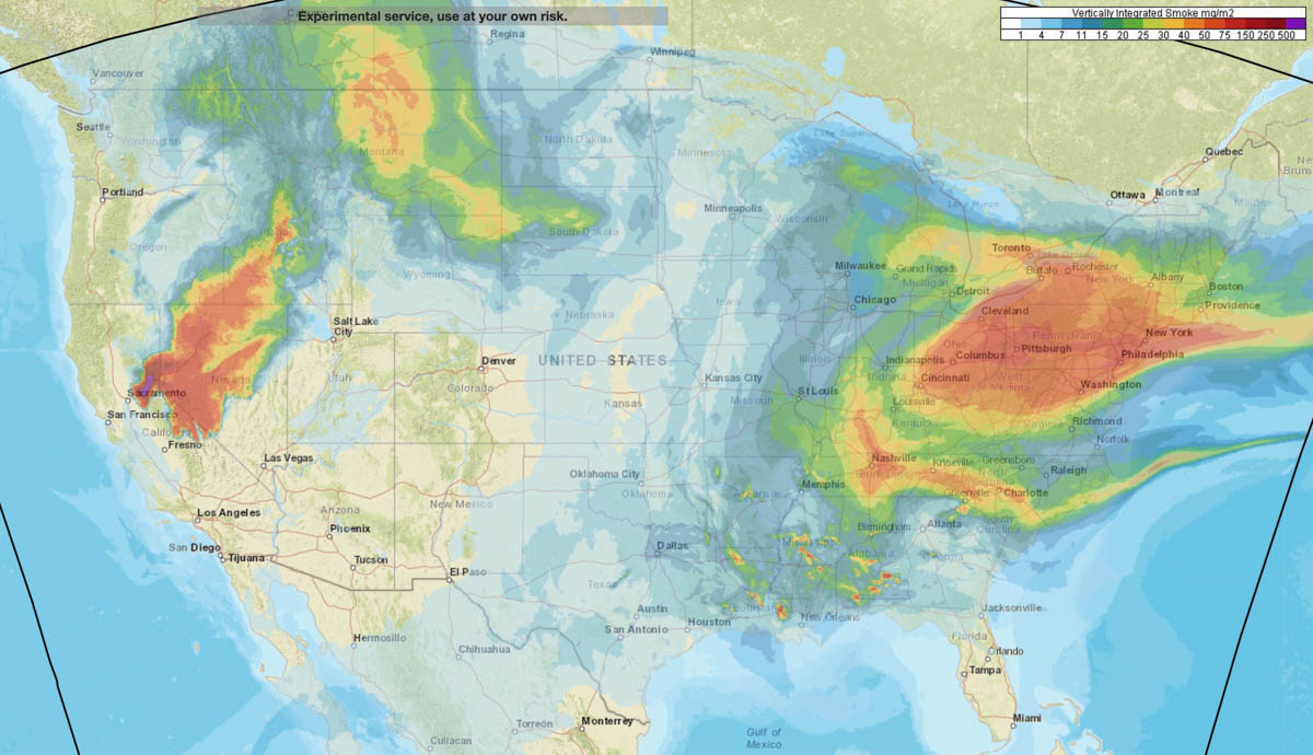
Forecast for distribution of smoke at 1 a.m. PDT Sept. 16, 2022. NOAA.

Wednesday afternoon most of the smoke from the Mosquito Fire 35 miles northeast of Sacramento was moving into Northern Nevada. But that changed overnight as it spread northwest toward Chico and Redding in north-central California.

A forecast produced by NOAA expects that by 1 a.m. Friday it will again be moving into Northern Nevada, Eastern Oregon, and Southern Idaho. And from there, most likely Montana.
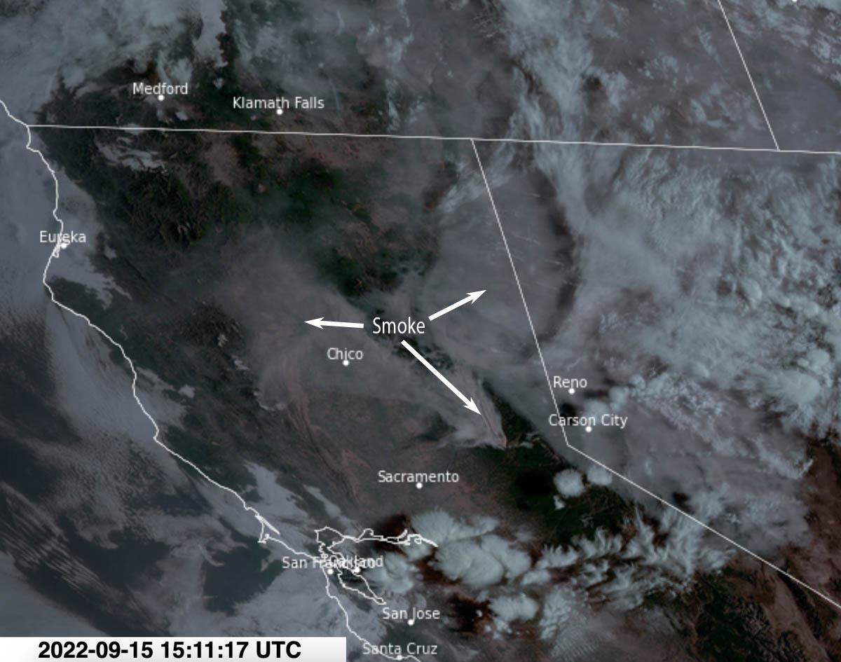
satellite photo Mosquito Fire California
Satellite photo showing smoke from the Mosquito Fire at 8:11 a.m. PDT Sept. 15, 2022.

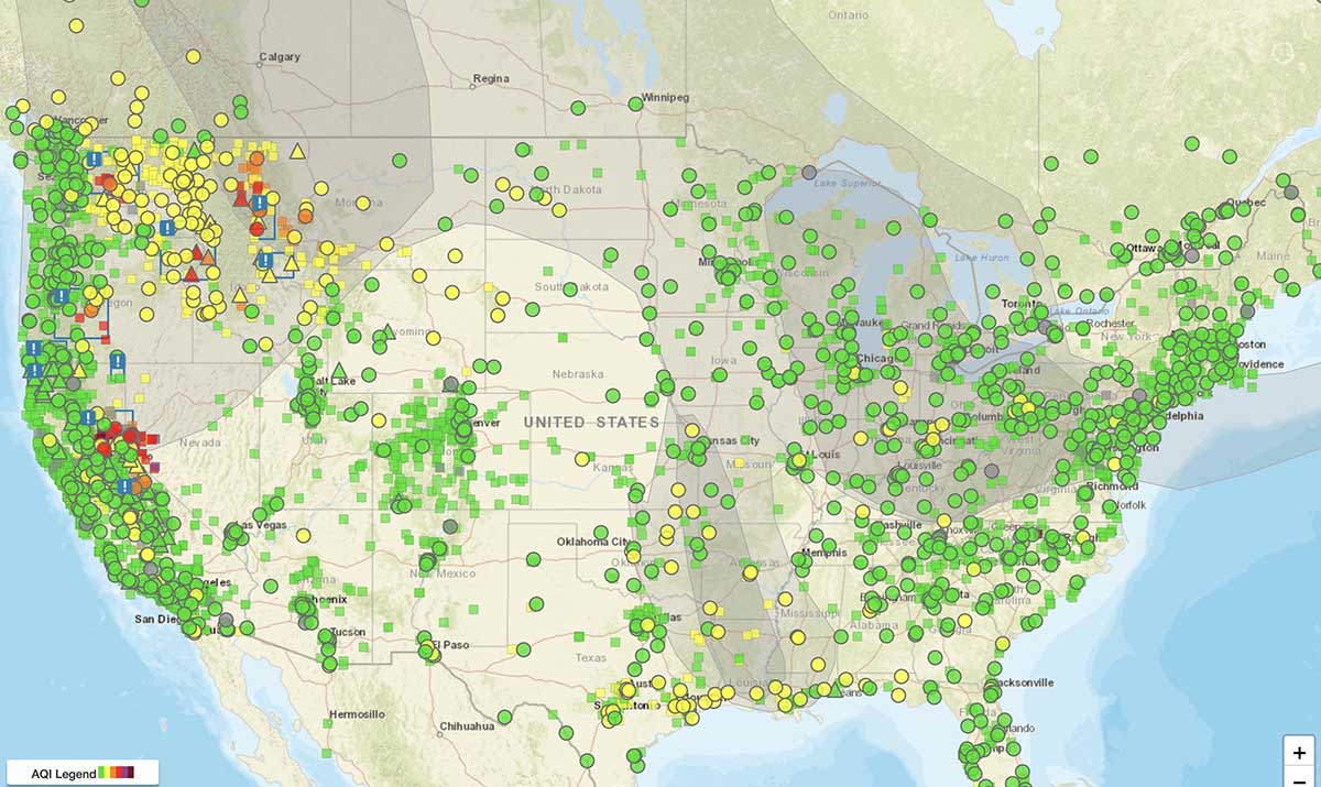
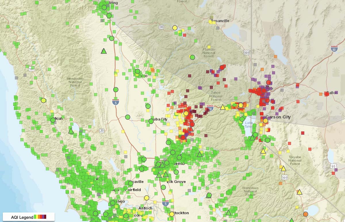
Below is the current air quality, produced by AirNow.
Air quality map
Air quality, from AirNow, at 8:54 a.m. PDT Sept 15, 2022.
Air quality map Mosquito Fire
Air quality, vicinity of Mosquito Fire, from AirNow, at 8:54 a.m. PDT Sept 15, 2022.
Cedar Creek Fire in Western Oregon triples in size

Cedar Creek Fire 3-D map
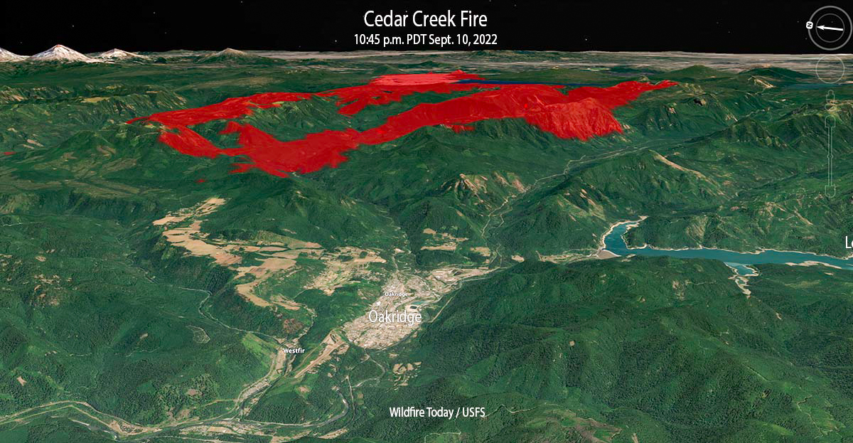
Cedar Creek Fire 3-D map looking east at 10:45 p.m. Sept 10, 2022.

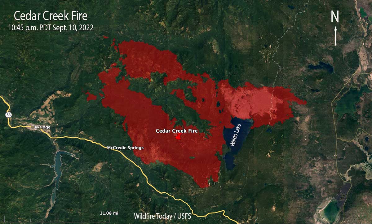
The Cedar Creek Fire that started August 1 in west-central Oregon was already very large at 27,512 acres on the morning of Thursday September 8. But as a result of dry, windy weather on the following two days when a mapping aircraft was over the fire at 10 p.m. Saturday it had more than tripled in size to 85,900 acres. That night the blaze was about 5 miles northeast of Oakridge.

Most of the growth was to the west, driven by strong easterly winds and dry fuels. Saturday evening while winds were from the west, firefighters on the western flank completed strategic burning operations near Eagle Butte, 5 miles northeast of Oakridge. The fire remained north of Highway 58, south of Forest Road 19, and east of Eagle Butte.

Cedar Creek Fire map, 10:45 p.m. Sept 10, 2022
Cedar Creek Fire map, 10:45 p.m. Sept 10, 2022.

The incident management team says 2,230 homes and 443 commercial structures remain threatened, but none have been reported as destroyed. The Office of the Oregon State Fire Marshal has committed seven task forces and an incident management team to the incident.

Saturday evening resources committed to the fire included 17 hand crews, 53 engines, and 8 helicopters for a total of 994 personnel. The estimated suppression costs so far are $47 million.

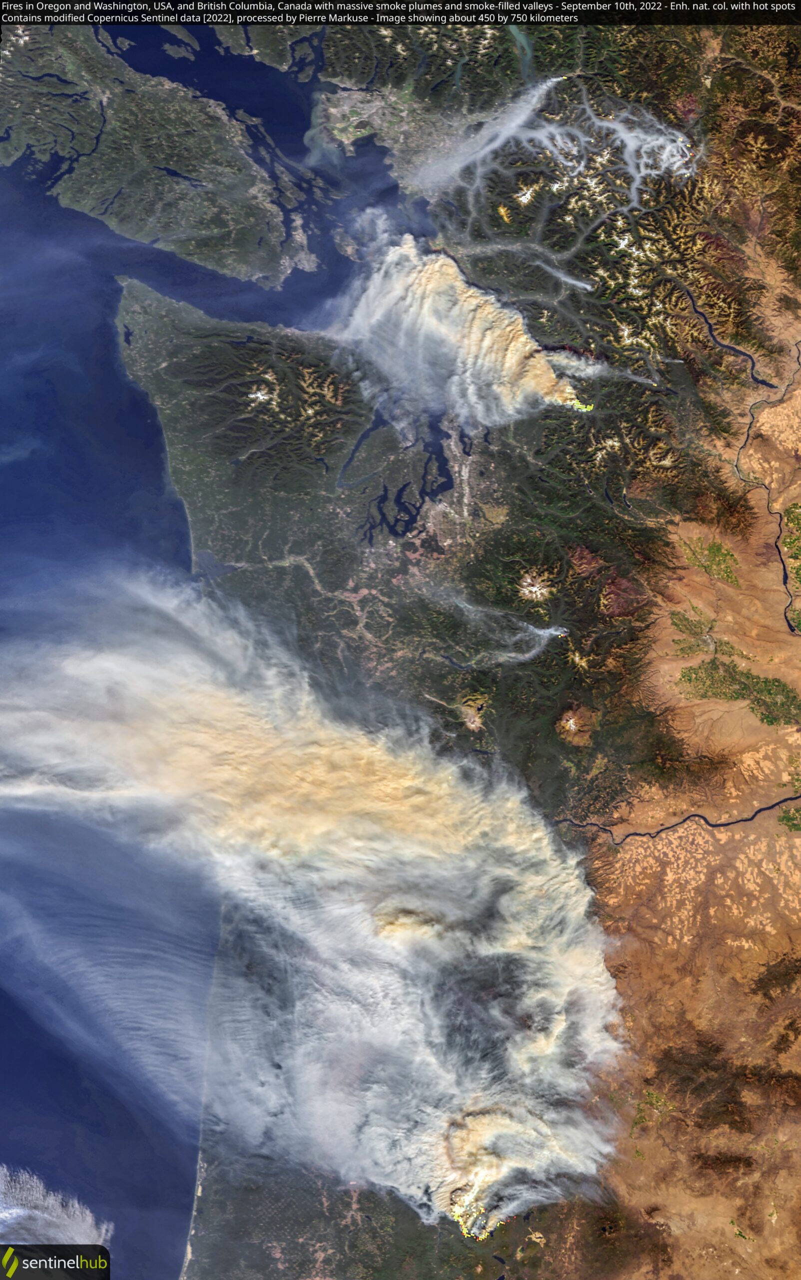
In the satellite photo below the Cedar Fire is producing the smoke seen in the lower portion of the image.

Satellite photo, Bolt Creek and Cedar Creek fires Sept. 10, 2022
Satellite photo, Bolt Creek and Cedar Creek fires Sept. 10, 2022. Processed by Pierre Markuse.