Forecasts for wildfire smoke

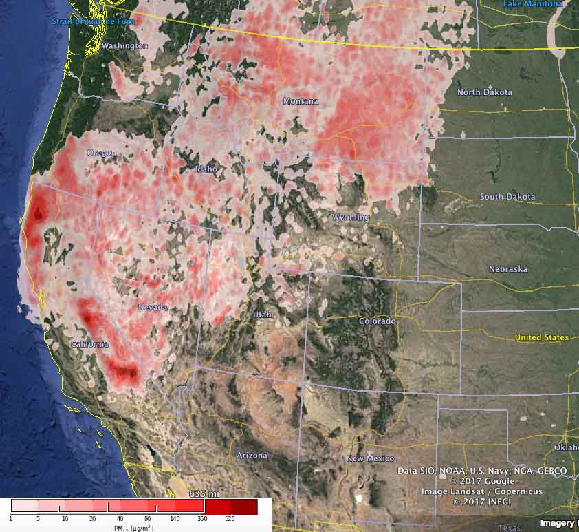
Above: The forecast for the maximum levels of wildfire particulate matter (PM 2.5) for August 14, 2017. Experimental product by U.S. Forest Service/BlueSky.

(Originally published at 10:40 a.m. MDT August 14, 2017)

These maps are experimental products developed by U.S. Forest Service researchers using the BlueSky modeling framework, in this case to predict the distribution of very small particulate matter (PM2.5) produced by vegetation fires. Their efforts link a variety of independent models of fire information, fuel loading, fire consumption, fire emissions, and smoke dispersion.

The map above is for Monday, August 14 and the one below is for Tuesday, August 15.
wildfire smoke pm25
The forecast for the maximum levels of wildfire particulate matter (PM 2.5) for August 15, 2017. Experimental product by U.S. Forest Service/BlueSky.

Here is information from the EPA about particulate matter:

Particulate matter contains microscopic solids or liquid droplets that are so small that they can be inhaled and cause serious health problems. Particles less than 10 micrometers in diameter [PM10] pose the greatest problems, because they can get deep into your lungs, and some may even get into your bloodstream.

Fine particles (PM2.5) are the main cause of reduced visibility (haze) in parts of the United States, including many of our treasured national parks and wilderness areas. They can only be seen with an electron microscope. Fine particles are produced from all types of combustion, including motor vehicles, power plants, residential wood burning, forest fires, agricultural burning, and some industrial processes.

Wildfire smoke travels farther south into the United States

Wildfire smoke
Wildfire smoke at 1:20 a.m. MDT August 14, 2017. NOAA.

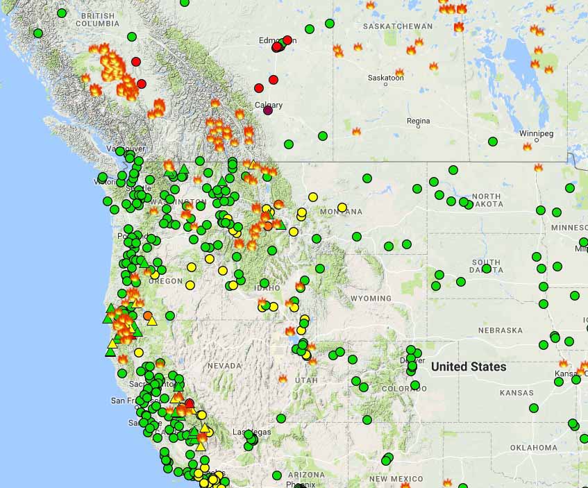
While sleeping with the windows open I woke up at 2 a.m. Monday morning with the strong smell of forest fire smoke in the house. I checked NOAA’s smoke map on my phone and sure enough there it was, in several shades of brown. Oddly, in spite of the strong smell, it is barely registering at the nearest air quality monitoring site.

Canadian smoke does not often drift this far south into the Black Hills of South Dakota in high enough concentrations to have a strong odor.

Wildfires air quality
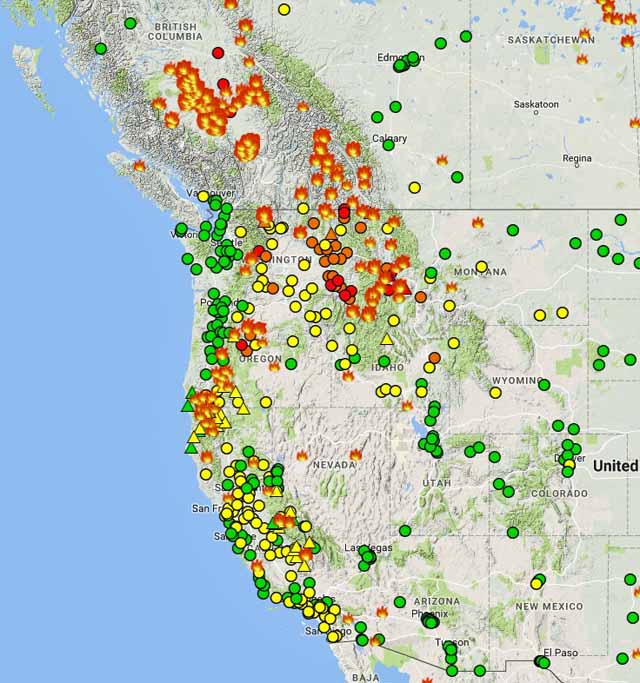
Wildfires and air quality, at 2 a.m. MDT August 14, 2017

air quality legendBut it is much, much worse in some areas. I have friends that basically evacuated from Missoula at least temporarily because of the smoke, where Saturday the air was “very unhealthy”. And this morning in Calgary, Alberta the PM2.5 is 234, also “very unhealthy”.

And, thanks to the South Fork Fire that started Sunday 1.5 miles east of the community of Wawona in Yosemite National Park and the Empire Fire that has been burning in that area since August 1, it is “unhealthy” to breathe in Yosemite Valley where the PM2.5 is 154. The Empire Fire is not being suppressed so the smoky conditions could persist for an extended period of time. The South Fork Fire is a suppression fire.

Protecting a historic site above the Arctic Circle

In recent weeks a wildfire in northern Yukon Territory on the Alaskan border threatened the Rampart House historic site. It occurred at 67 degrees North Latitude, which is about the same distance from the equator as the fires burning in Greenland.

Rampart House was the location of one of the first encounters of traders, missionaries, and police with the native people of the region. The archaeological resources and 21 historic structures are cooperatively owned and managed by the Yukon Government and the Vuntut Gwichin First Nation.

Rampart House

Doug Cote was assigned to the fire and sent us these photos along with this description:

A number of fires threatened the site over the two week period we were there.  Once our trigger points were breached we pulled out our fall back ignition plan which went off like text book. Aerial ignition from above and hand ignition on the ground for close to 2km along the base of the slopes above the site.  The area should be safe from fires for a good long while now.

There were a number of large fires burning north of the arctic circle in Alaska and Canada’s north west this summer with higher than average temperatures and higher than average amounts of lightning.  It would be real interesting to crunch the numbers and see the total burned area and how it compares to previous years and whether there is any evidence of an upwards trend.

Rampart House Rampart House

Thanks Doug!

TEDx: “Living (dangerously) in an era of megafires”

Why are fires getting bigger?

One of the talks at the TEDx hosted in Bend, Oregon in May was about wildfires. U.S. Forest Service Research Landscape Ecologist Paul F. Hessburg, Sr. gave a 15-minute presentation on megafires, explaining how fires have changed, and why, over the last 100 to 150 years.

Here is an excerpt from the official description of his talk:

Paul tells a fast-paced story of western US forests–unintentionally yet massively changed by a century of management. He relates how these changes, coupled with a seriously hotter climate, have set the stage for this modern era of megafires. He offers clear tools for changing course, a sense of urgency, and a thought-provoking call to community action…

Eucalyptus trees contribute to Portugal’s wildfire problem

When numerous fires burned through large expanses of Portugal in June killing more than 60 people, they were fueled in some areas by monocultures of eucalyptus trees. Many areas around the world grow them in order to harvest the wood, leaves, and oil to make paper and medicine. But wildfires burn rapidly under the trees and through the crowns, fed by the stringy bark, oil, and the leaves and forest litter on the ground that do not decompose. Earlier this year we took this photo after a fire in Chile spread through a plantation.

wildfire eucalyptus plantation
The aftermath of a wildfire that burned through a eucalyptus plantation in Chile, February 2, 2017.

The New York Times published an article today that looks at how eucalyptus and other issues combine to create a wildfire environment in Portugal that is difficult to manage.

Here is an excerpt:

…Even so, Portugal’s wood industry no longer relies on native species like oak and pine. Instead, it is increasingly built on eucalyptus, which feeds a pulp and paper sector that makes up 10 percent of Portuguese exports. The area of eucalyptus planting has more than doubled since the 1980s.

Eucalyptus can be harvested in half the time needed for pine. And unlike other species, “you have absolutely no need for people on the ground” to supervise its growth, said João Camargo, an environmental engineer.

The tree, however, contains a highly flammable oil that helps fires erupt more easily, spread and intensify.

Yet after every fire, more landowners switch to eucalyptus, hoping that a shorter production cycle can allow them to recoup their losses faster and to harvest their trees before the next fire erupts.

It is an accelerating sequence that has turned Portugal “from a pretty diverse forest into a big eucalyptus monoculture,” Mr. Camargo said.