West Mims Fire burns in Florida and Georgia

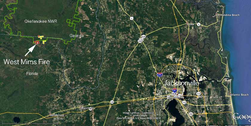
map West Mims Fire
The West Mims Fire is burning on the border of Georgia and Florida. The red and yellow squares represent heat detected by a satellite, the most recent (red) was seen at 2:19 p.m. EDT April 10, 2017. (click to enlarge)

(Originally published at 5:20 p.m. EDT April 10, 2017.)

Since the West Mims Fire started from a lightning strike on April 6 it has burned about 3,800 acres, growing substantially on Sunday and Monday.

The fire is 16 miles west of St. George, Georgia at the southern end of the Okefenokee National Wildlife Refuge and on private land just north of Florida Highway 2 on both sides of the Georgia/Florida state line.

Most fires in the Refuge, which is a Wilderness Area, are allowed to burn with little interference from humans, but with it on private land outside the Refuge firefighters are taking action to stop the spread.

Personnel with the Georgia Forestry Commission and Florida Forest Service are working the fire along with federal firefighters from the Refuge.

Below is an excerpt from an April 9 press release, but with the rapid growth of the fire on the 9th and 10th, it appears that fire managers have stepped up their suppression activity since the reported April 8 meeting:

…A meeting was held the morning of April 8 to discuss strategy. Representatives were present from the U.S. Fish and Wildlife Service, Georgia Forestry Commission, U.S. Forest Service, Florida Forest Service, Georgia Department of Natural Resources, and Baker County Emergency Management. Monitoring of the West Mims Fire will continue over the next 48 hours. Personnel with the Florida Forest Service at John M. Bethea State Forest will refresh fire lines on the southeast corner off Perimeter Road.

There will be a follow-up meeting on Friday, April 14 of the primary responders to re-evaluate the status of the wildfire and to discuss future strategy of attack.
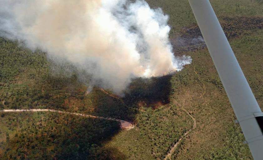
west mims fire
An undated and uncaptioned photo posted on the Okefenokee National Wildlife Refuge Facebook page on April 9, 2017.

Park rangers honored for clearing evacuation route during Gatlinburg fire

Two employees of Great Smoky Mountains National Park are receiving recognition for the pivotal role they played in helping to clear a highway of downed trees that were preventing thousands of people from evacuating from Gatlinburg, Tennessee as the Chimney Tops 2 Fire burned into the city on November 28, 2016.

The truck that Ryan Williamson and Andrew Herrington were in that day was carrying two chain saws because Mr. Williamson had been taking a tree felling class that morning. One of them was his personal saw and the other belonged to the National Park Service.

After assisting to evacuate one of the administrative sites in the park, they were on a stretch of U.S. 321/441 between Pigeon Forge and Gatlinburg called the Spur. Below is an excerpt from an article in the Knoxville News Sentinel:

When the two rangers arrived [on the Spur] after dark that evening, a line of what they estimated held more than 1,000 vehicles was gridlocked for more than a mile and a half coming out of Gatlinburg. Treetop-high flames came nearly up to the road shoulders, the wind was howling, and the smoke was blinding.

“It looked like the end of the world,” Herrington said.

With traffic stopped and their truck at the end of the line, Herrington jumped from the passenger seat and trotted, carrying a chainsaw more than a mile to the front where a large pine had fallen and was blocking the road.

The two of them worked for hours in the very strong winds with the fire nearby, each going through three tanks of chain saw gas, to keep the highway clear as trees continued to fall into the highway.

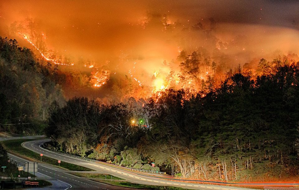
Chimney Tops 2 Fire
Chimney Tops 2 Fire. Incident Management Team photo.

They were recently honored by the Tennessee Chapter of the Wildlife Society with a newly established Tennessee Conservation Hero awards.

The fire killed 14 people and destroyed 2,013 homes and 53 commercial structures. It eventually burned over 17,000 acres in and outside the park.

Articles on Wildfire Today about the Chimney Tops 2 Fire.

Satellite view of wildfire activity in the southeast

Above: A satellite detected heat from fires (red dots) and smoke in the southeast United States, April 7, 2017.

While the rest of the United States has a reprieve from wildfire season, firefighters in the southeast and the southern plains have been busy in recent weeks with wildland fires and prescribed burns.

The photo above shows heat and smoke detected by a satellite on April 7, 2017. We added the arrows to indicate some of the larger smoke plumes.

There were at least a couple of large fires in Florida on Friday, but any large concentrations of smoke from those blazes may have occurred between satellite overflights.

Judging from the heat detected in Kansas there was a great deal of activity in the Flint Hills — much of it was probably controlled burning by landowners.

Fire burns thousands of acres in Broward County, Florida

wildfire broward county florida
Radar image showing smoke blowing to the south from the Holiday Fire in Broward County, Florida at 1:15 p.m. EDT April 7, 2017.

A wildfire that started on April 4 had burned approximately 4,600 acres by noon on Friday, April 7. Named the Holiday Fire, it is south of Highway 75 and west of Highway 27 and Krome Avenue.

Mack’s Fish Camp is threatened and was closed Friday morning. The fire started near Everglades Holiday Park in Pembroke Pines and has spread at least two miles to the south.

The entire state of Florida is under a Red Flag Warning on Friday. The weather forecast for the fire area for Friday includes temperatures in the mid 70s, relative humidity in the high 20s, and winds out of the north or northwest at 10 to 15 mph.

Red Flag Warnings April 7, 2017

The National Weather Service has issued Red Flag Warnings or Fire Weather Watches for areas in Florida, Wyoming, South Dakota, Nebraska, Arizona, New Mexico, and Texas for strong winds and low humidity.

The map was current as of 8:40 a.m. MST on Friday. Red Flag Warnings can change throughout the day as the National Weather Service offices around the country update and revise their forecasts.