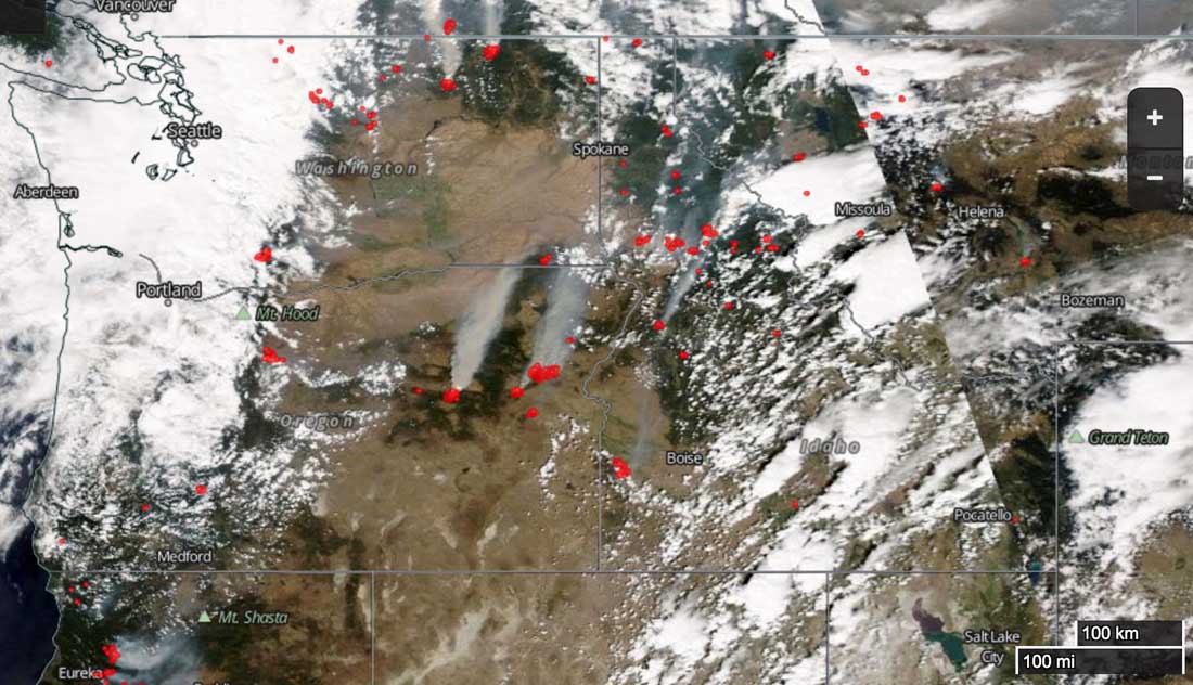
This August 14 satellite photo, with fire detections overlaid as red dots, shows many large fires that are generating smoke in northwest California, Washington, Oregon, Montana and Idaho.
News and opinion about wildland fire
The Regional Office in U.S. Forest Service Region 6, comprised of Washington and Oregon, distributed an update on the wildfire situation to USFS retirees. Below are some excerpts from the message, dated August 13.
****
“…As predicted, initial attack (IA) was heavy across the region yesterday and into today. Many new and extended attack fires grew steadily, and in some cases, quite dramatically. Wednesday saw 32 new fires in Oregon for 9,738 acres while Washington had 58 new fires for 1,426 acres. The most concerning of these is the Stickpin on the Colville National Forest . There is continued concern for the National Complex, the Cornet/Windy Ridge, and Cougar Creek. Four Type I teams are assigned in the region at the Wolverine Fire on the Okanogan-Wenatchee, the National Complex on the Rogue River-Siskiyou, Umpqua and Crater Lake National Park, the Stouts Creek also on the Umpqua, and finally at Cornet/Windy Ridge out on the Wallowa-Whitman. IA resources are stretched thin and many Type III teams are managing challenging fire situations while Type I and II teams get in place. For more information on specific incidents, please visit the INCIweb: inciweb.nwcg.gov
The regional situation is all juxtaposition with the fact that nationally, there are 73 (and counting) uncontained large fires. More than 19,000 U.S. Forest Service and other federal, state, and local wildland firefighters; more than 100 helicopters; and 25 large airtankers are working to suppress wildland fires. Over the last week however, of the more than 1,200 new fires reported on National Forest System and other federal, state, and private land nationwide, about 50 – just 4% – became large fires. This is a testament to those tremendous IA efforts. An interesting point here in the Pacific Northwest though is that many of the large fires are burning into fire scars, some as recent as 2013. We are finding that old fire scars are not slowing the progress of fire spread this year. I think this represents another example of how fire behavior is not as it once was and the unpredictably we now face…”
(UPDATED at 8:15 a.m. PT, August 19, 2015)
“This is not an emergency for us. This is what we do”.
(Deputy Incident Commander Rob Allen during a Wednesday morning briefing to firefighters, emphasizing that they should not feel pressure to take unnecessary chances performing what is to them routine work for which they have spent years accumulating skills and experience.)
The above quote can be heard in the brief video below.
All of the fires comprising the Chelan Complex of Fires grew on Tuesday, adding about 6,000 acres to what became a total of 69,445 acres burned. The Black Canyon and McFarland Fires burned together (see map below) while expanding on almost all the length of their perimeters. The First Creek and Antoine Fires both spread on their northwest sides.
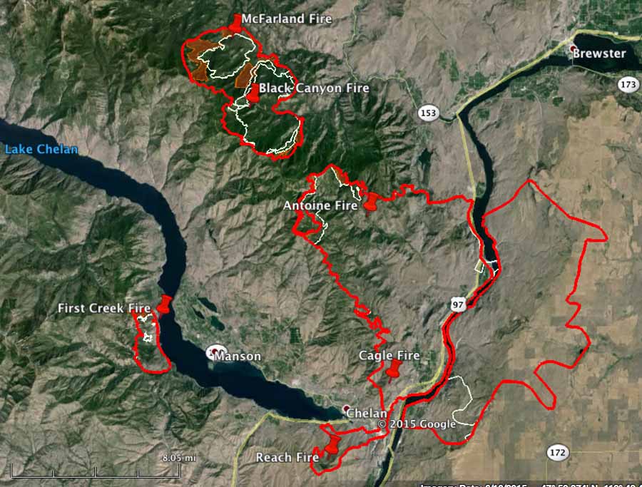
Evacuations are still in place for approximately 2,900 residents in the greater Chelan area.
****
(UPDATED at 3:04 p.m. PT, August 18, 2015)
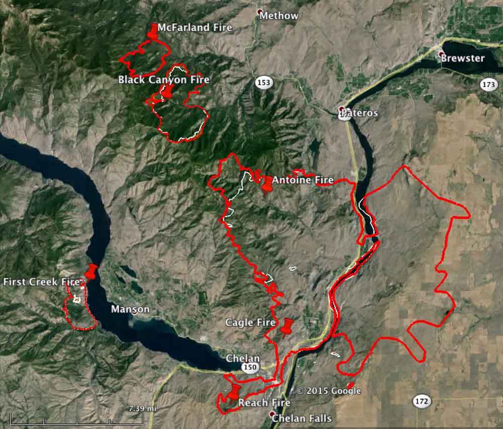
Monday night the assessors office confirmed that 35 residences and 21 outbuildings have been destroyed in the fire near Chelan, Washington. The surveys are not complete and those numbers could be revised upward in the next few days.
The Sheriff’s office is increasing the patrols in evacuated areas, hoping to stop the looting has been reported in the temporarily vacant homes.
Continue reading “Five fires in Chelan, Washington area, evacuations ordered”
The National Weather Service has issued Red Flag Warnings or Fire Weather Watches for areas in Washington, Oregon, Idaho, Nevada, North Dakota, California, and Montana.
The map was current as of 11 a.m. MDT on Friday. Red Flag Warnings can change throughout the day as the National Weather Service offices around the country update and revise their forecasts and maps. For the most current data visit this NWS site or this NWS site.
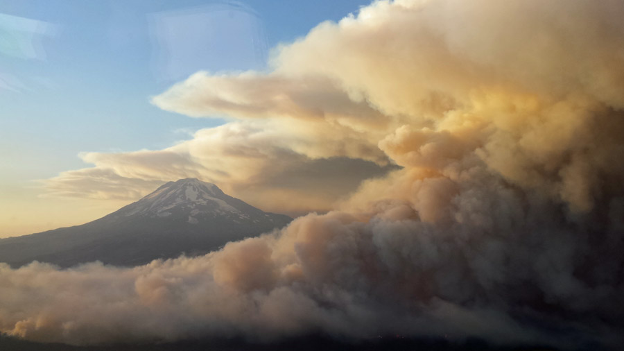
Jerry Messinger sent us these photos of the Cougar Creek Fire six miles northwest of Glenwood, Washington. The fire has burned 9,400 acres and is being managed by Washington Interagency Incident Management Team #5 (WIIMT5), Incident Commander Dave Leitch.
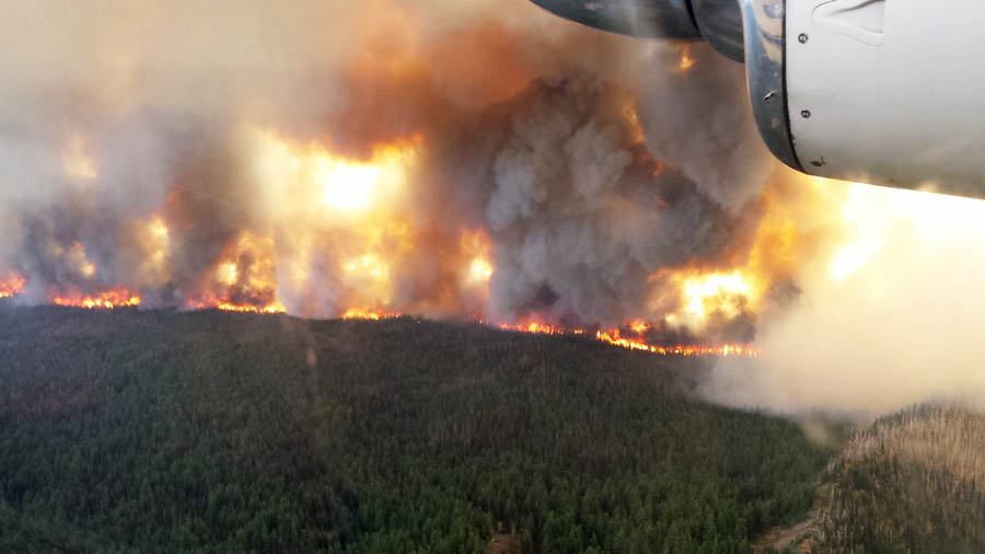
More information about the Cougar Creek Fire.
Thanks Jerry!