AFAC explains the process for accepting assistance in Australia during the bushfire crisis

AFAC bushfires Australia National Resource Sharing Centre
AFAC maintains the National Resource Sharing Centre (NRSC), which facilitates international and interstate deployments through its established partnerships and national arrangements. AFAC photo.

Many people would like to travel to Australia to help with the response and recovery from the historic bushfires, either as a paid employee or a volunteer.

The National Council for Fire & Emergency Services (formerly the Australasian Fire and Emergency Service Authorities Council or AFAC), is the primary organization responsible for representing fire, emergency services, and land management agencies in the Australasian region. It is still known as AFAC.

Below is a statement AFAC released January 11 that lays out their process for requesting and accepting assistance during the bushfire crisis.


AFAC maintains the National Resource Sharing Centre (NRSC), which facilitates international and interstate deployments through its established partnerships and national arrangements.

The NRSC is tasked by the Commissioners and Chief Officers of fire and emergency service agencies in Australia and New Zealand, and is supported the Australian Government through Emergency Management Australia and the Crisis Coordination Centre.

The NRSC coordinates interstate and international resources, responding to the needs of our members. Currently, we have international assistance from the Canada, the United States and New Zealand in Australia assisting our effort.

Australia continues to receive generous offers of support from around the world to assist during the ongoing bushfire crisis. Each request that is received is logged and in collaboration with the Crisis Coordination Centre, is assessed for its suitability to our Australian operating environment. Key considerations include:

– Is it fit for purpose?
– Does it meet our safety requirements?
– Can it easily align to our common incident management system?
– Does it meet the appropriate legal requirements?
– Does an agency want to receive it?

Unfortunately, not all requests are able to be accepted. Our number one priority is the primacy of life, for fire and emergency personnel and the community. We need to ensure that wherever possible, operations are carried out safely, supported by resources with the appropriate skills and equipment to meet the needs of the situation. Familiarity with Australian fire conditions is critical.

AFAC remains committed to supporting its members and will continue to work with our partners and the Australian Government to ensure that our fire and emergency services have the support that they need.
satellite photo map Australia bushfires fires
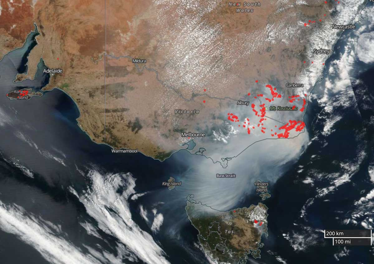
Satellite photo showing smoke from the fires in Australia, January 12, 2020. The red areas represent heat. NASA.
Map fires New South Wales, Victoria,  South Australia
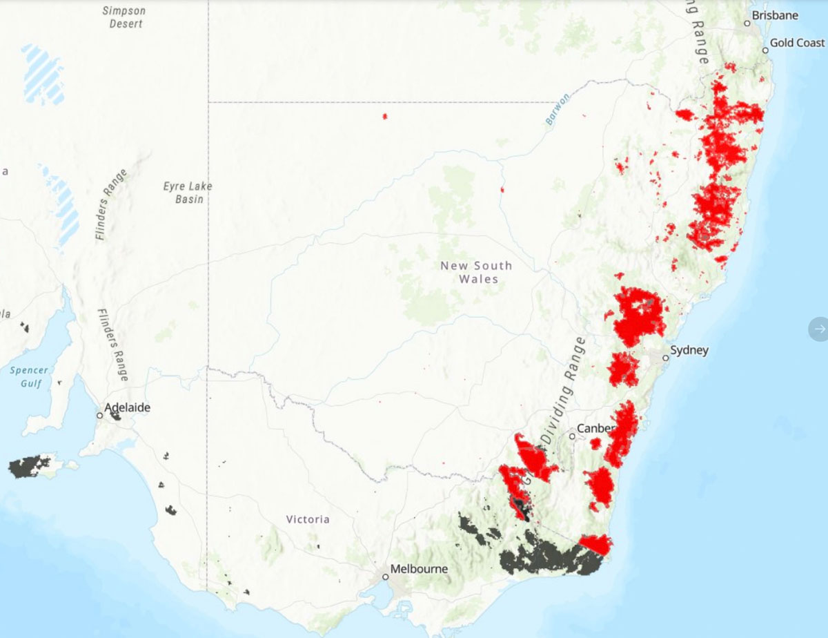
Map of fires in New South Wales, Victoria, and South Australia by @gergyl January 12, 2020.

Bushfire has burned almost half of Kangaroo Island

Two Country Fire Service trucks were involved in burn-overs

Map Ravine Fire Kangaroo Island
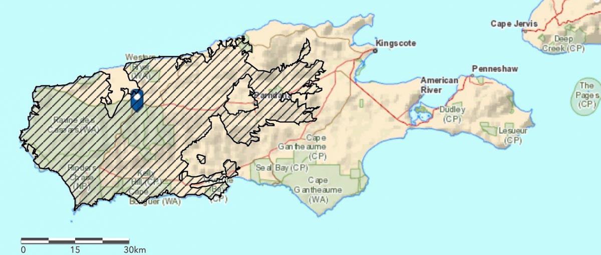
Map showing the extent of the Ravine Fire on Kangaroo Island, January 12, 2020. South Australian Country Fire Service.

The Ravine Fire that has been working its way across Kangaroo Island off the coast of South Australia has burned almost half of the area of the island, over 210,000 hectares (519,000 acres) or 48 percent. (See map of the fire above)

Below is an excerpt from a January 10 article at 9News:

Properties have been lost, firefighters injured and more land blackened after a night of horrific conditions across the Kangaroo Island bushfires, but the emergency has eased. Assessments are underway, but some homes are believed lost at Vivonne Bay while the town of Parndana was spared for a second time, despite fire bearing down on it from several directions. Both towns had been evacuated amid emergency warnings and the escalating danger.

Two Country Fire Service trucks were involved in burn-overs and two more CFS personnel were injured, taking the total hurt on Kangaroo Island to 22.

With rain falling across the fire ground on Friday, the warning levels for all fires were reduced first to a watch and act and then to a simple bushfire advice.

CFS chief officer Mark Jones said Thursday night was an “incredibly difficult” period for all 280 firefighters on the island.

“Winds were not consistent, they were blustery and came from many different directions,” he said.

The fire danger will increase on Monday as the forecast of Kingscote calls for winds out of the south at 8 to 16 mph. Those northerly winds will grow to 14 to 20 mph Tuesday through Thursday with very little chance of rain.

Much of the eastern third of the island consists of pastures or agriculture land without as many forested areas as found on the west end where Flinders Chase National Park is located. Most of the park has burned along with many structures in and near the park.

Two men were killed on January 4, Dick Lang and his son Clayton.

The State Government on Sunday reported that more than 32,000 livestock animals, mostly sheep, perished in the blazes as well as 830 hives and 115 nucleus hives.

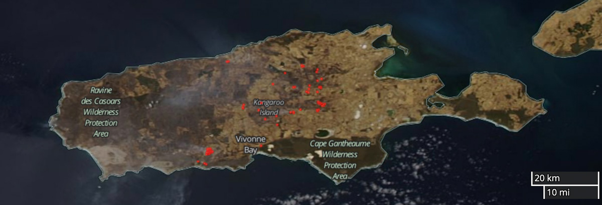
The satellite photos below illustrate the eastward growth of the fire on Kangaroo Island over a five-day period.

Map Ravine Fire Kangaroo Island satellite photo
January 6, 2020 satellite photo showing the Ravine Fire on Kangaroo Island. The red areas represent heat. NASA.
Map Ravine Fire Kangaroo Island satellite photo
January 11, 2020 satellite photo showing the Ravine Fire on Kangaroo Island. The red areas represent heat. NASA.

Firefighter killed on bushfire in Victoria, Australia

Near Omeo January 11

bushfire victoria december 30 2019
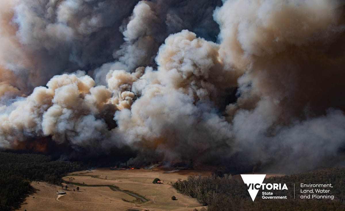
A fire in the East Gippsland region of Victoria, December 30, 2019. Photo by Ned Dawson for Victoria State Government.

UPDATED at 6:43 p.m. PST January 11, 2020.

The bushfires in Australia have claimed the life of a fifth firefighter. It occurred Saturday January 11 while a firefighter was working on a fire in the Omeo area of Victoria, Emergency Management Commissioner Andrew Crisp has confirmed.

Forest Fire Management Victoria Chief Fire Officer Chris Hardman said, “Bill Slade was working as a member of a task force at the Anglers Rest area and he was struck by a tree.”

“Family and fellow emergency personnel are being informed and will be supported,” he said. “The safety and wellbeing of our people is our highest priority. The matter will be investigated by Victoria Police who will prepare a report for the Coroner.”

Mr. Slade, 60, had worked for 40 years as a firefighter with Parks Victoria. He is survived by his wife Carol, daughter Steph and son Ethan.

Our sincere condolences go out to the family, friends, and co-workers.

Other recent firefighter fatalities in Australia:

January 3, 2020: Victoria Forest Fires Management worker Mat Kavanagh, 43, died on duty in a two vehicle crash on the Goulburn Valley Highway, in Victoria. His colleague was injured.

December 30, 2019: New South Wales Rural Fire Service volunteer firefighter Samuel McPaul died when a fire tornado or column collapse flipped his fire engine in New South Wales. Two other firefighters were also injured.

December 19, 2019: Andrew O’Dwyer and Geoffrey Keaton were killed while working on the Green Wattle Creek Bushfire when their truck hit a tree near Buxton in southwestern Sydney, New South Wales. They were both volunteer firefighters for the NSW Rural Fire Service.

At least 27 people have died in the Australia bushfires during the 2019/2020 bushfire season.

Thanks and a tip of the hat go out to Tom. Typos or errors, report them HERE.

Australians welcomed U.S. firefighters with cheers

Firefighters from the U.S. arrive in Australia
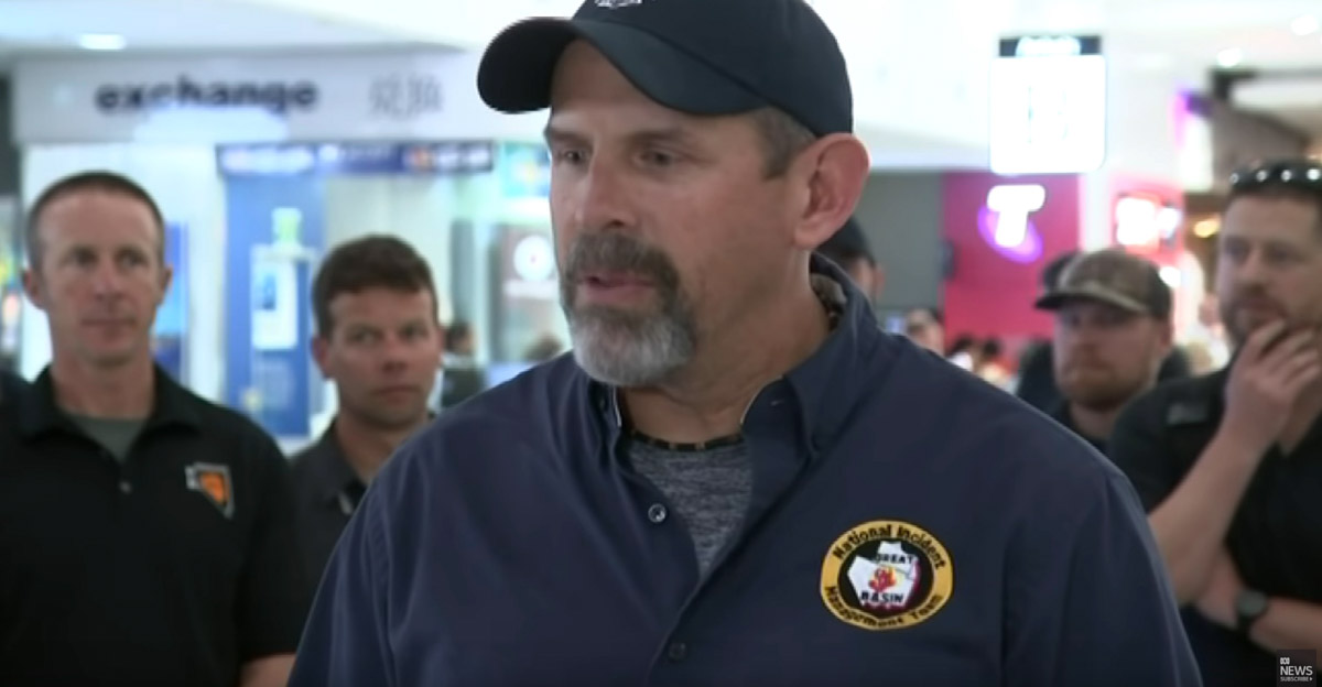
Firefighters from the U.S. arrive in Australia. Screenshot from ABC video.

Australians cheered firefighters from the United States as they arrived at the Sydney airport.

Below, firefighters are interviewed, including Shawna Legarza Director of Fire and Aviation for the U.S. Forest Service.

Thanks and a tip of the hat go out to Jim. Typos or errors, report them HERE.

Six bushfires merge in Australia to burn 1.5 million acres

gigafire australia victoria new south wales
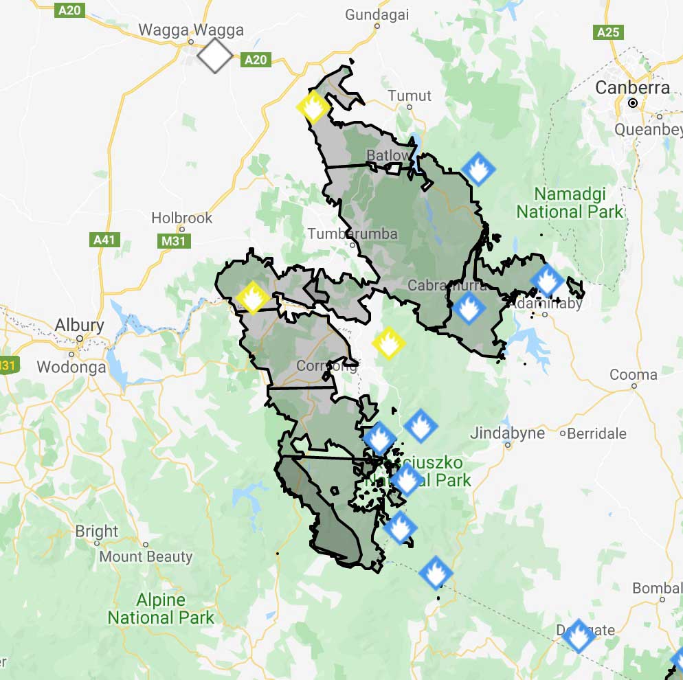
Six bushfires in two Australian states have merged, forming a huge megafire covering 1,532,484 acres (632,315 hectares). To get an idea of the scale, the distance between Canberra and Albury is 134 miles (216 km).  Map: NSW RFS

Six bushfires in two Australian states have merged, forming a huge blaze covering 1,532,484 acres (632,315 hectares) slightly smaller than the size of Delaware in the United States. The fires in Victoria and New South Wales met near Jingellic NSW between Canberra and Albury.

NAME            HECTARES
Dunns Road, 316,754
Doubtful Gap Trail, 48,918
Adaminaby Complex, 28,640
Green Valley, Talmalmo, 233,390
Mount Youngal, 1,000
Pilot Lookout, 3,613

TOTAL: 632,315 hectares (1,532,484 acres)

Below is an excerpt from an article at the Australian Broadcasting Corporation updated Friday night local time:

Firefighters are bracing for a difficult night ahead amid the formation of a second “mega-blaze” and a southerly change sweeping up the New South Wales coast, bringing gusts of up to 90 kilometres per hour.

Emergency warnings were issued earlier for the Dunns Road fire burning near Ellerslie and Tarcutta in the Snowy Valleys, as well as the Green Valley Talmalmo fire and the adjoining East Ournie Creek fire, burning east of Albury.

All three fires have now joined to form the state’s second “mega-blaze” and now covers more than 640,000 hectares, straddling the New South Wales and Victorian borders.

However, these blazes had all been downgraded to watch and act overnight. In total, four fires were at watch and act level last night, including the Erskine Creek blaze burning south of Leura and Wentworth Falls in the Blue Mountains.

NSW Rural Fire Service Inspector Ben Shepherd said warnings for the blaze had been upgraded in anticipation of the southerly hitting the area around midnight and he warned residents to monitor conditions as the front moved through.

In a Facebook post, Blue Mountains Mayor Mark Greenhill told locals it had been a “hard day” for the region ahead of a “night of vigilance for us all”.

“We were worried it would be a hard day. That has been the case,” he wrote.

“We have had fire activity in the Grose Valley a few kilometres from Faulconbridge. This was air-attacked throughout the afternoon. Work will continue tomorrow.

“Crews are working hard to manage this activity. They will have a long night … I am sorry the news is not better but tonight is a night of vigilance for us all.”

NASA has released an animation showing smoke from the Australian fires reaching across the Pacific to South America.

NASA’s description of the video:

“The animation shows RGB color images from NASA’s Moderate Resolution Imaging Spectroradiometer (MODIS) instrument on NASA’s Aqua satellite for December 31, 2019 through January 5, 2020. A plume of brown smoke extends from the southeastern coast of Australia, over the Tasman Sea and beyond into the Pacific Ocean.

“The overlaid vertical cross sections show CALIPSO lidar observations for these same days. The bright colors indicate the presence of small particles (aerosols) and the white color indicates clouds. Visible in each of the cross sections near 40 degrees south is a thick layer of smoke from the fires at altitudes above 9 miles (14.5 km). The dark shading below these layers is due to the absence of lidar signals below the opaque smoke layers. These layers contain very small particles and have optical properties similar to smoke.

“The sequence of CALIPSO and MODIS tracks in the animation indicates the continued transport of the smoke layer to the east. As of Jan. 5, 2020, smoke was detected more than 4,000 miles from the source.

“Credit: NASA Langley/Roman Kowch”

Another area of Kangaroo Island evacuated prior to high bushfire danger

Fire has had major impacts on Kangaroo Island’s wildlife, killing thousands of koalas

Ravine Fire Kangaroo Island Australia
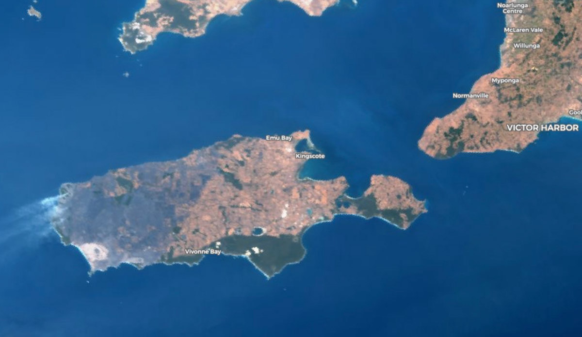
The gray area on the west side of Kangaroo Island has burned in the Ravine Fire. Copernicus image. January 8, 2020 local time.

As the lightning-caused Ravine Fire on Kangaroo Island off the coast of South Australia continues to grow to the east new evacuations have been ordered. In anticipation of high fire danger on Thursday the South Australian Country Fire Service has taken the unusual step of calling on police to help evacuate the town of Vivonne Bay on the south side of the island. There are concerns that the fire could cross control lines and burn into areas with heavy fuel loading near the town of 400 residents.

The weather forecast on Thursday calls for winds east to northeasterly 25 to 35 km/h increasing to 40 km/h before shifting westerly 20 to 30 km/h in the late afternoon.

The red areas represent heat detected on the Ravine Fire on South Australia’s Kangaroo Island. January 8, 2020 local time.

The 164,000-hectare (405,000-acre) fire has had a major impact on the wildlife while burning over a third of the island. It has been called a Noah’s Ark since it supports species that are not found in large numbers in other locations.

Several organizations on the island are caring for koalas that have been injured in the fire. About 50 have been brought to the Kangaroo Island Wildlife Park, but at least one-third had to be euthanized due to extreme burns. The Guardian reports that Sam Mitchell, co-owner of the park, estimates that of the estimated 50,000 koalas on the island “probably more than half” would have perished in the fires, but it was “a guessing game”.

There is also concern about other species including the Kangaroo Island dunnart, glossy black-cockatoo, wallabies, pygmy possums, and the rare green carpenter bee.