Increased risk of bladder cancer for firefighters

It seems like there are more and more chronic diseases that firefighters are predisposed to get. Now you can add bladder cancer to the list.

ScienceDaily (May 15, 2008) — A new study presented at the Annual Scientific Meeting of the American Urological Association (AUA) suggests that firefighters may be at an increased risk of developing transitional cell carcinoma (TCC, or bladder cancer) and should be considered for routine annual screening. Currently, no guidelines exist for regular TCC screening.

Researchers are from the University of California, San Francisco.

It is well known that prolonged exposure to certain environmental pollutants and chemicals puts humans at a major risk for developing bladder cancer. As the body absorbs carcinogenic chemicals, such as cigarette smoke, the chemicals are transferred to the blood, filtered out by the kidneys and expelled from the body through the urine. Greater concentrations of chemicals in the urine can damage the endothelial lining of the bladder and increase a patient’s odds of developing transitional cell carcinoma (TCC). Firefighters, who are regularly exposed to smoke and chemical fumes, may be at a higher risk for developing the disease than other groups.

Researchers explored this possibility in a screening study of 1,286 active and retired San Francisco firefighters. From August 2006 to March 2007, the subjects – mean age 45 (SD+9.7) – participated in voluntary urine dipstick testing and point-of-care NMP-22 testing. 93 Patients tested positive for hematuria and six tested positive for NMP-22. These 99 patients were referred for upper tract imaging, cystoscopy and urine cytology. Of the group, a single firefighter tested positive for both NMP-22 and hematuria, with two patients – both retired firefighters – ultimately diagnosed with TCC.

The age and sex-adjusted incidence for TCC is 36 per 100,000. These findings represent a higher incidence, suggesting that retired firefighters may be a high-risk group.

In Canada, the British Columbia government recognizes as an occupational hazard for firefighters the following diseases:

  • testicular cancer
  • lung cancer in non-smokers
  • brain cancer
  • bladder cancer
  • kidney cancer
  • ureter cancer
  • colorectal cancer
  • non-Hodgkin’s lymphoma
  • leukemia

This means that full-time, volunteer, part-time, and paid on-call firefighters suffering from the diseases will qualify for worker’s compensation and benefits, without having to prove individually that the diseases are linked to their jobs.

Rather sobering, don’t you think?

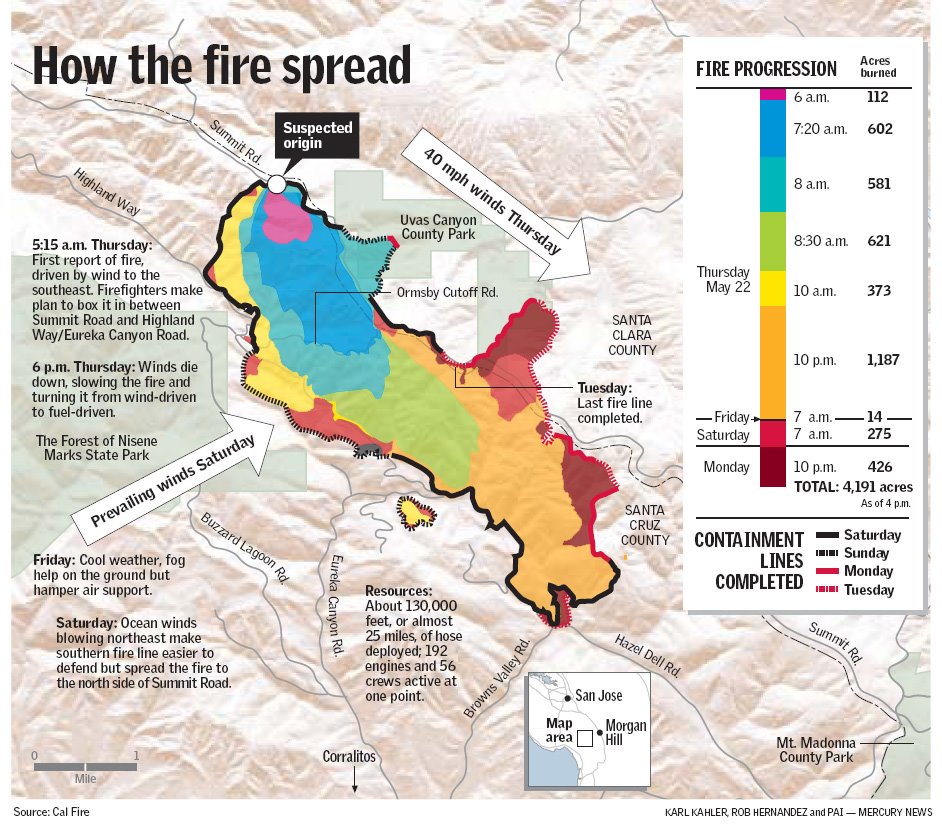
California: Summit fire progression map

I just finished teaching a Situation Unit Leader S-346 class. Much of the class is about maps. The next time I teach it in September, I’ll use this fire progression map produced by the Mercury News as an example of what can be done. It includes some interesting facts about the fire that most official firefighter-made maps would not have, but it’s a great product for public consumption.

According to the map, within the first 16 hours the fire spread at least 5 miles and burned 3,376 acres.

Click on it to see a larger version.

Summit fire progression map


Wildland fire roundup, May 26, 2008

Posted on Categories Uncategorized

Summit fire

The Summit fire south of Santa Cruz, California is expected to be contained by the middle of this week, but many of the evacuees have still not been allowed to return to their homes. The fire is 70% contained and has burned 3,970 acres in an area that has not burned in the 100 years that fire records have been kept. 36 residences have been destroyed. The fire burned 3,000 acres in the first 8 hours. While most people at a public meeting yesterday were supportive of the firefighters, one person questioned what they described as a “slow response” to the Ormsby Road area where several homes burned. Chief John Ferreira of CalFire said:

“We kill enough firefighters over their own desire to do their best and protect the community. I regret that the houses were lost, but we would not have sent our firefighters into that situation.”

I wonder what the person that questioned the CalFire response did in advance to make his house fire safe?

Fire lookouts

WRAL.com has a story about Peter Barr who got obsessed interested in the 120 fire lookout towers in North Carolina. He wrote a book, “Hiking North Carolina’s Lookout Towers”, that includes descriptions of how to hike to 26 of them in western and central North Carolina. And, in case you didn’t know, there is a Forest Fire Lookout Association. Mr. Barr is the director of the state’s chapter.

Concrete logs for fire resistant house construction

Posted on Categories Uncategorized

A company in Missoula, Montana has developed “cultured logs”, a fire resistant building material which looks very much like wood logs. Dick Morgenstern, Chairman of Cultured Log Systems, had experience in precasting concrete for bridges and sewer manholes.

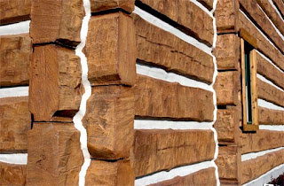
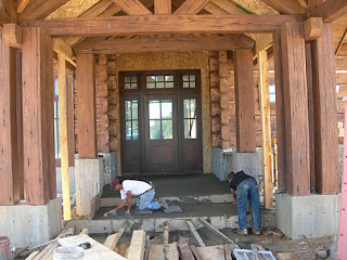
After seeing houses threatened by wildland fires being wrapped in fire shelter material, he started experimenting in Missoula by making a rubber impression from real logs, then transferring that impression to concrete. The concrete is tinted and judging from the photos, looks very real, at least from a distance.

The logs have a polystyrene core encased by concrete and reinforced with metal rods. Wall sections weigh about 100 pounds per linear foot. The company, after accepting the plans for a house, will produce the logs, transport them to the building site, and erect the structure, all in 60-90 days.

The cost is about 10-20% higher than conventional wood frame construction and costs about the same as handcrafted logs, but the cultured logs are virtually maintenance free. The company claims this type of construction is much more air tight and provides more insulation than conventional wood frame or log construction.

Put a metal roof on one of these puppies and keep the vegetation around the house cleaned up, and your neighborhood firefighters will love you!

UPDATE January 21, 2009
The company has changed their name to EverLog Systems. Their web site is www.everlogs.com

California: Summit fire update

Posted on Categories Uncategorized

The Summit fire, south of San Jose, California, has now burned 3,400 acres according to a CalFire spokesman. Early today it jumped over the Santa Cruz County line into Uvas Canyon County Park in Santa Clara County. The community of Sveadal near the park entrance was evacuated. The spokesman said they expect the fire to grow to 4,000 before it is contained next week. The fire has burned 28 structures and is 25% contained.

Investigators traced the direction of spread indicators back to the point of origin which turned out to be a location where someone had been clearing vegetation.

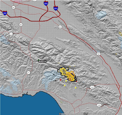
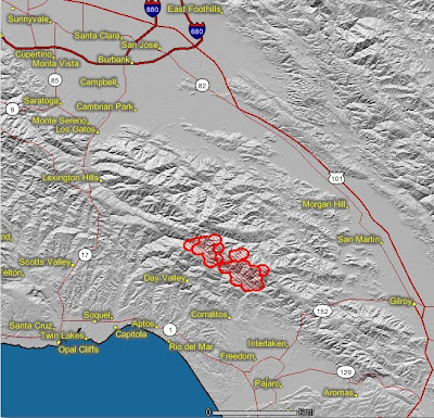
Click on the below map of the Summit fire to see a larger version. This map shows heat detected by satellites. The fire perimeter, as uploaded from the incident management team, is hard to see, but it is in yellow cross-hatching–it may not be very current.

Below is a map from Google uploaded by CalFire that has a little more detail. The perimeter was produced from infrared imagery at 1700 hours on May 23. This is a new application, to me anyway, and it is a little buggy. It takes a while to load and refresh. But I applaud CalFire for providing this service.

California: Summit fire, south of San Jose

Posted on Categories Uncategorized

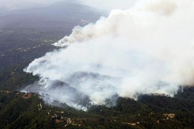
The Summit fire started early Thursday morning about 12 miles south of San Jose, California and over the course of the day grew to 3,000 acres in the Santa Cruz Mountains. By 5 PM local time on Thursday at least 10 structures had burned and 350 residents had been forced to evacuate with another 1,400 asked to leave their homes voluntarily. Heavy brush and timber along with winds gusting up to 50 mph were complicating firefighting efforts.


There was a report that it has the potential to grow to 10,000 acres. The cause is under investigation but a local resident said that she had seen someone burning debris piles recently near where the fire started and last week the piles were still smoldering.

The map below of the Summit fire shows heat in red as detected by satellites on Thursday.
Google has some interesting maps and photos of the fire.

Photo courtesy of Mercury News.