This year the U.S. and Mexico celebrated their 200th year of diplomatic relations, and for almost 25 years now the two countries have worked together in information-sharing and wildfire management. The U.S. Forest Service and the National Forest Commission of Mexico (Comisión Nacional Forestal, or CONAFOR) work with similar wildland fire challenges and a shared approach in the Incident Command System.
This collaboration has its roots back in 1998, when Mexico suffered through its worst fire season on record and was mounting a massive response to try to contain environmental damage and community threat. According to a recent feature story by the Forest Service’s International Programs, smoke from the 1998 Mexico fires caused serious air quality deterioration across hundreds of miles from Veracruz north to the Gulf States along the U.S. border.
The USFS sent literally tons of equipment, personnel, and other resources to Mexico, initiating what’s become a longstanding knowledge-sharing exchange. U.S. firefighters began then to regularly travel to Mexico to teach ICS principles and operations and to share resources, and Mexican firefighters started traveling here to help fight fires and add skills alongside U.S. firefighters.
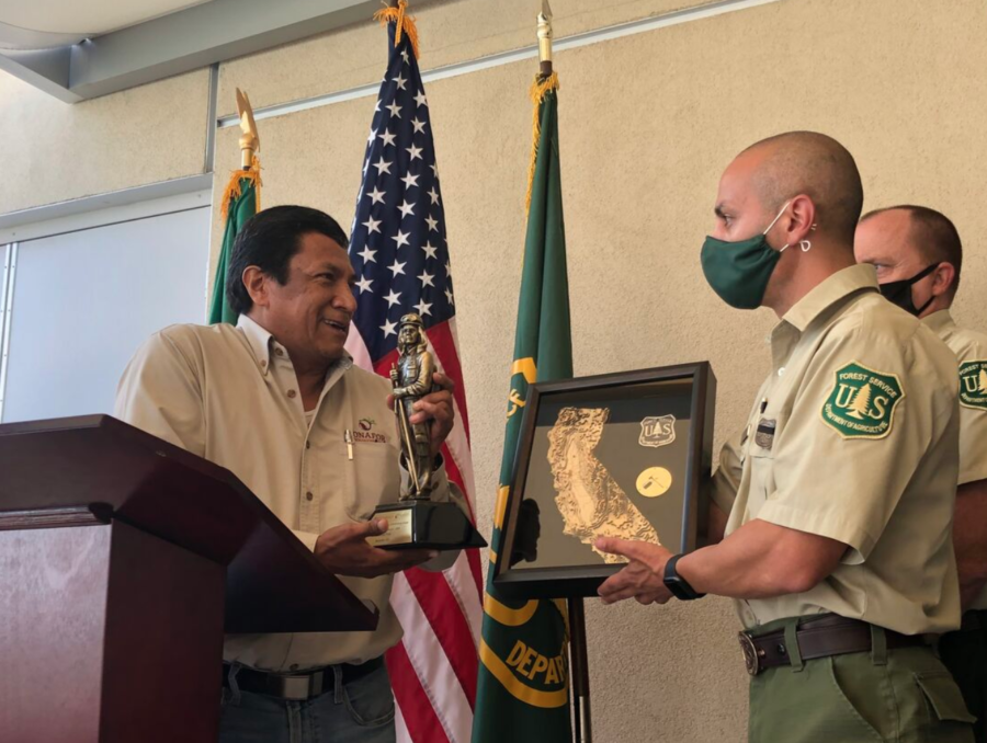
Eduardo Cruz with USFS Region 5 fire people photo courtesy CONAFOR
Eduardo Cruz traveled from Mexico to the Sequoia National Forest soon after the 1998 fires. He worked on a helitack crew in California and launched longtime international friendships; Cruz is now the fire management director of CONAFOR. During 2020’s brutal R5 season, he brought five crews of Mexican firefighters to California to work on fires — the first time that Mexico had sent an entire delegation of firefighters to support U.S. efforts.
CNN reported back in September 2020 that the Mexican crews brought to California by Eduardo Cruz worked on the Sequoia Complex, which at the time had burned more than 144,000 acres and was just 35 percent contained. “Fires do not have borders, fires do not have different languages and cultures,” Cruz told CNN. “In the end we all speak the same language when it comes to fighting fire.”
The Forest Service has a 2020 photo album online [HERE].
An archived story from WILDLAND FIREFIGHTER Magazine about the 1998 fires in Mexico is online [HERE]. (NOTE that it’s on the archive.org website and most of the old links on that page are no longer functional.)
The National Wildfire Coordinating Group (NWCG) has added the DoD as a primary member of its executive board.
“A key function of NWCG is the establishment of standards for the wildland fire community,” said Shane McDonald, NWCG Executive Board Chair. “With the addition of DoD to the Executive Board, they will now be a part of the process to help create the common operating framework for wildland fire resources.”
Across its 27 million acres of land used for training and testing, DoD manages about a million acres for wildland fire, according to a press release from the Homeland Security news. Including the DoD on the NWCG board acknowledges the cross-jurisdictional nature of wildfire and will contribute to the interagency approach of the federal agencies in charge of fire management.
NWCG provides national leadership to enable coordinated wildland fire operations among federal, state, local, tribal and territorial partners. Other primary members of NWCG include the Forest Service, Bureau of Indian Affairs, Bureau of Land Management, National Park Service, U.S. Fish and Wildlife Service, National Association of State Foresters, U.S. Fire Administration, Intertribal Timber Council, and the International Association of Fire Chiefs. Associate members include the U.S. Department of the Interior’s Office of Wildland Fire and the National Weather Service. The NWCG priorities include training, operations standards, qualifications, IT requirements, research, policy, and safety. More info is available on the NWCG website.
Increased spending on wildland fire suppression risks states’ fiscal stability, according to a recent report from The Pew Charitable Trusts. Over the last ten years, the five major federal fire agencies within the Department of the Interior and the Department of Agriculture have nearly doubled combined spending on wildland fire.
State governments, particularly those in the West, operate under differing budgetary constraints and organizational approaches to wildfire management, according to the report, but unlike the federal agencies, states are required to balance spending and revenue every budget cycle. After their extensive review of existing research and available data, the Pew researchers completed 18 semi-structured interviews between December 2021 and July 2022 with wildfire and budgeting experts in six states — Alaska, California, Florida, Nevada, Texas, and Washington. They also interviewed key fire officials with the DOI, the USFS and FEMA, and the National Association of State Foresters — which has information on all states’ wildfire management online.
Oregon Public Broadcasting reported that the Pew study looked at how states budget for wildfire costs, the challenges with those budgets, and what might be done for improvement. Each of the analyzed states primarily uses general fund appropriations to pay for wildfire costs upfront; revenue for the general fund comes from state taxes and fees and is used for general state operations.
“To the extent that more expensive and unpredictable wildfires are being pulled from that same pool of money, it’s a problem for state fiscal stability moving forward,” Colin Foard with the Pew Trusts told OPB. “As fires have grown, so has government spending on the costs associated with them.”
The report and other related studies are available online from PewTrusts.org.
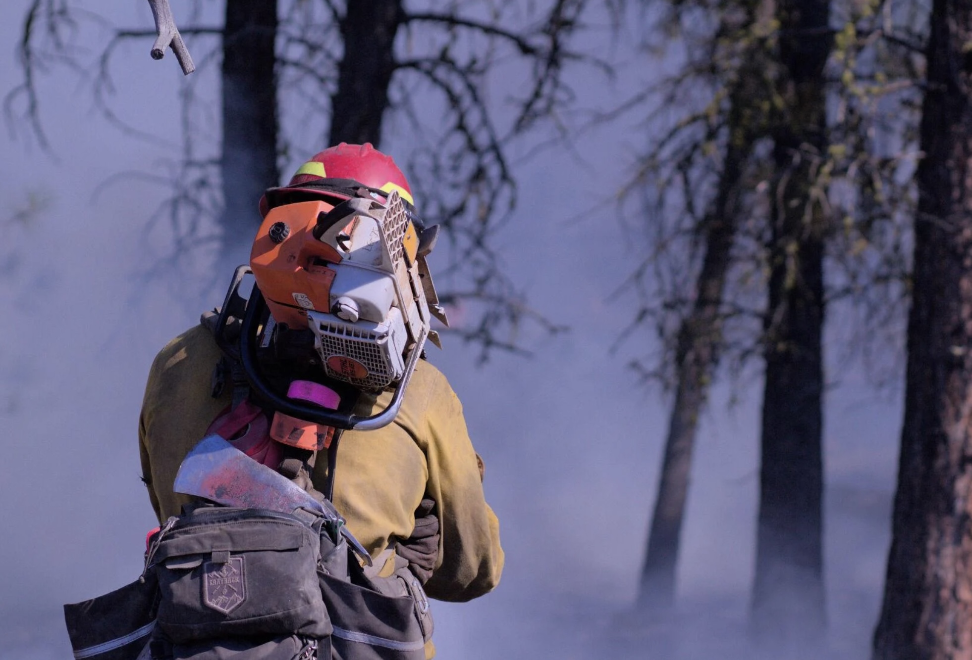
A Grayback employee at the Starr 6 prescribed fire, Oct. 19, 2022. Tony Chiotti – Blue Mountain Eagle.
Editor's note
This article was written by Blue Mountain Eagle reporter Tony Chiotti who was on the scene of the Starr 6 prescribed on the Malheur National Forest in Oregon before it jumped containment and spread to private land on Oct. 19. In reporting this story, he drew on observations made that day as well as multiple interviews with Forest Service officials, burn crew workers, and landowners. It is used here with permission.
When Rick Snodgrass approached Grant County Sheriff Todd McKinley, he thought the sheriff was there to help him.
According to Snodgrass, he’d called for law enforcement to help control aggressive traffic and to deal with harassment his crews had been receiving while implementing a prescribed burn on the Malheur National Forest in Bear Valley, about 7 miles north of Seneca.
That burn — called the Starr 6 — had since jumped the fireline, and now there was active fire on both sides of County Road 63, where Snodgrass and McKinley met: the prescribed burn operation on Malheur National Forest land to the north of the road — now flaring up in gusts of wind — and an uncontained slopover on private land to the south. The crews under Snodgrass’ direction were now attempting to quell one fire while holding the reins on another, with tempers, smoke, wind and now traffic adding to the dangers to his crew.
But instead of assistance, what Snodgrass got was arrested.
When the sheriff cuffed Snodgrass, it is thought to be the first time a U.S. Forest Service firefighter has been arrested in the course of performing their job.
Snodgrass, the “burn boss” on the day’s operation, was taken away from the scene and charged with reckless burning, a Class A misdemeanor that carries a maximum penalty of a year in jail and a $6,250 fine. Before it was contained, an hour after it kicked off, the spot fire burned an estimated 20 to 40 acres of private land owned by members of the Holliday family.
The arrest of Snodgrass on Wednesday, Oct. 19, has drawn national attention and has fanned the debate over Forest Service fire mitigation policies, especially as they pertain to intentional burns adjacent to private lands.
And in the aftermath of this burn, there are accusations on both sides of this contentious debate about which actions on that day deserve the blame. Critics of the Forest Service and the affected landowners feel the conditions on the day never should have allowed the burn to proceed. Others, including Forest Service personnel who planned and executed the burn, say that by arresting the burn boss at the moment of maximum danger, the planned operation and the safety of the crews were placed in jeopardy.
“Other individuals were able to pick up the slack, fortunately, that were well trained,” Snodgrass said. “He put not only my guys at risk out there, their safety, but he put that land at risk as well as, you know, all of Bear Valley.”
The buildup
In 2015 the Canyon Creek Fire, which started with lightning strikes on Malheur National Forest land and spread to private ground, ultimately burned over 110,000 acres and destroyed 43 structures in Grant County.
There is general agreement that a hundred years of fire suppression has led to forests that are overfilled with fuel, a situation made more dangerous by a prolonged drought. Part of Canyon Creek’s legacy is the strongly held and polarized views on how to best prevent catastrophic fires in the future.
Proponents of prescribed burning see the scorched canyons along US 395 as a reminder of the stakes, the need to create buffers, remove built-up fuels and restore forests to a pre-suppression state where they can better survive the inevitable blaze, while critics of federal land management and the Forest Service see a constant reminder of botched containment efforts and mismanaged public land that only fuel their distrust.
“Every individual has a different opinion and motivation,” said Craig Trulock, supervisor of the 1.7 million-acre Malheur National Forest. “You have people that are just anti-federal and don’t want any federal agency doing anything that could affect their lands. Others don’t like prescribed burning for various reasons, whether it’s risk or a sense that it doesn’t achieve what we should be doing out there because they want every log to go on a log truck. And then you have people that are saying, ‘When you burn, would you please burn my property as well?’”
According to Trulock, the burn had been going to plan. “We were within prescription on the burn,” Trulock said, noting he couldn’t say much more as the incident is now the subject of an active federal and local investigation.
Firefighter at the Starr 6 prescribed fire, Oct. 19, 2022. Tony Chiotti – Blue Mountain Eagle.
The fire was the second day of prescribed burning in as many weeks. The burn area planned for Wednesday, Oct. 19, was 300 acres, including trees and meadowland within the Malheur National Forest in an operation involving federal, state and contract firefighting crews, according to information from the Forest Service.
This was among the first prescribed burns to be allowed after a new set of restrictions came into effect this year, following high-profile cases of prescribed burns getting out of control on federal land and causing massive damage, including the Calf Canyon/Hermit’s Peak blaze in New Mexico, which burned several hundred thousand acres and hundreds of structures this spring. After a 90-day pause on all prescribed burns, a revised set of restrictions was published.
As part of those new rules, before ignitions could begin in Bear Valley, a go/no-go checklist had to be completed on site.
This day’s final check represented the end of a multiyear process. That process involved an environmental analysis of the project area that included commercial logging, noncommercial thinning and burning treatments. The burn plan takes the form of a 100-plus-page document, updated year over year as the preparatory steps of thinning, fuel removal and tree grinding continued, all to get the area into ideal shape for a burn.
As part of the new rules, the final ignition authorization had to be signed by four people: the agency administrator, local unit line officer, burn boss, and fire management officer or duty officer. This process only authorizes ignitions for 24 hours, in effect giving all four officers veto power over the burn based on that day’s conditions.
On this day, all four individuals assessed the conditions, and all four signatures were affixed to the burn authorization, meaning ignitions could begin. One of those four signatures belonged to Rick Snodgrass.
Smoldering tensions
The ignition was delayed for about 45 minutes while crews did a grid search to ensure there were no cows in the burn area after hearing reports that the Hollidays still had some “stragglers” left on national forest land, a common occurrence as cows are seasonally moved off grazing allotments. The Windy Point Ranch allotment specified an Oct. 15 “off date,” but Chad Holliday explained that some fence that was burned the previous week, along with gates being left open by fire personnel, meant he couldn’t be sure the cattle were all out.
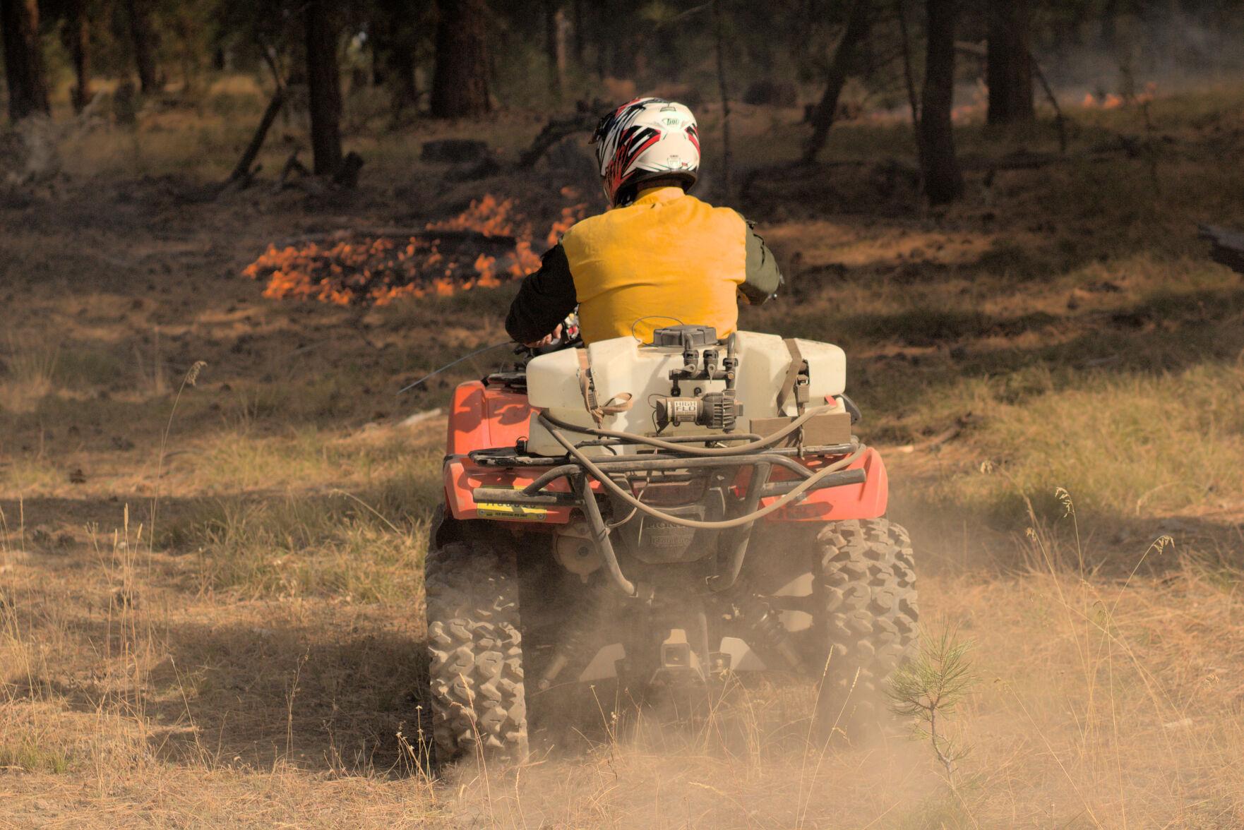
Initially, the burn went according to plan, with light winds of 0-3 mph and the heat of the fire drawing smoke up into a clean, bent column over the county road. The fire moved slowly across 50 acres over the course of five hours, with fire crews monitoring the progress of its leading front and continuing drip-torch ignitions.
Ignitions paused in the afternoon, to begin again a couple hours later. It was then that the wind picked up and a few trees in the interior of the already-burned area torched, sending up “duffers” with the smoke, up and over the road.
Members of the Holliday family, who own the Windy Point Ranch and other land adjacent to the burn area, were standing across the county road from the fire as an ember from the burn area touched town on their ranch, starting a new fire that soon began to spread.
“We were glad to see Oregon Department of Forestry and Grayback (contract crews) show up,” said Mandy Taylor, Chad Holliday’s sister.
ODF and Grayback Forestry crews were contracted to work alongside Forest Service employees throughout the day’s burn, but due to tensions between the landowners and the federal crews, they were eventually asked to take over mop-up after the flames of the spot fire were extinguished, according to Trulock, who said the move was meant to calm tensions on the scene.
Those kinds of tensions are not unusual.
“I think in a lot of parts of Oregon, it’s just a very real experience for federal employees to have a lot of hostility towards what they’re doing right now,” said Christopher Adlam, a regional fire specialist for Oregon State University’s Extension Service. “I’m not saying that people don’t also appreciate firefighters and thank firefighters. But it’s a pretty common thing in some parts of Oregon for federal employees to face hostility.”
Indeed, federal crews called the regional interagency dispatch center on both days of the burn to report verbal harassment, threats and aggressive driving through the smoke, and to request law enforcement assistance on the scene.
The Hollidays maintain they were welcoming and cooperative with federal crews, providing access to their land in order to contain the blaze. But as the fire spread and crews worked to contain it, the Hollidays called 911. They didn’t call to report the fire. They asked for the sheriff. “We knew that somebody was doing something wrong,” said Taylor.
Planning for contingencies
If you use the phrase “controlled burn” in the vicinity of firefighters operating a prescribed burn, you will be corrected.
This is fire. You don’t control it. The best you can plan for is to manage it and be prepared if the fire has other ideas.
Adlam points out that spillover fires like the one that happened in Bear Valley are rare occurrences but can still have a huge impact on people. “I think that, the last 20 years, we’ve had one other occurrence of a burn crossing over from federal land onto private land in Oregon,” he said.
The Malheur National Forest supervisor notes that the spillover was quickly brought under control.
“They caught it with the resources they had on scene,” said Trulock. He noted that the number of crew on scene before the fire jumped was far more than their own burn plan had recommended, and that the new rules and added caution likely led to their ability to ultimately contain the spot. “We didn’t use any aviation or anything. The only additional resource we brought on was that dozer, and that was to really secure the edge of the spot so that they could then mop it up. So we were staffed enough to actually catch something like this.”
The Grant County Sheriff’s Office and the Forest Service estimated the size of the spot fire as approximately 20 acres. Chad Holliday estimates it as closer to 40, after measuring the perimeter of the area at “exactly one mile.”
“Somebody’s got to be held accountable”
As the federal crews were attempting to control the spot fire on the ranch, McKinley arrived. Chad Holliday received a call from his sister, who was on the scene and told him to get home. He arrived to see Sheriff McKinley speaking with people along the fence.
“I walked up, and Todd said, ‘Chad, right now you’re (being) videorecorded. You’re the spokesman for the ranch. Would you like to press charges?’ And I said, ‘Absolutely. Somebody’s got to be held accountable.’”
Holliday said McKinley then went directly to Snodgrass on the county road and “put the cuffs on him.”
The Eagle has filed a public records request for bodycam footage or any other video taken at the scene during this incident by the Grant County Sheriff’s Office. The newspaper is also seeking any other video footage captured at the scene that could further help establish the sequence of events.
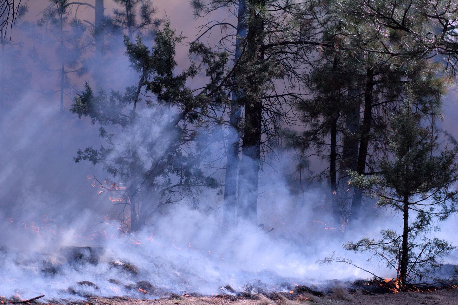
The Starr 6 prescribed fire, Oct. 19, 2022. Tony Chiotti – Blue Mountain Eagle.
“A reasonable person”
The fire was set in the days before predicted rain, and will likely prove to be the last of this year’s short burn season. But the issues surrounding prescribed burning and federal land management, especially as it impacts private landowners, will undoubtedly remain a flashpoint in Grant County.
For now, as the investigation continues, McKinley is playing things close to the vest. He’s declined offers to comment on the case beyond his initial press release, which said “details cannot be released at this time.”
Grant County District Attorney Jim Carpenter has been slightly more forthcoming, stating in his own press release that just because the burn boss was working as part of a federal crew doesn’t mean he will be shielded from potential legal consequences.
“To be clear, the employer and/or position of Snodgrass will not protect him if it is determined that he acted recklessly,” he wrote. “That the USFS was engaging in a prescribed burn may actually raise, rather than lower, the standard to which Snodgrass will be held.”
Carpenter lays out in his release the full legal standard for determining if a burn is or is not “reckless” as defined in Oregon statute: “The risk must be of such nature and degree that disregard thereof constitutes a gross deviation from the standard of care that a reasonable person would observe in the situation.”
McKinley, known as a level head in the wider context of Grant County politics, might not have intended to make a statement. But this extraordinary arrest has caught national attention and sparked debate in the press and online. And now in the actions of the sheriff and the actions of the Forest Service, both sides see actions that created real danger.
Critics of the Forest Service point to the simple fact that the fire escaped the lines as evidence the conditions were unsafe and that the fire should never have been approved. To the Hollidays, and those skeptical of federal land management in general, it’s a clear measure: the fire got onto their land and threatened or destroyed their property. How could that have been a reasonable thing to do?
It has also stirred the ire of wildland firefighter communities, who fear this development will set a precedent and only complicate an already difficult and dangerous job. And in these groups’ online conversations, it is clear many believe that the arrest created a situation on the ground that may have added to the real risk faced by fire crews in Bear Valley.
“One of the huge watch-out situations in any fire operation is a transition in leadership,” said Trulock. “And that’s when it’s a plan to transition in leadership. This was obviously unplanned. What I would say is there were definite heightened risks because of that action. Until leadership can be reestablished under a new person, then everybody is distracted because they know something happened. And so it created a huge distraction in the middle of what I would consider is a relatively high-risk operation.”
Adlam, the Extension Service fire specialist, agreed.
“The burn boss’s role is never more important than at the moment where something happens that is not part of the plan,” he said. “If you cut off the head of an operation before it’s finished, how is that supposed to be leading to a positive outcome?”
When reached for comment on this story, McKinley clarified why he’s reluctant to say too much at this point.
He said he knows how it appears in the court of public opinion to withhold detail, but added that as long as it protects the process he just doesn’t care. “I just want to respect the case and not get too much detail out so that it doesn’t mess with potential jury pools and all that,” he said, “because then we’d have to have (the trial) out of the area.”
For McKinley, the important thing is that the facts surrounding this case and the decisions of Rick Snodgrass are ultimately determined by 12 reasonable people — ideally, reasonable people from Grant County.
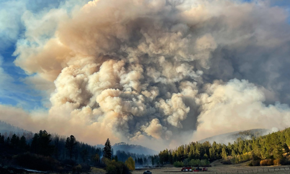
South Moccasin Fire in Montana, October, 2021. Photo by Lauren Kokinda, BLM.
By Matt Vasilogambros
As wildfires continue to burn in parts of the United States, state public health officials and experts are increasingly concerned about residents’ chronic exposure to toxin-filled smoke.
This year has seen the most wildfires of the past decade, with more than 56,000 fires burning nearly 7 million acres nationwide, according to the National Interagency Fire Center. While the total area burned is less than in some recent years, heavy smoke has still blanketed countless communities throughout the country.
Climate change is causing more frequent and severe wildfires, harming Americans’ health, pointed out Dr. Lisa Patel, deputy executive director at the Medical Society Consortium on Climate and Health, which raises awareness about the health effects of climate change.
“The data we have is very scary,” she said. “We are living through a natural experiment right now — we’ve never had fires this frequently.”
Patel sees the effects of wildfires in her work as a practicing pediatrician at Stanford Medicine Children’s Health, treating more women and underweight and premature infants at the neonatal intensive care unit when wildfires rage in Northern California.
As researchers focus on the public health impact of wildfire smoke, state health and environmental officials across the country have had to issue more air quality notices and provide guidance and shelter for residents struggling during periods of heavy wildfire smoke. And as experts have found, this issue isn’t isolated to the West Coast — it hurts more residents in the Eastern U.S.
Studies show that chronic exposure to wildfire smoke can cause asthma and pneumonia, and increase the risk for lung cancer, stroke, heart failure and sudden death. The very old and very young are most vulnerable. Particulates in wildfire smoke are 10 times as harmful to children’s respiratory health as other air pollutants, according to a study in Pediatrics last year.
What concerns experts is particulate matter in the air smaller than 2.5 microns across; there are around 25,000 microns in an inch. People inhale these microscopic bits, which then can embed deep in their lungs, irritating the lining and inflaming tissue. The particles are small enough to get into a person’s bloodstream, which can lead to other short- and long-term health effects.
Forecast for wildfire smoke at 12:01 a.m. PDT Sept. 1, 2021.
Particulates in wildfire smoke are even hindering national progress on reducing air pollution, after decades of improvement.
The federal Clean Air Act has substantially decreased the level of toxic particles from industrial and automotive pollution across the country since 1970, the U.S. Environmental Protection Agency notes. But air pollution is expected to worsen in parts of the West because of wildfires, some researchers have found. A United Nations report earlier this year warned of a “global wildfire crisis,” saying the probability of catastrophic wildfires could increase 57% by the end of the century.
Researchers are trying to better understand how more frequent wildfires affect human biology.
Keith Bein, associate professional researcher at the University of California, Davis, created a rapid response mobile research unit in 2017 that he deploys when there are fires around the state. He’s like a storm chaser but for wildfires.
With his mobile unit, Bein can measure particulate matter in the air, take samples back to his lab and then determine their toxicology and chemical compositions. When near these fires, he said, the smoke is so bad that it feels like there’s no escaping it.
“The smoke rolls in, and you get that sinking feeling all over again,” he said.
Massive wildfires that tear through communities are becoming more common. The fires aren’t just burning trees but also synthetic materials in homes. And with repeated exposure to different particulates, health risks are more pronounced and can evolve into chronic conditions, Bein said.
Researchers are just beginning to understand how more frequent wildfires in residential areas impact human health, he added.
“It’s happening more frequently every summer,” he said. “The length of the fires is growing. The public exposure to the smoke is also growing. Once-in-a-lifetime events are happening every summer. This is a different kind of exposure.”
In 2020, a study in Environment International found that winter influenza seasons in Montana were four to five times worse after bad wildfire seasons, which typically last from July until September. The findings shocked study lead author Erin Landguth, an associate professor at the University of Montana.
“We know that hospitalizations for asthma and other respiratory conditions spike within days or weeks of wildfires,” she said. “The thought that this could potentially lead to effects later and how that can affect our immune system is really scary.”
Landguth is currently expanding her study to all Western states. She expects to find a similar trend throughout the Mountain West and Pacific Northwest. Monsoon season in Arizona and New Mexico may disrupt the trend there, she said, while air pollution is already so bad in California from smog and other pollutants that it might be difficult to pinpoint how wildfires are harming human health.
But wildfires are not just in the West, nor is their health impact geographically isolated. Some fires burn so intensely at such high temperatures that smoke rises into the atmosphere, where strong winds can carry the smoke long distances.
This was glaringly apparent in 2021 when the sun glowed red, and the sky hazed over New York City and throughout the Northeast, as smoke drifted from massive wildfires in California, Oregon and other Western states.
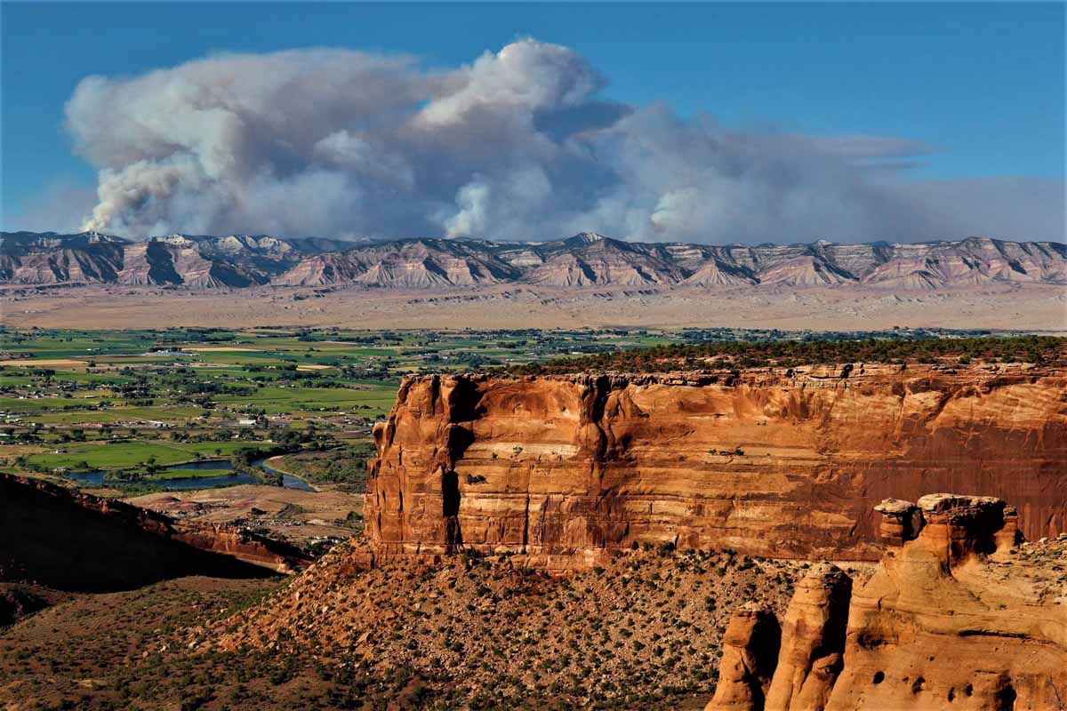
Shot from Colorado National Monument August 7, 2020 about 15 miles Southwest of the Pine Gulch Fire. The view is looking towards the northeast and shows some of the explosive activity on the northern front Friday and the huge smoke plume extending to the east. Photo by Jennifer Deering.
That smoke is hurting the health of more people in the Eastern U.S. than it is in the West, said Katelyn O’Dell, a postdoctoral research scientist at George Washington University, who released that finding in a study in GeoHealth in 2021. Wildfire smoke contributed to more asthma-related deaths and hospital visits in Eastern communities than those in the West, she and other researchers found, in part because of higher population density.
The smoke hitting the Eastern U.S. doesn’t just come from the West; there are wildfires and prescribed burns throughout the country, said O’Dell.
“It’s sometimes easy to feel distant from fires and their impacts when you’re far from the flames of these large Western wildfires that are in the news,” she said. “But wildfires impact the health of the U.S.”
The next orange sunset people enjoy should be a moment to check an air quality mobile app, she said.
In Minnesota, the state has issued 46 air quality alerts since 2015, according to the state’s Pollution Control Agency. Of those, 34 were due to wildfire smoke, and 26 of those were issued last year.
That took state officials by surprise, said Kathy Norlien, a research scientist at the Minnesota Department of Health. The wildfire smoke risk is not just coming from the plumes that drift from the West Coast and Canada, but also from wildfires in the Boundary Waters — a lake-filled region in the northern stretches of the state. She expects the problem to worsen in the coming years.
“At this point, we’re planning for the worst-case scenario,” she said. “We have not had the extent that the Western states have had. But with climate change and concern over drought and the dry conditions, planning is of the utmost importance.”
She meets regularly with the Minnesota Pollution Control Agency and other state officials about how to get the message to state residents about the increasing wildfire risk to public health, encouraging residents to sign up for air quality alerts. State officials also have established larger community centers and buildings as safe air shelters.
The public plays an enormous role in both preventing (nearly 90% of wildfires are caused by humans, according to U.S. governmental data) and adapting to wildfires, many experts say.
For people living in fire-prone areas, there are nonflammable building materials for new homes and indoor air purifiers and upgraded HVAC systems. But these solutions may be too costly for some families, said Patel, of Stanford Medicine.
She counsels families about how to affordably stay safe during wildfire season, encouraging the use of N95 and KN95 masks, which were pivotal in combating the spread of the coronavirus. She also shares designs for do-it-yourself air filtration systems.
But she emphasized that wildfires will continue to rage across the country and cause adverse health effects unless climate change is reined in through serious public policy. Until then, climate change will continue to be the biggest threat to public health, she said.
“Summer used to be a time I’d look forward to,” she said, “but now I look at it with dread with the heat and wildfires.”
First published by Pew Charitable Trusts on Stateline. Used with permission.
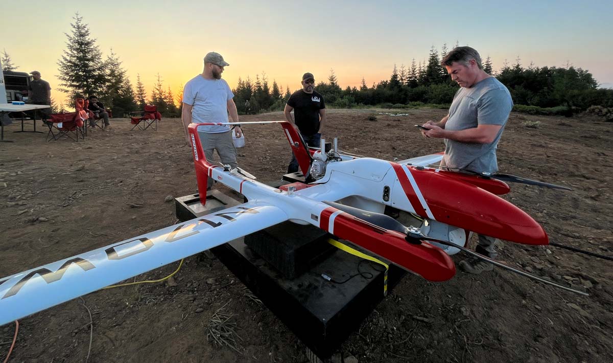
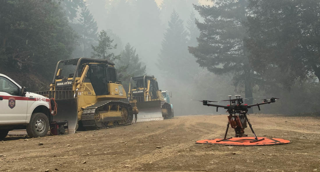
A contracted UAS crew with Precision Integrated Programs / Overwatch Aero — Tyler Kock, Daniel Rodriguez, and Cliff Savage — on the Lighting Complex of fires. US Forest Service photo by Andrew Avitt. FVR-90, N170WA.
By Andrew Avitt, US Forest Service, Pacific Southwest Region
Drones – also called UAS or unmanned aerial systems – are playing an increasingly important role in fighting wildfires by supporting operations with aerial ignition and gathering intelligence for firefighters. The greatest benefit drones provide is they can take to the sky when manned aircraft are grounded for pilot safety.
Take, for example the FVR-90, a fixed-wing drone with a 14-foot wingspan capable of traveling at speeds up to 46 mph with a flight time of 8 hours. They are sent airborne just at dusk when other manned flights are grounded. The sky is theirs, and the overhead view they have of the fire is detailed and in real time.
“The way we use UAS now is very much a supplement,” said Justin Baxter, the Forest Service National UAS Operations Specialist. “There are certain times that it’s just not safe for us to utilize manned helicopters or fixed-wing aircraft, like nighttime operations or in thick smoke or high winds.”
USFS photo by Andrew Avitt.
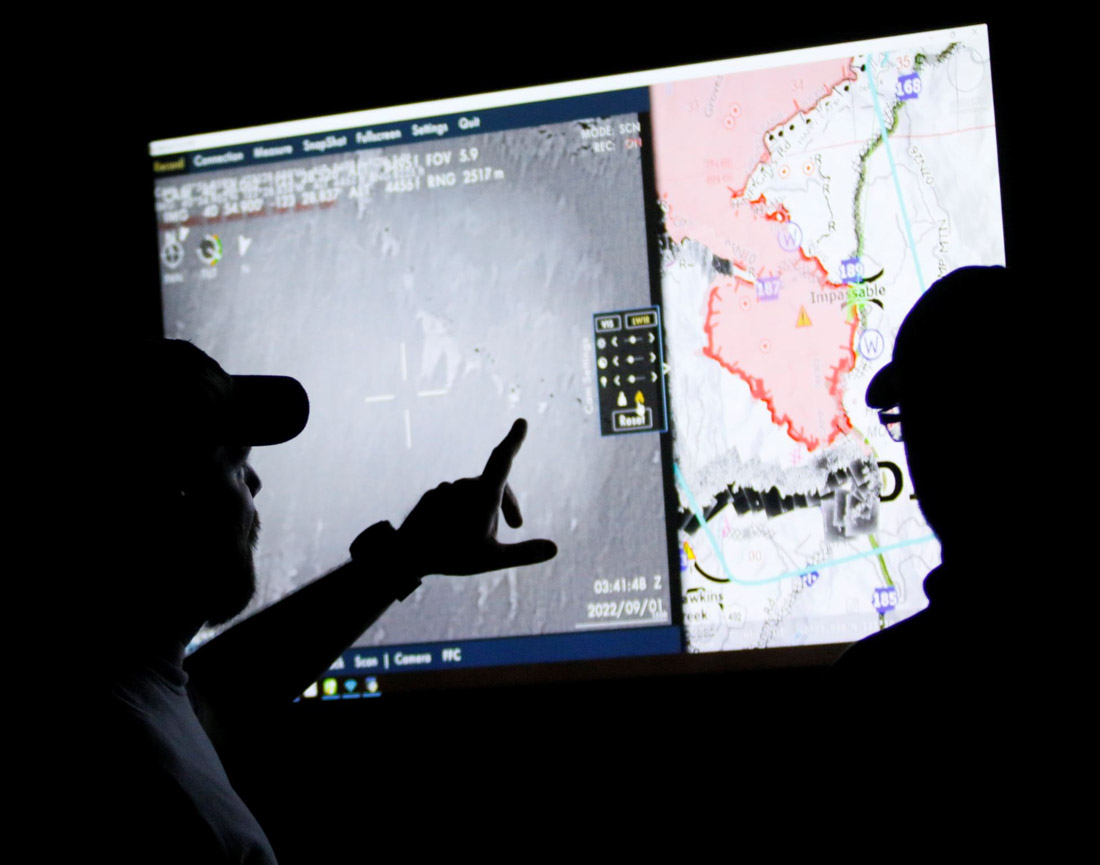
The drones that Baxter and his team fly are equipped with cameras that are not your normal cameras. They have multiple types of sensors, including infrared, that allow the team to see through smoke and, at night, see heat signatures, or thermal-based imaging. This allows the identification of areas where fire is still active and new areas where flames have advanced, such as spot fires.
Spot fires occur when embers from the main fire are thrown into the air and pushed by wind until they fall to the ground, starting a new fire. They are notoriously hard to identify because they are small at first and visibility is diminished by smoke. They may occur in hard-to-reach places difficult for firefighters to patrol, like on steep slopes or down in drainages.
“Drones are changing that labor-intensive process to identify these spot fires, especially when an operational area can span hundreds of thousands of acres,” Baxter said. With drones, fire managers and incident management teams can scan large areas quickly and easily identify spot fires that may be a mile from the main fire. That enables firefighters to get in and suppress those new starts before they grow.
“To give you an idea, this drone can detect a 2-inch by 2-inch spot fire from a half-mile away,” said Baxter as he gestured to the imposing drone just to his left minutes before takeoff to fly around the perimeter of the Six Rivers Lightning Complex Fire near Willow Creek, California.
Baxter said that much has changed since 2015 when the agency began the UAS program. With each passing year, incident management teams have increasingly incorporated the capability into their strategies.
The communication between the UAS crew and firefighters on the ground flows in both directions. The drone may be flying over and see heat in an area and transmit the information to a hotshot crew. Conversely, the hotshot crew can ask the UAS crew for assistance in exploring an area that they suspect might be active, and then view a feed from the drone of the area in question.
John Crotty served as the air operations branch director with California Interagency Incident Management Team 15 that responded to the Lightning Complex Fire on the Six Rivers National Forest.
A drone equipped for aerial ignition. USFS photo by Mike Yearwood.
Aerial intelligence isn’t new in wildland firefighting, said Crotty referring to the recently retired Cobra helicopter and its Firewatch capabilities. But the implications of unmanned flight— that opens up new possibilities.
“With the Cobra aircraft, we needed a pilot and an interpreter up there to run the camera and talk to the folks on the ground. So, we expose two individuals plus a flight [to risk],” said Crotty, “But what we really needed was the visibility to fly.”
Thick smoke on the fires like the Lightning Complex can ground manned aircraft. That’s where drones come into play and the images it captures can inform firefighters working across a large area.
“The other day I heard from one of the hotshot crews out there. They were in heavy smoke conditions, at night. With the low visibility they couldn’t see if they had a spot fire across the line,” Crotty said. “This tool being up in the air, looking down at that exact area, the UAS crew was able to pinpoint the spot and provide precise coordinates to the firefighters who were able to check it out and put it out. That kind of information we would never have without these unmanned aircraft and that capability. Drones are the future of aviation for not only fire but for aviation in general. It’s a win-win for the agencies to operate under an umbrella of this type of aircraft that can provide precise and timely info to firefighters and incident management teams. And most importantly, we can do it safely.”
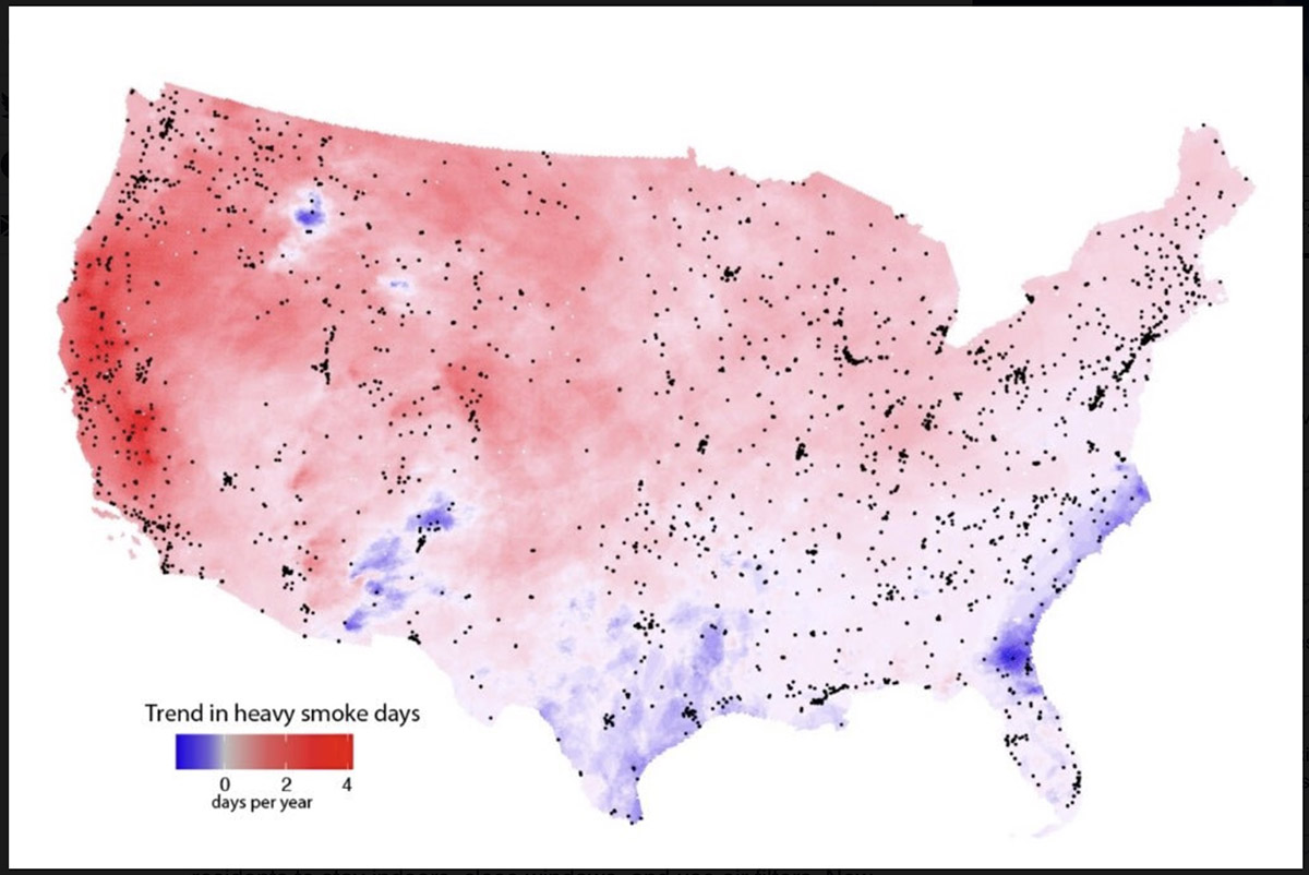
Measurements from satellites indicate rapidly growing exposure to heavy smoke plumes across much of the U.S. Map shows the estimated annual increase between 2011 and 2020 in the number of smoke plumes that NOAA analysts designate as “heavy,” their densest plume classification. Dots indicate EPA ground-based pollution monitors. Credit: Burke et al.
By Josie Garthwaite, Stanford University
When drifting wildfire smoke brings hazardous air pollution to cities and towns across the country, public health officials urge residents to stay indoors, close windows, and use air filters. New research from Stanford University shows Americans are getting the message, yet still rarely succeed at keeping smoke from entering their homes.
Researchers led by Marshall Burke, an associate professor of Earth system science, analyzed data from consumer-grade air pollution sensors in 1,520 single-family homes across the U.S., as well as nearby outdoor air pollution monitors, cell phones, social media posts, and Google searches in English and Spanish between 2016 and 2020.
They found internet searches for air quality information increased on heavy smoke days, regardless of income, while searches for air filters, smoke masks, and other protective measures recommended by health officials rose only in wealthy neighborhoods. Residents of wealthier neighborhoods are also more likely to shelter at home when wildfire smoke pollutes outside air. “People seem to know they’re being exposed. We see a lot of behaviors change even at pretty low levels of smoke exposure, although those responses differ by socioeconomic status,” said Burke.
The results, published July 7 in Nature Human Behaviour, show that better education and information about health hazards from wildfire smoke are not enough to protect people from the health harms of wildfire smoke exposure. The findings also bolster evidence for nascent efforts to take a more proactive and systematic approach to mitigating public health risks from wildfire smoke, predicted to be one of the most widely felt health impacts of climate change nationwide.
While most current government policies rely on a do-it-yourself approach to avoiding unhealthy air from wildfires, this tactic will have “modest and unequal benefits,” the authors write. Short-term solutions include establishing clean air shelters and providing public subsidies for lower-income households to filter indoor air. “If people can’t maintain good air quality in their homes, they need a place to go where they can breathe clean air,” said Burke, who is also deputy director of Stanford’s Center on Food Security and the Environment. “That’s a great place to start.”
Leaky homes
Overall, the authors found indoor concentrations of the deadliest type of particle pollution, known as PM 2.5, often remain three to four times higher than public health guidelines, and can vary by a factor of 20 between neighboring households during heavy smoke days. “Households that look exactly the same in terms of income, house price, and house size had enormously different indoor air for a given level of outdoor air quality,” said study co-author Sam Heft-Neal, a researcher at the Center on Food Security and the Environment. According to the authors, the most likely culprits are open doors and windows, leaky buildings, and a lack of filtration.
As the number of heavy smoke days in California and the West continue to climb, lawmakers from several western states have introduced bills that would allow the president to declare a “smoke emergency,” provide federal funding to establish clean air shelters and relocate vulnerable populations, and create a grant program for local community planning related to wildfire smoke. None have been enacted.
“To be able to intervene appropriately, we have to be able to measure things, including what people are exposed to in their home and how they’re behaving,” said Burke. That ability is rapidly expanding, thanks to the growing number of people buying relatively low-cost but reliable air quality monitors from PurpleAir, a private company, and agreeing to have the data put on a public website—although households who own the monitors, for now, are overwhelmingly Californian and higher income. “Our ability to precisely measure infiltration at the household level and then relate that to things we observe about the house or the community is new,” Burke said.
In the absence of systematic support at the federal level, a patchwork of local and state mitigation efforts has emerged. Oregon’s environmental agency, for example, has provided a grant for the city of Ashland to set up a free air purifier distribution program for vulnerable residents. In California, where more than half the population experienced a month of wildfire smoke levels in the range of unhealthy to hazardous during the 2020 fire season, the state has launched a $5 million pilot program providing grants for smoke shelters.
Still, most places are no better prepared for unhealthy air this year than they were in 2020 and, as large fires become more frequent, it will become increasingly onerous for people to protect themselves. “We’ve dug ourselves a huge hole in terms of the amount of accumulated dry fuel in our forests. It’s going to require unprecedented levels of investment over a sustained period to reduce fire risk and lower smoke exposures for everyone,” Heft-Neal said. “In the meantime, we have to be prepared for the large wildfires that, unfortunately, we’re going to get. And we have to be ready to deal with the downwind exposures that those wildfires generate.”
From the National Park Service, Yosemite National Park, August 12, 2022:
“We are sad to report that pioneering Yosemite scientist Jan van Wagtendonk died on July 15, 2022.
“Jan was a Yosemite and National Park Service legend: an accomplished scientist, a preeminent fire ecologist, a wilderness advocate, and a beloved colleague. He was an innovative wilderness manager, coming up with the trailhead quota system that we still use today to protect wilderness while ensuring that hikers are free to enjoy that wilderness on their own terms. His impact affects fire policy to this day as one of the authors of the first federal fire policy in 1995. Jan possessed an amazing intellect, deep humility, a sharp wit, and a profound love of Yosemite and the Sierra Nevada.
“Jan was a strong advocate for returning fire to the Sierra landscape. His pioneering use of prescribed fire in the early 1970s in and around the Mariposa Grove started us on the path to reestablishing an ecological balance lost in over 100 years of fire suppression. There is poetry, in the words of Jan’s son Kent, that in Jan’s final days the fruits of those efforts had a direct and dramatic effect in saving the Mariposa Grove from the Washburn Fire, which started just outside of the grove.
“Our heartfelt condolences go to Jan’s family and wide circle of friends and colleagues. He was one of a kind, and will be deeply missed.”
The article below from the US Geological Survey was originally written in 2020, based on an interview with Jan van Wagtendonk in 2019:
The first thing to know about emeritus scientist Jan van Wagtendonk is that he loves trees—always has and always will. As a kid, he looked at trees, inventoried trees, wrote a report on trees. One of his neighbors as a kid described young Jan by saying “I never saw him inside.”
He was a forest scientist before he even knew that was a thing you could be.
At age 13, van Wagtendonk was on two-months long family camping trip when he met a forest ranger. Upon realizing that he, too, could work with trees for a living, van Wagtendonk decided to become a forester. Several years later, he entered the forestry school at Purdue University in Indiana.
Wildfire 101
One day in college, van Wagtendonk found a listing on a campus bulletin board for a summer job on a wildland firefighting crew in Oregon. He applied, got the job, and headed West. It was his first experience with wildfire, the subject that would become his life’s work. Unsurprisingly, he loved Oregon—it had great trees—and ended up transferring to Oregon State University. He would spend several summers on fire crews in Oregon and then Alaska, first mopping up the final embers of wildfires and later working as a smoke jumper. The job was to put the fires out. Years later, his job became more about the opposite—reintroducing fire to Western forests.
Van Wagtendonk claims he “had no inkling about fire ecology at all” at the time, but he thinks that several experiences he had during his smoke jumping days may have shaped his thinking as a forest scientist and led him to fire ecology. In one instance, he was assigned to a put out a fire in a remote part of Alaskan tundra. The landscape was dotted with bird nests. The flames were about two inches high, and the fire crept along at about a foot per minute. Van Wagtendonk was struck by the birds’ seemingly nonchalant reaction to the fire: “the fire would be coming, they’d go up like this”—he mimes a bird flapping its wings and rising into the air a few inches as he tells this story— “fire’d go by, and they’d go right back on the nest.”
Many wildfires, he found, were not destructive. They burned slowly, part of the landscape.
After graduating from Oregon State University, van Wagtendonk served in the army as an officer in the 101st Airborne Division and as an advisor to the Vietnamese army. But after four and a half years, he was ready to move on and applied for graduate school, eventually ending up studying fire ecology under Dr. Harold Biswell at UC Berkeley.
Bringing Fire Back to the Forest
Van Wagtendonk began his study of fire ecology just as it was coming into its own as a field and taking forestry by storm. When van Wagtendonk was an undergraduate forestry major, fire ecology was only obliquely mentioned.
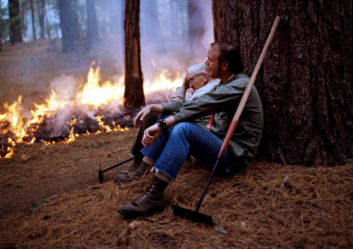
Dr. Harold Biswell (L) and Jan van Wagtendonk NPS sit against a ponderosa pine near a prescribed fire in 1970 in Yosemite National Park. Van Wagtendonk’s dissertation work on prescribed fire in Yosemite around this time led to prescribed burning guidelines still in use in Yosemite today, and a long career in forest and fire science with the federal government.
At the time, he says, “fire had not been truly accepted as an academic discipline, certainly not something you tell people you’ll set.”
Biswell, van Wagtendonk’s graduate school mentor, was something of an outlier. Biswell would conduct prescribed burns and then take students, scientists, ranchers, land managers, and interested citizens out into the field and show them what he was doing.
Those efforts paid off. By 1968, the year that van Wagtendonk began his doctoral dissertation, lessons from fire ecology were starting to reshape federal fire management policy. The National Park Service, in particular, began incorporating prescribed fire programs in recognition of the ecological role of wildfire; other agencies followed suit in the decade that followed.
Van Wagtendonk’s dissertation research played a major role in this transition. Biswell’s guidance for prescribed burning was based on experience.
“He could go out in the woods and snap a twig and say, okay it’s ready to burn,” as van Wagtendonk tells it. That method wouldn’t do if prescribed burning was to be adopted more broadly. For his dissertation, van Wagtendonk set out to quantify Biswell’s prescriptions. Van Wagtendonk conducted his work at Yosemite National Park after being turned down by the Forest Service. The result? A set of guidelines for prescribed burning that are still in use in Yosemite today.
From Wilderness Management to Megafires: A Career at Yosemite
Soon afterwards, van Wagtendonk was offered a job at Yosemite—and 48 years later, he’s still there, first as an employee and now as an emeritus. The decades have brought changes—to fire ecology, to the park, and to federal government science–and lots of fascinating research about fires, forests, and the way people engage with wild places.
In the 90s, van Wagtendonk moved from the National Park Service to the USGS along with many other federal scientists, keeping his home base at Yosemite. He was among the original scientists of the USGS Western Ecological Research Center that served on the founding Science Council under its first Director, Anne Kinsinger, who is currently the USGS Associate Director for Ecosystems. That Council helped form the Center into the outstanding scientific institution that it is today.
Van Wagtendonk’s research over the years has touched on many aspects of fire science. He has developed methods for mapping fuel types, assessed the effects of fire suppression and fuel treatments like prescribed fire, analyzed patterns of lightning strikes, and studied the influence of fire on owls and small mammals. Over the years, van Wagtendonk has incorporated new technology and methods to the study of fire and wilderness, including GIS, remote sensing, and computer modeling, not only using these tools but also publishing highly-cited guidance on using these tools for fire science.
Van Wagtendonk’s work hasn’t been limited to fire research. Early on in his time at Yosemite, he began to study recreation in the park, especially in its backcountry wilderness areas. Backcountry had increased drastically in the 1960s and ‘70s. Van Wagtendonk described the changes in a 1981 paper, writing that in 1972, managers found trampled vegetation, eroded trails, and up to 200 people camped at popular sites. In the 1970s, the park implemented mandatory permit and quota systems for backcountry use that were informed by van Wagtendonk’s research.
Van Wagtendonk has witnessed Yosemite and fire science shift over the decades. In several publications, he’s traced the history of fire policy and management in Yosemite and beyond. Visitor numbers have skyrocketed at Yosemite, and larger wildfires burn in California as the climate warms. In the past two decades, his research has given more attention to today’s megafires and climate change. There’s still a lot to learn about the future of fire.
It can take a long time for new science to really shape management on the ground, but van Wagtendonk marvels at how far we have come, and how much the still-young field of fire ecology has influenced policy already.
“It has been very gratifying to see my work actually be used in park management and beyond,” he says.
Van Wagtendonk has been in Yosemite for 48 years, and still can’t get enough of it. When he’s not working on his writing and research, he loves to hike and backpack the trails.
“I’ve hiked every trail in the park,” he says. “I’ve been backpacking every summer. . . I’m at the point where I’m going back to places I’ve liked the most . . .but I want to be able to keep doing that as long as I can, do it now before my legs give out.”
Jan van Wagtendonk in the Mariposa Grove, Yosemite National Park, approximately 2019. USGS photo.
Thanks and a tip of the hat go out to Jim, Gerald, and Kelly.

 This collaboration has its roots back in 1998, when Mexico suffered through its worst fire season on record and was mounting a massive response to try to contain environmental damage and community threat. According to a recent feature story by the Forest Service’s International Programs, smoke from the 1998 Mexico fires caused serious air quality deterioration across hundreds of miles from Veracruz north to the Gulf States along the U.S. border.