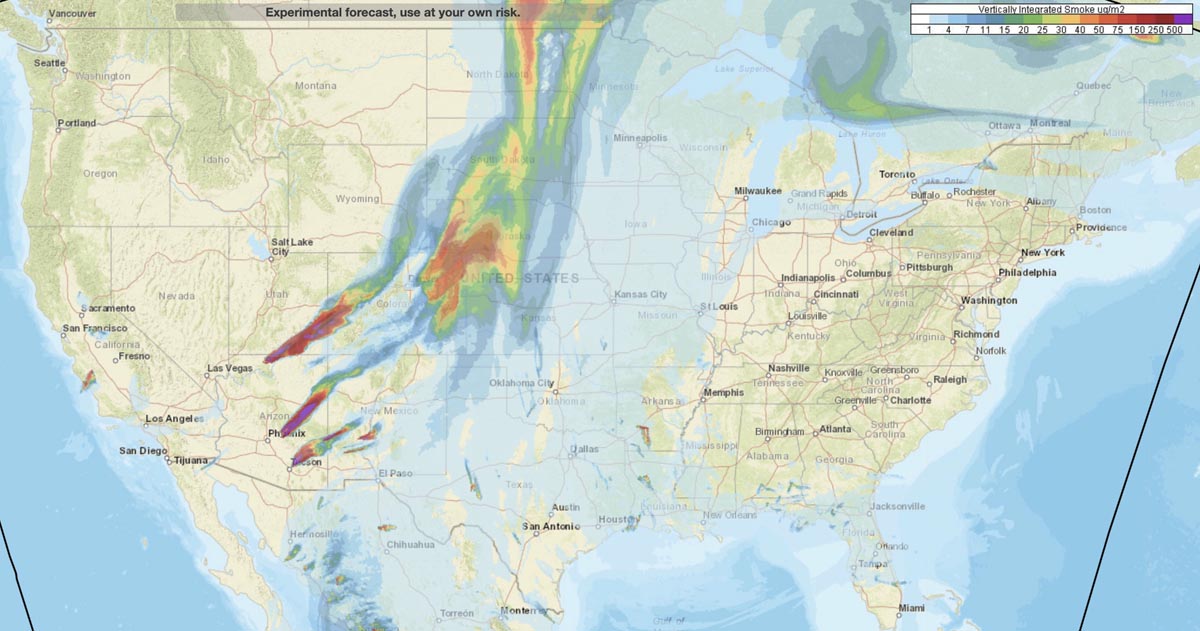
This is the forecast for the distribution of vertically integrated and near surface smoke at 7 p.m. MDT June 17, 2020. By NOAA.
The locations especially hard hit are areas in Arizona, Utah, Colorado, New Mexico, Kansas, and Nebraska.
News and opinion about wildland fire

This is the forecast for the distribution of vertically integrated and near surface smoke at 7 p.m. MDT June 17, 2020. By NOAA.
The locations especially hard hit are areas in Arizona, Utah, Colorado, New Mexico, Kansas, and Nebraska.
Nine firefighters and pilots were killed when the Sikorsky S-61N crashed in 2008
(This article first appeared on Fire Aviation)
A judge has refused to reduce the sentence for Steven Metheny, 50, the former Vice President of Carson Helicopters whose falsification of records for a Sikorsky S-61N helicopter under contract to the U.S. Forest Service led to the deaths of nine firefighters and crew members.
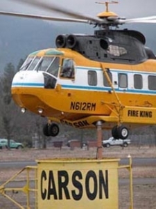
Metheny was accused of falsifying performance charts and the weights of helicopters his company had under contract to the U.S. Forest Service for supporting wildland fire operations. As of a result of his fraud, a Carson helicopter crashed while trying to lift off with too much weight from a remote helispot on the Iron 44 Fire on the Shasta-Trinity National Forest near Weaverville, California in 2008. He was sentenced to 12 years and 7 months in prison in 2015 for attempting to defraud the government out of more than $32 million and has been serving time in Lompoc, California.
Nine people were killed, including the pilot-in-command, a U.S. Forest Service check pilot, and seven firefighters. The copilot and three firefighters were seriously injured.
Below is an excerpt from a June 16, 2020 article in the Mail Tribune:
…[Metheny] argued last year that he wouldn’t have pleaded guilty in November 2014 to a count of conspiracy to commit mail fraud and wire fraud in U.S. District Court in Medford for lying about helicopter weight limits — which caused the Aug. 5, 2008, Iron 44 crash near Weaverville, California — had he known crash victims were going to be allowed to testify at his sentencing, or that he’d be ordered to repay tens of millions of dollars in restitution upon release from prison.
In a 13-page court order filed May 27, U.S. District Court Judge Ann Aiken denied Metheny’s motion to vacate or correct his June 2015 sentence, saying it doesn’t match Metheny’s allegations of ineffective counsel by his defense lawyer, Steven Meyers, nor does it match the court record.
Judge Aiken also presided over Metheny’s trial.
Metheny went to great lengths after the crash to attempt to conceal the fraud. When he knew that investigators would be examining the company’s operations, he directed other employees to remove weight from other similar helicopters, including taking off a fuel cell and replacing a very heavy battery with an empty shell of a battery. Some of the employees refused to participate in that deception, with one explaining that he was done lying about the helicopter’s weight.
During the trial defense lawyer Steven Myers argued that the helicopter pilot could have avoided the crash by doing a standard maneuver on takeoff, where the pilot hovers and checks his gauges.
Judge Aiken dismissed that argument, noting her father had flown helicopters in the Korean War, crashing 13 times. “Whether the gauges were right or not, the pilot didn’t have the right information,” Aiken told Metheny.
The Forest Service awarded contracts to Carson, including option years, amounting to over $51,000,000. Carson received $18,831,891.12 prior to the FS canceling the contracts.
Levi Phillips, 45, the former maintenance chief of Carson Helicopters, agreed to cooperate with authorities in the case against Mr. Metheny and pleaded guilty to a single charge of fraud. He was sentenced to 25 months in prison to be followed by 3 years of supervised probation.
According to the National Transportation Safety Board, there was “intentional wrong-doing” by Carson Helicopters that under-stated the weight of the helicopter and over-stated its performance in the documents they provided to the U.S. Forest Service when bidding on their firefighting contract. The NTSB estimated that the actual empty weight of the helicopter was 13,845 pounds, while Carson Helicopters stated in their contract proposal that the weight was 12,013 pounds. For the purpose of load calculations on the day of the crash, the pilot assumed the weight to be 12,408 pounds, which was 1,437 pounds less than the actual weight estimated by the NTSB. According to the NTSB, for the mission of flying the firefighters off the helispot that day, the helicopter was already over the allowable weight even without the firefighters on board.
In Mr. Metheny’s plea agreement there was an admission that the helicopters had not actually been weighed.
Killed in the crash were pilot Roark Schwanenberg, 54; USFS check pilot Jim Ramage, 63; and firefighters Shawn Blazer, 30; Scott Charlson, 25; Matthew Hammer, 23; Edrik Gomez, 19; Bryan Rich, 29; David Steele, 19; and Steven “Caleb” Renno, 21. The copilot and three other firefighters were seriously injured.
Thanks and a tip of the hat go out to Kelly. Typos or errors, report them HERE.
The fire moved across the iconic Four Peaks and has now burned 114,941 acres
(UPDATED at 8:13 a.m. MDT June 18, 2020)
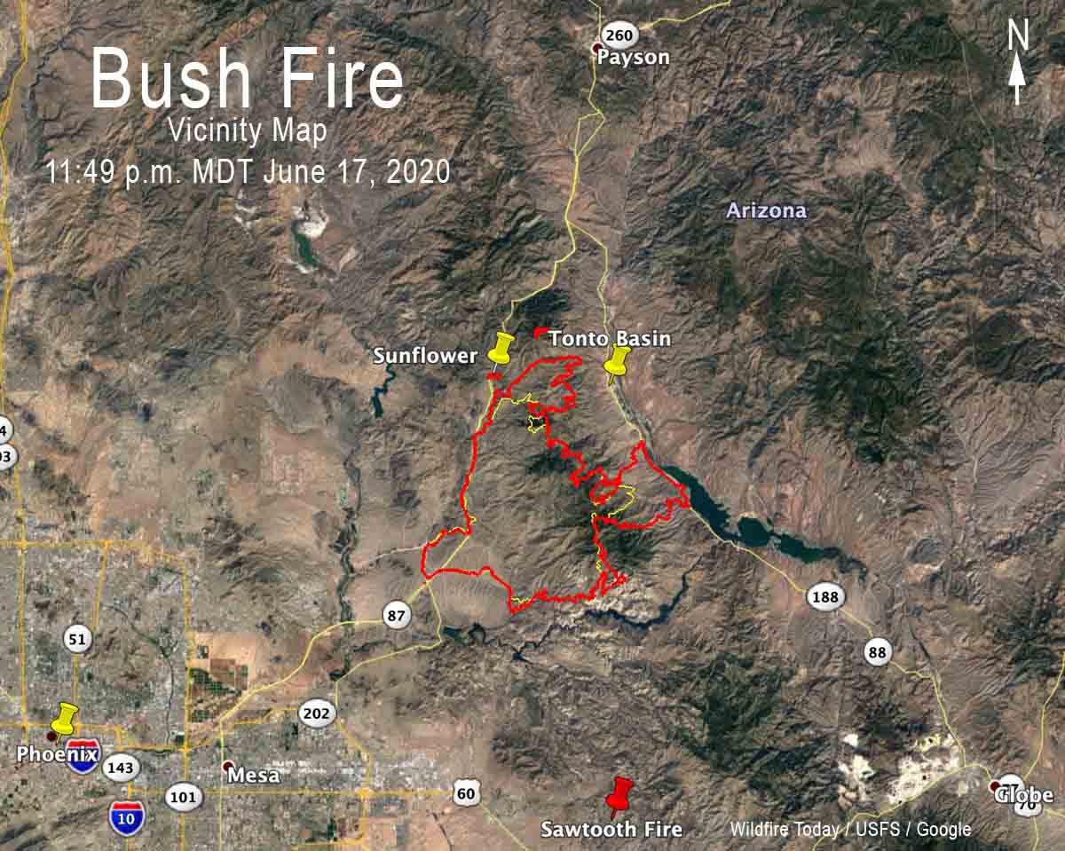
Firefighters on the Bush Fire northeast of Phoenix are fighting fire with fire, removing fuel ahead of the blaze by firing out to keep it from crossing highways and destroying structures.
Wednesday night firing operations were conducted south of Sunflower near Highway 87, near the fire lookout and communication facilities on Mt. Ord (2 miles north of the fire), and along Highway 188 south of Tonto Basin and Punkin Center. Fire is now established along approximately 10 miles of the west side of Highway 188.
For all articles on Wildfire Today about the Bush Fire northeast of Phoenix including the most recent, click here.
About 10 miles north of the fire fire officials are preparing areas around Jake’s Corner near the intersection of Highways 188 and 87 for burning out in order to protect structures.
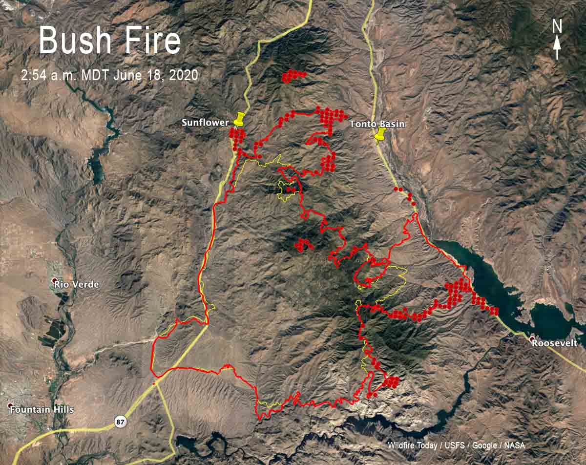
A fixed wing mapping flight at 11:49 p.m. Wednesday night determined that the Bush Fire had burned 114,941 acres, an increase of over 25,000 acres in 24 hours.
(UPDATED at 7:21 p.m. MDT June 17, 2020)
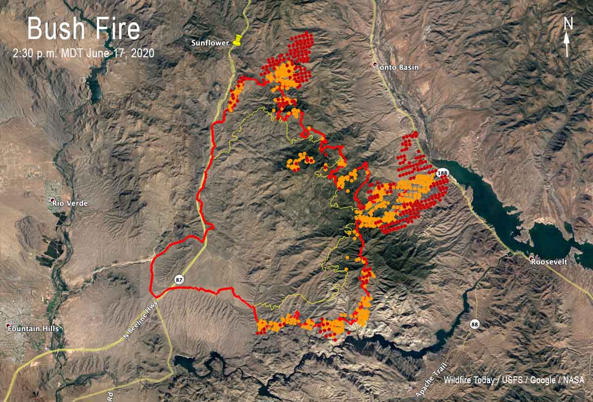
The Bush Fire east of Phoenix has been very active on Wednesday, chewing up more vegetation on the north, east, and south sides.
Between the time of the fixed wing mapping flight at 11:46 p.m. MDT June 16 and a satellite overflight at 2:30 p.m. June 17 the northernmost point of the blaze moved about three miles to the north-northeast, roughly parallel to Highway 87. During that same time frame the east side spread down the east side of Four Peaks and reached Highway 188. At 2:30 there was fire along approximately four miles of the highway at the north end of Theodore Roosevelt Lake four miles south of Tonto Basin. It is likely that firefighters helped tie in the fire with the highway by burning out, a tactic intended to remove the fuel ahead of the main fire in order to check its spread, preventing it from crossing the road.
Late Wednesday afternoon several large air tankers and helicopters were working on the south side of the fire west of Apache Lake north of the Salt River. This is most likely an attempt to keep the fire from crossing the river and moving into the Tortilla Flat area along Highway 88. If it does cross the river putting this huge fire out becomes much more complicated.
A Type 2 Incident Management Team has been managing the fire, but Wednesday afternoon the Southwest Coordination Center announced that a higher level team, a Type 1 Team, has been ordered with Alan Sinclair as Incident Commander. It has been unusual to have the lesser qualified team on this very large fire for this long as it approaches megafire status, 100,000 acres. Typically in a situation like this the incoming team will not assume command until Thursday or possibly even Friday, depending on how quickly they assemble (except those working remotely) and transition with the existing team members.
(Originally published at 10:07 a.m. MDT June 17, 2020)
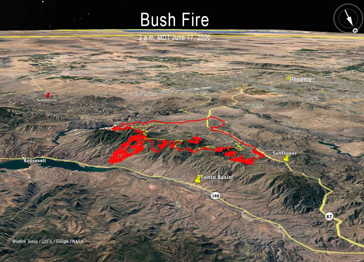
The “Bush Fire” east of Phoenix was very active again Tuesday and Tuesday night, spreading to the south, north, and east, moving across the iconic Four Peaks.
The fire spread aggressively north on the east side of Highway 87 to Boulder Pass coming to within two miles of the community of Sunflower.
For all articles on Wildfire Today about the Bush Fire northeast of Phoenix including the most recent, click here.
After a fixed wing aircraft mapping flight at 11:12 p.m. MDT June 16, a satellite overflight at 3 a.m. MDT June 17 revealed that the fire continued to move to the north and east. During that four-hour period satellite data showed that it spread two miles downhill almost reaching Highway 188 at the north end of Theodore Roosevelt Lake.
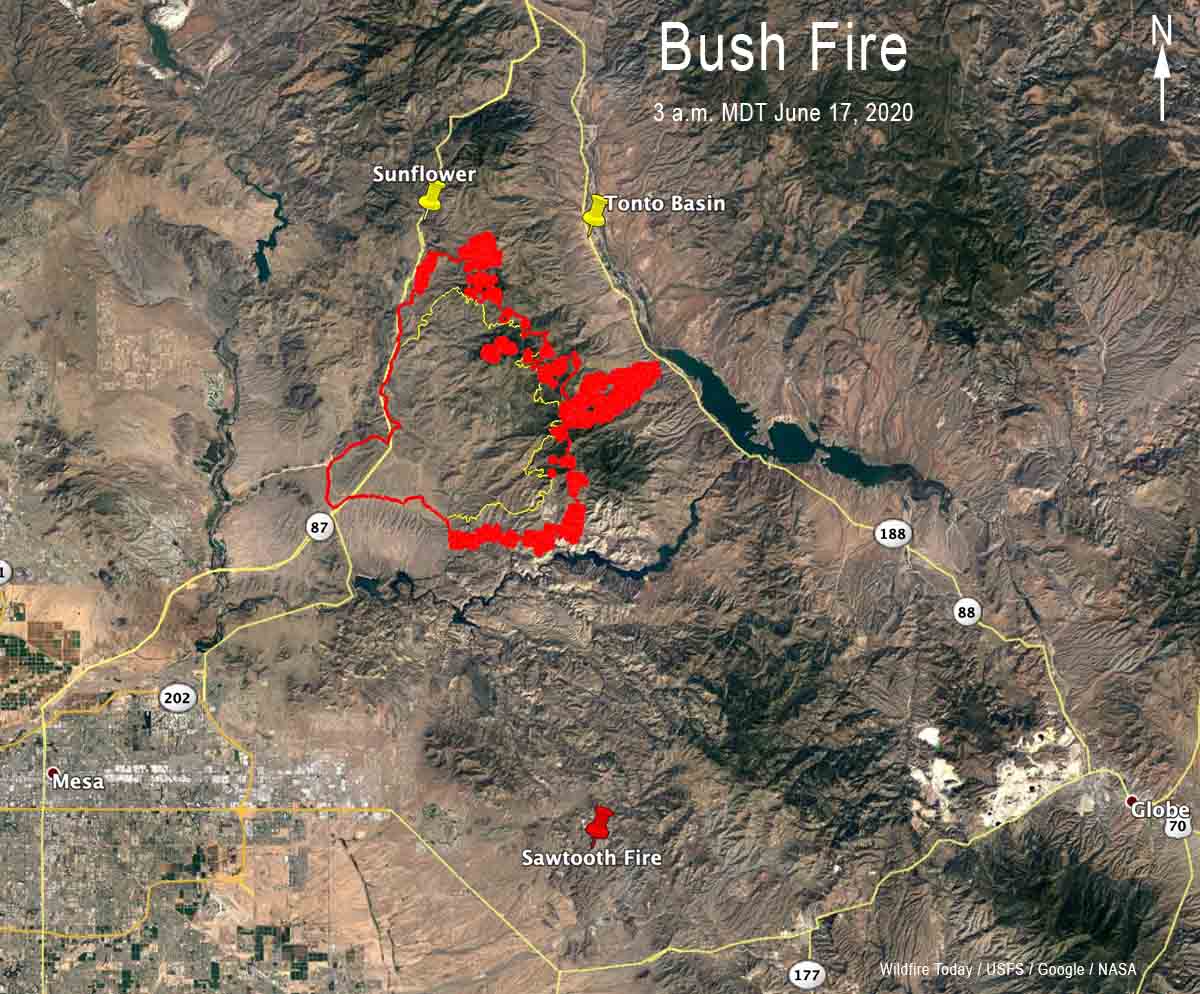
A Type 2 Incident Management team lead by Incident Commander Mark Bernal is managing the fire which was mapped Tuesday night at 89,058 acres.
Resources assigned to the fire according to the National Situation Report include 14 hand crews, 26 engines, and no helicopters for a total of 541 personnel.
There are no reports of structures being destroyed. Sections of Highways 87, 88, and 188 are closed due to the fire.
Information about evacuations that are in effect can be found at the official Facebook page for the fire.
The weather forecast for the fire area on Wednesday predicts 99 degrees, 8 percent relative humidity, and winds out of the south switching to the southwest in the afternoon at 13 mph gusting to 20 mph.
(UPDATED at 7:28 a.m. PDT June 17, 2020)

The relative humidity at a weather station on Hogan Dam Road near the Walker Fire increased early Wednesday morning, climbing to 74 percent. That will change later in the day under a Red Flag Warning with predictions for 12 to 17 percent in the afternoon with northwest winds increasing to 15 mph on ridgetops with gusts to 24 mph.
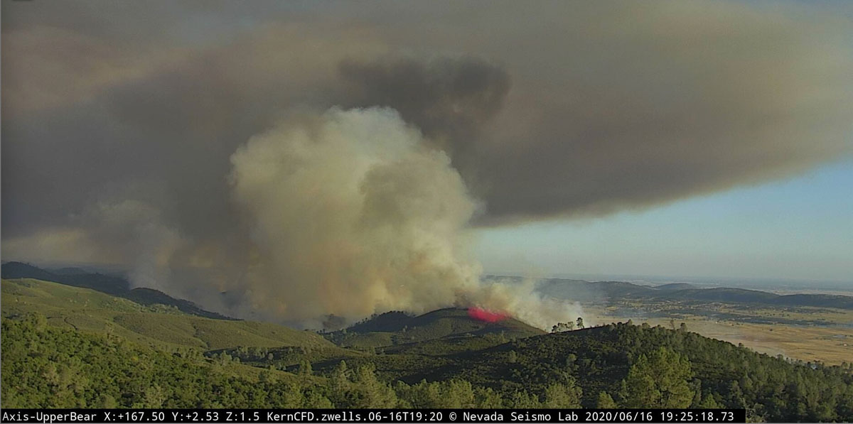
As you can see in the photo above taken Wednesday morning there was much less activity on the fire compared with Tuesday evening.

Firefighters planned for a substantial effort on Wednesday, placing an overnight order for 45 fire engines, 20 hand crews, four air tankers, and several helicopters.
There has been no update from CAL FIRE since Tuesday evening when they said the fire had burned 1,000 acres.
(Originally published at 8:01 p.m. PDT June 16, 2020)

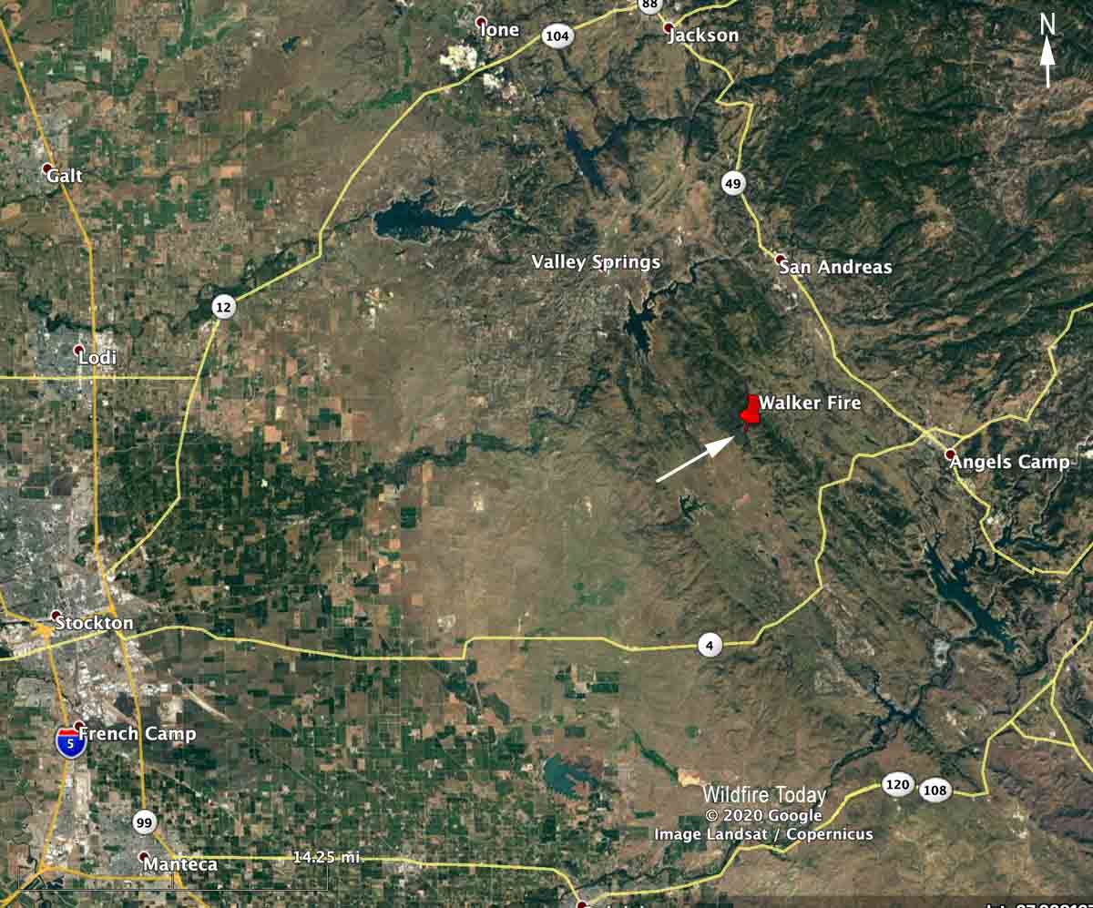
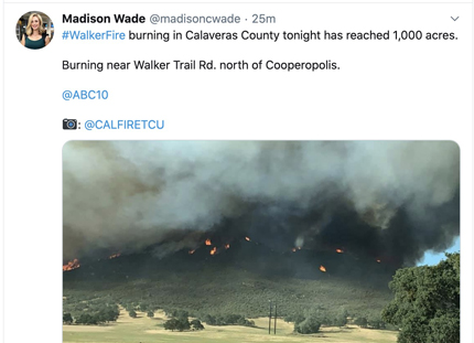
The California Department of Forestry and Fire Protection is battling the Walker Fire that broke out Tuesday afternoon about 10 miles northwest of Angels Camp and 29 miles east-northeast of Stockton.
The fire grew rapidly and by 7:30 p.m. firefighters estimated it had burned approximately 1,000 acres and described the rate of spread as “critical”, but were optimistic about making good progress in the coming hours. Numerous hand crews, engines, dozers, air tankers, and helicopters have been requested or are on scene.
The fire is close enough to the Upper Bear Alert Wildfire camera that excellent photos are available.

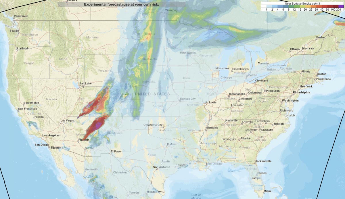
Smoke created by wildfires in Arizona, especially the Bush and Mangum Fires, is very noticeable in parts of Utah, New Mexico, and Colorado. NOAA’s map above of near surface and vertically integrated smoke, shows the forecast for 11 p.m. MDT June 16, 2020.
The fire was mapped by a fixed wing aircraft Monday night at 64,513 acres, an increase of 28,256 acres in 24 hours
(UPDATED at 6:37 p.m. MDT June 16, 2020)
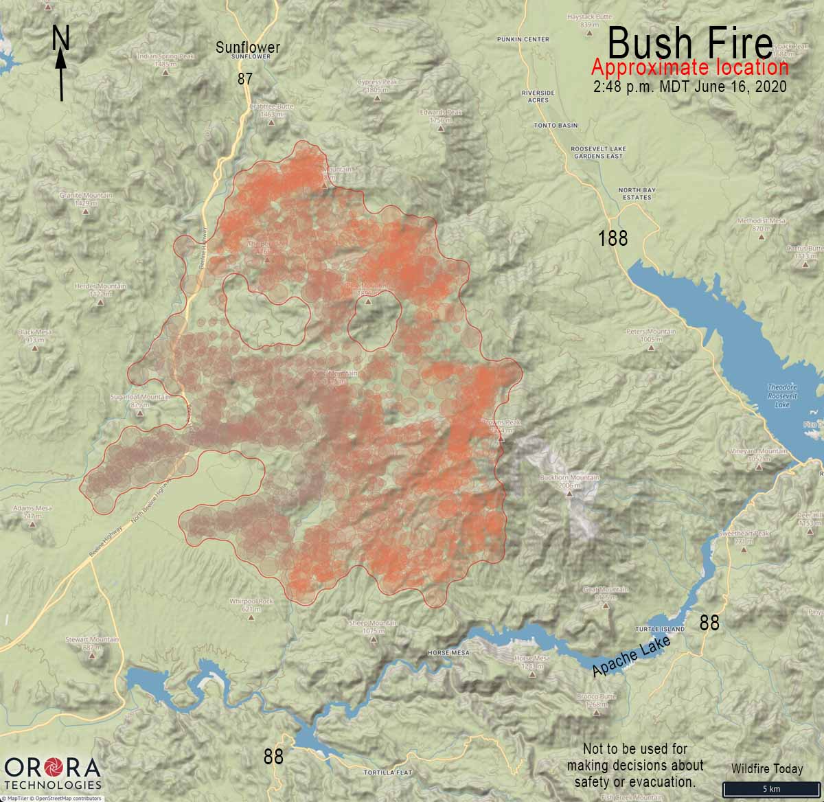
Tuesday afternoon the Maricopa County Sheriff’s Office issued an additional evacuation order, this time for an area on the south side of the Bush Fire — Apache Lake north of Highway 88:
More information about the evacuation can be found at the official Facebook page for the fire.
For all articles on Wildfire Today about the Bush Fire northeast of Phoenix including the most recent, click here.
(UPDATED at 2:26 p.m. MDT June 16, 2020)

Additional evacuations have been ordered for the Bush Fire.
From the Maricopa County Sheriff’s Office at about 1:30 p.m. MDT June 16, 2020:
ATTENTION: EVACUATE NOW
A “Go” notice has been issued in the area of Sunflower due to the Bush Wildfire burning along State Route 87. Residents in the Sunflower area should evacuate now. Grab your emergency Go-kit and go to your relocation area or with friends/family.
The Red Cross Evacuation Center has not been set up in Payson at this time. Drive with care and follow the directions of emergency personnel.
Just before the Sheriff’s Office issued the notice above, this was in another message about the new evacuation:
Evacuated residents should proceed north towards Payson. Proceed to the Payson Police Department at 303 N. Beeline Highway, Payson, AZ. 85541. Drive with care and follow the directions of emergency personnel.
More information about the evacuation can be found at the official Facebook page for the fire.
As of Monday night the Bush Fire had burned over 64,000 acres northeast of Phoenix, Arizona.
(Originally published at 8:07 MDT June 16, 2020)

The “Bush Fire” northeast of Phoenix grew substantially Monday adding another 28,256 acres to bring the total to 64,513 acres. All of the growth was on the north and east sides, spreading away from the greater Phoenix area, but moving closer to the communities north of Theodore Roosevelt Lake, including Tonto Basin and Punkin Center.
For all articles on Wildfire Today about the Bush Fire northeast of Phoenix including the most recent, click here.
The fire is in the Tonto National Forest, with much of it within the Four Peaks Wilderness. The blaze has already burned over Boulder Mountain and Pine Mountain, and is close to reaching Brother Peak and Browns Peak, the highest point in the Wilderness at 7,659 feet.
On June 15 the Gila County Health and Emergency Department announced the evacuation of Tonto Basin and Punkin Center from Highway 188 and A-Cross Road to Highway 188 at Rambo Realty. The Sheriff’s office has more information about evacuations on their Facebook page.
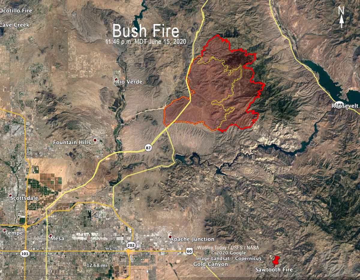
A Type 2 Incident Management Team, Southwest Team 5, assumed command of the fire Monday morning.
The fire started June 13 at 2:00 p.m. near the intersection of Bush Highway and Highway 87. The cause listed on InciWeb is “human caused, vehicle fire”.
As of Monday, no structures have been damaged or destroyed.
Hot and dry weather is expected for the next several days with winds out of the Southwest. Tuesday may bring red flag conditions which will cause additional challenges for firefighters.
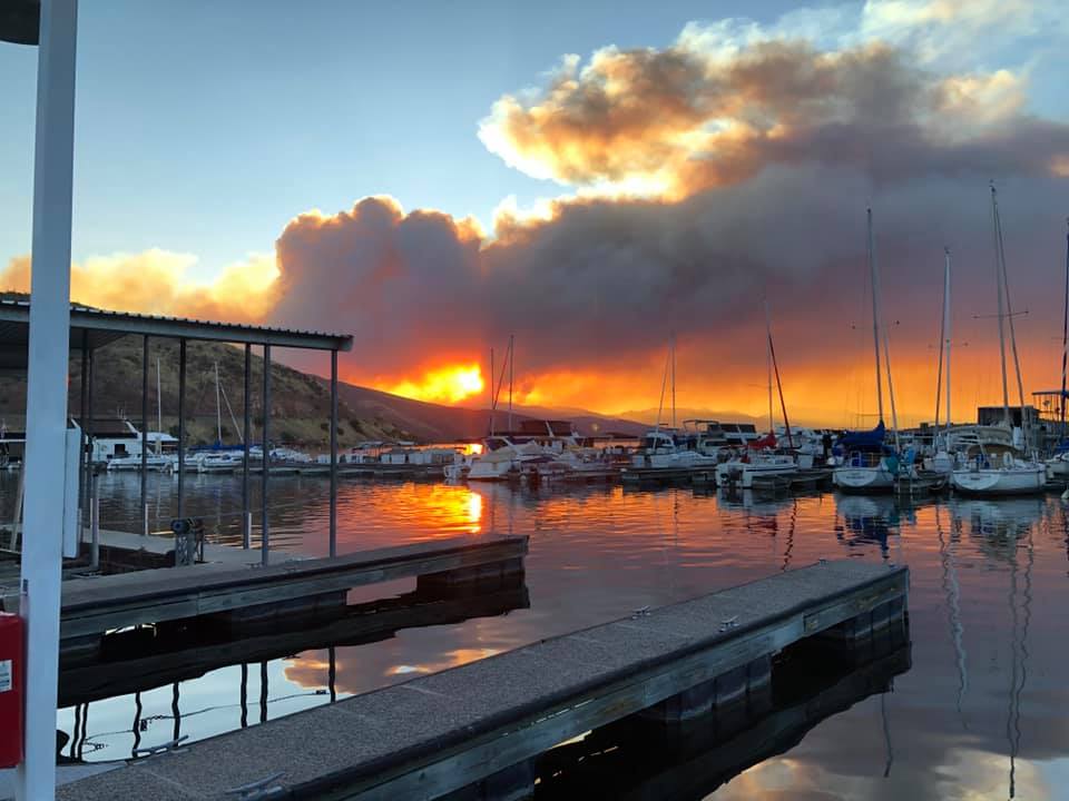
The Bush Fire has exceeded the size of the fire that for six years held the record for the largest fire in Arizona, the 61,000-acre Lone Fire, also in the Four Peaks Wilderness. It was caused April 27th, 1996 by a party of two campers who left a campfire unattended near Lone Pine Saddle. That record was blown away in 2002 by the 468,638-acre Rodeo-Chediski Fire at Show Low.