Will efforts to reduce carbon dioxide emissions affect forest management?

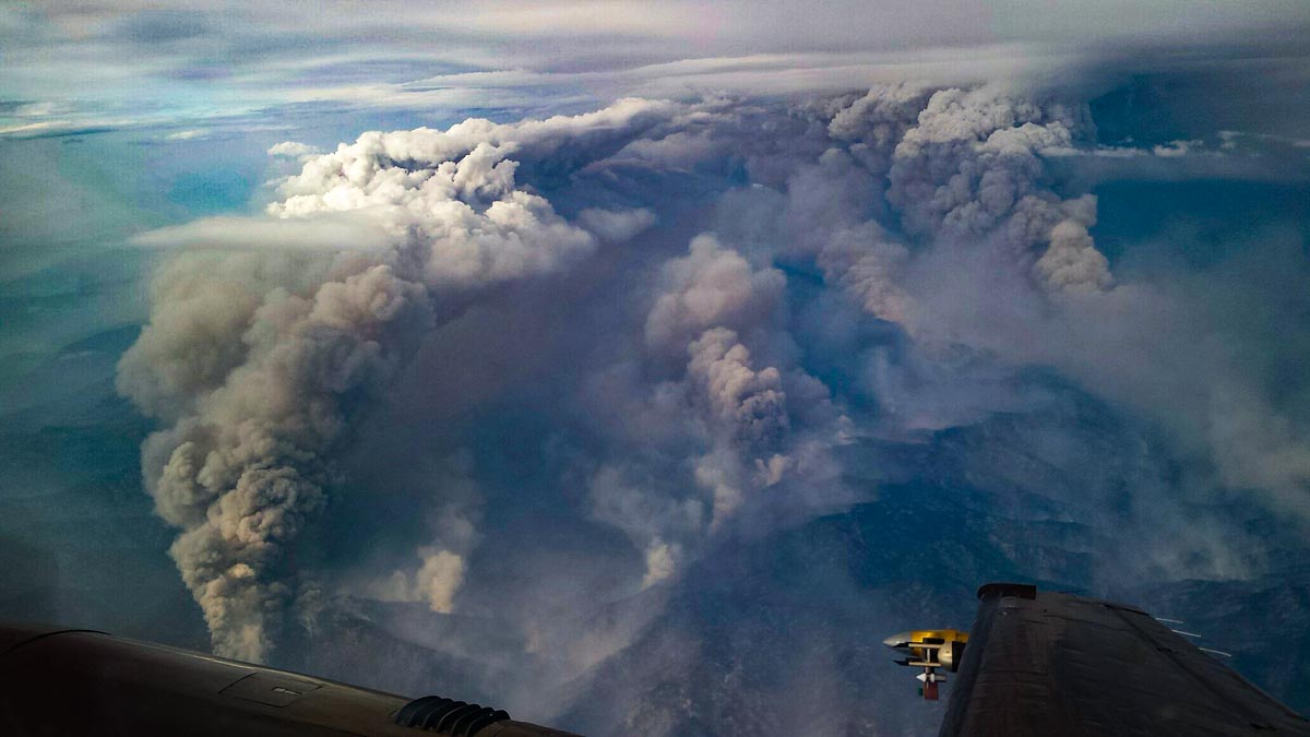
Convection column Pioneer Fire
Convection column on the Pioneer Fire, August 30, 2016. Photo by Nick Guy of the University of Wyoming.

In case you came to our website yesterday and saw the green banner saying the site was closed for the day to recognize the global #ClimateStrike, we are back in service as you can see.

On Friday millions of people across the world, many of them young,  assembled to help bring awareness to what I and others are convinced is an emergency — a climate emergency. The more scientists learn about the changing climate the more serious the situation looks. A few years ago we were hearing that we had to reach net zero carbon dioxide (CO2) emissions by 2050. That is a long way off and many of us will not be around then. But the young people marching today will be stuck with the results of what we do between now and then.

We still need to reach net zero CO2 emissions by 2050, but we can’t wait until 2049 to begin making changes. Scientists are saying that to reach that goal, emissions would have to start dropping well before 2030 and be on a path to fall by about 45 percent by 2030. The longer we wait to begin making significant changes, the more difficult it will be to meet the 2050 goal.

Scientists estimate that wildland fires make up 5 to 10 percent of annual global CO2 emissions when taking into account renewed forest growth in the burned areas. Fires also release other greenhouse gasses such as methane. Experts estimate that the wildfires in California’s North Bay in October of 2017 emitted as much CO2 in one week as all of the state’s cars and trucks do in one year.

Up until now fire management in developed countries has virtually received a free pass when it comes to CO2, at least compared to what it could become in the next 10 to 15 years. There is world-wide pressure now to rapidly reduce the burning of fossil fuels. It is only a matter of time before we start hearing a chorus saying all vegetation fires are “bad”, including prescribed or “good fires”, using a term now being used by some U.S. Forest Service personnel.

Land managers should be thinking about how to deal with strong pressure to significantly reduce CO2 emissions from burning vegetation. Part of the answer is additional firefighters, engines, dozers, helicopters, and air tankers. The U.S. Forest Service budget for wildland fire has remained flat for the last several years, while the costs of suppression infrastructure has increased. In light of the climate emergency, allotting fewer real dollars to suppression is counter intuitive. Congress and the President need to take action on this budget issue.

Fuel treatment projects, including mechanical projects and prescribed fires, can reduce the size and resistance to control of wildfires. However, pressure to reduce CO2 emissions could make it more difficult to obtain approvals to conduct prescribed fires even though the results if done on a large enough scale can reduce emissions from wildfires over the long term. But it will be difficult to develop the formula for the right mix and priorities of mechanical treatments, prescribed fires, wildfire suppression, or doing nothing.

There are many irons in that fire, so to speak, such as dealing with smoke, protecting communities, restoring forests, conserving water resources, wildlife, endangered species, and of course the amount of CO2 and other greenhouse gasses coming out of our forests as they burn one way or the other. It remains to be seen if all of those goals can be satisfied as we move closer to the climate emergency tipping point. Some of them may have to be de-emphasized. Land managers might be accused of being selfish if they insist on attempting to accomplish all of these traditional objectives that may exacerbate the climate for the entire planet. As well meaning as de-emphasis might me, unless skillfully implemented using the best science, the unintended consequences could actually increase CO2 emissions over time.

Precipitation slows fire season in the Northwest

Precipitation in the northwest one-quarter of the United States received over the last 72 hours will slow if not end the wildland fire season in some areas. The map shows precipitation detected by weather radar, which means there are gaps in areas with poor radar coverage.

According to the data, many areas received more than half an inch which will definitely have an effect lasting more than a few days.

You might notice that the rainfall in southeast Texas is completely off the chart, showing more than 15 inches. As this is written Thursday afternoon the Houston area is in the middle of the fifth 500+ year rainstorm in the last five years.


What has the weather been like in your area over the last week?

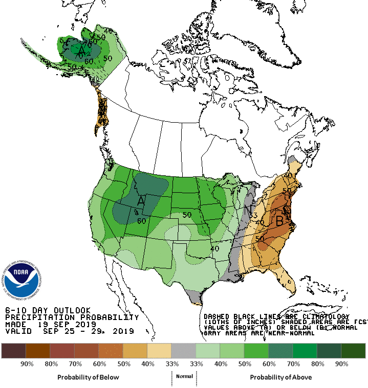
The maps below show the precipitation and  temperature outlooks for September 25 through 29.

temperature outlook 6-10 days precipitation outlook 6-10 days

Oklahoma firefighter suffered severe burns after becoming entrapped

The firefighter was operating a UTV when it became disabled

Oklahoma Map EntrapmentOn September 12, 2019 an Oklahoma firefighter operating a UTV became entrapped during the initial attack of a wildfire in the southeast part of the state 24 miles northeast of Antlers.   The Oklahoma Forestry Services released the following preliminary information about the incident.


“On September 12, 2019 during initial attack efforts on the Jack Creek Fire, an Oklahoma Forestry Services firefighter from the Southeast Area / Antlers District was involved in an entrapment and subsequent burnover while scouting control line opportunities. The fire was burning in steep, rugged terrain dominated by dense pine forest with occasional hardwood glades. The firefighter was operating a UTV scouting logging roads for access and suppression opportunities when the UTV became disabled. The firefighters escape route was compromised when fire behavior increased due to the fire making an uphill run in the flashy understory fuels and crown fire in the canopy fuels. The firefighter did not deploy his fire shelter.

“The dispatch office requested an ambulance at the time of the incident while Oklahoma Forestry Services and local fire department personnel located the firefighter. The firefighter was transported to ground ambulance then transferred to air ambulance taking the firefighter to a burn center. The firefighter remains at the burn center and is being treated for second and third degree burns on >30% of his body with the most intense burns to his face and hands.

“An Incident Review Team has been assembled.”


Thanks and a tip of the hat go out to Matt. Typos or errors, report them HERE.

A film about Rowdy Muir

A District Ranger and Area Commander

Rowdy Muir
Rowdy Muir. Screenshot from the video below.

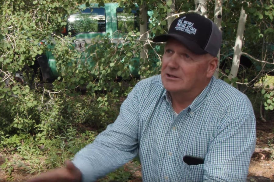
Near the beginning of the video below, Rob Morrow, a retired Fire Management Officer, said we don’t put enough effort into honoring those in the wildland fire profession that deserve recognition.

I don’t know why we don’t have a book about our General Pattons … our Abe Lincolns. Rowdy is one of those in our outfit. We need a story about leaders in the Forest Service and the wildland fire community. Rowdy will be truly a shining star in that book.

Rowdy Muir came up through the ranks in the U.S. Forest Service and the Bureau of Land Management and currently is a District Ranger on the Ashley National Forest in Utah and is an Area Commander on one of three existing Area Command Teams.

A third person featured in the video is Steve Jackson a retired “FOS”.

You may remember reading Mr. Muir’s initial thoughts about the 19 fatalities on the Yarnell Hill Fire that was written several months before the first official report was released.

Spread of the Taboose Fire slows, but strong winds predicted

Forecasters expect 30 to 40 mph winds on Wednesday and Thursday, changing directions about every 12 hours

3-D map Taboose Fire
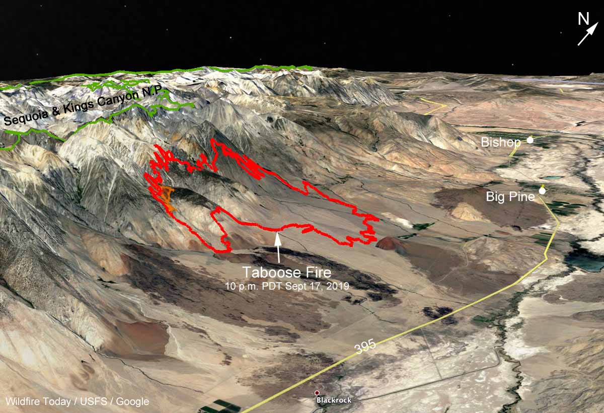
3-D map of the Taboose Fire mapped at 10 p.m. PDT September 17, 2019. Looking northwest. Click to enlarge.

(9:16 a.m. PDT Sept. 18, 2019)

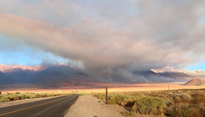
After burning 10,187 acres since it started September 4, the growth of the Taboose Fire on the east slope of the Sierras slowed Tuesday. A mapping flight found that the fire added another 174 acres primarily on the south side along Taboose Creek. Firefighters took advantage of lower winds Tuesday and continued to work on fire suppression and strengthening containment lines with crews on the ground assisted by helicopter water drops.

But 30 to 40 mph winds in the forecast for Wednesday and Thursday of this week could challenge firefighters, particularly on the south side in the Shingle Mill Bench area. The changing wind direction, which will shift about every 12  hours, will present even more headaches, coming from the south Wednesday, from the west Wednesday night, and out of the north Thursday and Thursday night. During this period the relative humidity at the base of the fire will be in the lower teens during the day. The wind event should be over by Friday. The area is under a Red Flag Warning until Thursday evening.

Taboose Fire
The Taboose Fire on September 8, 2019. InciWeb photo.

Most of the Taboose Fire is in the Inyo National Forest 7 miles south of Big Pine and 20 miles south of Bishop, California (see  map above). It is burning on a steep slope, from 4,700 feet on the east side up to 10,000 feet on the west where it could be running out of fuel. The ridge top at 13,000 feet is also the eastern boundary of the Sequoia and Kings Canyon National Park.

Mt. Whitney, the highest point in the contiguous United States is 27 miles farther south on the ridge at an elevation of 14,505 feet.

Resources assigned to the fire include 12 hand crews, 24 fire engines, and 5 helicopters for a total of 575 personnel.

Francis Fire requiring evacuations in Davis County, Utah

The fire is between Salt Lake City and Ogden

Francis Fire Utah

(Updated at 11:16 a.m. MDT Sept. 17, 2019)

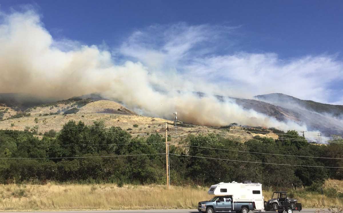
At 6:30 p.m. on Monday the size of the Francis Fire between Salt Lake City and Ogden, Utah was estimated at 100 to 200 acres but Tuesday morning fire officials said it spread since then to 550 acres. (Later in the morning that was changed to 365 acres.)

The  weather overnight was conducive to additional fire growth, with the relative humidity remaining in the 20s until it began rising after 2 a.m. eventually topping out at 82 percent at 7 a.m. when 0.03 inches of precipitation was measured at the BEUU1 weather station near Ogden. The overnight wind speed was 3 to 8 mph with gusts up to 20 mph.

In a briefing Tuesday morning fire officials said the cause of the fire was lighting that occurred a week ago.


Below is a video that apparently was shot shortly after the fire began spreading near Main Street and Haight Creek Drive.

It is not common for a lightning strike to ignite light to medium fuels, such as grass or brush as seen in the video above, and for it to smolder unreported for a week near a heavily populated area before growing into a large wildfire. But it is possible that investigators found evidence at the point of origin indicating a lightning strike and lightning occurrence data confirmed a ground strike at that location.

The mandatory evacuations ordered Monday were lifted at 10 p.m. Monday.


(Originally published at 6:47 p.m. MDT September 16, 2019)

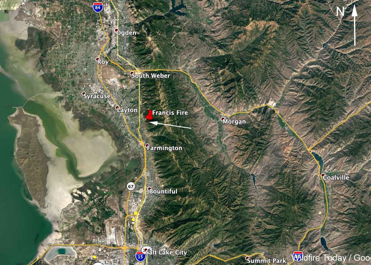
A vegetation fire that was reported around 3 p.m. MDT Monday has spread across a slope above Fruit Heights between Salt Lake City and Ogden, Utah. Structures have been threatened and the Davis County Sheriff’s Office (@DavisCountySO) has ordered evacuations in some areas. (see map below)

At 6:30 p.m. @UtahWildfire, a Twitter account associated with a government agency, reported that the Francis Fire had burned 100 to 200 acres. A strong wind has been pushing it across the slopes and caused spotting in the grass  and oak brush.

In addition to the 17 fire engines working the fire, the aircraft assigned include an MD-87, a BAe-146 (Tanker 168), and four helicopters plus an air attack ship and lead plane. Below we have one video from Twitter of an air tanker drop, and more are on Fire Aviation.


There have been many fires in the greater Salt Lake City area in the last one to two months. They all have a Utah tag on Wildfire Today.

Francis Fire Utah map
Map showing the approximate location of the Francis Fire at 5 p.m. MDT September 16, 2019.