Fishhawk Fire doubles in size, evacuations ordered

The fire is burning between Yellowstone National Park and Cody, Wyoming

Yellowstone Cody Map location Fishhawk Fire
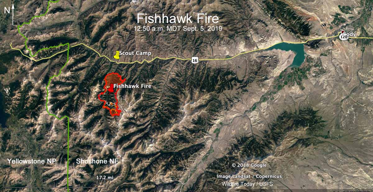
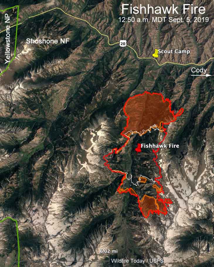
Map showing the location of the Fishhawk Fire. The red line was based on a USFS mapping flight at 12:50 a.m. MDT September 5, 2019. The white line was the perimeter at 8:19 p.m. MDT September 3, 2019. Click to enlarge.

(UPDATED at 12:37 p.m. MDT September 5, 2019)

Strong winds gusting up to 33 mph along with low humidities caused the Fishhawk Fire to more than double in size Wednesday to 10,321 acres. It spread two miles to the north and the same distance to the south. The spread to the west and east is slowed by steep ridges going up to 9,000 to 11,000 feet. However the overnight mapping shows the northeast section of the fire crossed the ridge at the 9,800-foot level, establishing fire in the adjacent drainage to the east.

During the 12:50 a.m. MDT mapping flight on Thursday the Fishhawk Fire was 1.5 to 2 miles from Highway 14/16/20 and the Camp Buffalo Bill Scout Camp. It is 38 miles west of Cody, Wyoming and about 6 miles east of the east entrance to Yellowstone National Park. (see the map above)

(To see all articles on Wildfire Today about the Fishhawk Fire, including the most recent, click here.)

Wednesday night the Park County Sheriff’s Office issued a mandatory evacuation notice for the Scout Camp as well as the cabins in the Kitty Creek drainage.

The evacuation notice said, “…the fire has breached a line of protection that indicates a full evacuation is necessary.”
Yellowstone Cody Map location Fishhawk Fire
Map showing the location of the Fishhawk Fire. The red line was based on a USFS mapping flight at 12:50 a.m. MDT September 5, 2019.  The areas with orange shading indicate intense heat. The white line was the perimeter about 20 hours before.

The Rocky Mountain Type 2 Blue Team assumed command of the fire at 6:00 am. Thursday.

The fire is not being fully suppressed, however the Forest Service will attempt to protect structures and private property.

On Thursday structure protection work continued in the North Fork corridor along Highway 14/16/20. Firefighters have been building fireline around structures in Kitty Creek in addition to implementing structure protection around the nearby lodges. Due to rugged terrain and safety concerns, the southern perimeter of the fire will not be staffed by personnel, but will be monitored by air assets, according to the Incident Management Team.

The day after the fire was detected, Mark Giacoletto, the Shoshone National Forest Fire Management Officer said, “Appropriate actions will be taken when it is needed and where it is safe to do so with the highest probability of success. The amount of standing dead timber and the hazardous terrain in the vicinity of the fire makes it unsafe to put firefighters near the current location of the fire.”

While the 2008 Gunbarrel Fire north of Highway 14/16/20 burned at least 67,000 acres, there have been relatively few fires in recorded history south of the highway. Much of the vegetation in the area has not burned in more than 80 years.

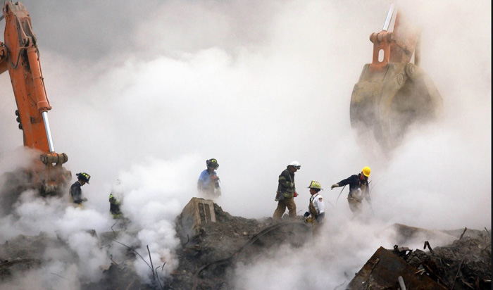
TBT: EPA’s Whitman not liable for statements about 9/11 air quality

From a post on Wildfire Today April 24, 2008.


9/11 smoke
Credit: Washington Examiner

On April 22, 2008 a federal appeals court dismissed a suit against the former administrator of the Environmental Protection Agency, ruling that Christie Whitman can not be held liable for giving the false information that the air was safe to breathe following the September 11, 2001 attacks on the World Trade Center. Many firefighters, including those working on the Incident Management Teams at the scene, were affected by the contaminated air while working on the recovery and clean-up in New York City.

More information from the New York Times:

The Second Circuit Court of Appeals said that Mrs. Whitman, a former governor of New Jersey, was forced to balance competing interests after the attack. The court found that complying with instructions from the White House to hasten the return of financial workers to Wall Street as soon as possible after the World Trade Center was destroyed conflicted with Mrs. Whitman’s obligation to highlight the health risks facing people who lived, worked or went to school in Lower Manhattan.

“Whether or not Whitman’s resolution of such competing considerations was wise,” the court said, “she has not engaged in conduct that ‘shocks the conscience’ in the sense necessary to create constitutional liability for damages to thousands of people.”

In February 2006, Judge Deborah A. Batts of Federal District Court in Manhattan refused to dismiss a range of charges brought by residents against Mrs. Whitman in 2004. Judge Batts found that Mrs. Whitman made statements about safety that were so misleading that they were “conscience-shocking.”

The plaintiffs alleged that Mrs. Whitman and the environmental agency she led had deliberately misrepresented the health risks of the dust from the collapsed trade towers that clouded the air in Lower Manhattan.

In their lawsuit, they argued that Mrs. Whitman should have been obligated to pay for the cleanup of homes, schools and offices in Lower Manhattan.

In her defense, Mrs. Whitman argued that as a public official she was entitled to immunity because her conduct had not violated anyone’s constitutional rights.

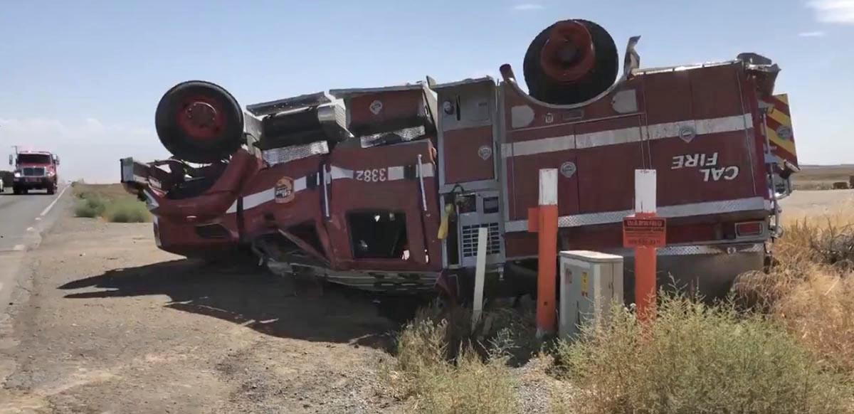
CAL FIRE engine rolls over, four firefighters injured

CAL FIRE engine rollover Porterville
A CAL FIRE engine rolled over injuring three firefighters September 4, 2019 near Porterville, CA. Photo by @GilbertABC30

The California Department of Forestry and Fire Protection announced that at 8:43 a.m. September 4 one of their engines was involved in a single vehicle rollover. Four firefighters were on board. Three were treated and released, while one was scheduled to remain overnight.

The San Diego County based engine was covering a CAL FIRE station during the Creek Fire.

ABC30 reported that it happened on a rural road in the Porterville area near Avenue 56 and Road 240.

Thanks and a tip of the hat go out to Tom. Typos or errors, report them HERE.

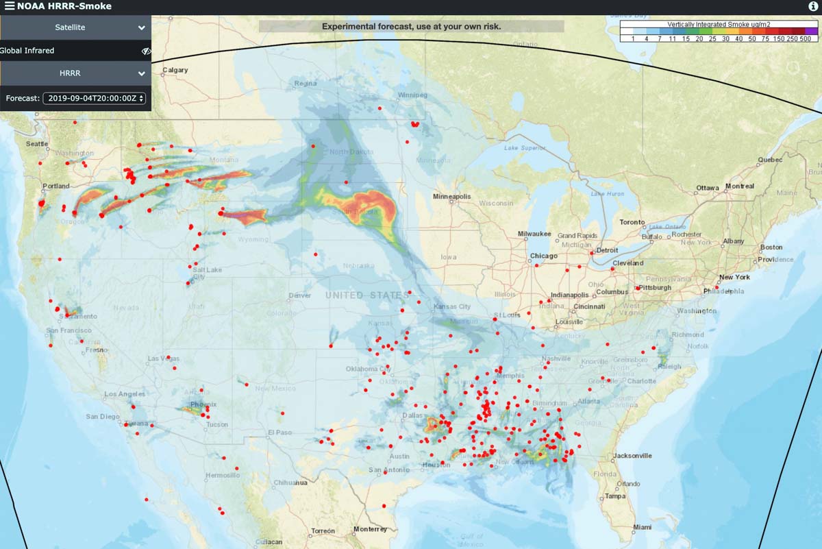
Smoke from wildfires in the Northwest spreads to the east

Posted on Categories UncategorizedTags

Above: Near Surface Smoke that is remaining near the Earth’s surface, created by vegetation fires. Forecast for 9 p.m. MDT September 4, 2019. Red dots represent heat detected by a satellite.

These images represent the forecast for the distribution of smoke from vegetation fires at 9 p.m. MDT September 4, 2019.

The red dots represent heat detected by a satellite.

Vertically Integrated Smoke, at high altitudes, created by vegetation fires. Forecast for 9 p.m. MDT September 4, 2019. Red dots represent heat detected by a satellite. Click to enlarge.


Firefighter seriously injured on wildfire in Okanogan County, Washington

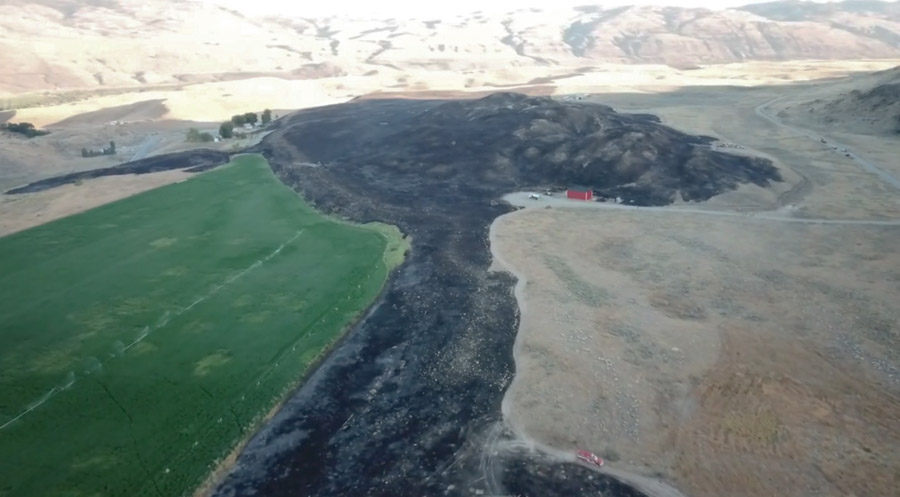
video Spring Coulee Fire Okanogan County, Washington
The Spring Coulee Fire in Okanogan County, Washington, September 1, 2019. Screenshot from video by Okanogan County Emergency Management.

A firefighter suffered serious burns September 1, 2019 while working on a 142-acre fire near Spring Coulee Road in Okanogan County, Washington.

The information below is from Okanogan County Emergency Management, September 3:


Christian Johnson, Assistant Chief of the Okanogan Volunteer Fire Department, has suffered serious injuries while on the Spring Coulee Fire. He has second and third degree burns over 60% of his body.

Christian is currently in a medically-induced coma at Harborview Medical Center in Seattle. They are trying to stabilize him so they can proceed with skin graft surgery. He will be looking at a minimum of 2-3 months in the ICU.

Christian has served his country as a sergeant in the Army, and was deployed with the Washington State National Guard from November 2003- May 2005 in Baghdad. He retired after 22 years of service and has volunteered for the Okanogan Fire Department for 20 years.

Christian is a selfless man, who is always willing to help those in need, and never asks for anything in return. We are now asking for your help to make this long journey a little easier for him and his family. Any amount of donations are greatly appreciated and will go towards helping the family with travel, housing, food, etc.

If anyone would like to make a donation, they may use the GO FUND ME account or make a donation to: Christian Johnson Donation Account at North Cascades Bank, PO Box 672, Okanogan WA 98840.

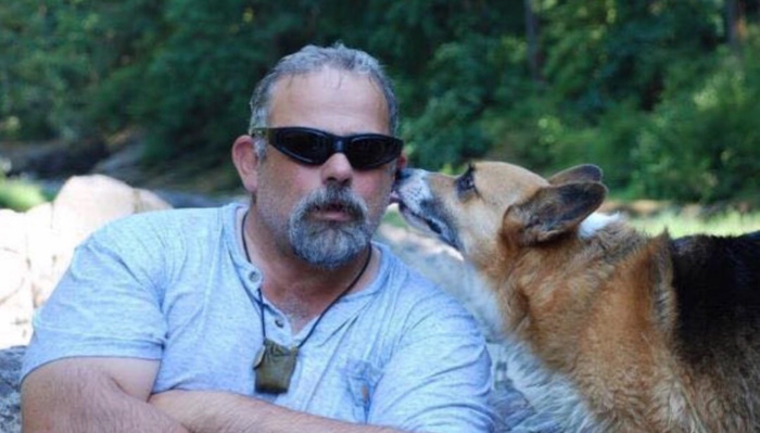
Christian Johnson
Christian Johnson, Assistant Chief of the Okanogan Volunteer Fire Department. Go Fund Me.

Below: Video of the Spring Coulee Fire in Okanogan County, Washington, September 1, 2019. Okanogan County Emergency Management.

Thanks and a tip of the hat go out to Tom. Typos or errors, report them HERE.

Engine burned over on Country Fire east of Auburn, California

Injuries to two firefighters were described as minor

Country Fire Cool, California
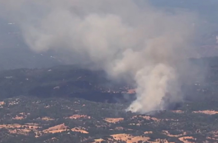
Screenshot from KCRA video of the Country Fire east of Cool, California September 3, 2019.

(UPDATED at 1:09 p.m. PDT September 5, 2019)

On September 4 the Garden Valley Fire Protection District released a statement confirming that the burnover incident on the Country Fire involved one of their engines and two of their firefighters.

Here is an excerpt:

The two firefighters were transported to UC Davis Medical Center with minor injuries and released later the same day. The fire engine sustained major damage.

In an article on CBS 13 about the burnover, they quoted a radio transmission,“We have a burn over with shelters deployed. On that also would like one medivac helicopter.”

The same day the Fire District issued that statement, they also reported that the result of a recent election will require them to lay off three of their six firefighters. As the changes are phased in the staffing will be reduced from two firefighters to one, and 66 percent of the time that one firefighter will be a qualified paramedic.


(Originally published at 7:40 a.m. PDT September 4, 2019)

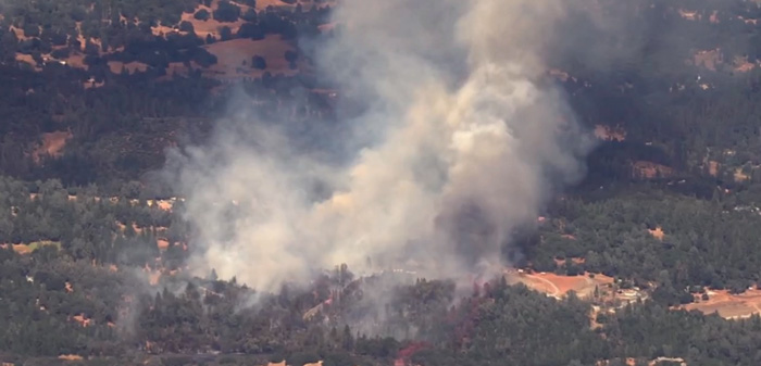
An engine was burned over and two firefighters were injured while battling the Country Fire in Northern California Tuesday, seven air miles east of Auburn. CBS 13 quoted a radio transmission,“We have a burn over with shelters deployed. On that also would like one medivac helicopter.”

Tuesday night CAL FIRE said two firefighters had minor injuries on the fire.

Steve Large, a reporter for CBS 13, said CAL FIRE is launching a “Serious Accident Investigation”.

map Country Fire Cool, California
Map showing the location of the Country Fire east of Cool, California September 3, 2019. Google Earth.

The spread of the fire was stopped after it burned 85 acres. There is a media report that three outbuildings, but no homes, were destroyed.

Country Fire Cool, California
Screenshot from KCRA video of the Country Fire east of Cool, California September 3, 2019.

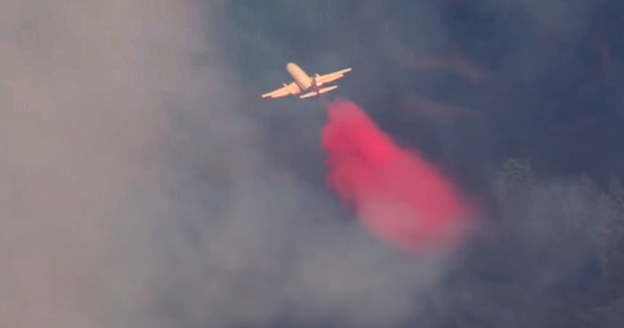
737 air tanker Country Fire Cool, California
Air Tanker 137, a B-737. Screenshot from KCRA video of the Country Fire east of Cool, California September 3, 2019.

Thanks and a tip of the hat go out to Tom. Typos or errors, report them HERE.