Firefighters make progress on Vallecito Fire northeast of San Diego

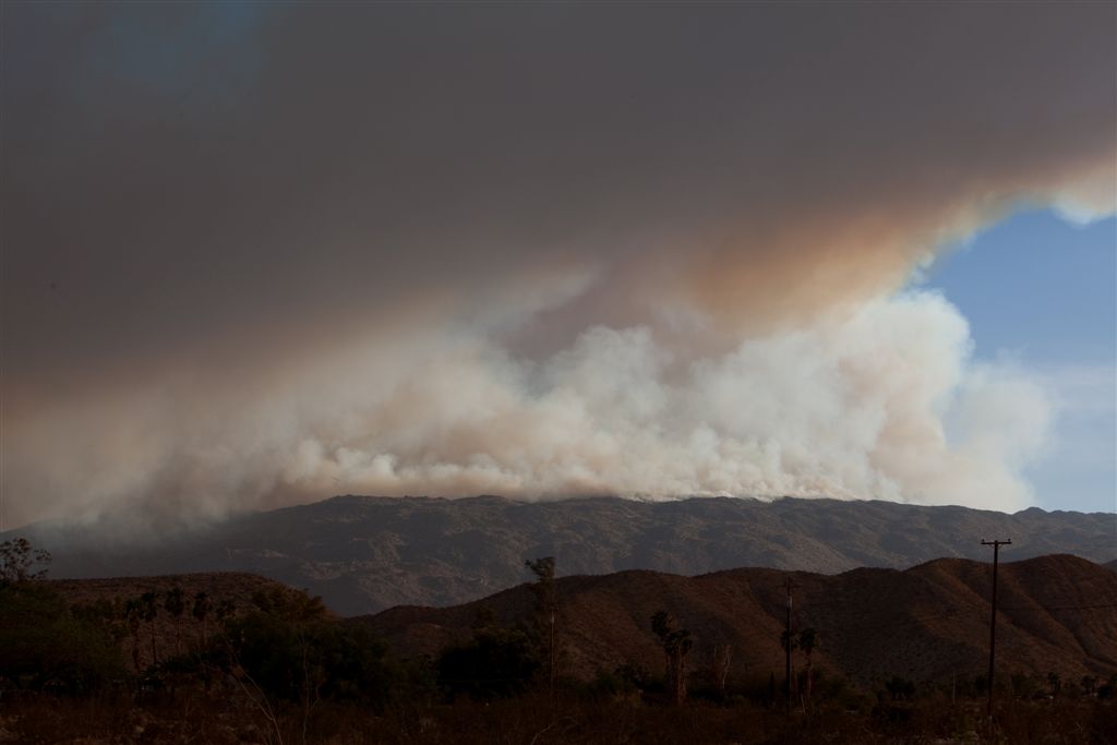
Vallecito Fire, Aug 13  6:07 PM
Vallecito Fire, Aug 13 6:07 PM +5 hours after strike. Photo by Lone Ranger

The overall containment of the six fires comprising the Vallecito Lightning Complex 40 miles northeast of San Diego has increased to 85 percent. Most of the roads are now open in the area except for access to San Felipe, which is open for residents only.

  • Vallecito Fire: 519 acres 100% contained, located South-East of Julian
  • Wilson Fire: 11,691 acres 75% contained, located near Scissors crossing North-East of Julian
  • Stewart Fire: 10,630 acres 90% contained, located near Scissors crossing North-East of Julian
  • Cooper Fire: 3 acres 100% contained, located near Scissors crossing North-East of Julian
  • Wynola Fire: 3 acres 100% contained, Hwy 79 at Wynola
  • Shoots Fire: less than 1 acre 100% contained, eastern San Diego Co.

A big THANKS goes out to Lone Ranger who sent us these photos taken a five and six hours after the fire started.
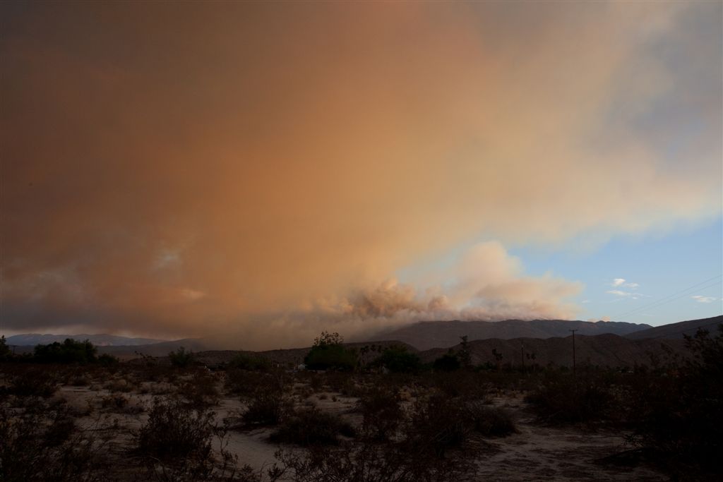
Vallecito Fire, August 13  7:14 PM
Vallecito Fire, August 13 7:14 PM. Photo by Lone Ranger

Former USFS Forest Supervisor blasts NPS for management of Reading Fire

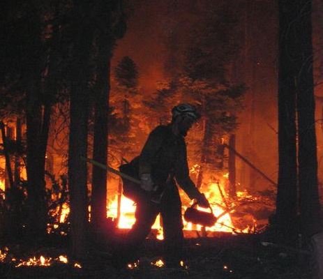
Reading fire burn operation
Reading fire burn operation, August 14, 2012. Photo by Kim Lemke

Steve Fitch, a retired Forest Supervisor of the Shasta-Trinity National Forest and “fire behavior expert” is criticizing the National Park Service for their management of the Reading fire, which has burned 25,242 acres. Approximately 16,000 of those acres are inside Lassen Volcanic National Park, 46 miles east of Redding, California. Apparently the NPS chose a limited fire suppression strategy during the early stages of the fire.

Here is an excerpt from an article in the Redding Record Searchlight:

I can’t believe they went ahead with letting a fire burn for the ecosystem’s benefit in a season that, for the entire nation, is record dry. That fire is creating its own weather. It’s extreme temperatures there. … They probably nuked 10 percent or 15 percent (of the land).

[…]

Fitch said all signs should have pointed to immediately stopping the fire.

Fitch said prescribed burns, designed to clear out vegetation that climbs up into the trees, normally serve a good purpose in the wetter, cooler months. They prevent fires from using the overgrowth as a ladder to snake up into the tall trees that cover the forest.

But in the summer, high temperatures and low humidity give fires a high growth potential he said.

However, a host of other issues made the bad decision even worse, he said. The Forest Service’s aerial tanker fleet was at one-quarter strength this year.

“Everybody in fire management knew that,” he said. “That country up there, there’s no way to get into it. You’re relying on aerial firefighting resources.”

Firefighters making progress on Lassen NP fire

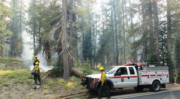
Reading Fire Lassen National Park
Reading Fire from Harkness, August 7, 2012. Credit: Lassen NPS

Higher humidities and lower temperatures have enabled firefighters on the Reading fire in Lassen National Park in Californina to make some progress in the last couple of days. That may change a little today with the forecast for warmer and drier conditions, including a high in the mid-eighties and a relative humidity of 21 percent.

While the fire behavior has slowed, firefighters have been conducting burnouts and constructing direct fireline where it is feasible. The fire is 46 miles east of Redding, has burned over 25,000 acres, and is listed at 25 percent containment.

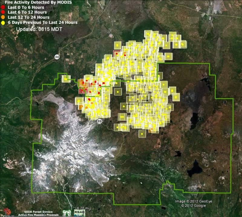
Map of Reading Fire in Lassen NP
Map of Reading Fire in Lassen NP, showing heat detected by a satellite at 3:55 a.m. August 16, 2012. The green line is the park boundary. Click to enlarge.

While the firefighters work their butts off today, we can appreciate these photographs provided by the National Park Service.

Reading Fire
Reading Fire, August 5, 2012. Credit: Lassen NPS

Continue reading “Firefighters making progress on Lassen NP fire”

San Diego County fire causes evacuations of San Felipe and Ranchita

Map of Vallecito Lightning Complex, San Diego County
Map of fires in eastern San Diego County, showing heat detected by a satellite on the Vallecito Lightning Complex, at 12:35 p.m., August 15, 2012

The Vallecito Lightning Complex of fires in eastern San Diego County, California is causing evacuations of two communities, San Felipe and Ranchita. Five fires started by lightning have burned a total of 15,525 acres. Two of the fires were contained at 3 acres, and one burned 519 acres before it was contained. But two others, the Wilson and Stewart fires, have burned 8,000 and 7,000 acres, respectively, and are likely to merge. The two large fires are 40-50 percent contained.

On Wednesday highways between Borrego Springs, Julian, and Ranchita were closed. There have been no reports of structures that have burned.

Eight helicopters, CH-53 Super Stallions and CH-46 Sea Knights, from Camp Pendleton and Miramar Marine Corps Air Station are assisting with the fire, transporting firefighters and making water drops.

Over 1,400 personnel are fighting the fire, along with 77 engines, 48 hand crews, and 28 water tenders.

Wildfire burns 15 percent of Lassen Volcanic National Park

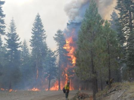
Reading fire, Lassen
Firing out on the Reading fire, Lassen Volcanic NP. Photo by Steve Burns

A wildfire with the odd name of “Reading” has burned 15 percent of Lassen Volcanic National Park in northern California. Approximately 15,506 acres of the 23,958-acre fire are within the northern boundary of the park (see the map below).

The Reading fire is being managed by Pincha-Tulley’s Type 1 Incident Management Team; 1,239 firefighters and overhead are committed, including 36 crews. The fire burned 2,380 acres on Monday. Heavy timber and brush burned actively Monday night with low rates of spread and isolated single tree torching. Lassen Volcanic National Park Highway continues to be closed for seven miles from Manzanita Lake to Summit Lake. Summit Lake, Butte Lake, Lost Creek and Crags Campgrounds remain closed. (Source: National Park Service)

Below is a map showing the perimeter of the Reading fire, 48 miles east of Redding, California.
Continue reading “Wildfire burns 15 percent of Lassen Volcanic National Park”

Wye and Walker fires in northern California burning hot

Two fires burning east of Clearlake Oaks, California, are threatening homes and ranches and forcing evacuations. The Wye Fire, near the intersection of Highway 20 and Highway 53, was at 3,000 acres and about 25 percent containment. The Walker Fire, near Walker Ridge Road, is 30 percent contained at 2,000 acres after causing evacuations of 480 residents in the Spring Valley area. A Cal Fire spokesman told the Lake County News that both fires were very active this morning.

Wilbur Hot Springs and other areas in Lake County are popular summer destinations about two hours north of San Francisco.

NBC News reported that the smoke could be seen from Napa County from the south and Butte County from the north. The L.A. Times, which has several photos, reported that the fire was burning on both sides of Highway 20 and moving toward Spring Valley.

Crews were challenged by triple-digit temperatures, erratic winds, and low humidity; an incident command post has been set up at the Lake County Fairgrounds. California Highway Patrol closed Highway 20 east of Clearlake Oaks for a firing operation, but it should be re-opened this afternoon. Cal Fire said there were 324 personnel on the fire, along with 44 engines, eight crews, seven bulldozers, two airtankers, and four helicopters.

http://www.wilburhotsprings.com/index.htm