


 Colorado FireHawk and CL-415 at Chatfield Reservoir, Quarry Fire July 2024
Tim Russell sent us this photo of the State of Colorado Firehawk after collecting water from Chatfield Reservoir, with a CL-415 scooping in the background.
The Denver Post reported that Gov. Jared Polis has deployed Colorado National Guard troops to the Quarry, Stone Canyon, and Alexander Mountain fires. He said they’ll help with logistics, road closures, and other tasks to free up fire officials and firefighters.
The four fires along Colorado’s Front Range have burned thousands of acres, killed one person, and destroyed at least six buildings. As of Wednesday night, they’d evacuated thousands of people and burned over 9,500 acres.
In Oregon, meanwhile, 33 major wildfires have burned well over a million acres, according to a KGW-TV report.
Today four Colorado lawmakers asked NIFC to send more resources to the state.
 U.S. Reps. Brittany Pettersen and Joe Neguse and U.S. Sens. Michael Bennet and John Hickenlooper asked fire officials to help Colorado get more hand crews as soon as possible plus any available engines, incident management teams, or aviation resources.
“We understand the pressures facing our wildland firefighting workforce, as wildfires rage all across the western United States and continue to threaten many of our communities,” the lawmakers wrote in a letter [PDF] to headquarters. “Existing resources are stretched thin to meet those demands … Time is of the essence to save lives and homes.”

The wildland firefighting community in Oregon and beyond mourns the loss of one of their own. The Grant County Sheriff in eastern Oregon confirmed that SEAT pilot James Bailey Maxwell, 74, was killed while working near the Falls Fire near Seneca on the Malheur National Forest on July 25, 2024.
The BLM said Maxwell had dropped retardant on the Parasol Fire north of the Falls Fire and was returning to the base at Burns to reload. He disappeared just before 7:00 p.m. Thursday. Owned and operated by North Dakota-based Aerial Timber Applicators, the aircraft was reported missing and triggered a search by numerous agencies including a night-flying helicopter with the Oregon National Guard.
Search and rescue teams searched overnight and located the aircraft Friday morning in steep terrain.
The Falls Fire today is almost 70 percent contained at 142,30 acres.
The Maxwell family and firefighters are grateful for the support expressed throughout the community and online. Services have not yet been announced and the family requests time and privacy.


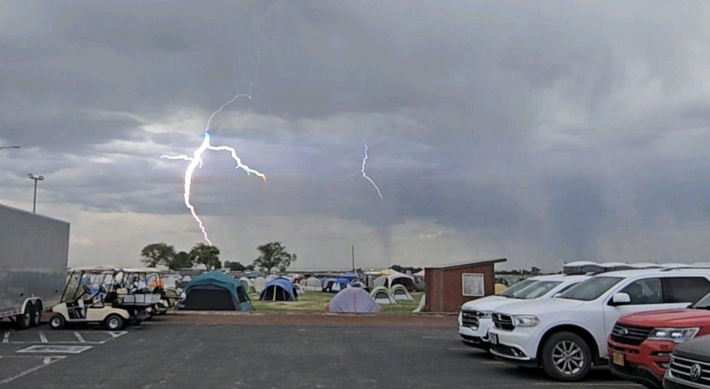
Great shot! THANKS RYAN — and George too.

An early report by KOIN-TV indicated crews were searching for a lost airtanker that disappeared late Thursday. The BLM-contracted SEAT went missing while fighting a lightning-started fire near Seneca, Oregon. The Central Oregon Daily News said the pilot was en route to a spot fire near the the Falls Fire and was killed in the crash. The BLM confirmed that the wreckage was found and the pilot’s body recovered; the pilot’s identity has not been released.
The Aviation Safety Network reported that an Air Tractor AT-802A owned by Wakefield Aircraft out of North Dakota crashed near Seneca, with one occupant, unknown injuries, and unknown aircraft damage.
The plane went missing around 7 p.m. while working a lightning start near the Falls Fire. The Grant County Sheriff’s Office and Falls Fire personnel immediately began a search and the Oregon National Guard searched overnight without success. Grant County Search and Rescue on Friday joined the search. KGW-TV said the SEAT was flying out of Burns, about 45 miles from Seneca via US-395. The Falls Fire’s about 25 miles south of John Day.
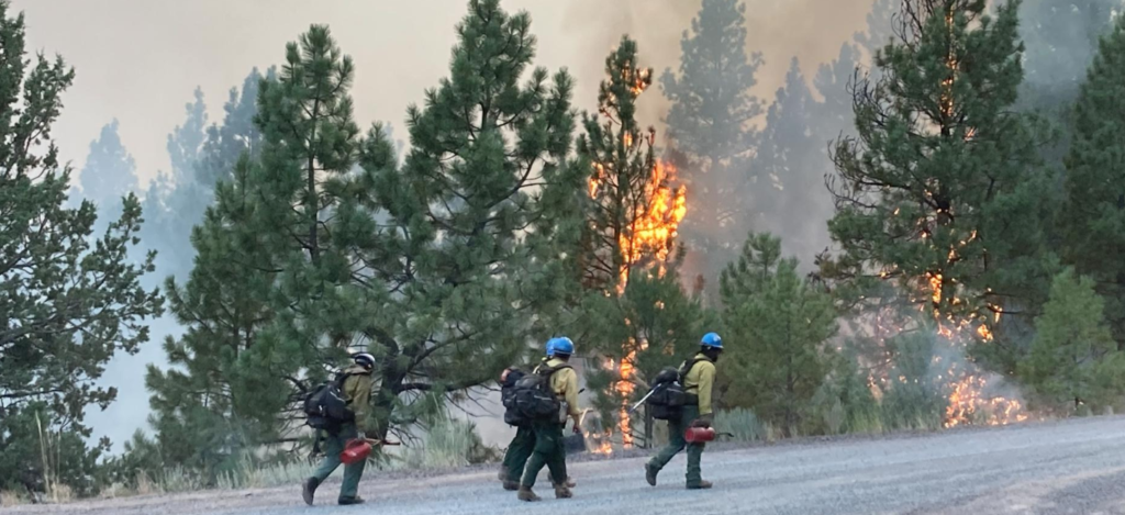
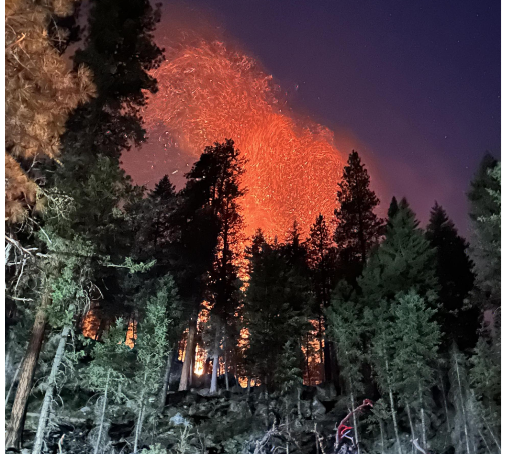
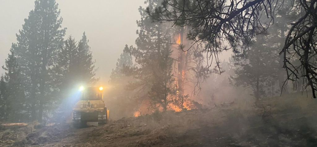
KPTV reported that fire managers reported the aircraft missing on a lightning-started fire on the Malheur National Forest. Search crews have been hunting for the plane since Thursday night and will continue Friday.
The fire was human-caused and is under investigation. Investigators ask for the public’s assistance with any tips or information about the start of the Falls Fire on the Malheur. Please email tips to SM.FS.R6TipHotLine@usda.gov
Threatened property includes 377 homes, 118 commercial buildings, and nearly 700 outbuildings. Resources include 38 crews, 79 engines, 24 dozers, 25 watertenders, plus helicopters and SEATs, for a total of 1560 personnel.
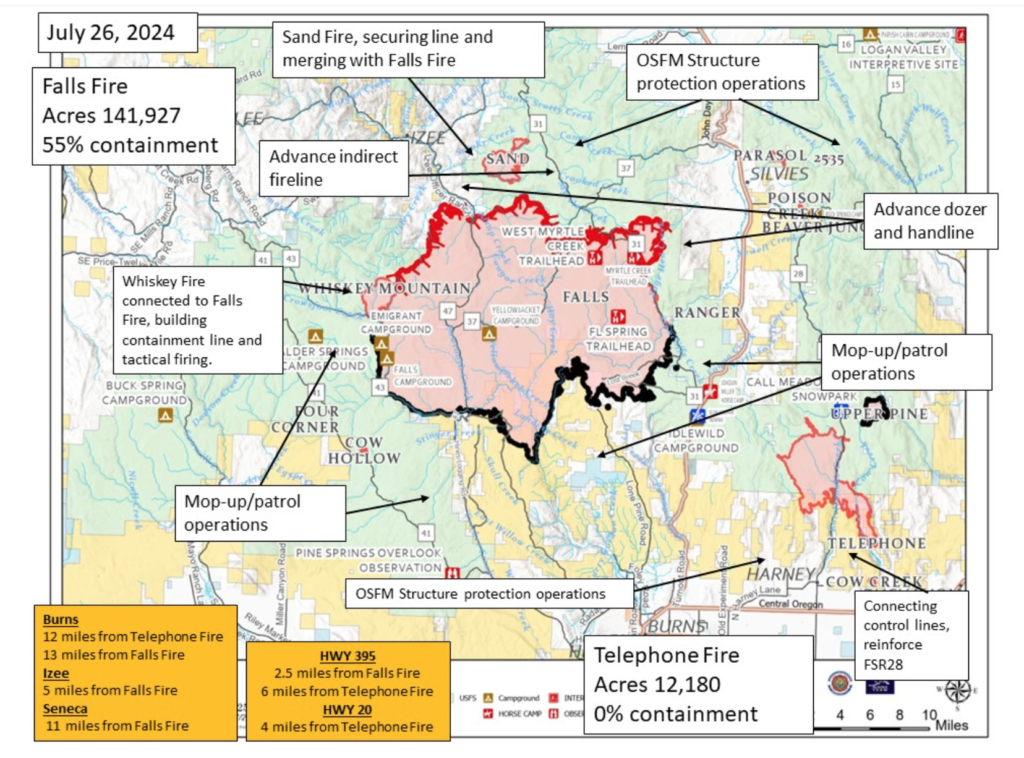
The Alaska Complex IMT 1 assumed command of the Falls and Telephone fires at 6:00 am Friday and is in unified command with the Oregon State Fire Marshal (OSFM). Their thorough update for today is posted online [HERE] but includes no mention of the crash or the search for the missing SEAT. The Harney County Sheriff’s evacuation map is [HERE] and the Grant County Emergency Management wildfire info page is [HERE].
Strong afternoon winds together with extremely dry fuels increased fire behavior on the Telephone Fire, and several new starts were identified east of the Falls Fire in the Parasol Butte area. Evacuation levels were announced and extended in response to the new starts and the Telephone Fire’s move across FSR 28.
Crews responded along with aerial resources, and structure protection crews mobilized and responded to the area. The Telephone Fire has grown 3,000 acres and moved farther southeast overnight; it’s now about 4 miles north of Hwy 20. Smoky conditions are expected to continue; an inversion layer sits over the fire but may lift by early afternoon. Temperatures have been in the mid-80s.
~ Thanks and a tip of the hardhat to Jeff on this one.

RyanWeather.com
Park Fire Morning Update 8 AM 7/28/24
From the Northern California Coordination Center:
CA-BTU Park: 353,194 acres grass, brush and timber, 12 percent contained. Extreme fire behavior reported with long-range spotting. Multiple communities are threatened. Structures are threatened with evacuation orders and warnings in place. Critical infrastructure, communication sites, power transmission lines, and private timberlands threatened. Threatened and endangered species, cultural and natural resources are also threatened.

Lassen National Volcanic Park is closed and the town of Paradise is under evacuation warnings.
Highways 32, 36 and Cohasset Road are closed in the fire area with additional threats to Highway 99. Numerous other road, area, and trail closures in effect. The incident is under unified command with CAL FIRE Team 3 (See), CAL FIRE Team 4 (Martin), and the Lassen National Forest.

Though the cause was earlier reported as under investigation, the Chico ER reported that investigators had arrested a Chico man suspected of igniting the fire.
07/26 FRI a.m. Park Fire burns to 164,286 acres, over 4,000 evacuated

The 42-year-old suspect is facing arson charges. Butte County District Attorney Mike Ramsey said Thursday that investigators apprehended Ronnie Dean Stout, a twice-convicted felon and registered sex offender.
Investigators followed up on local reports of a man pushing “a car on fire” into a gully and down a 60-foot drop near Alligator Hole in upper Bidwell Park midafternoon on Wednesday. Ramsey said the guy was seen calmly leaving the area as the fire took off.
The fire spread from the car, which Ramsey said was Stout’s mother’s car, and grew 45,000 acres overnight; it was estimated Thursday afternoon at 75,000 acres.
It’s at 125,000 acres tonight burning in both Butte and Tehama counties; numerous firefighting airtankers from throughout the state are flying as conditions allow, along with over 1,100 personnel assigned, 6 helicopters, 41 dozers and 10 watertenders, 40 crews, and 153 engines.


 Redmond Airtanker Base, 1 million gallons 07/25/24

The force is supported by a fourth helicopter, a Sikorsky S-76, equipped with a suite of thermal and HD cameras as well as mapping software for accurate detection and reporting of a fire’s perimeter and hotspots.

Wildfires in Arizona are burning near the town of Kearny, about 90 miles southeast of Phoenix.
The Romero Fire is estimated at 3,500 acres, spreading west and north through grass and brush. It’s 13 miles southwest of Kearny and 22 miles northwest of Mammoth, according to the Arizona Department of Forestry and Fire Management. There is as of Saturday afternoon zero containment.
 Romero Fire, Arizona, east of Casa Grande
azcentral.com reported that another fire, the Circle Fire, has burned about 200 acres at the base of Antelope Peak southeast of Kearny. The fires are just north of the Freeman Fire, which burned 32,568 acres.
The Southwest Coordination Center (SWCC) reports that scattered to numerous wetting thunderstorms are predicted for the Mogollon Rim and parts of eastern Arizona. The region reported 17 new fires on July 19, with 1,517 recorded so far for 192,579 acres thus far in 2024.
The Southwest Region is at Preparedness Level 3.

A fire east of Québec in Newfoundland and Labrador has burned more than 24,000 acres and forced thousands to evacuate Labrador City. CNN reported that the “extremely aggressive inferno” was considered contained earlier this week, but weather changes on Friday blew the fire back to life and it spread rapidly. Premier of Newfoundland and Labrador Andrew Furey said Saturday the fire had grown to 22,000 acres and had spread 13 miles in about four hours.
In a news conference on Sunday, Furey said weather conditions are favourable for firefighting. “We have some good news today. There is no significant growth in the size of the fire that is just northwest of Lab City,” he told reporters. The fire has burned through about 14,000 hectares (about 35,000 acres) to within four kilometres of the community — the same as Saturday.
 Newfoundland and Labrador fires, ESRI map
Light rain, lower temperature and humidity, and northeast winds has kept the fire away from the town and burning onto itself.
Four water bombers are fighting on the eastern front of the fire. Six to eight are fighting on the western side from Quebec.
Around 9,500 people were evacuated from Labrador City, said Jeremy Reynolds with the provincial government. “A contingent of essential personnel have remained behind to oversee the emergency response,” he said.
The remoted town of Labrador City, in the northwestern part of the province, is about 900 miles north of Canada’s capital city of Ottawa.
A province-wide outdoor fire ban prohibiting setting of fires on forest land or within 300 metres of forest land is now in effect in Newfoundland and Labrador.
Significant firefighting resources are currently dedicated to wildfire suppression near the communities of Labrador West.
Updates on the location, status, and size of active fires can be viewed online at the NL Active Wildfire Dashboard.
 Labrador City fires
Residents were told to evacuate to the Town of Happy Valley-Goose Bay – a six-hour drive away.